Kidwelly Castle: A Norman Fortress in Wales
Site at a Glance
- Rating
- 4.7
- Popularity
- Medium
- Country
- United Kingdom
- Primary era
- Medieval
- External website
- Open
- Eras represented
- Medieval
- Civilizations
- English, Welsh
- Site type
- Military
- Remains
- Castle
On this page20 sections
History
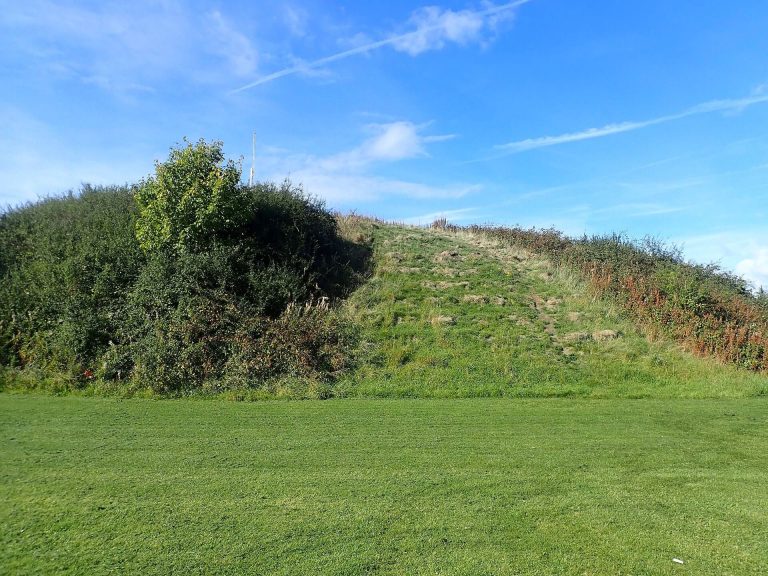
Kidwelly Castle is a medieval Norman fortress in Kidwelly, United Kingdom, established in 1106 after Roger, bishop of Salisbury and royal administrator under Henry I, received the Welsh cantref of Cydweli. Roger began an earth-and-timber ringwork, a bank-and-ditch fortification strengthened with timber, to secure Norman authority. The castle, its adjoining priory, and the settlement that grew to the south formed a military, economic, and religious centre during the contested Norman expansion into south Wales.
Norman foundation and Welsh resistance
The priory had been founded before 1114, while a settlement south of the castle existed by 1115. Its inhabitants came from Normandy, England, and Flanders. The first earthwork defences were later replaced or supplemented by stone construction as control of the area changed between Norman lords and Welsh rulers.
In 1136, during a Welsh revolt, a battle was fought near Kidwelly between Welsh forces led by Gwenllian, wife of the prince of Deheubarth, a medieval Welsh principality in south-west Wales, and an Anglo-Norman army commanded by Maurice de Londres of Ogmore Castle. The Welsh were decisively defeated, and Gwenllian was killed or executed after the battle. By 1139, after Roger had lost the favour of King Stephen, Kidwelly had passed to Maurice de Londres.
Rhys ap Gruffydd, the powerful ruler of Deheubarth also known as the Lord Rhys, captured the castle during his campaigns against Anglo-Norman strongholds in south-west Wales, probably around 1159. He carried out building work in 1190, probably replacing the earlier timber defences with a stone curtain wall. After his death in 1197, struggles among his sons allowed the castle to return to Anglo-Norman control by 1201. That year, Maredudd, one of Rhys ap Gruffydd’s sons, was killed near Kidwelly by followers of William de Londres.
Twelfth- and thirteenth-century rebuilding
In 1215, Rhys Gryg and Llywelyn ap Iorwerth, commonly called Llywelyn the Great, captured Kidwelly during a major Welsh campaign in south Wales. Under pressure from Llywelyn, Rhys Gryg returned the castle to Hawise de Londres, heiress of the Londres estates, in 1220. Llywelyn captured or heavily damaged it again in 1231. In 1243, Maredudd ap Rhys, son of Rhys Gryg, surrendered control to Hawise and her husband, Patrick de Chaworth.
Kidwelly resisted a Welsh siege after the English defeat at the Battle of Cymerau. The neighbouring castles of Llansteffan and Laugharne fell, but Kidwelly’s garrison held out. Patrick de Chaworth was killed shortly afterwards in a battle near Cardigan against the Welsh.
Hawise de Londres’s sons, Payn and Patrick de Chaworth, then developed Kidwelly into a major stone fortress. Payn probably began the inner curtain wall around 1275, perhaps drawing on castles he had seen during Prince Edward’s crusade in Palestine. After Payn died in 1279, Patrick continued the work and probably strengthened the outer curtain wall.
This rebuilding made Kidwelly one of the strongest English castles in Wales, comparable in strength with Edward I’s new castles in north Wales and with Caerphilly Castle. Edward I stayed at Kidwelly for several days in 1284. After Patrick de Chaworth died in 1289, William de Valence administered the castle for Patrick’s infant daughter, Maud de Chaworth, and probably continued the works, including the hall range and chapel. Maud later inherited Kidwelly and married Henry of Lancaster in 1291.
The Lancaster estate
Henry of Lancaster and his descendants continued to improve the castle, although Kidwelly served mainly as a local administrative centre for the extensive Lancaster estates rather than as a residence. It later became part of the Duchy of Lancaster, a major English landed estate closely associated with the Crown, and consequently entered the private property of the English kings.
John of Gaunt probably began rebuilding the principal gatehouse around 1388. In 1399, Richard II granted the castle to his half-brother John Holland. Richard spent one night at Kidwelly while travelling to a campaign in Ireland. During the king’s absence, John of Gaunt’s exiled son Henry Bolingbroke seized the English throne and later became King Henry IV. As part of the Duchy of Lancaster, Kidwelly thereafter belonged to the private estates of the English kings.
The Glyndŵr rebellion and later changes
The rebellion led by Owain Glyndŵr, the Welsh leader of the major revolt against English rule that began in 1400, accelerated work on the unfinished gatehouse. In August 1403, Welsh forces commanded by Henry Dwnn, a former administrator of Kidwelly, besieged the castle with help from soldiers from France and Brittany. The rebels captured and destroyed the town, but the small garrison held the castle until the siege was abandoned before winter. A further attack in summer 1404 also failed.
Work on the gatehouse resumed in 1408, and the building was completed around 1422. In 1485, Henry VII granted Kidwelly to Rhys ap Thomas, one of his principal allies at the Battle of Bosworth. Around this period, new buildings were added in the outer ward, reducing its effectiveness as a defensive enclosure. After Rhys ap Thomas’s grandson, Rhys ap Gruffydd FitzUrien, was executed for treason in 1531, the castle reverted to the Duchy of Lancaster.
Kidwelly lost its military importance during the sixteenth century and gradually ceased to function as an administrative centre. It was still used as a courthouse in 1609, but was already declining into decay. The Vaughan family of Golden Grove near Llandeilo acquired the castle in 1630. It played no significant role during the English Civil War.
Preservation and archaeological study
John Vaughan carried out minor stabilisation work between 1793 and 1803, probably in response to increasing visits. William Turner visited Kidwelly in 1795, sketched the castle, and later used the drawings for a watercolour produced in 1835. The Earls of Cawdor inherited the ruin during the nineteenth century and carried out further stabilisation work on the outer curtain wall around the middle of that century.
In 1927, the Earl of Cawdor transferred the ruin to the state’s Office of Works. Archaeological excavations followed in 1930 and 1931 under Sir C. Fox and C. A. R. Radford. Kidwelly is now managed by Cadw, the Welsh government’s historic-environment service. It is a Grade I listed historic monument and a protected Scheduled Monument, and is regarded as one of the best-preserved medieval castles in Wales.
Remains
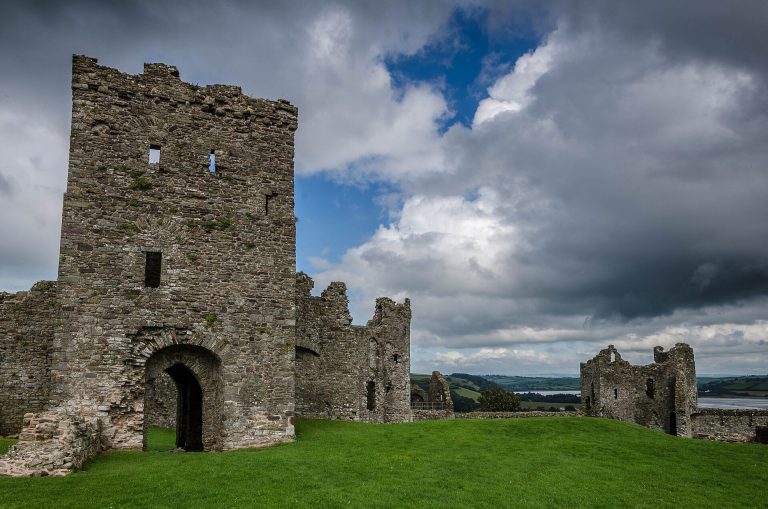
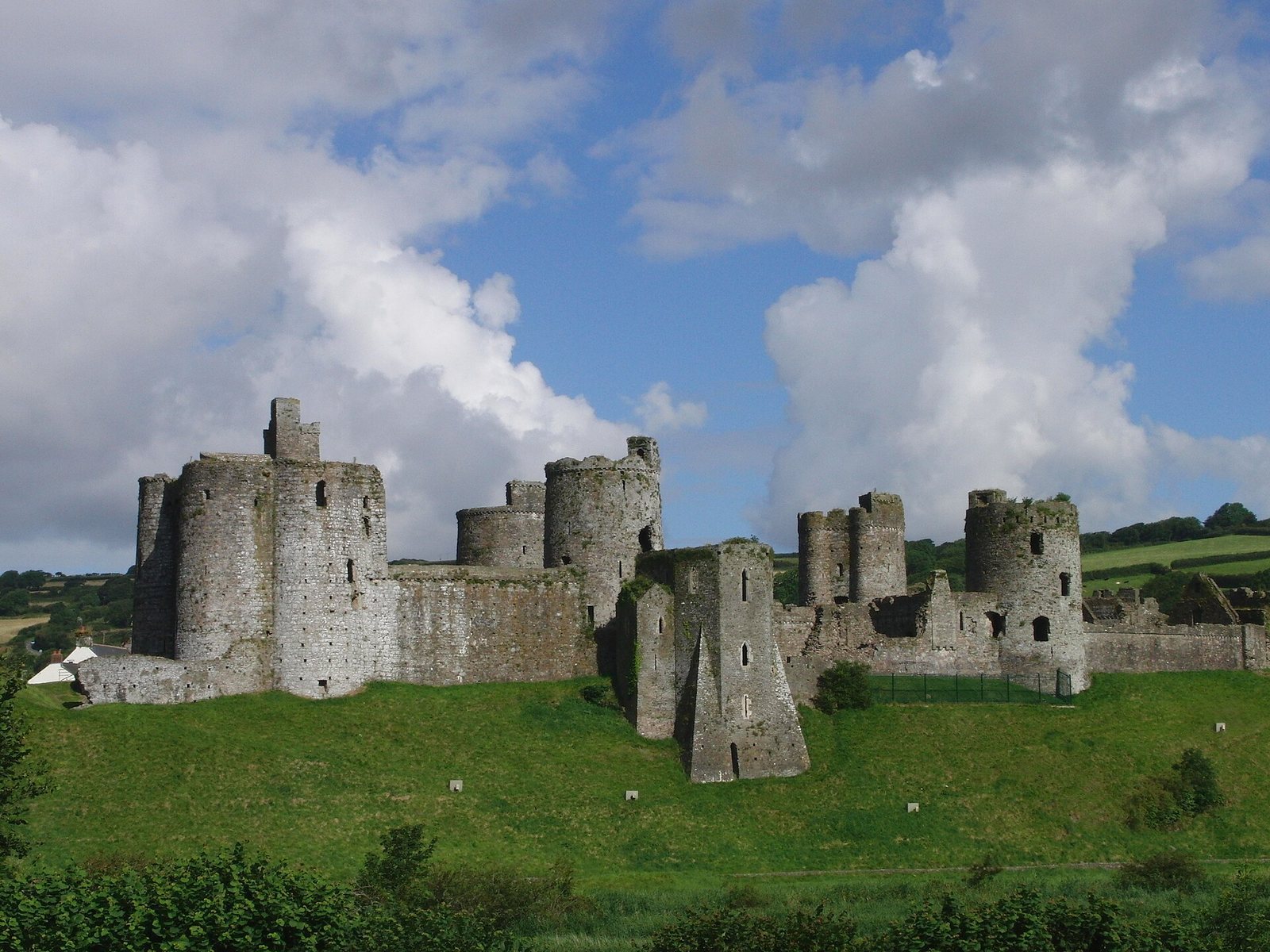
Kidwelly Castle occupies a ridge at the edge of the town, with the ground falling steeply eastward towards the River Gwendraeth. The river reaches Carmarthen Bay shortly beyond the castle and was navigable by boat as far as the site, allowing supplies to reach the fortress during a siege. The plan combines a square inner ward with a roughly semicircular outer ward, creating an overall D-shaped arrangement. Its straight eastern side follows the steep river-facing slope, while a sharp V-shaped ditch surrounds the castle on the other sides. The medieval town’s defences bordered the ditch on the south-east and west.
Outer defences and entrances
Southern gatehouse
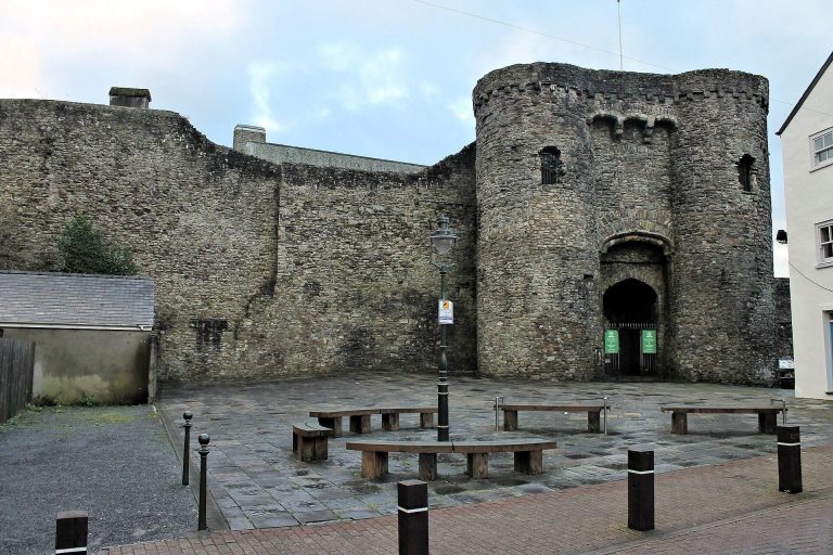
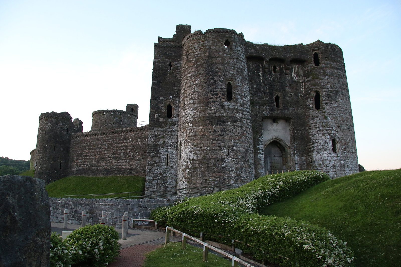
The principal entrance is the asymmetrical southern gatehouse, a three-storey building begun by John of Gaunt around 1388 and 1389. It replaced earlier gates whose remains have not survived. Construction was suspended from 1403 to 1408 during the Glyndŵr rebellion, after which the plans were altered and a stair tower was added to the north-west side of the courtyard elevation. A fire damaged the building between 1408 and 1415, and work was completed around 1422.
The gatehouse resembles the gate of Carmarthen Castle and is among the last large medieval gatehouses built in England and Wales. Two semicircular towers flank its outer face, with a vaulted entrance passage protected by a drawbridge and machicolations, projecting openings in the parapet through which defenders could attack people below. The strongly defensive exterior contrasts with the courtyard side, where large upper-storey windows and an external stone stair lead to the first floor.
The ground floor contains doors from the vaulted passage into rooms on both sides, as well as two vaulted chambers in the lower levels of the towers that were probably prisons. The west tower provided accommodation for gate guards, with fireplaces and a latrine. The east tower included another guardroom and a room with a drop hole, an opening in the floor leading to a bottle-shaped cellar shaft. The shaft probably served as a strongroom. The adjoining ground-floor room, with a fireplace and latrine, probably functioned as the paymaster’s office.
More than twenty rooms occupied the upper floors, probably including accommodation for the constable. The first floor contained the drawbridge-winch room, a kitchen, and a hall. Tower rooms provided sleeping chambers, some with individual fireplaces and latrines. A large private chamber stood above the hall on the second floor, alongside further tower chambers. The partly lead-covered roof was enclosed by a crenellated parapet, a battlemented wall with alternating raised sections and openings.
Barbican and northern approach
A short wall crosses the ditch immediately before the southern gatehouse. Probably built around 1450, it is the surviving part of a former barbican or outer gate enclosure. A separate northern forecourt was protected by an earthwork bank and ditch.
Outer curtain wall and towers
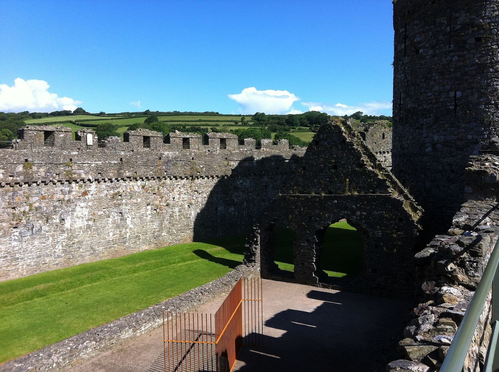
The outer ward was originally a defensive enclosure. Its massive outer curtain wall follows the western side, while the square inner ward stands within it and directly beside the eastern, river-facing edge. The curtain wall developed in three phases. Its lowest section dates from the late twelfth or early thirteenth century, it was substantially enlarged and raised towards the end of the thirteenth century, and it reached its surviving height in the early fourteenth century.
Three semicircular flanking towers stood along the western outer curtain wall. All were built in the late thirteenth century, although the central tower has collapsed. A smaller northern gatehouse had two semicircular towers and a drawbridge like the principal gatehouse, but only its foundations survive. A round tower on the north-east side of the castle has also been destroyed.
Outer-ward buildings
Two large gabled buildings were erected in the outer ward towards the end of the fifteenth century, after Kidwelly had ceased to serve as a major military stronghold and residence. Only their gable ends survive. Their precise functions are unknown, although they may have been stables. The building beside the outer wall of the inner ward may have been a courtroom. Smaller structures were built against the curtain wall, including a bakehouse on the northern side.
Inner ward and residential buildings
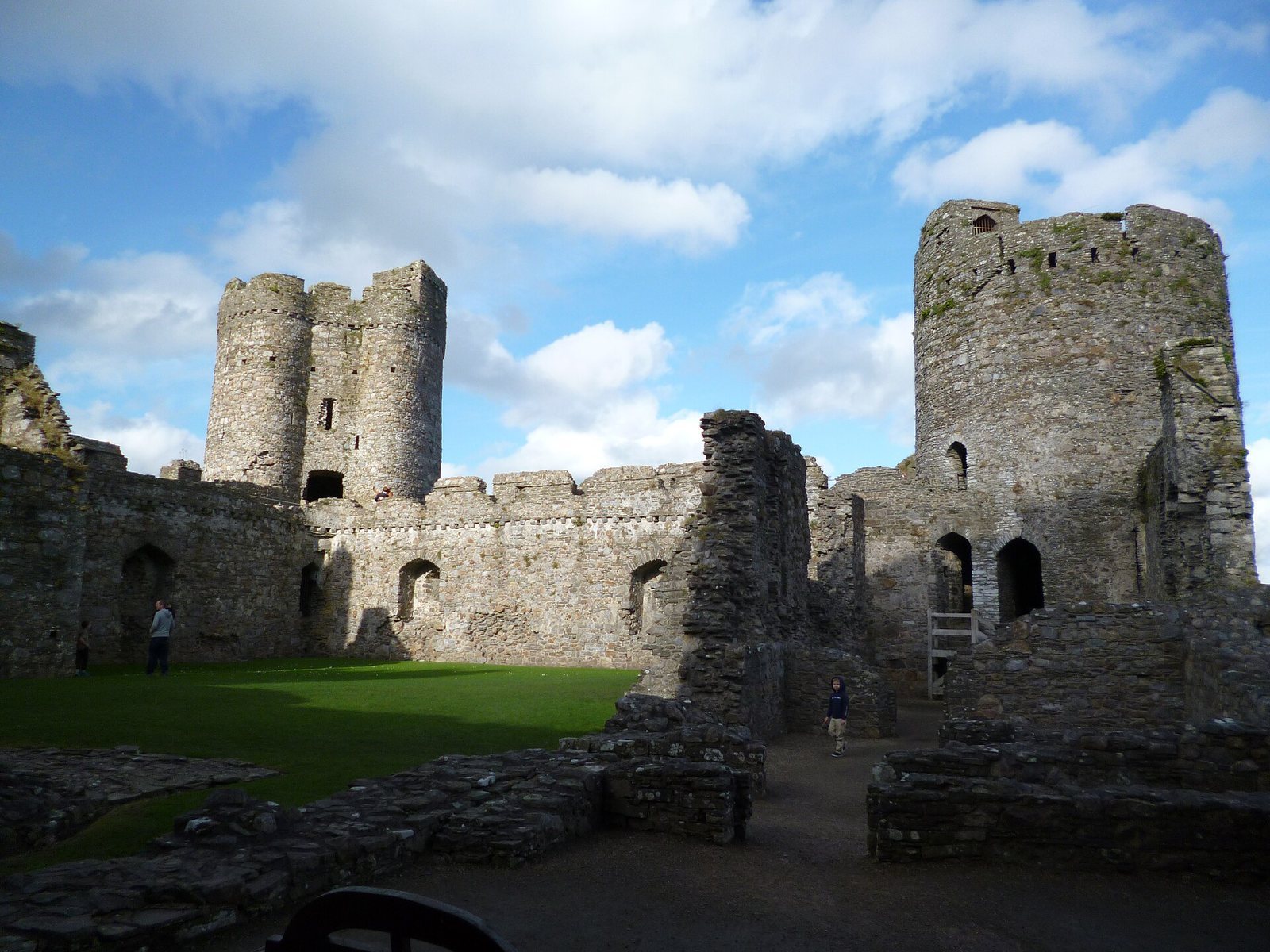
The square inner ward is enclosed by a curtain wall with four round corner towers. Its eastern side adjoins the castle’s outer curtain wall. Simple gates in the south and north walls provided access, protected by projecting openings used to drop missiles or other materials onto attackers.
The Chaworth brothers began the inner ward towards the end of the thirteenth century. Its projecting towers and high curtain wall created two successive defensive rings. When the outer curtain wall was raised and strengthened in the early fourteenth century, this arrangement was partly reduced in effectiveness because attackers could then be engaged directly mainly from the four corner towers.
South-east tower
The four corner towers were individually designed and were raised by one storey at the beginning of the fourteenth century so that they could continue to overlook the outer ward. Each has a spiral stair ending in a small turret on a crenellated roof platform. The two northern towers also had timber hoardings.
The south-east tower was the most residential. It contained several fireplaces and latrines and probably served as the lord’s residential tower before the hall was built. Afterwards, its two lower floors became service rooms, while its two upper floors held guest chambers.
South-west tower
The south-west tower is the only inner tower with surviving stone vaults. Its ground floor probably served as a dungeon, while the three upper floors provided accommodation.
North-west tower
The north-west tower has two spiral staircases and an unusual kidney-shaped plan. Its ground floor could be entered only from the upper floor.
North-east tower and chapel connection
The north-east tower contained a storeroom on the ground floor that opened towards the courtyard, more refined residential rooms on the three upper floors, and a chapel. A first-floor door opened towards the river-facing exterior. From there, a timber gallery probably ran outside the hall to the chapel tower and the south-east tower.
Hall and kitchen
The heavily ruined hall or residential range on the eastern side of the inner ward dates from the late thirteenth century. Positioned between the two eastern corner towers, it contained a basement, a residential hall, and the lord’s private rooms.
The kitchen building occupies the south-west corner of the inner ward and survives as a well-preserved ruin. It also dates from the late thirteenth century.
Chapel tower
Probably soon after the hall was built, a chapel tower was added outside the eastern wall between the south-east tower and the hall. The polygonal structure stands on substantial spur-like buttresses and contained the new castle chapel above two upper-storey residential rooms. A small angular addition served as the sacristy. An additional outer wall between the chapel tower and the north-east tower protected the hall, although this wall is now largely destroyed.
Memorial landscape
A modern memorial stone stands outside the southern gatehouse in memory of Gwenllian, who was killed in 1136. The nearby battlefield retains the name Maes Gwenllian, meaning “Gwenllian’s Field.”