Khtzkonk Monastery: An Armenian Medieval Monastic Complex in Türkiye


Site at a Glance
- Rating
- 4.1
- Popularity
- Very Low
- Country
- Turkey
- Primary era
- Medieval
- Eras represented
- Medieval
- Civilizations
- Armenian
- Site type
- Religious
- Remains
- Monastery
On this page11 sections
History
Khtzkonk Monastery is an Armenian medieval monastic complex in Türkiye, near Ani in the historical region of Ayrarat. Associated with the Armenian Apostolic Church, the ancient national church of the Armenian people, it developed between the seventh and thirteenth centuries, with five churches built between the seventh and twelfth centuries. The complex was linked to both the Emirate of Armenia, an earlier Islamic-ruled polity in the Armenian highlands, and Bagratid Armenia, the kingdom governed by the Bagratuni dynasty before its fall in the eleventh century.
Medieval development
The monastery’s foundation is uncertain. It is also described as a ninth-century foundation, and one tradition credits its construction to Smbat I, a Bagratid king of Armenia. The five churches emerged over several centuries, making the complex a record of changing Armenian religious architecture. Khtzkonk became one of the important cultural centers of medieval Armenia.
Religious life continued after the Armenian kingdom fell in the eleventh century and after the subsequent Seljuk invasions. The monastery was abandoned in the thirteenth century following the Mongol invasions. Inscriptions preserve later evidence of its religious and institutional life. A 1211 inscription states that the monastery or church had been saved from Muslim rulers. Another inscription, dated 1214, records David, son of Grigor and a Zakarian general, donating half of the village of Vahanardesh to the church as a memorial for himself and his ancestors. It also names the abbot Hovhannes and records the monks’ annual participation in liturgies on the feasts of David, Jacob, Paul, Peter, and St. Shoghakat.
Renewed use and destruction
Before the Russo-Turkish War of 1877–1878, Armenian clergy were expelled and the churches were used as stables. After the Kars region passed to Russian rule in 1878, the monastery was returned to the Armenian Church, repaired, and reopened for religious ceremonies. By the late nineteenth century, it again had regular services and accommodation for pilgrims. Its mineral springs also drew people seeking treatment.
The complex remained in use until 1920, when the Armenian population was expelled. The area was then declared a military zone, and access required special permission. Ashkharbek Kalantar photographed Khtzkonk in August 1920, shortly before the Turkish takeover of the area, when all five churches were still standing. By 1959, only St. Sarkis remained, already in poor condition.
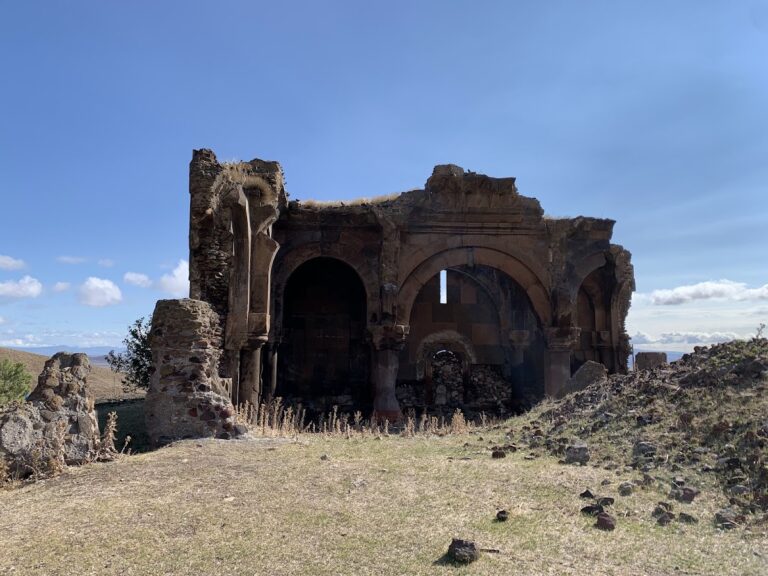
The destruction of the other four churches remains contested in its precise circumstances. A 1987 interpretation attributed their collapse to rolling stones, while local testimony and physical evidence supported deliberate demolition with high explosives by the Turkish army, dated to 1966. William Dalrymple observed in 1989 that the damage could not have resulted from an earthquake. The four churches were subsequently reduced to ground level. An earthquake in 1989 severely damaged St. Sarkis, splitting its concrete foundation into sections and leaving the surviving church at risk of collapse. Treasure hunters had also damaged the medieval cemetery on the slope above the Church of St. Gregory the Illuminator in 1986.
Remains
Khtzkonk stood on three rocky outcrops in a plain near the center of the Digor district, historically called Tekor. Its buildings were integrated with the surrounding mountainous landscape. The complex contained five finely cut-stone churches with domes. Three stood close together, while a smaller church adjoined a larger one but retained its own entrance and altar.
The churches
Church of St. John the Baptist
The Church of St. John the Baptist, also called St. Karapet, may have been the oldest church in the complex. Its date is placed either in the seventh or tenth century, while its umbrella-shaped roof has been associated with a later twelfth- or thirteenth-century addition. The oldest wall inscription dates to 1001 or 1006 and refers to Queen Katranide, the wife of King Gagik. The church had four apses and a dome carried by arches. Its surviving fabric consists of part of one wall and the foundations of the apses.
Church of St. Mary
The Church of St. Mary, or St. Astvatsatsin, stood south of St. John the Baptist and probably dated from the tenth or eleventh century. It was rectangular on the outside and cruciform inside, with two side chapels and a semicircular apse. A hall between the two churches was also recorded as part of the complex.
Church of St. Stephen
The Church of St. Stephen stood opposite St. John the Baptist on a separate rock and probably belonged to the tenth or eleventh century. Its exterior was rectangular, while its interior formed a cross with two side chapels and a semicircular apse. The entrance was concealed in the south facade and was difficult to find. Graves and khachkars, carved Armenian stone crosses often associated with graves or commemoration, surrounded the church. Tradition connected nearby graves with people killed during the 1208 siege of Kechror, also identified as Gechivan-Tunchkaya. Part of the foundations survives.
Church of St. Gregory the Illuminator
The Church of St. Gregory the Illuminator stood farthest east and probably dated from the tenth or eleventh century. Its small foundation was unusually high in relation to its plan. A walled area contained a prominent elongated khachkar set in a grave and dated to 1031. Medieval graves occupied the slope above the church, while the building itself collapsed completely and survives in several stone fragments.
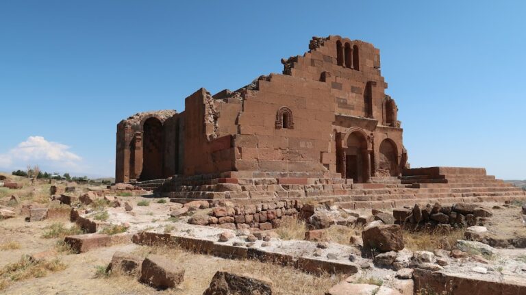
Church of St. Sarkis
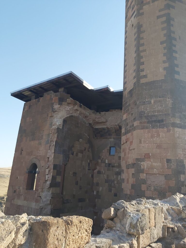
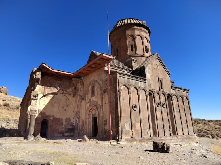
St. Sarkis was the largest church and is the only one still standing, although it survives in a severely ruined and unstable condition. Its construction date and patron are not securely established. The proposed date of 1025 derives from the account of Samuel of Ani, a medieval Armenian historian, which states that Prince Sarkis ordered the church to be built in that year. The oldest surviving wall inscription dates to 1033.
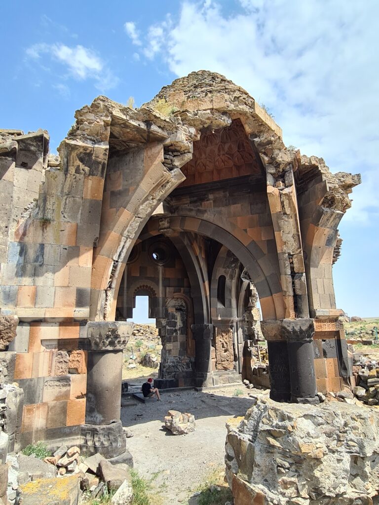
The church has a domed, centrally planned design with four apses and a circular exterior. Arches support the gabled zone beneath the dome, which carries an umbrella-shaped roof. If this roof belongs to the proposed 1025 construction, it would be the earliest known Armenian example of the type. Small rooms occupy all four interior corners. Their lower levels served as chapels, while the upper rooms were reached through high, narrow openings in the inner walls and probably provided storage for valuable objects and access to the roof.
Each apse contains one window. Inside, the windows have unusual cornices formed as curved gables resting on columns embedded in the apse walls. The column-and-gable ornament resembles layers around turned wooden cylinders, and a continuous band encircles the upper inner wall. This treatment has been described as foreign to Armenian architectural practice. Outside, shallow arches divide the facade into twenty sections. Most of the flat wall surfaces between them carry large, plain, deeply carved inscriptions.
A 1214 inscription on St. Sarkis preserves the memorial donation by David, son of Grigor, and names the abbot Hovhannes and the monks’ annual liturgical obligations. A large, carefully carved khachkar stood beside the north wall, with another similar monument to the northeast.
Monastic buildings and springs
Accommodation buildings ran along the edge of the largest rocky outcrop beside the river in the lower valley, northeast of St. Sarkis. They provided lodging for monks, pilgrims, and other visitors. A later guesthouse near St. Sarkis contained several rooms. The complex also had two mineral-water sources, a warm sulfur spring and a cold alkaline spring, together with several carbonated springs.