Khirokitia: A Neolithic Settlement in Cyprus


Site at a Glance
- Rating
- 4.4
- Popularity
- Medium
- Country
- Cyprus
- Primary era
- Stone Age
- External website
- Open
- Eras represented
- Stone Age
- Civilizations
- Unclassified
- Site type
- Military
- Remains
- Fortified Town
On this page12 sections
History
Khirokitia is a Neolithic archaeological settlement in Cyprus, founded around 7000 BC by farming communities of the Aceramic Neolithic, the phase before pottery became a regular part of material culture. The settlement occupied the slopes of a hill in the Maroni River valley and developed into a planned communal complex with substantial buildings, circulation routes, and enclosing walls. Its remains illuminate the organization of settled society on Cyprus and the island’s connections with Anatolia, the Levant, and the eastern Mediterranean.
Foundation and Neolithic life
Radiocarbon dating places Khirokitia’s foundation at approximately 7000 BC. Porphyrios Dikaios, who later discovered and excavated the site, initially proposed a date around 4000 BC. The settlement was probably founded by migrants from Anatolia and the Levant. Their cultural traditions and migration history remain poorly understood, and they are not regarded as descendants of Cyprus’s earlier inhabitants or as ancestors of the island’s later populations.
The inhabitants led a settled farming and herding life. They cultivated wheat, barley, lentils, peas, horse beans, and vetch, while gathering pistachios, figs, olives, plums, pears, and flax. Sheep, goats, and pigs were kept outside the settlement, and deer were hunted. Fishing supplied large species such as mullet, apparently caught with nets or lines fitted with strong hooks. The population probably ranged from 300 to 600 people at a time. Average adult stature was about 160 to 161 centimetres for men and 150 to 151 centimetres for women, while average life expectancy was approximately 35 years for men and 33 years for women. Infant mortality was high.
Abandonment and later occupation
Khirokitia and nearby settlements were abruptly abandoned around the middle of the sixth millennium BC, probably about 6000 BC, for reasons that remain unknown. The area was not resettled for roughly a thousand years, although small, dispersed communities may have continued elsewhere on Cyprus. A later population introduced new domestic animals, plants, and pottery during the Ceramic Neolithic. Khirokitia was finally abandoned in the early fourth millennium BC, around 3500 BC.
The settlement belongs to a group of roughly 20 Aceramic Neolithic sites distributed across Cyprus. Its scale and organization provide evidence for a coordinated collective society. The movement of people, animals, plants, and materials between Cyprus and surrounding regions also places the settlement within wider patterns of cultural transmission across the Near East, Asia, and the eastern Mediterranean.
Excavation and protection
Porphyrios Dikaios, director of the Cyprus Department of Antiquities, discovered Khirokitia in 1934 and directed six excavations between 1934 and 1946. His initial findings appeared in The Journal of Hellenic Studies in 1934. Excavations resumed in the early 1970s but were interrupted by the 1974 Turkish invasion of Cyprus. A French archaeological mission directed by Alain Le Brun began substantial work again in 1977, and French specialists, including an expedition associated with the National Centre for Scientific Research, have continued excavation and conservation since the 1970s.
Khirokitia was added to the UNESCO World Heritage List in 1998 under criteria ii, iii, and iv. UNESCO, the United Nations Educational, Scientific and Cultural Organization, uses this designation for cultural and natural places considered to have outstanding importance for humanity. In November 2010, the settlement received enhanced protection under the international system for safeguarding cultural property during armed conflict.
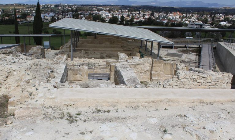
The Cyprus Department of Antiquities manages the site and protects its wider setting through a controlled buffer zone of 68 hectares. Conservation has concentrated on treating building materials to keep the ruins structurally safe while retaining their original form, materials, location, and setting. Temporary shelters protect exposed remains, and no reconstruction has been carried out directly on the archaeological site. Five buildings and part of the fortification wall have instead been reconstructed outside the archaeological area using excavation evidence.
The origin of the name Khirokitia is uncertain. Proposed explanations associate it with terms connected with pigs or pig raising, an earlier name linked to iron, palmistry, a sacred place, or the circular form of the prehistoric houses. A local tradition connects the name with Queen Rigena addressing a female friend from Kition. Older maps preserve forms equivalent to Cherochetica and Chierochitia, while a derivation from the cultivated plant cherimoya is considered very unlikely.
Remains
Hill setting and fortifications
Khirokitia occupies the southern slope of a high hill in the Maroni River valley, about 6 kilometres inland from Cyprus’s southern coast and overlooking the fertile Vasilikos Valley. At its greatest extent, the settlement covered approximately 6.2 hectares and descended toward the river in three segments. The Maroni channel was probably wider and higher than it is today. The river, steep slopes, and enclosing walls formed an integrated environmental and defensive setting.
A planned stone route led from the foot of the hill to its summit. It included numerous steps and rose about 200 metres above the surrounding plain, requiring substantial communal construction and maintenance. On the western side, a powerful stone wall about 2.5 metres thick enclosed the settlement. Its original height is unknown, although the highest preserved ruins reach about 3 metres. The steep riverbanks protected the other three sides. A second wall was later built farther west for an expansion of the settlement. Both walls contained substantial gateways, and the outer wall incorporated a staircase with three rows of steps.
Domestic and communal buildings
Round houses
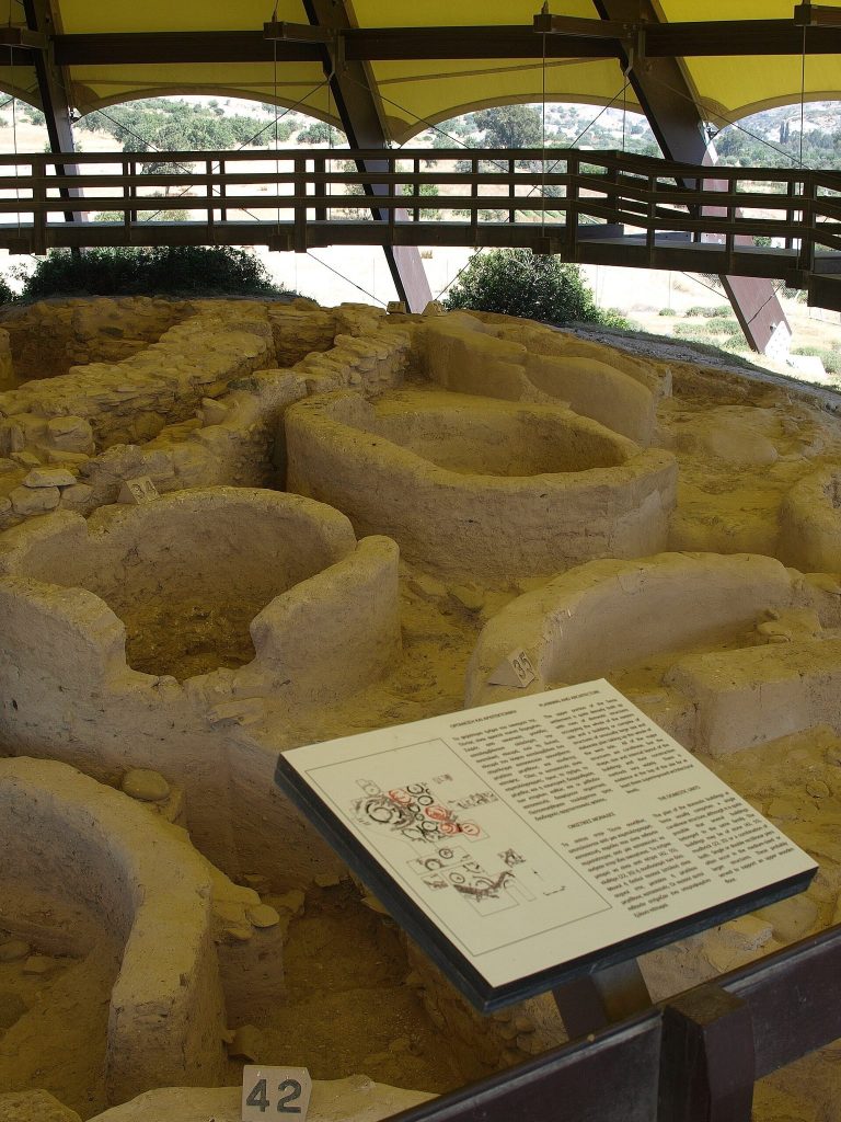
Excavations have exposed 48 dwellings within a settlement that may once have contained more than 1,000 buildings. The houses were closely grouped circular structures, often called tholoi, meaning round buildings used in prehistoric domestic or communal architecture. They were built directly on the ground without conventional foundations. External diameters ranged from about 2.3 to 9.2 metres, while internal diameters measured approximately 1.4 to 4.8 metres.
Lower walls commonly used rough limestone blocks, while upper sections were made from unfired bricks and compacted or plastered clay. Some buildings had stone-faced exteriors and interiors finished with clay and brick. Repeated applications of interior plaster created as many as ten layers in some structures. Roofs were probably flat constructions of branches and reeds or straw covered with clay or mud. A collapsed flat roof showed that the buildings were not all domed, as was once believed. Traces of paint survive in some interiors, while possible wall paintings are too poorly preserved to establish whether their designs were geometric or figurative.
Courtyards and interior spaces
Small circular structures stood around larger buildings and shared small courtyards, creating a closely packed, honeycomb-like arrangement. These units probably served domestic or agricultural purposes. Several hut-like spaces could be grouped around an open courtyard to form a larger household. Entrances were raised above ground level and reached by descending several steps; the elevated thresholds may also have helped protect buildings from flooding.
Many houses contained two stone columns or comparable supports, probably carrying an upper level or mezzanine used for sleeping or storage. Sleeping surfaces were made from branches and reeds. Hearths were placed on the floor between the supports and probably served cooking and heating. Low walls, platforms, benches, windows, and storage or working areas divided the interiors according to their functions.
Tools, vessels, and exchange
Objects from the settlement include flint tools, implements of limestone and diabase, bone tools, grinding equipment, mills, hammers, tampers, stone vessels, plant remains, and animal remains. Bone needles and other implements were used in agriculture, cereal harvesting, straw cutting, woodworking, and the scraping of fresh hides. Most domestic vessels were made from grey-green andesite. Bowls, dishes, trays, pots, and spoons included rectangular and elongated forms reaching about 30 centimetres in length. Carved decoration included bands, slanting lines, and stepped geometric patterns. One reported object bears a human representation.
Obsidian sickles and arrow or spear points were made from volcanic stone unavailable naturally on Cyprus. Their presence indicates contact with Asia Minor and northern Syria, probably through maritime exchange. Personal ornaments included stone beads, carnelian pendants, shell beads, and tooth-shaped shell ornaments. A small fragment of woven fabric provides evidence for Neolithic clothing.
Figurines and distinctive objects
Carved river pebbles, small domed stone figurines, and anthropomorphic figurines were found at Khirokitia. Most of the human forms were carved from stone, apart from one head made from pottery clay. The purpose of some domed figurines is unknown, although they may have been regarded as objects with magical power. Other unusual finds include decorated basalt pebbles engraved with complex lines on one or both sides and two pointed rings whose shapes resemble facing question marks. The purpose of these objects is also unknown.
Burials and ritual practice
The dead were placed in individual pits beneath the compacted-earth floors of houses. Bodies were commonly arranged in crouched or foetal positions on the right side. After burial, the pits were filled and covered with earth or mud, restoring the floor surface. In some cases, a stone was placed over the body, possibly to prevent the dead from returning to the world of the living.
Many child burials have been identified, and grave offerings included broken stone vessels, stone beads, bone needles and pins, food, and highly stylized, sexless anthropomorphic stone figurines. These burial practices point to complex ritual and religious beliefs and may reflect household ancestor cults. Electromagnetic surveys and further excavations have clarified the extent of the built environment, while the exposed ruins remain protected by temporary shelters.