Kawagoe Castle: A Uesugi and Tokugawa Fortress in Japan


Site at a Glance
- Rating
- 3.9
- Popularity
- Low
- Country
- Japan
- Primary era
- Early Modern
- External website
- Open
- Eras represented
- Medieval, Early Modern
- Civilizations
- Later Hōjō, Tokugawa, Uesugi
- Site type
- Military
- Remains
- Castle
On this page22 sections
History
Kawagoe Castle is a Japanese hill-and-plain castle in Kawagoe, Japan, founded in 1457 during the Kyotoku War as a defensive base of the Ogigayatsu branch of the Uesugi clan. Uesugi Mochitomo ordered his retainers Ōta Dōshin and Ōta Dōkan to construct it, creating a medieval stronghold against the Koga Kubo Ashikaga, whose forces held bases including Koga, Sekiyado, and Shinobi. Mochitomo became the castle’s first lord, although a separate tradition assigns the principal responsibility for its construction to Dōshin rather than Dōkan.
The Uesugi Defensive Line
Kawagoe and Edo castles formed parts of the same Uesugi defensive line. A military road connected them and later developed into the Kawagoe Highway. Dōkan became lord of Edo Castle, while residences for Dōshin and Dōkan were established west and northwest of Kawagoe Castle. The Koga Kubo was an Ashikaga branch based at Koga after losing control of Kamakura. It contested authority in the Kantō with the Uesugi, who were divided into the Yamanouchi and Ogigayatsu branches.
The castle was drawn into the Kyotoku War, the Chōkyō War, and the continuing conflicts among the Uesugi branches, the Koga Kubo, and the Later Hōjō clan. In 1497, Uesugi Akisada, leader of the Yamanouchi branch, established the Ueto camp on the opposite bank of the Iruma River at the former Kawagoe Castle site. He invited Ashikaga Masauji there, creating a seven-year standoff with the castle.
Hōjō Control and the Battle of Kawagoe
Hōjō Ujitsuna seized the castle in 1537 after the death of Ogigayatsu leader Uesugi Tomooki and the succession of the young Uesugi Tomosada. The Later Hōjō were a powerful warlord clan that expanded across the Kantō from Izu and Sagami during the sixteenth century. Under their rule, Kawagoe became a principal base in Musashi Province and was defended by an elite garrison known as the Kawagoe Corps, which included members of the Daidōji family.
From October 1545, Uesugi Tomosada, Ashikaga Haruuji of the Koga Kubo, and Uesugi Norimasa of the Yamanouchi branch besieged the castle with an army said to number 80,000. Hōjō Tsunashige resisted for about six months. In April 1546, Hōjō Ujiyasu returned from fighting the Imagawa and launched a night attack. The Battle of Kawagoe defeated the allied army, brought about Tomosada’s death, ended Ogigayatsu Uesugi power, drove the Koga Kubo into flight, and enabled the Hōjō consolidation of Musashi.
During the Later Hōjō period, Daidōji Masashige extensively repaired and enlarged the fortress, particularly the Third Bailey and Hachiman Enclosure. The work strengthened its western defenses. For roughly forty-five years, Kawagoe served as a satellite fortress protecting Edo and Odawara, the Hōjō central castle, while also providing a base for operations toward northern Kantō.
The Kawagoe Domain
In 1590, during Toyotomi Hideyoshi’s conquest of Odawara, Daidōji Masashige surrendered after campaigning against the invading army in Kozuke Province. Maeda Toshiie’s forces then entered Kawagoe Castle. Hideyoshi was the ruler who unified Japan in the late sixteenth century. After Tokugawa Ieyasu was transferred to the Kantō region, Sakai Shigetada received Kawagoe as a domain assessed at 10,000 koku in August 1590, establishing the Kawagoe Domain. A koku measured a domain’s assessed agricultural production and was conventionally associated with the rice needed to support one person for a year.
The castle lords who followed came from the Sakai, Hotta, Ōkōchi-Matsudaira, Yanagisawa, Akimoto, Echizen-Matsudaira, and Matsui-Matsudaira houses. These seven houses supplied twenty-one lords in total. The domain reached its highest assessed revenue, 170,000 koku, under the Echizen-Matsudaira branch.
In 1639, Matsudaira Nobutsuna became lord after suppressing the Shimabara Rebellion and began a major enlargement of the castle. Nobutsuna was a senior Tokugawa administrator and daimyō of the early Edo period, the era of Tokugawa rule from 1603 to 1868. The enlargement was completed around the Kanbun era, approximately 1661 to 1672, and transformed the medieval stronghold into a much larger early-modern fortress. Nobutsuna also organized the surrounding castle town, improved flood control and agriculture, and helped establish Kawagoe’s economic importance.
During the Edo period, Kawagoe Castle served as the administrative headquarters of the Kawagoe Domain. The castle town became known as “Little Edo” and developed as a center for commerce, manufacturing, agriculture, and the distribution of goods. Products traveled to Edo through the Shingashi River, while the Kawagoe Highway carried domain lords on alternate attendance journeys between their territories and Edo. It also connected the domain with holdings around Maebashi in Kozuke Province. Alternate attendance required lords to travel periodically between their domains and Edo.
Maebashi, Reconstruction, and Decline
In 1767, the Echizen-Matsudaira house acquired Kawagoe after the Akimoto house was transferred elsewhere. Flooding had badly damaged Maebashi Castle and made rebuilding difficult, so the family received permission to use Kawagoe Castle as its residence. This arrangement lasted until Maebashi Castle was rebuilt in 1867. The former Kawagoe and Maebashi territories were then divided between the Kawagoe and Maebashi domains.
The palace in the Second Bailey burned in 1846. Matsudaira Naritsune rebuilt the residence in the First Bailey in 1848, producing the portion of the Honmaru Palace that survives today. In 1868, Matsui-Matsudaira Yasuhide ordered the castle’s moats to be filled as a sign of submission to the Meiji government. Dismantling of the aging buildings began around 1869 to 1870, and after the 1873 Abolition of Castles, unused and damaged structures were auctioned and sold.
Preservation and Local Traditions
The castle site became a Saitama Prefectural Historic Site in 1924. The surviving Honmaru Palace received designation as a Saitama Prefectural Tangible Cultural Property in 1967, and the relocated Chief Retainer’s Assembly Room received the same designation in 1991. Kawagoe was selected as one of Japan’s 100 Famous Castles in 2006. A preservation and repair project for the Honmaru Palace took place from October 2008 to March 2011. Plans developed from 1989 proposed enlarging the castle-ruins park and restoring portions of the former castle area. A reduced plan was revived in 2017, and a 2019 proposal called for relocating the stadium and swimming pool built on the ruins around 2032.
Traditional names preserve aspects of the castle’s historical identity. “First Wild Goose Castle” is linked in one tradition to wild geese circling a sacred cedar near Miyoshino Shrine. Another tradition says that opening a covered well during warfare released protective mist over the castle, giving rise to the name “Mist-Hiding Castle.” Local traditions also connect the castle’s construction with a sacrificial offering to a dragon deity. Another story credits Dōkan with consecrating water from a nearby well after receiving guidance from an old man believed to be Tenjin.
Miyoshino Shrine was traditionally regarded as the setting of the children’s song Tōryanse. Its lyrics have been interpreted as referring to restricted popular access to the shrine and strict inspection on the return journey. A folding screen depicting the conflict known as the Horikawa Yōchi was traditionally donated by Sakai Shigetada to Yōjuin. He had attributed disturbing sounds heard at night in the castle to the screen, which is said to remain at the temple.
Remains
Kawagoe Castle was built on the northeastern edge of the Musashino Plateau, where its ground stood roughly 5 to 6 metres above the surrounding lowlands. The Akamagawa, now called the Shingashi River, flowed north of the castle. The Iruma and Oppe rivers lay farther north, while wetlands associated with the Yōna River extended to the south. These waterways and lowlands formed natural defensive barriers around the elevated site.
Baileys, Enclosures, and Towers
The original castle covered about 50,000 tsubo and contained eight gates and eight towers. Its defensive plan, known as the “Dōkan style,” used connected blocks in which independent baileys were enclosed by earthen ramparts about two ken high and divided by moats. A bailey was an enclosed subdivision of a castle, separated from other enclosures by walls, banks, gates, or moats. Flying bridges, earthen bridges, drawbridges, offset entrances, and side firing positions allowed each bailey to resist an attacker.
The complex grew repeatedly from the medieval period through the early modern period. Its enlarged form included the First, Second, and Third Baileys, together with the Hachiman, Outer, Rice-Field, New, Middle, and Obi enclosures. The total area exceeded 99,000 tsubo, approximately 326,000 square metres. The completed early-modern castle had four principal towers and thirteen gates, including the West Main, South Ten, First, Second, Third, Tenjin, Hasuike, Middle, Shimizu, Rice-Field, Obi, New, and Buried gates.
Fujimi Tower
Kawagoe had no conventional central keep. Fujimi Tower, a Japanese castle tower used for observation, storage, signaling, or defense, stood at the highest point and served as its substitute. Descriptions differ over its form. It has been described as a two-storey, two-level tower and elsewhere as a three-tiered structure, while recently found drawings also indicate two levels. An 1866 survey gave approximate dimensions of 15 metres in length and 14 metres in width. The name referred to the view of Mount Fuji.
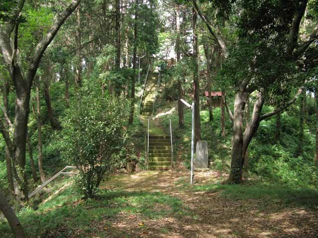
The tower stood on a mound about 20 metres high southwest of the First Bailey. It was approximately 150 metres from the Honmaru Palace in a straight line, or about 300 metres by route. The mound, now south of Kawagoe High School on the former Third Bailey site, remains the castle’s highest surviving point. Asama Shrine and Ontake Shrine now stand on it.
Other Defensive Towers
The principal defensive towers also included Tora Tower at the northwest corner of the First Bailey and the two-tiered Hishi Towers in the Second Bailey. Some records reverse the names Tora and Hishi, so the exact arrangement of these towers is not entirely consistent.
Residences and Administrative Areas
The Second Bailey held the lord’s residence until it burned, together with the Weapons Office. The retired lord’s residence stood in the Third Bailey, whose southern side also contained a riding ground and a horse-viewing stand. Senior retainers’ residences occupied the Outer Enclosure. The New Enclosure contained rice granaries and a gunpowder storehouse, reflecting the administrative and military functions distributed across the wider castle.
Honmaru Palace
Surviving Palace Buildings
The Honmaru Palace was rebuilt in 1848 with an irimoya roof, which combines a gabled upper section with sloping lower planes. Its grand entrance and carriage porch had a large karahafu, a curved bargeboard gable, and a canopy protecting them from rain. The palace frontage measured nineteen ken and its depth five ken. The surviving entrance and Great Hall occupy approximately 165 tsubo. The Great Hall measures thirty-six tatami mats and is separated from the entrance by a wooden-floored space. It has a boarded ceiling, a reception room three ken deep, and a corridor nine shaku wide around it.
Palace Layout and Reuse
The original Honmaru Palace consisted of sixteen buildings covering about 1,025 tsubo, or approximately 3,388 square metres. The surviving complex comprises the entrance, Great Hall, and Chief Retainer’s Assembly Room. The entrance and Great Hall were successively reused as the Iruma Prefectural Government Office, Iruma County Public Hall, a Kawagoe branch factory of the Yodobashi Tobacco Monopoly Bureau, the training hall of the Kawagoe Martial Arts Promotion Association, Kawagoe’s First Wild Goose Martial Virtue Hall, and a postwar junior-high-school classroom and gymnasium.
The surviving Great Hall is one of two Japanese castle Great Halls that remain. The other is at Kochi Castle. Complete castle-palace complexes are rarer still, with Nijo Castle and Kakegawa Castle identified as the other principal examples.
Chief Retainer’s Assembly Room
The Chief Retainer’s Assembly Room was dismantled and moved to a private house in present-day Fujimino. It was later returned to the castle compound, although not to its original position. The present Honmaru Palace therefore preserves part of the former palace while the assembly room does not stand in its first location.
Moats, Banks, and Former Gates
Middle Gate Moat
The Middle Gate Moat survives about 300 metres west of the Honmaru Palace near residential buildings in Kakumachi. Matsudaira Nobutsuna arranged it to obstruct an enemy advancing from the West Main Gate toward the First Bailey. Since 2008, the moat and part of the gate have been restored within a municipal park project.
Earthen Ramparts and Gate Sites
A raised area beside Miyoshino Shrine, east of the Honmaru Palace, is regarded as a surviving castle earthen rampart. The low ground between the castle site and Hikawa Shrine to the north marks the former position of a moat. The West Main Gate stood near the present city hall, the Main Gate near the former Hatsukari Stadium, the Rice-Field Bailey Gate near the Fujimi Tower mound, and the South Main Gate near the west gate of the present First Elementary School. A road leading from the South Main Gate’s barbican preserves the line of a former internal castle route.
Relocated Structures and Samurai Residences
Nagashima Residence
Nagashima Residence near the South Main Gate occupies the site of a samurai residence. It is described as the only surviving Edo-period samurai-house remains in Saitama Prefecture. Its hedge is made of trifoliate orange, a plant prescribed for samurai residences in Kawagoe.
Relocated Gates and Buildings
The gate of Eirinji Temple in Kawagoe was relocated from the Hasuike Gate in the Second Bailey. The Noguchi family’s two-storey nagaya gate in Kuzubukuro, Higashimatsuyama, is traditionally identified as a relocated rear gate of Kawagoe Castle. It measures fourteen ken across, three and a half ken in depth, and two and a half ken across the door section. Traces of red pigment remain on the upper part of the doors, although only the doors are considered to derive from the castle.
The former Naritasan guest residence in Kawagoe and a martial-arts hall at Musashino Village in Kazo are also recorded as having been relocated from the castle. The Kazo building was later demolished. A gate leaf said to come from Kawagoe Castle is preserved at the Kawagoe City Museum but is not publicly displayed.
Castle Town and Water Transport
Much of the former castle area now lies beneath the urban fabric, making its original layout difficult to visualize. The Second Bailey site contains the Kawagoe City Museum and Kawagoe City Art Museum, while Kawagoe High School occupies the Third Bailey site. The Honmaru Palace, Fujimi Tower mound, moat traces, earthen banks, and relocated components form the principal surviving material evidence.
The castle and town were organized around the defensive form of the plateau. The town plan called “Ten Towns and Four Temple-Front Towns” included village and castle-affiliated areas, with approximately twenty-three longitudinal streets and seventy-eight transverse streets. Cul-de-sacs, angled streets, multiple bends, and T-junctions gave the urban plan deliberately defensive forms.
The West Main Gate opened toward Edomachi, where a relay station handled horses and labor and where rice from the domain granaries was inspected. The Kawagoe Highway began there and ran south toward Edo. The high-post station called Fuda-no-tsuji lay west of the gate. The commercial Upper Five Districts surrounded Fuda-no-tsuji, while the artisan Lower Five Districts and four temple-front districts occupied adjacent areas.
The southern side of the castle was associated with the extensive temple lands of Kitain and Senba Tōshōgū, institutions directly administered by the Edo shogunate. The arrangement also had a military purpose. Senior samurai residences stood south of the moats near the South Main Gate, lower-ranking retainers lived in barracks near the highway entrance, and the samurai quarter expanded southward along the highway as the domain acquired additional territory.
The Kawagoe Five Wharves formed the town’s external port and its main logistics center for large cargo, which in the premodern period could generally be transported only by boat. A surviving castle map preserved in the Rakuchidō Nenroku and dated 1694 is regarded as the oldest known early-modern map depicting Kawagoe Castle.