Kasbah of Amergou: A Medieval Fortress in Morocco
Site at a Glance
- Popularity
- Medium
- Country
- Morocco
- Primary era
- Medieval
- Eras represented
- Medieval
- Civilizations
- Almoravid
- Site type
- Military
- Remains
- Fort
On this page15 sections
History
The Kasbah of Amergou is a medieval fortress on Mount Imergou in northern Morocco. Its foundation date and builders remain disputed, but it is associated with the Almoravid Empire, a North African and Iberian Muslim dynasty, and its eleventh- and twelfth-century military network. That network helped counter rebellions among tribes in northern Morocco and resist the rise of the Almohads, a movement and dynasty opposed to Almoravid rule.
Origins and competing interpretations
The fortress is also known by the names Amargu and Imargu. Its medieval character was once confused with Roman military remains: La Martinière identified it as the Roman post of Prisciana. Nearby ancient sites, including Volubilis, Ain Schkour, and Tocolosida, contributed to the mistaken association.
Henri Terrasse attributed Amergou to the Almoravids. He suggested that Christian militias or renegades from the Iberian Peninsula who served them may have influenced its design, citing features he read as a fortified strongpoint and outer entrance defense, along with stone construction and rounded towers. Manuel P. A. Almansa instead proposed an earlier origin, possibly under the Idrisids, an early Moroccan dynasty, or the Fatimids, a North African and eastern Mediterranean dynasty. He argued for eastern Mediterranean influences and questioned both Terrasse’s interpretation and the reliability of the Kitab al-Istibsar, which he considered a later work shaped by oral tradition. He also contrasted Amergou with the Almoravid-attributed fortresses of Zagora and Tasghimout, and drew comparisons with the Idrisid walls of Al-Basra and the fortifications of Dimna.
A later group of four researchers, including Spanish scholar María Marcos Cobaleda and three Portuguese researchers, defended an Almoravid date. They argued that the Kitab al-Istibsar was not as late as Almansa proposed, pointing to its connection with a twelfth-century revision and references by al-Himyari, Léon l’Africain, and the early-fourteenth-century work Rawd al-Qirtas. They also compared Amergou with fortifications at Algeciras and Tasghimout. Their interpretation assigns the fortress to the eleventh-century emir Youssef Ibn Tachfin, as a means of controlling rebellious tribes in northwestern Morocco. They attribute Tasghimout to his son and successor, Ali Ibn Youssef, and explain the differences between the two sites through changes in Almoravid building techniques. The competing explanations for Amergou’s origin remain unresolved.
Almoravid and Almohad conflict
Amergou served a defensive role during the struggle between the Almoravids and Almohads. After Almohad advances captured major Almoravid cities, survivors driven from Fez took refuge at the fortress. Almohad forces under Abd al-Mumin Ibn Ali later captured it. The kasbah is also described as a refuge for forces during subsequent Marinid and Saadian rule, two successive Moroccan dynasties.
Marinid rebellion
During a rebellion in 1270–1271, the fortress sheltered members of the Marinid royal family and rebels led by Mohammed Ibn Idriss Ibn Abd Al Haq and Moussa Ibn Rahou Ibn Abd Al Haq. Abu Yaqub Yusuf an-Nasr pursued them with 5,000 horsemen. On the second day of the siege, his brother Abu Malik arrived with another 5,000. The emir Abu Yusuf Yaqub ben Abd al-Haqq came from Marrakech with additional troops on the third day.
After two more days, the rebels surrendered, bringing the siege to an end in less than a week. The emir had promised amnesty on the condition that they leave for exile in Tlemcen.
Saadian-era religious associations and conflict
During Saadian rule, the area around Amergou developed as a religious center. In 1589, Mohammed Ibn Moussa Ach-Chaoui, a regional saint and religious teacher, was buried south of the fortress. His disciple, Sidi Mohammed el Hadj el-Baqqal, is associated with the Ghomara region during the Saadian succession conflict. Ach-Chaoui’s burial gave rise to the name Moulay Bouchta, meaning “Lord of the Rain,” and to the belief that he could bring rain in times of drought. He became regarded as the region’s patron saint. A mausoleum was built in his honor, and periodic religious gatherings, known as moussems, are held there.
Accounts of the succession struggle place a battle at Moulay Bouchta’s mausoleum. Around 1603, Mohammed ech-Cheikh el-Mamoun, governor of Fez and son of Sultan Ahmed al-Mansour, fled toward the Fechtala mountains after challenging his father’s authority and sought refuge at the shrine. Pasha Judar and the local official Mansour Nabili pursued him, defeated him, and led to his imprisonment. Since the mausoleum was not a defensive structure, a later interpretation proposes that the battle took place at the Kasbah of Amergou, which may have been al-Mamun’s final refuge before his capture.
Heritage protection and restoration
A decree dated 10 December 1930 declared the kasbah Moroccan national heritage, with the designation taking effect on 16 January 1931. Partial restoration and rehabilitation began several years before 2019.
Remains
Mountain setting and defensive enclosure
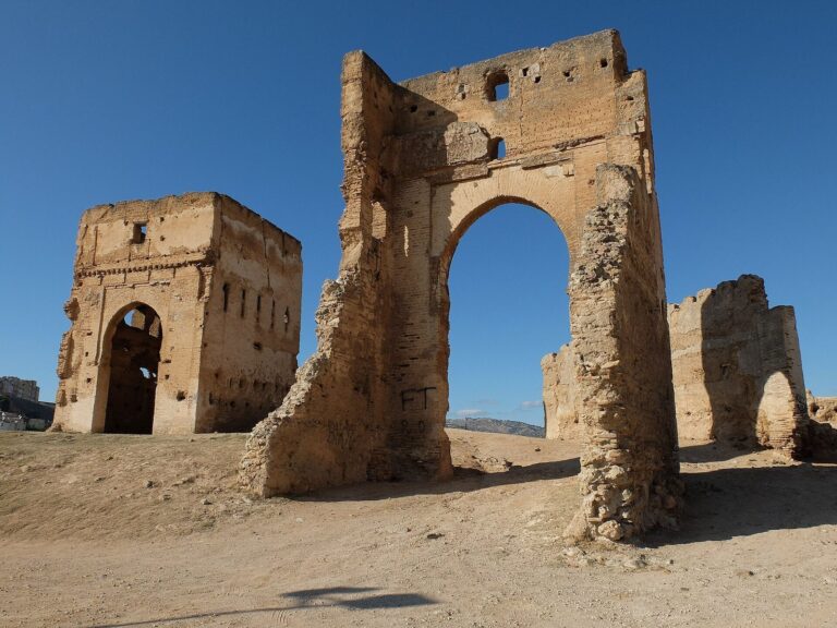
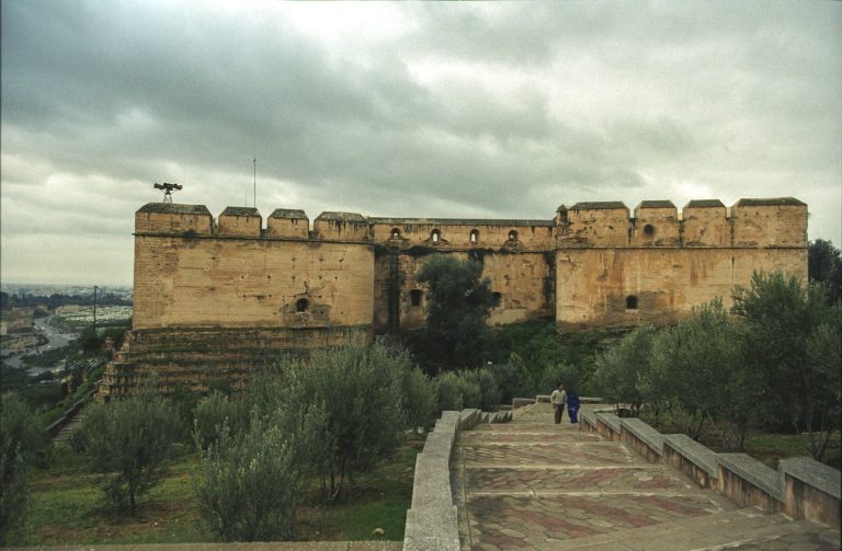
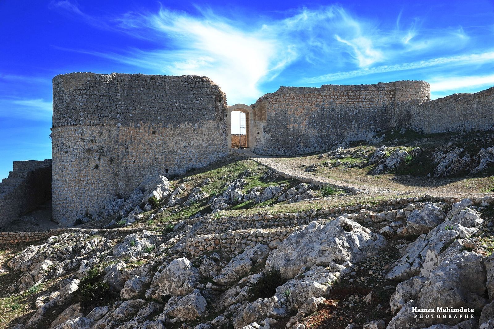
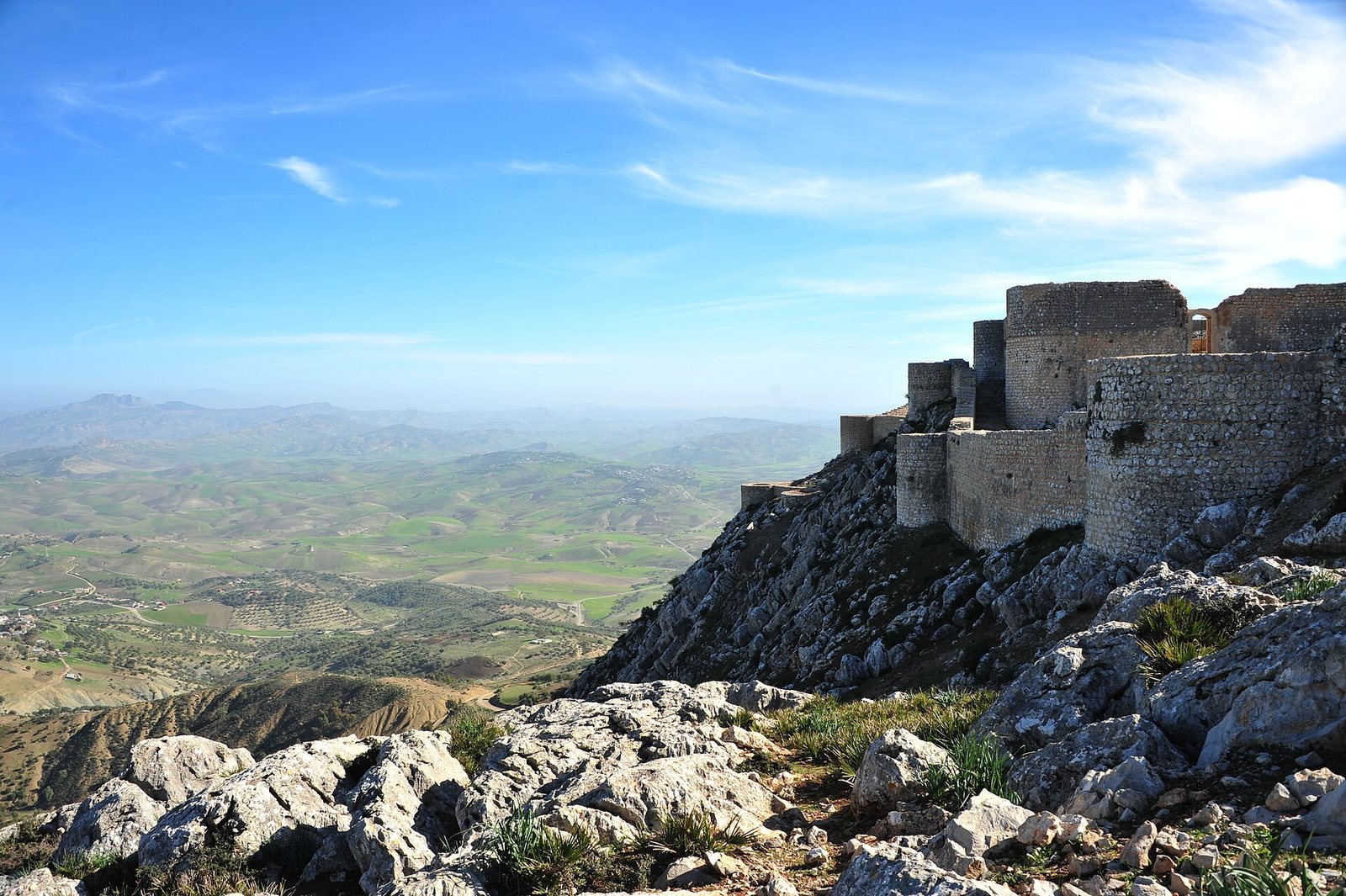
The fortress stands at about 640 metres above sea level on the summit and spur of Mount Imergou, roughly 73 kilometres northwest of Fez and 65 kilometres west of Taounate. It overlooks the Ouergha plain and surrounding region; Douar Amergou lies below, while the village of Moulay Bouchetta al-Khammar, which contains the regional saint’s mausoleum, is about three kilometres south. The enclosure follows the mountain spur in an irregular plan that is longer than it is wide. Curtain walls, meaning defensive walls joining towers or other fortified structures, run along rocky ridges between the slopes and summit, creating a polygonal outline with several defensive angles. Sixteen circular and hemispherical towers of unequal size reinforce the mountain’s angles and served observation and defense. Henri Terrasse estimated the enclosure at about 225 by 62 metres, or nearly 1.4 hectares.
Forework and central block
Northeastern forework
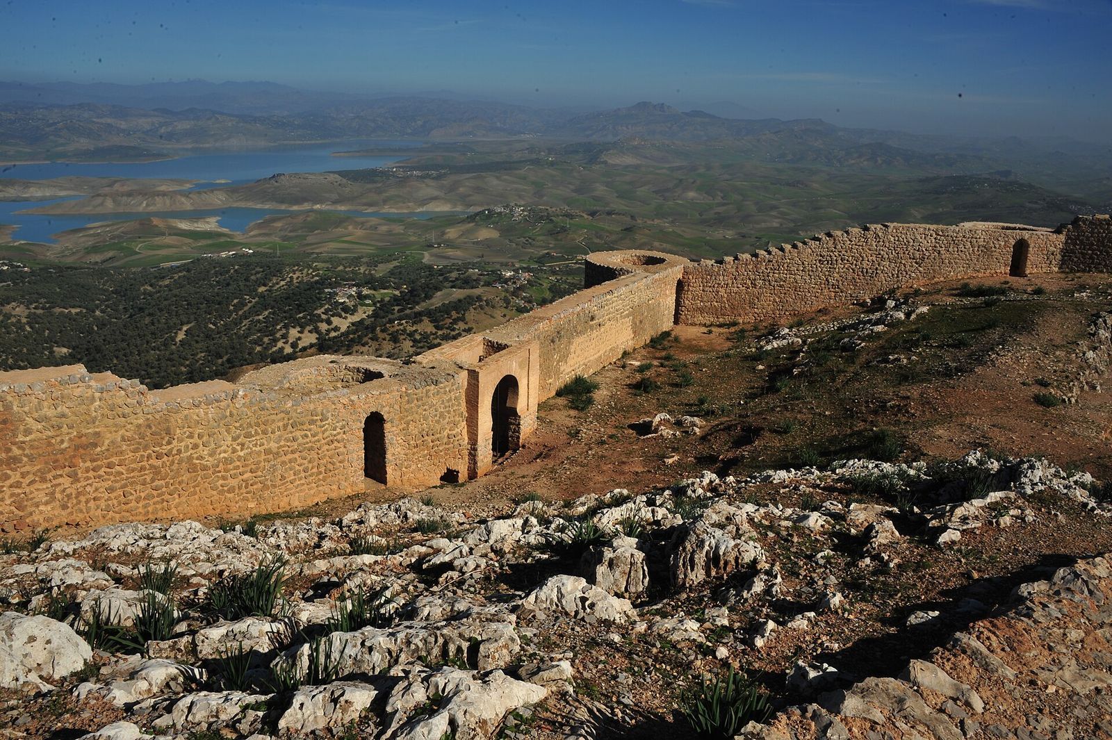
The northeastern forework consists of two towers linked by a curtain wall, with a further structure on the east connecting them to the main enclosure. Its western corner is open. An opening beside a tower of the central enclosure gives direct access to this area. Henri Saladin interpreted the forework as an outer defensive work protecting an entrance. Terrasse saw it as an early arrangement of detached or projecting defensive towers. Almansa considered both explanations unproven and called for closer study.
Central block
A square block divides most of the interior into three areas. Its southern part comprises two circular towers joined by a curtain wall and connected to the rest of the enclosure. To the north, two hemispherical towers and a curtain wall stand across a narrow passage from the northern part of the outer enclosure; the passage links the two ends of the kasbah. Two doorways on opposing sides open toward the fortress’s flanks. Partition walls survive inside the block, and a storage silo may also have been present. Its purpose is uncertain: Saladin considered it a possible living area, while Terrasse interpreted it as a fortified strongpoint, an identification Almansa regarded as unsupported.
Courtyard and entrance passage
Southeastern courtyard
The southeastern area is a large courtyard with two exits. A northern doorway opens toward the forework, while an eastern doorway is flanked by two towers. A rectangular excavated depression in the courtyard may indicate the position of a cistern, a structure for storing water. Rehabilitation work cleared and restored the base of a circular structure at the courtyard’s southwestern corner.
Northwestern entrance
The northwestern area has an opening at its northern end and another opposite it, probably the main entrance. Two horseshoe arches lead into a passage with a vaulted, or curved, ceiling. A rectangular room lies northwest of the passage and a square room southeast of it.
Materials and openings
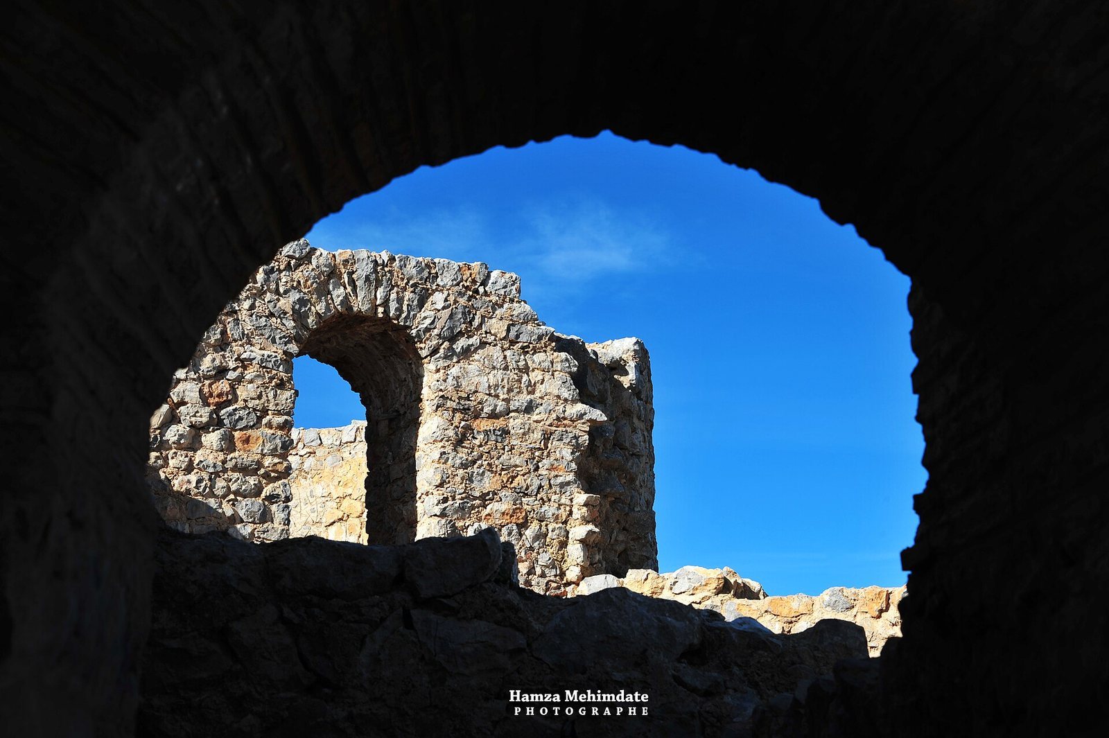
Stone and roughly dressed rubble form the curtain walls, projecting defensive structures, and openings. A plaster-like coating called stucco may have covered parts of the enclosure, where traces survive. Red brick appears in the exterior doorways except for the southeastern one, in both doorways into the central block, and in some tower windows. Semicircular arches, shaped like half-circles, provide access to all the towers and form some exterior doorways. Pointed horseshoe arches, which curve inward before meeting at a point, frame the main entrance and the entrance to the northeastern forework. A horseshoe arch also decorates the central block’s western doorway.