Kalaroos Caves: An Ancient Cave Network in India
Site at a Glance
- Rating
- 4.5
- Popularity
- Low
- Country
- India
- Primary era
- Unclassified
- Eras represented
- Unclassified
- Civilizations
- Unclassified
- Site type
- Infrastructure
- Remains
- Tunnel
On this page11 sections
History
Kalaroos Caves are an ancient cave network in Misri Behak, Kupwara district, Jammu and Kashmir, India. Their builder, age, and original purpose remain unknown, and the legends surrounding them have not been substantiated by archaeological research. The caves are also known as Qil-e-Roos, meaning “Russian Fort.”
Local traditions and uncertain origins
Local folklore attributes the caves to Russian traders several hundred years ago. It associates them with alleged underground routes linking the Kashmir Valley with Russia and other neighbouring countries, but no such connections have been verified. Another tradition connects the caves with the Silk Route, the long-distance trading network that linked East Asia, Central Asia, South Asia, the Middle East, and Europe. In this local interpretation, the passages served as routes through the Kashmir region when the valley was heavily snowbound.
Traditions also describe the caves as places of refuge where people sought safety and prayed for salvation. The seven openings carved into the main rock formation are likewise associated with seven routes, including a supposed Russian route and six passages leading to other countries. These claims remain matters of local belief rather than established history.
Conflict and modern investigation
During the early years of the Kashmir insurgency, the prolonged armed conflict and militancy associated with the Kashmir region, the Indian Army used explosives at the site because of suspected militant hideouts. The blasts damaged parts of the cave complex. Local accounts further state that Cave 3 was sealed with explosives because of suspected bears or militants.
In 2018, American explorers Amber and Eric Fies of North Star Adventure Consulting surveyed three caves while examining the claims about secret underground passages. They suggested that two caves might once have been interconnected because they have similar elevations and orientations, with one passage rising and the other descending. Cave 3 could not be fully examined because it had been sealed. Traces of Himalayan porcupines were observed inside it.
A graveyard in Kalarooch village is traditionally said to contain the remains of about 300 people, including dozens of militants. This claim forms part of the modern local history associated with the caves.
Remains
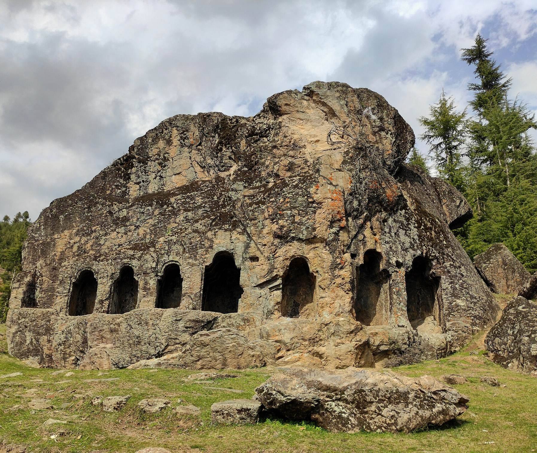
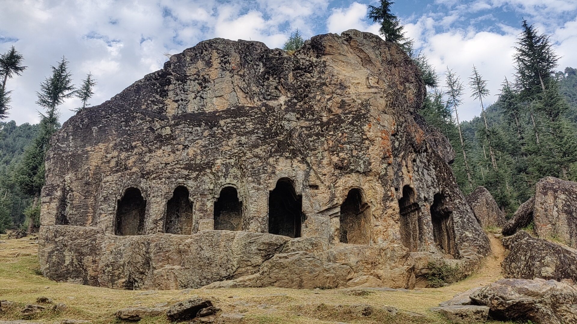
The cave complex lies in the Lolab Valley of Kupwara district at approximately 1,900 metres above sea level. Its central landmark is Satbaran, a prominent rock formation with seven carved openings known locally as the “seven doors.” Additional caves are situated a few metres from this formation, while three larger caves rise at progressively higher elevations on the mountainside. Their passages contain narrow sections, loose rock, shafts, and corridors that end within the cave system.
Satbaran and nearby workings
Satbaran
Satbaran is the principal rock formation at the site. Its seven carved openings form the physical basis for local traditions about routes to Russia and other countries. The alleged long-distance connections have not been demonstrated.
Tramkhan
Tramkhan, one of the nearby caves, has crimson-coloured walls and is believed locally to have been a copper mine. A weathered inscription in an unidentified foreign script appears within it. Local claims also associate the wider cave complex with underground water bodies, although these claims remain unverified.
Surveyed caves
Cave 1
Cave 1 lies beyond Satbaran at approximately 1,980 metres above sea level. Its entrance passage is narrow and rises for about 50 metres, becoming tighter in places before reaching a 15-metre vertical shaft, a steep passage descending or rising within a cave. Below it is a small chamber, followed by a further 10-metre shaft leading to another room. A five-metre upward passage then reaches a narrow horizontal corridor, a relatively level passage through the rock, which continues for about 15 metres before ending. Side passages and openings near the entrance were also explored and ended shortly afterward.
Cave 2
Cave 2 is higher on the mountainside, at approximately 2,020 metres above sea level. It has the largest entrance among the three surveyed caves. Its main passage descends for about 50 metres before ending abruptly. The passage appears to have been partly filled, possibly by a landslide or natural erosion.
Cave 3
Cave 3 lies highest on the mountain, at approximately 2,260 metres above sea level. Its passage slopes downward for about 40 metres and reaches a narrow horizontal corridor that continues for 20 metres. Partially explored side passages end shortly afterward. The cave was sealed with explosives according to local accounts, leaving its interior only partly examined.