Jubb Yussef: A Historic Well and Caravan Station in Israel
Site at a Glance
- Popularity
- High
- Country
- Israel
- Primary era
- Medieval
- Eras represented
- Medieval, Modern
- Civilizations
- Crusader, Mamluk, Ottoman
- Site type
- Economic
- Remains
- Caravanserai
On this page18 sections
History
Jubb Yussef is a historic well and former caravan station near Ami’ad in Israel, known from the mid-tenth century as a landmark, a holy place, and a water source for travellers. Muslim tradition identifies the well with the pit into which Joseph was cast by his brothers, though the location of that pit is uncertain. The site also developed as a road station connected to Safed and the wider routes between Egypt, Damascus, and the Mediterranean coast.
Tradition and early references
In the biblical and Qur’anic traditions, Joseph’s brothers throw him into a pit. The Qur’an describes the event but does not identify where it happened. Muslim commentators proposed several locations, among them Jerusalem, the Galilee, and places between Sangil and Shechem. The Galilean identification became established from the tenth century onward, although another tradition places the pit at a well in the Jenin area.
From the middle of the tenth century, Jubb Yussef appears in descriptions of the region as a landmark and a place where caravans could obtain water. The geographer Qudamah located it between Kfar Leila and Tiberias. In 985, al-Muqaddasi used the site to describe distances to other destinations, reflecting its value as a recognizable point on regional routes.
Crossroads under Crusader and Mamluk rule
In the twelfth and thirteenth centuries, Crusaders adopted the Muslim identification of Jubb Yussef as Joseph’s pit. Because the biblical story connects the pit with Dothan, they applied that name to the surrounding region. Saladin, the Ayyubid ruler who campaigned against the Crusaders, passed the site in 1189 while travelling to the siege of Acre.
A settlement existed in the area between the thirteenth and seventeenth centuries. Pottery from a settlement east of the well dates to the second half of the thirteenth century. Its founding may have occurred under Crusader or early Mamluk rule, perhaps to serve pilgrims, but its origins are not certain.
Jubb Yussef lay at a junction on the Via Maris, a major historic route through the region, and on roads serving Safed. The coastal passage was difficult because of the Sharon marshes, Mount Carmel, and the rugged Ladder of Tyre, making the inland corridor important. Routes from the main road linked the site with Safed, Acre, Damascus, Banias, and the Beqaa Valley. Three paths connected it to Safed: one via Khirbet al-Shuna and Nahal Amud; another via Bab al-Khanin, near the Ami’ad reservoir and the route of a British military road; and a third through the Ami’ad valley and Korazim toward Capernaum, also used between Safed and Tiberias. The western road toward Acre crossed Beit Kerem, sometimes by way of the Sakhnin Valley. After a road between Rosh Pina and Safed was built in the early twentieth century, the direct route through Nahal Amud fell out of use.
The Mamluk rulers secured the road between Egypt and Damascus with roadside inns and forts. Sultan Jaqmaq built or restored a chain of inns in 1440, including Khan al-Minya and the one near Bnot Yaakov Bridge; Jubb Yussef does not appear to have had an inn at that time. A separate inn at Jubb Yussef was described as newly built in 1470 by the Belgian traveller Anselme Adorno. Its construction date is unknown. A late-thirteenth-century date has been proposed on limited architectural grounds, while construction during Sultan Inal’s mid-fifteenth-century reign is considered more likely. Sultan Qaitbay passed through the area in 1475.
During the Mamluk period, Jubb Yussef apparently prospered chiefly because of its ties to Safed, then a major city and district capital. The site served as a toll station staffed by soldiers, and the governor of Safed arranged supplies for state caravans travelling that way. The distances between inns on the main road meant that Jubb Yussef was not needed as an additional overnight stop.
Ottoman-era settlement and pilgrimage
In 1560, Jubb Yussef was described as an estate belonging to the sultan where road tolls were collected. An Ottoman tax register from 1596 lists it as a village of 72 people in 13 tax-paying households. Their taxes, paid directly to the sultan, were levied on crops, goats, and beehives.
A 1577 plan for postal horses travelling between Egypt and Damascus did not include Jubb Yussef, consistent with its role as a toll station connected to Safed rather than a horse-relay post. Muslims and Christians continued to revere the place and to hold prayers and observances associated with Joseph. In 1599, the Italian traveller Aquilante Rocchetta described groups of Eastern Christians performing a ritual that appeared to be connected with Joseph. Pilgrims generally continued to other stopping places instead of staying at Jubb Yussef.
Earthquakes, changing use, and decline
A map made during Napoleon’s 1799 campaign marks Jubb Yussef as a crossroads. In 1812, Swiss traveller Johann Ludwig Burckhardt described the inn as rapidly deteriorating. About twelve North African soldiers and their families were living there and cultivating nearby fields. The well remained a place of prayer for Muslim and Christian travellers. The road past the inn linked Acre and Damascus, a route associated with the Ottoman rulers Suleiman Pasha and his predecessor Jazzar Pasha.
The 1759 earthquake may have contributed to damage to the inn. The earthquake of 1837 probably caused the well to collapse, ending its use as a water source, and may also have damaged the inn. The courtyard around the well and its small mosque appear to have been ruined in that earthquake; some stones may later have been reused in an animal enclosure beside the inn. A British survey in 1875 described the inn as a stopping place for merchants. In 1900, a benefactor apparently of Indian origin placed a marble plaque on the domed structure over the well.
The inn continued to decay, and its remaining entrance arch collapsed in 1985. Jubb Yussef remains associated with the tradition of Joseph, although the well no longer serves as a water source.
Remains
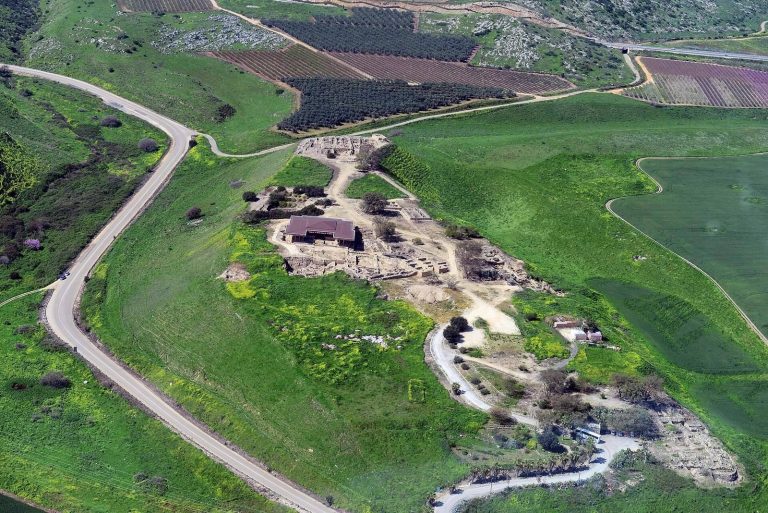
The site occupies the western edge of an isolated rocky hill near Ami’ad, at an elevation of about 246 metres. Its remains include the well and traces of its religious precinct, a settlement area to the east, and a rectangular inn about 80 metres west of the well. A path between the two is partly cut into the rock.
The well precinct and settlement
The well and cupola
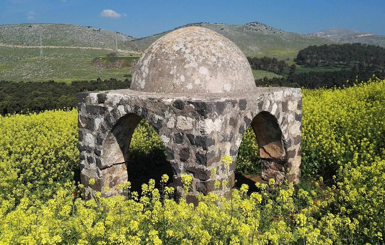
The well is a dug shaft about one metre across and roughly four metres deep. Its covering cupola rests on four pillars, and ancient graves surround the structure. Rocchetta’s description of the site in 1599 specifies marble pillars. Burckhardt later described a masonry-lined shaft about three feet wide and at least thirty feet deep, ending in rock. It held good drinking water to a depth of about ten metres until the nineteenth century.
A marble plaque was fixed to the domed structure in 1900 by a benefactor apparently from India. Its inscription, written in Nastaliq, a flowing calligraphic style used for Persian and Urdu, translates as: “In the name of Allah, Joseph’s Well; peace be upon him.”
Courtyard and mosque traces
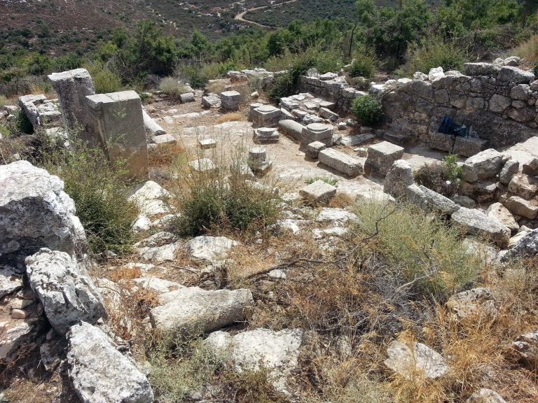
The well and cupola stood in a courtyard beside a small mosque. Traces of foundations survive around the area, though their identification as parts of the courtyard and mosque is uncertain. Some stones from these structures may have been reused later in the animal enclosure beside the inn.
Settlement east of the well
An area of about ten dunams lies east of the well, which marks its western edge. Foundations are the visible remains of a settlement dated by pottery to the second half of the thirteenth century. Local tradition later associated the ruins with Jacob, Joseph’s father.
The caravan inn and its water system
The inn
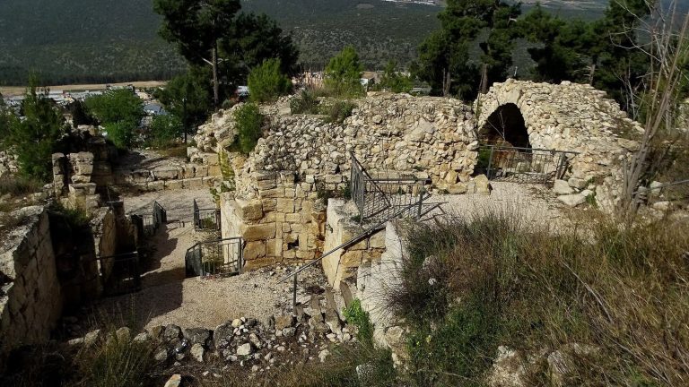
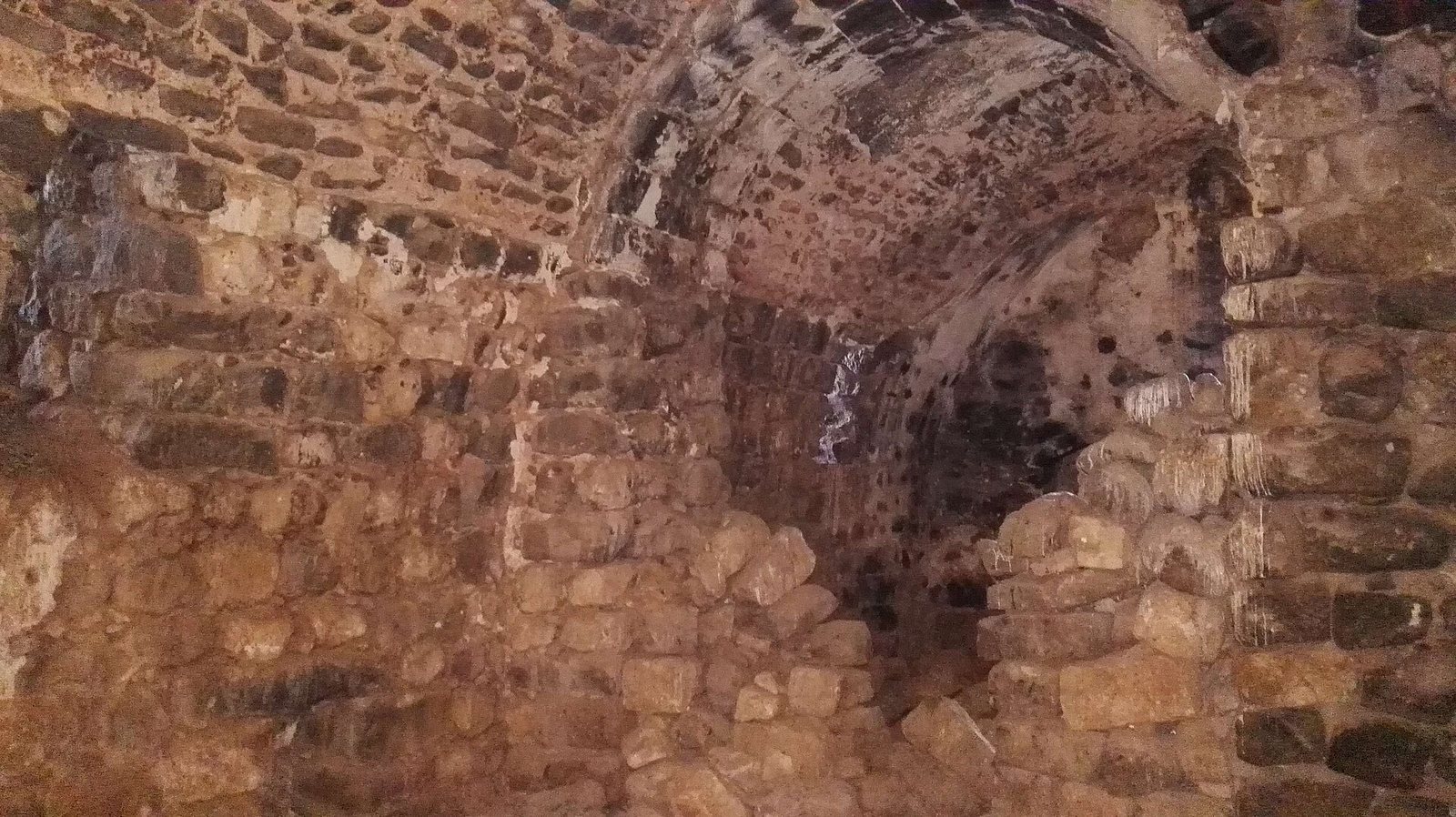
The rectangular inn measures about 47 by 34 metres and encloses a courtyard roughly 22 by 16 metres. Its walls, between 1.5 and 2.8 metres thick, were built largely from alternating layers of limestone and basalt without mortar. The building is mostly single-storey, though part of the north wing has a second level containing four small chambers and a watchtower.
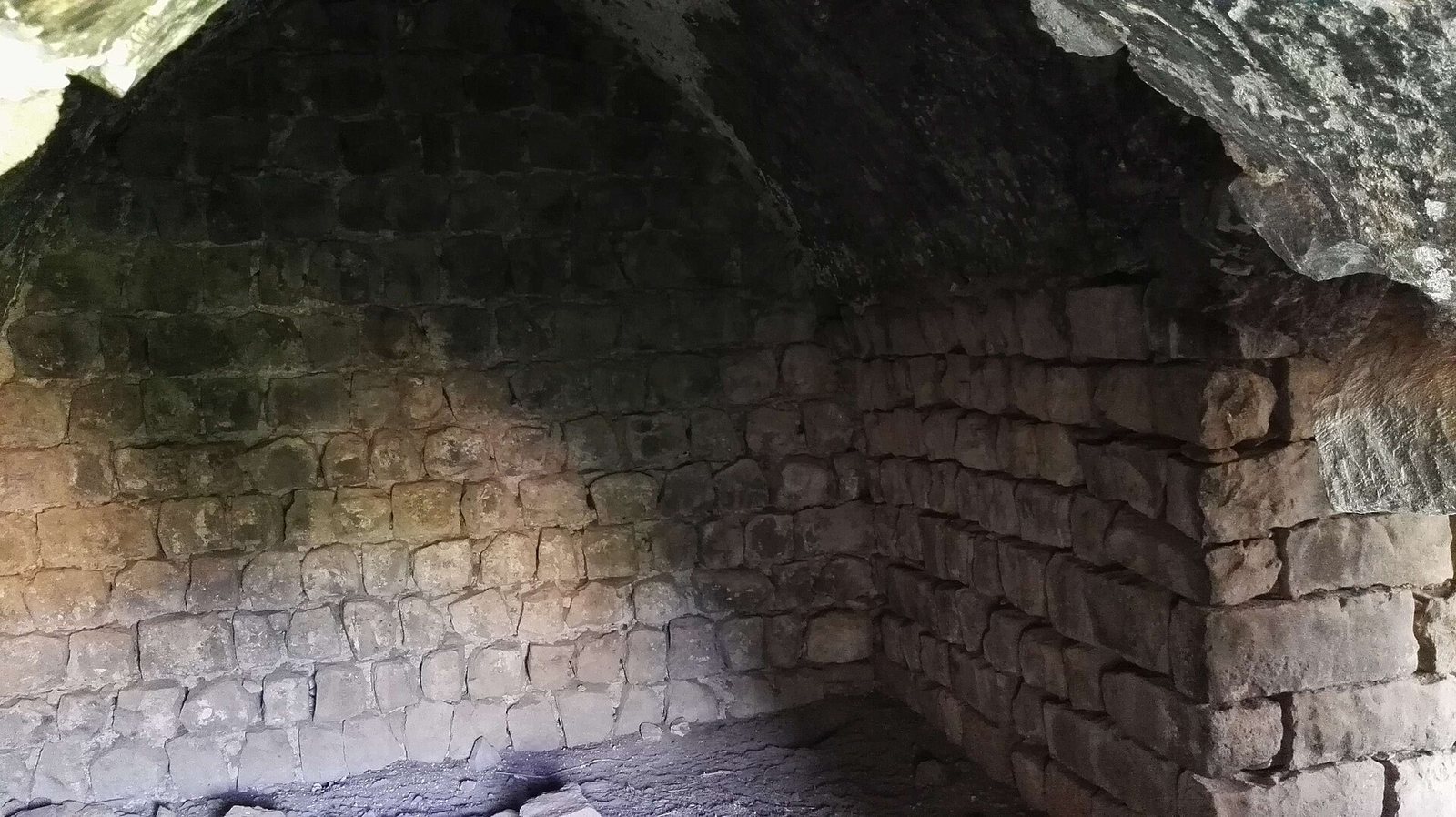
The entrance is on the north side. From it, a passage about 17 metres long leads to the courtyard, with stairs on its eastern side ascending to the roof and upper floor. Long vaulted halls flank the courtyard: the western hall is about 28 by 6 metres, and the eastern one about 35 by 6 metres. These halls sheltered pack animals, while rooms around the courtyard served travellers and prayer.
On the courtyard’s south side, a room measuring about 5.5 by 5 metres contains a mihrab, a niche indicating the direction of prayer. An adjoining room to the east is about 5 by 4 metres. Two similar rooms stand opposite, one on each side of the entrance passage.
The northern part of the north wing appears to be a later addition. It contains an eastern hall about 11 by 6 metres and a western hall about 6 by 5 metres, along with narrow openings and wall niches apparently used for storage. Other small openings resemble arrow slits, but their size and splayed shape suggest that they brought in light and air. One northern room has a fireplace with a chimney running through the upper floor; another fireplace is set within a wall niche.
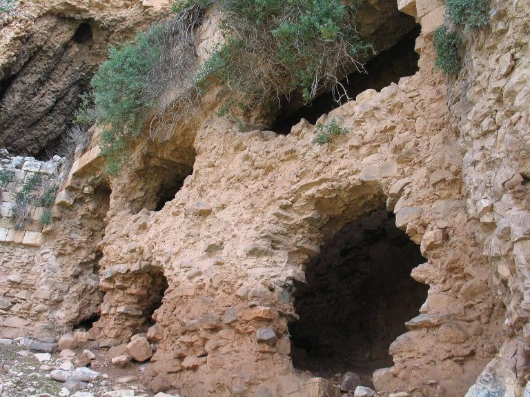
The inn’s western wing has collapsed, while parts of the eastern wing and upper floor are damaged. Walls, vaulted halls, and portions of the second storey remain. Its mortarless construction and location in an earthquake-prone part of the Jordan Rift Valley are notable aspects of its physical condition.
Cistern
A cistern occupies the inn’s northwest corner. It measures about 8 by 8 metres and is currently about 2.3 metres deep. The lower part is cut into rock, while the upper part is built of stone; most of the interior is plastered. Basalt slabs resting on masonry arches form the roof, and the cistern holds about 130 cubic metres. Water remains at its bottom even at the end of summer, although its collection channels are damaged.
The cistern was once enclosed by a wall and was probably reached from inside the inn through a room immediately to its south, where a simple prayer area is located. The cistern and well are about 110 metres apart, and their bottoms appear to be at a similar level. An underground water-bearing layer may feed both, which could explain the well’s depth of water and its reported quality rather than relying solely on collected rain.
Eastern enclosure
A rectangular enclosure of about half a dunam adjoins the inn’s eastern wing. Built largely of dressed stone, it appears to have served as a livestock pen in a later period.
Features in the surrounding landscape
Seasonal pond
A seasonal pond lies about 80 metres north of the inn. Roughly 30 metres square, it is built from simple materials and receives water from a small wadi at the foot of the hill. It still gathers water in rainy years. When Ami’ad was established in 1946, Bedouin encampments in the valley used the active pond as a water source for livestock.
Sheikh Abdallah’s grave and oak
The grave of Sheikh Abdallah lay beneath an old oak in the valley, about 120 metres west of the inn and 240 metres west of the well. The grave was first recorded in 1745 and appears under that name on maps from the British Mandate period. The oak remains.
Dark stones
The nearby hills are described as strewn with black stones, although limestone is the area’s principal rock. Local tradition explains the dark stones as Jacob’s tears, said to have turned white stones black while he searched for Joseph.