Itálica: An Ancient Roman City in Spain


Site at a Glance
- Rating
- 4.6
- Popularity
- Medium
- Country
- Spain
- Primary era
- Classical
- External website
- Open
- Eras represented
- Classical
- Civilizations
- Roman
- Site type
- City
On this page24 sections
History
Itálica is an ancient Roman city in Spain, located at Santiponce near Seville. Founded in 206 BC by Publius Cornelius Scipio Africanus after the Second Punic War, it was established when wounded Italic auxiliary soldiers were settled beside a pre-existing Turdetanian settlement near the Guadalquivir River. The city became the first Roman foundation in Hispania and took its name from the Italian origin of its settlers.
Before and during the Roman foundation
The pre-Roman settlement occupied the Aljarafe highlands and dates back at least to the fourth century BC. Archaeological indications of earlier Argaric and Greek activity have also been reported, while the indigenous name of the settlement remains unknown. Itálica lay between Hispalis and Ilipa and was probably connected to a river port, giving the new Roman community a position within the wider communications network of the Guadalquivir valley.
Its early legal status was possibly that of a Latin colony, and its original urban plan probably followed a Hippodamian grid, a regular arrangement of intersecting streets. Around 45 BC, at the end of Julius Caesar’s final stay in Hispania, Itálica probably became a municipium of Roman citizens. A municipium was a Roman city whose inhabitants possessed defined civic rights. This change may have rewarded the community for supporting Caesar against Pompey.
A bronze mint operated at Itálica under Augustus and continued under Tiberius. Its coins carried an emperor’s image on the front, while their strongly Romanized reverse designs gave them a distinctive place among the coinages of Hispania.
Imperial prosperity and the new city
Itálica reached its greatest prosperity in the late first and second centuries AD. The emperors Trajan and Hadrian were both born there, and their rise strengthened the city’s prestige. Trajan ruled from AD 98 to 117, while Hadrian, his adopted son and successor, ruled from AD 117 to 138. Both emperors showed particular generosity toward their birthplace.
Hadrian expanded the city northward, rebuilt or added public buildings, and granted Itálica colonial status at the inhabitants’ request. A colonia was a Roman community with a prestigious formal status and institutional ties to Rome. The city then adopted the official name Colonia Aelia Augusta Italica.
The northern extension was known as the nova urbs, or “new city.” It may have begun under Trajan, but it is chiefly associated with Hadrian’s large building programme. The expansion covered an extensive urban area with broad streets, large houses, baths, an amphitheatre, and monumental public architecture. It was never fully completed and began to decline toward the end of the second century, probably because of political and economic changes. Most of the excavated archaeological complex represents this Hadrianic expansion.
Decline and late-antique survival
The older settlement, known as the vetus urbs or “old city,” had greater continuity than the new northern quarter. Itálica’s decline may have begun as early as the third century, when changes in the course of the Guadalquivir probably left its river port unusable. The shift was likely connected with silting, an ancient environmental problem associated with the removal of forest cover, while nearby Hispalis continued to expand.
Itálica remained an important community in late antiquity. It had its own bishop, and bishops from the city attended several Christian councils. The last documented bishop was Cuniuldo, who attended the Sixteenth Council of Toledo in 693. The city also maintained a garrison during the Visigothic period. In 583, King Leovigild restored its walls during his conflict with his son Hermenegild, a dynastic and religious struggle within the Visigothic kingdom.
The city may also have been the birthplace of the emperor Theodosius I and his eldest son Arcadius, although that association remains uncertain. During the Muslim period, Arabic authors referred to Itálica under forms of the name Talikah or Taliqa. It was probably abandoned as a populated city by the twelfth century and later became an uninhabited area known in Christian usage as Campos de Talica and Sevilla la Vieja.
Rediscovery and protection
From the sixteenth century onward, scholars recognized Itálica’s importance, and foreign travellers described and sometimes illustrated its ruins. The site nevertheless suffered continuous looting and provided building materials from the Islamic period into modern times. In 1740, Seville’s municipal authorities ordered the demolition of parts of the amphitheatre walls for a dam on the Guadalquivir. In 1796, sections of the vetus urbs were destroyed or quarried during construction of the new Camino Real of Extremadura.
The first legal protection came in 1810 during the Napoleonic occupation. It restored the ancient name Itálica and assigned an annual budget for regular excavations, although organized excavation began only in 1839 and 1840. In the 1820s, Nathan Wetherell, a British textile merchant living in Seville, excavated nearly ten Roman inscriptions near Itálica. These inscriptions were later donated to the British Museum.
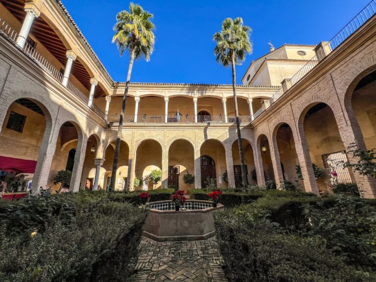
Excavations intensified in the late nineteenth century, while looting continued. Some mosaic floors were acquired by the Countess of Lebrija and conserved in the Palace of the Countess of Lebrija. The archaeologist Rodrigo Amador de los Ríos regarded their removal as looting rather than conservation. Itálica was declared a National Monument by Royal Order on 13 December 1912. An Andalusian decree of 9 January 2001 clearly delimited the archaeological zone and its protected surroundings. Excavation, restoration, and conservation have continued with modern scientific techniques.
Remains
Urban layout and fortifications
The archaeological complex consists mainly of the Hadrianic nova urbs, while much of the older city lies beneath modern Santiponce. The excavated quarter follows a regular grid and contains paved Roman streets, large elite residences, public buildings, baths, and surviving mosaic pavements. Its buildings reflect residential, civic, religious, commercial, bathing, theatrical, and gladiatorial functions. The size of the amphitheatre also reflects the public display expected from local elites who funded games and performances as magistrates and public officials.
At its greatest second-century extent, the city wall circuit exceeded 3,000 metres, averaged about 1.5 metres in thickness, and enclosed more than 50 hectares. The walls were built and altered in several phases as the urban area expanded and contracted.
Augustan and Hadrianic walls
A tower beside the theatre belongs to the Augustan period, approximately 27 BC to AD 14. Its construction combines concrete with vertical bands of ashlar masonry. Beside the amphitheatre, a surviving stretch near the northern end of the city belongs to the Hadrianic expansion, although the described remains there consist only of concrete foundations.
A geophysical survey carried out between 1991 and 1993 located another wall section behind the elevation supporting the presumed Traianeum. Its date remains uncertain. It may be a late Roman wall built after the urban area was reduced, or part of the sixth-century restoration associated with Leovigild.
Public buildings and entertainment spaces
Amphitheatre
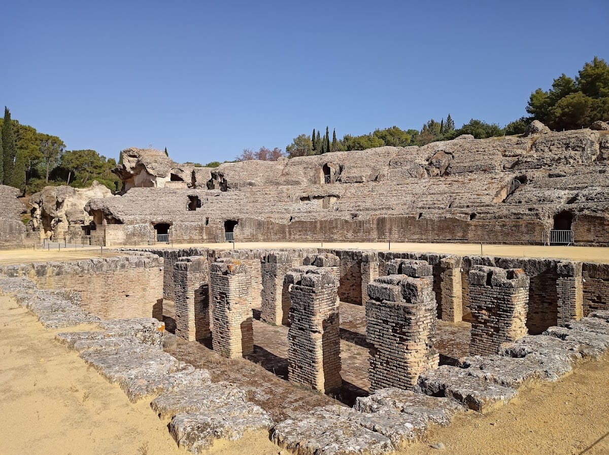
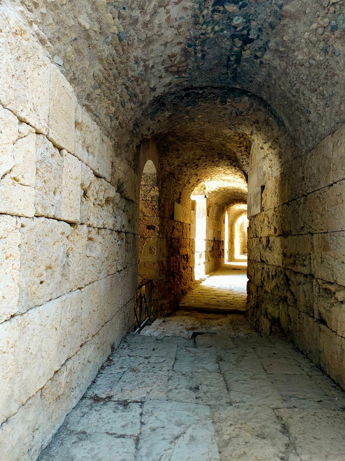
The amphitheatre could accommodate about 25,000 spectators in three seating tiers. Beneath the former wooden arena floor was a service pit used for gladiatorial spectacles and animal shows. The building was among the largest amphitheatres in the Roman Empire, slightly larger than the amphitheatre at Tours and holding approximately half as many spectators as Rome’s Colosseum. Its surviving fabric is heavily damaged.
Theatre
The theatre stands on San Antonio hill west of Santiponce, using the natural slope above the Baetis, the Roman name for the Guadalquivir. Built between the first century BC and the first century AD, it is the oldest known civic building at Itálica apart from probable curia remains found in 1984. A curia was a civic meeting building, although the identification of those remains is not certain.
The theatre continued in use, probably intermittently, until at least the fifth century. Afterward, parts of it were filled and converted into storage areas, animal pens, dumps, and occasional burial places during the medieval period. Flooding from the Guadalquivir eventually filled and buried the structure. Its approximate location was known from the eighteenth century, some seating was visible in the 1940s, and large-scale excavation took place from 1970 to 1973. Later work exposed the portico, and restoration began in the 1980s.
Traianeum
The Traianeum is a large presumed temple dedicated to Trajan and traditionally attributed to Hadrian. No conclusive evidence proves that identification. It occupies a central double urban block at the highest point of the nova urbs and measures approximately 108 by 80 metres.
A porticoed square surrounded the central precinct. Its alternating rectangular and semicircular recessed spaces housed sculptures. More than one hundred columns of expensive Cipollino marble from Euboea and a series of fountains decorated the complex.
Bathing complexes and water supply
Large Baths
The larger Hadrianic baths, popularly called the Large Baths or Baths of the Moorish Queen, occupy a full city block in the nova urbs. Dating from the first half of the second century, they cover approximately 32,000 square metres and appear to have been left unfinished. The complex remains partly unexcavated.
The surviving features include pools, furnaces, service rooms, and parts of the bathing installation. An entrance stairway led to a vestibule and then to a T-shaped pool whose walls and floor were faced with white marble. The baths also contained hot, warm, and cold rooms, a library, a massage room, a sauna, changing rooms, and probably a palaestra, an exercise area associated with a bathing complex. The palaestra may have occupied nearly half of the building.
Small Baths
The older baths, popularly called the Small Baths or Baths of Trajan, lie in the vetus urbs beneath the historic area of Santiponce. They cover approximately 1,500 square metres and predate Hadrian. Their construction has been associated with Trajan’s reign because of their building techniques, while Hadrian’s period brought structural reinforcement.
The excavated rooms include two hot rooms, a warm room, a cold room, and an area apparently connected with exercise. The baths extend beneath surrounding houses, particularly near the principal entrance, and the excavated area covers only part of the complex.
Aqueducts and cisterns
Itálica’s water system comprised an older first-century aqueduct and a Hadrianic extension, with a combined length of approximately 37 kilometres. The earlier line drew water from at least ten springs near the Guadiamar, the ancient Maenoba, especially the Huerta de Basilio spring, and supplied the vetus urbs.
Much of the older aqueduct ran underground. At the La Pizana estate near Gerena, an exposed gallery survives for approximately 40 metres. It is about 1.70 to 1.80 metres high and 0.80 to 0.90 metres wide. Its covered water channel had a barrel vault. The system used substantial quantities of concrete, circular access shafts, and limited brick facing, including brick voussoirs in some small bridges.
The Hadrianic extension collected water from more distant springs at Peñalosa near Tejada la Nueva and joined the earlier line at Cañada de Conti. Near Itálica, it divided again and supplied its own three-nave cisterns beside the amphitheatre. This aqueduct was built of concrete and completely faced with brick, an unusually luxurious treatment for an Iberian Roman water system.
Its water channel was smaller and equipped with a hydraulic fillet, while a raised substructure maintained a constant gradient. Open sections were probably covered with roof tiles or stone slabs from Tarifa. Square, brick-lined access shafts replaced the circular shafts of the older aqueduct. Long arcades crossed streams and hollows, and a substantial section survives at the crossing of the Guadiamar.
After a prolonged period of neglect and the ecological disaster of 1998, surviving aqueduct remains became part of the protected Guadiamar Green Corridor and the Route of the Historic Landscapes of Olive Groves. Large sections have been lost, while further buried remains may survive.
Elite residences
The nova urbs contained a quarter of large, richly decorated residences. These houses followed the Roman domus tradition, with rooms arranged around internal courtyards, while also displaying the Hellenistic aesthetic common during the imperial period. A peristyle was a colonnaded courtyard, a tablinum a reception room, a triclinium a dining room, a cubiculum a private room, and a taberna a shop or commercial room.
House of the Exedra
The House of the Exedra occupies an entire urban module of approximately 4,000 square metres. Its function is uncertain. It has the features of a private house but may also have served as a semi-public building or a facility for a private association whose members lived there. Seven tabernae flank the entrance, with two additional shops on the right side and another at the rear.
The house contains a vestibule, an entrance passage, a rectangular peristyle, a long curving pool or fountain, numerous private rooms, and a bathing area reached by stairs. A large rectangular palaestra ends in a vaulted exedra, a recessed or projecting apsidal space used as a room or seating area. Cruciform piers, rather than conventional columns, supported the surrounding portico and may have carried heavy loads and one or more upper storeys. Two bathing rooms had quarter-spherical vaults.
Its opus sectile pavement, a decorative floor made from fitted pieces of cut stone or marble, consists of fifteen rectangular panels framed in grey marble. Circular or star-like central motifs may represent schematic astral designs.
House of the Neptune Mosaic
The House of the Neptune Mosaic is a partly excavated semi-public building occupying an entire block of approximately 6,000 square metres. Its western sector contains a bathing area with a warm room and a hot room, where brick pillars from the underfloor heating system survive. A cold-water area and a large cistern occupy the northern side.
The Neptune mosaic, probably from the cold room, depicts Neptune with a trident driving a chariot drawn by two hippocamps. Around him are marine versions of centaurs, a ram, a bull, dolphins, fish, molluscs, and crustaceans. Other mosaics show a walled city with towers and a labyrinth, probably linked with Minos and Theseus, together with scenes associated with Bacchus or Dionysus, including dancing maenads, satyrs, centaurs, and tigers.
House of the Rhodian Patio
The partly excavated House of the Rhodian Patio is oriented eastward. Its rooms are arranged around successive open spaces, including a Rhodian patio, a courtyard with one gallery raised above the other three and reached by steps. A square fountain occupied the principal peristyle. Paved areas contain finely made mosaics, many of which have been lost or deteriorated through exposure and human action.
Pits and a small pool beyond the mosaic area may belong to a laundry. The entrance is uncertain, possibly lying on the east side through a large vestibule or, less probably, on the south side. A lower dining room contains a mosaic of the four seasons, while the larger principal dining room has a tiger mosaic and is flanked by two patios.
House of Hylas
The partly excavated House of Hylas shares the neighbouring residence’s Rhodian-patio arrangement. It includes a raised peristyle gallery, a square fountain, dining rooms, patios, and mosaic-paved rooms. A northern patio connects by stairs to an antechamber and then to a room containing a mosaic of Hylas being abducted by nymphs under the supervision of Hercules.
The central scene is now in the Provincial Archaeological Museum of Seville, while the geometric surrounding decoration remains at the house.
House of the Birds
The House of the Birds is a fully excavated aristocratic residence organized around a columned peristyle with a well. A vestibule and entrance passage lead to the courtyard, which distributes access to the surrounding rooms. At the rear, a dining room is flanked by two open recessed spaces, one containing a fountain and the other a pool.
The residence includes service rooms, kitchens, drains, shops opening toward the exterior, and a private room paved with the bird mosaic that gives the house its name. It was the first residence in the complex to be completely excavated. The rooms have been restored and marked with low walls approximately 60 centimetres high.
House of the Planetarium
Construction of the House of the Planetarium began under Hadrian, and the residence underwent several late Roman alterations, including division into multiple habitation units. It covers nearly 1,600 square metres, excluding the shops, and occupies the western half of a block between the amphitheatre and the presumed Traianeum.
The entrance leads to a vestibule and reception room, followed by a large columned peristyle with a central garden. Private rooms and reception spaces opened around it, while a dining room occupied the rear on the main axis. An atrium admitted air, light, and rainwater through an opening in the roof.
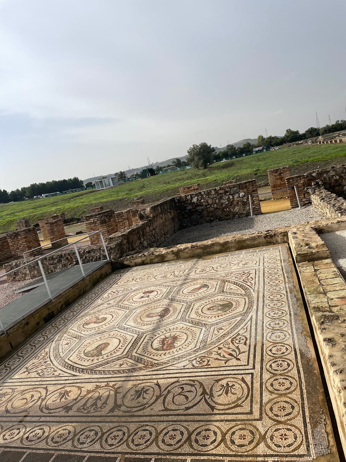
The principal mosaic consists of a circle containing seven medallions of planetary deities associated with the Roman days of the week. Venus occupies the centre, surrounded by the Moon, Mars, Mercury, Jupiter, Saturn, and the Sun. During the late Roman period, the peristyle was divided. Its northern part remained connected with the mosaic-decorated domestic area, while the remainder became a garden or courtyard. Columns on the southern side were replaced by substantial piers supporting a second storey, and service structures were built over the second-century rooms at the rear.
Archaeological collections
Roman inscriptions excavated near Itálica in the 1820s were later donated to the British Museum. Richer finds from the city, including a marble statue of Trajan, are held in the Archaeological Museum of Seville.