Ishibutai Kofun: An Early Seventh-Century Burial Tomb
Site at a Glance
- Popularity
- Very High
- Country
- Japan
- Primary era
- Medieval
- Eras represented
- Medieval
- Civilizations
- Yamato
- Site type
- Burial
- Remains
- Tomb
On this page12 sections
History
Ishibutai Kofun, a Japanese burial mound in Asuka, Nara Prefecture, Japan, was built in the early seventh century, at the transition from the late Kofun period, when such tombs were constructed, to the Asuka period that followed. Its occupant is often identified as Soga no Umako, a powerful court minister, although the attribution remains uncertain.
Construction and proposed occupant
The Nihon Shoki, an early Japanese chronicle, records that the chief minister died in 626, during Empress Suiko’s reign, and was buried in a tomb. Historian and archaeologist Sadakichi Kita proposed that this was Ishibutai Kofun. Another scholar has suggested Soga no Iname, an earlier prominent member of the Soga clan, based on the stone and the tomb’s construction date. An inscription on the chamber wall has also been interpreted as reading “Umako’s tomb.”
Kita further argued that the mound was removed after Umako’s death as punishment of the Soga clan by the imperial government. This remains an interpretation rather than an established explanation.
Names and traditions
A record from 1681 referred to a mausoleum at the site, understood at the time to belong to Emperor Tenmu. A pilgrimage guide published in 1848 also associated the place with Tenmu, a late seventh-century emperor, but current scholarship does not support that attribution. Another tradition says a fox transformed into a woman and danced on the mound, giving the site its name. An archaeologist raised nearby regarded this story as a recent invention.
Ishibutai combines words meaning “stone” and “stage,” a reference to the structure’s resemblance to a large stone platform. The name was in use by the Tokugawa period and appears in a Buddhist pilgrimage guide from 1853. The site is also called Ishibutoya.
Excavation and protection
Kōsaku Hamada led the first excavations in 1933. Work on the mound base and moat began in 1935, and excavation of the tomb continued until 1975. Because the tomb was associated with Soga no Umako rather than treated as an imperial tomb, it was excavated extensively. Its moat was the first around a kofun to be identified through excavation in Japan.
After the Second World War, substantial rebuilding and repairs were carried out around the tomb, including restoration and maintenance from 1954 to 1959. A prefectural road that crossed above the mound was diverted to permit excavation of the outer moat. The tomb became a National Historic Site in 1935 and a Special Historic Site in 1952. The site and its surroundings are now part of Asuka Historical National Government Park. In 2026, it was registered as part of the UNESCO World Heritage property “Ancient Capitals of Asuka and Fujiwara.”
Remains
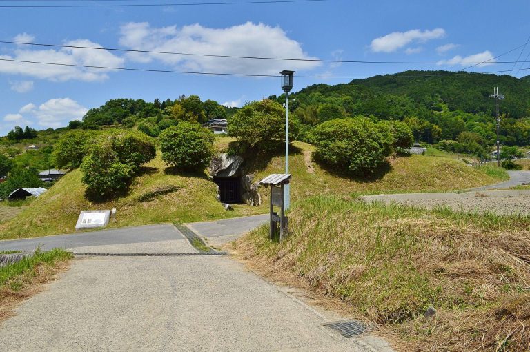
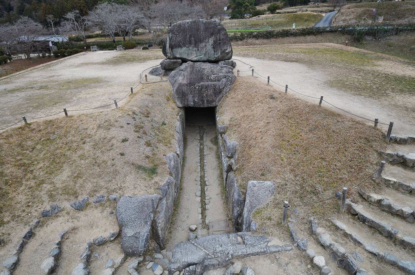
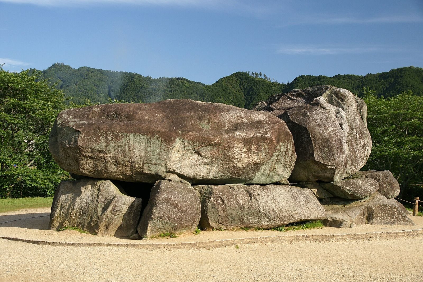
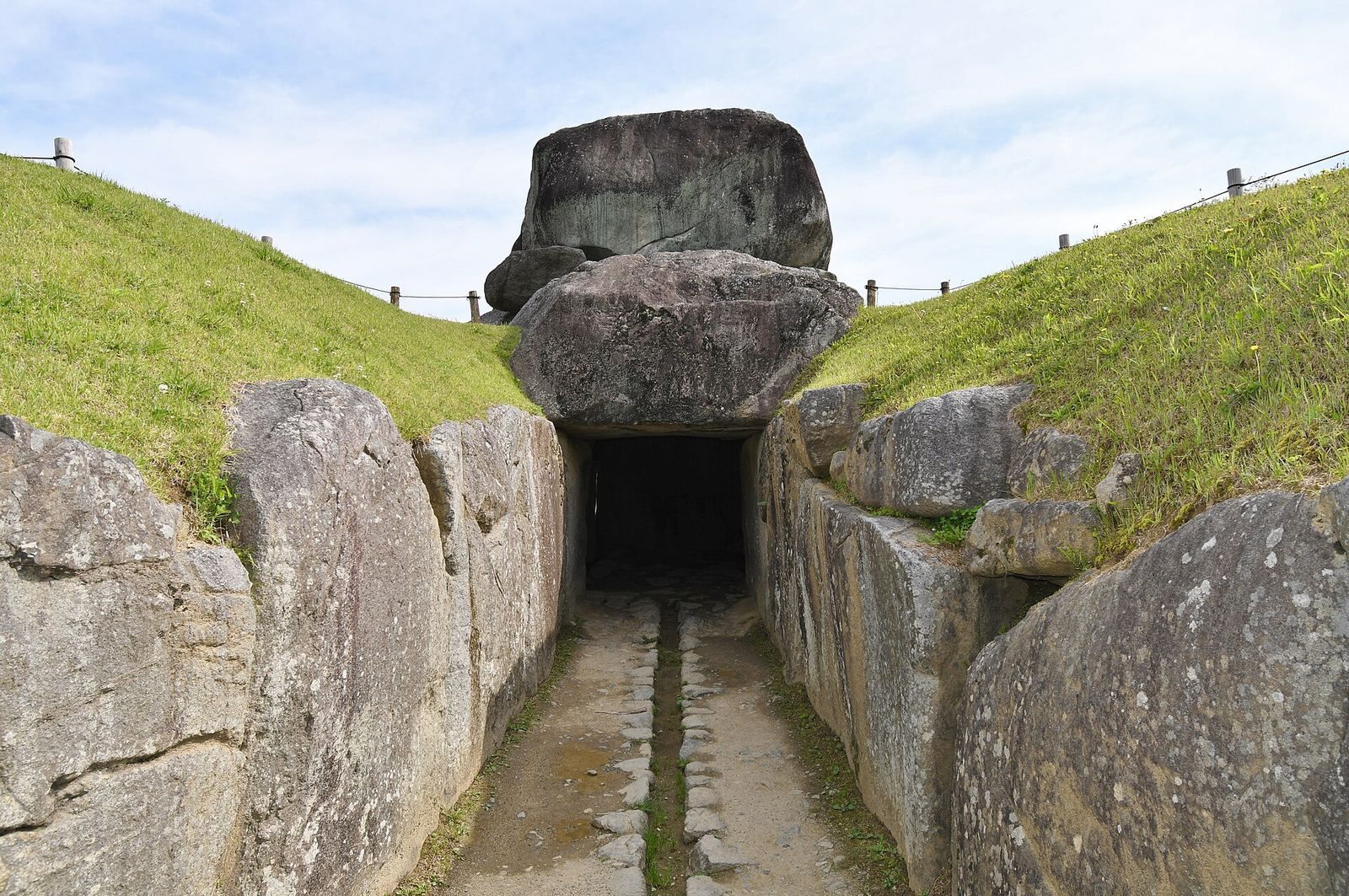
The tomb stands on a mountain spur that slopes northeast toward a small plateau, east of the archaeological remains of Shimanoshō in Asuka. Its earthen mound has disappeared, exposing the large stone burial chamber. The stone structure is about 54 metres long and is the largest known megalithic structure in Japan.
Mound and surrounding enclosure
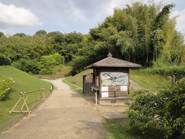
The mound stood on a square platform roughly 50 to 51 metres on each side. Granite blocks about 20 to 50 centimetres across faced its lower portion, set at an incline of around 30 degrees. The mound’s original shape is uncertain. It may have been a broad, flat square, while other proposed reconstructions include a two-tiered square, a square base with a rounded upper section, or a low octagonal form. A moat about 5.9 to 8.4 metres wide encircled the tomb, with an outer embankment about 7 metres wide. The embankment is reconstructed as roughly 83 metres from north to south and 81 metres from east to west, and about 1.2 metres high. The tomb, platform, and moat together probably covered an area about 85 metres across.
Stone chamber and drainage
Burial chamber
The chamber has a horizontal entrance opening to the southwest. Its interior measures approximately 7.5 to 7.7 metres long, 3.4 to 3.5 metres wide, and 4.7 to 4.8 metres high. Around 30 stones form the structure, with a combined estimated weight of 2,300 tonnes. The granite blocks came from Mount Tōnomine, about 3 kilometres away. Two enormous stones make up the roof: the northern one weighs about 60 tonnes, while the larger southern stone weighs about 77 tonnes.
Entrance and water channels
The approach to the entrance extends about 38 metres. Along it, a shallow drainage channel measures 11.5 metres long and 2.55 metres wide. The entrance was originally covered with a stone roof like that of the chamber, but its ceiling stones are gone. Smaller drains run beside the chamber on its east, north, and west sides, carrying water from the north toward the channel. The chamber and entrance corridor deteriorated over time and were later repaired.
Additional burials and finds
Burials beyond the main chamber
A separate stone chamber containing a carved stone coffin was found beyond the northwest corner of the outer embankment. Excavations also identified seven small burial chambers around the main tomb. These are thought to have belonged to earlier graves that were levelled, with their earth reused to build Ishibutai Kofun.
Excavated objects
Fragments of a tuff sarcophagus, a coffin made from compacted volcanic ash, came from southeast of the tomb. Finds from the approach and outer embankment include pottery fragments, gilt and bronze implements, and copper fittings. Song-period coins, from a Chinese dynasty, and Kan’ei cash coins, issued in Japan during the Tokugawa period, were also recovered. The burial chamber had already been largely robbed.