Huaca Huantille: A Ychsma Ceremonial and Administrative Center in Peru
Site at a Glance
- Rating
- 4.2
- Popularity
- Low
- Country
- Peru
- Primary era
- Medieval
- Eras represented
- Medieval
- Civilizations
- Unclassified
- Site type
- Religious
- Remains
- Temple
On this page14 sections
History
Huaca Huantille is a Ychsma archaeological and ceremonial center in Magdalena del Mar District, Lima, Peru. Built by the Ychsma, it emerged during the tenth century and flourished during the Late Intermediate Period, the Andean era before Inca expansion, approximately from AD 900 to 1450. The Ychsma, also called Ichma, were a pre-Hispanic society organized into political territories known as curacazgos, each governed by a local hereditary or chiefly ruler. Huantille belonged administratively to the Maranga curacazgo and became one of the major religious and administrative centers of the lower Rímac and Lurín valleys.
Ychsma and Inca phases
Huantille was the principal temple of the Huantille Group, which once included five other huacas. A huaca was a sacred place or monument in the Andean world, and could take the form of a temple, pyramid, burial monument, natural feature, or other religiously powerful place. The complex was connected by roads with monumental centers such as Mateo Salado, Tres Palos, and huacas in the Maranga complex. Its scale led some archaeologists to interpret it as a defensive structure protecting Huatica or Maranga, producing the occasional name “Fortress of Huantille.” The prevailing interpretation instead identifies it primarily as an administrative and religious center.
The site also served as a pilgrimage center. Ceremonial offerings included vegetables, pacae leaves, fruits, peanut shells, and smaller quantities of marine foods such as crabs and fish. Their placement followed particular practices, with marine offerings put into shallow pits, often alongside peanuts and pacae leaves, while salt grass could be laid on damp surfaces or incorporated into construction fills. These activities formed part of the religious use of the monument and connected it with wider communities in the Chancay, Asia, and Cañete valleys.
After the Inca conquest of the Rímac Valley, approximately from AD 1450 to 1532, the site entered an Inca phase. Archaeological study of this occupation remains limited, but the period brought stronger connections with the Chimú and Chincha, major societies of the northern and southern Peruvian coasts. The Inca state also moved transplanted populations, luxury goods, and raw materials from across the central Andes into the Lima region.
Colonial disruption and early descriptions
The arrival of the Spaniards in 1533 brought territorial reorganization and the forced evangelization of local Ychsma populations. New settlements, including the reductions later known as Santísimo Salvador de Pachacamac and Santiago de Surco, were established from 1572. Pachacamac, a major coastal religious center and oracle in the Lurín Valley, was associated with a creator deity whom the Incas incorporated into their imperial religious system.
In 1872, the American explorer and writer E. George Squier visited the ruins and called the main structure the Temple of Magdalena. He regarded it as a finely decorated and prestigious building and tentatively associated it with the cult of the Rímac or Límac idol, an oracle described by colonial chroniclers as an important religious power in the Rímac Valley. Thomas J. Hutchinson described the structure as San Miguel in 1873 and identified it with Huantille. During the 1880s, Ernst W. Middendorf also referred to it as the San Miguel huaca, a name derived from a neighboring estate. In 1892, Adolph Bandelier mapped it as the most imposing of roughly a dozen mounds in the La Magdalena area.
Urban pressure and archaeological recovery
From the 1940s, expanding urban development led to the demolition of many Lima huacas and the reuse of their remains as building material. The northern part of Huantille was occupied during the 1960s, and in 1968 the National Housing Board cut into the monument to construct a market along its southern side. A 1972 proposal by district mayor Alberto Yábar to demolish the huaca for a civic center was not carried out.
District mayor Ricardo Flores enclosed the archaeological zone in 1987, but residents were not immediately relocated. By 2006, about fifty families had settled within the area, and the growth of precarious housing damaged the surviving walls. The site was also used as a refuge by criminals and people addicted to drugs, while some nearby residents advocated demolition. Negotiations in 2006 led to the recovery of the site. Most families moved elsewhere, although three families continued to have unresolved legal proceedings with the Peruvian state.
Huaca Huantille, also called the Huantille or Echenique archaeological zone, was declared Cultural Heritage of the Nation by National Directorate Resolution 425/INC on 23 May 2001. The designation established an intangible area of 1 hectare plus 1,133.73 square meters, with a perimeter of 426.09 linear meters, and revised earlier boundaries. After the 2006 recovery, the Municipality of Magdalena del Mar, advised by the National Institute of Culture, began archaeological research, conservation, restoration, and heritage work under archaeologist Marco Antonio Guillen Hugo. The interventions revealed rooms, patios, the central monumental staircase, funerary bundles, and other remains. In 2019, rubble and rubbish were removed from interior areas. In 2022, the perimeter enclosure along Castilla, Huamanga, and Echenique was replaced with a more secure structure, and architectural lighting was improved.
Remains
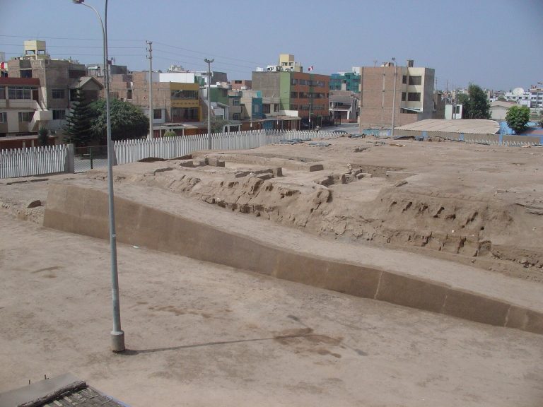
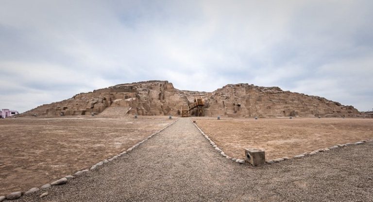
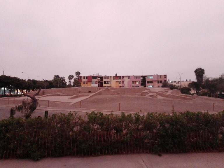
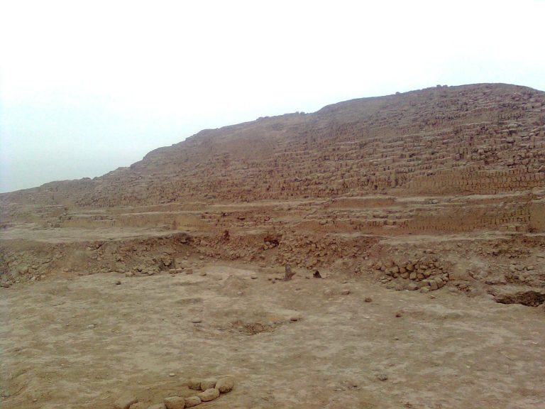
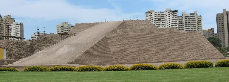
Huaca Huantille survives as a stepped, truncated pyramid with a central staircase. Descriptions give its height as approximately 16 meters, while a nineteenth-century account estimated about 90 feet. The monument once occupied roughly 3 hectares, but the surviving archaeological area is approximately 11,000 square meters, about 30 percent of its original extent. It now lies within the urban fabric of Magdalena del Mar, bordered by Mariscal Castilla Street to the south, Rufino Echenique and Ayacucho streets to the west, José Salas Street to the north, and Rufino Echenique and Huamanga streets to the east.
Pyramid and platforms
Eastern facade
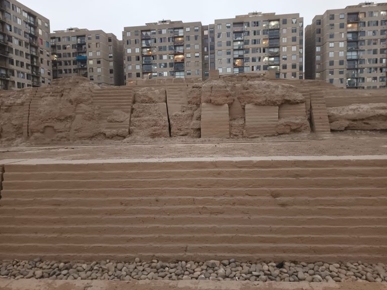
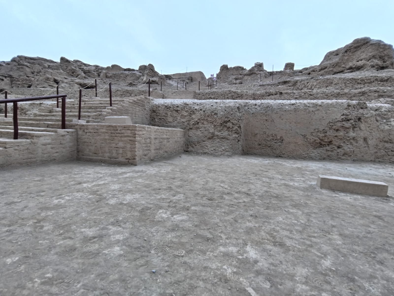
Adolph Bandelier described two large attached stepped pyramids with substantial ramps facing east. The eastern facade remains the best-preserved side of the monument. Superimposed platforms rise one above another to form the pyramidal profile, while some upper platforms remain partly buried. The structure was built with retaining walls, fills of earth and rounded stones, and upper walls made from tapia, a technique that compacts moist earth inside forms. Adobe, made from sun-dried earthen blocks, and tapia were well suited to the dry coastal environment. Large tapia walls formed the terraces and facades, while thick double-faced walls enclosed rooms in the upper part.
Central staircase and northern section
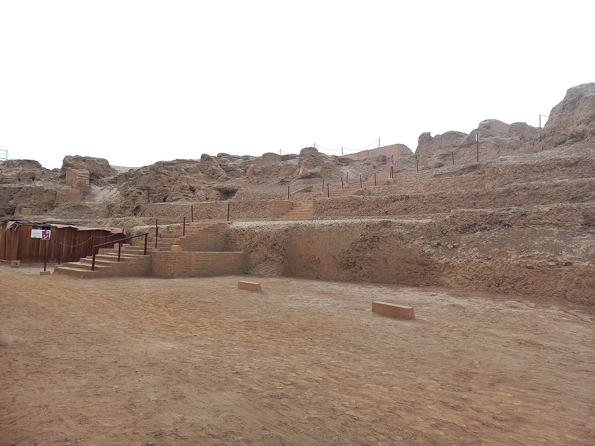
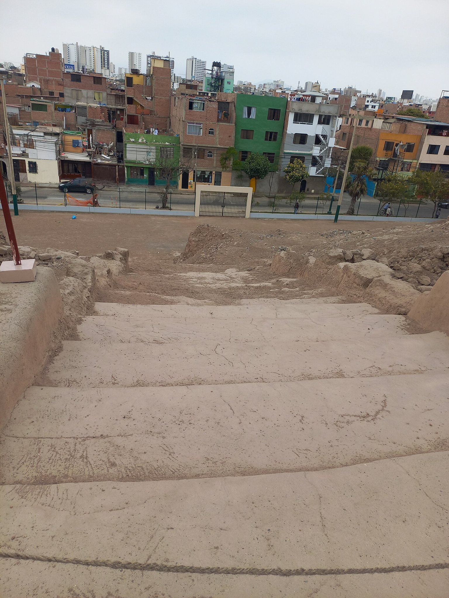
The central staircase led toward a plaza and upper patio area. The northern section formed the principal facade and was associated with this staircase and with the stacked platforms above it. Much of the monument has been destroyed, buried, or altered, but the surviving fabric still exposes the staircase, platforms, plazas, rooms, and sections of decorated wall.
Enclosures and ceremonial spaces
Main plaza and benches
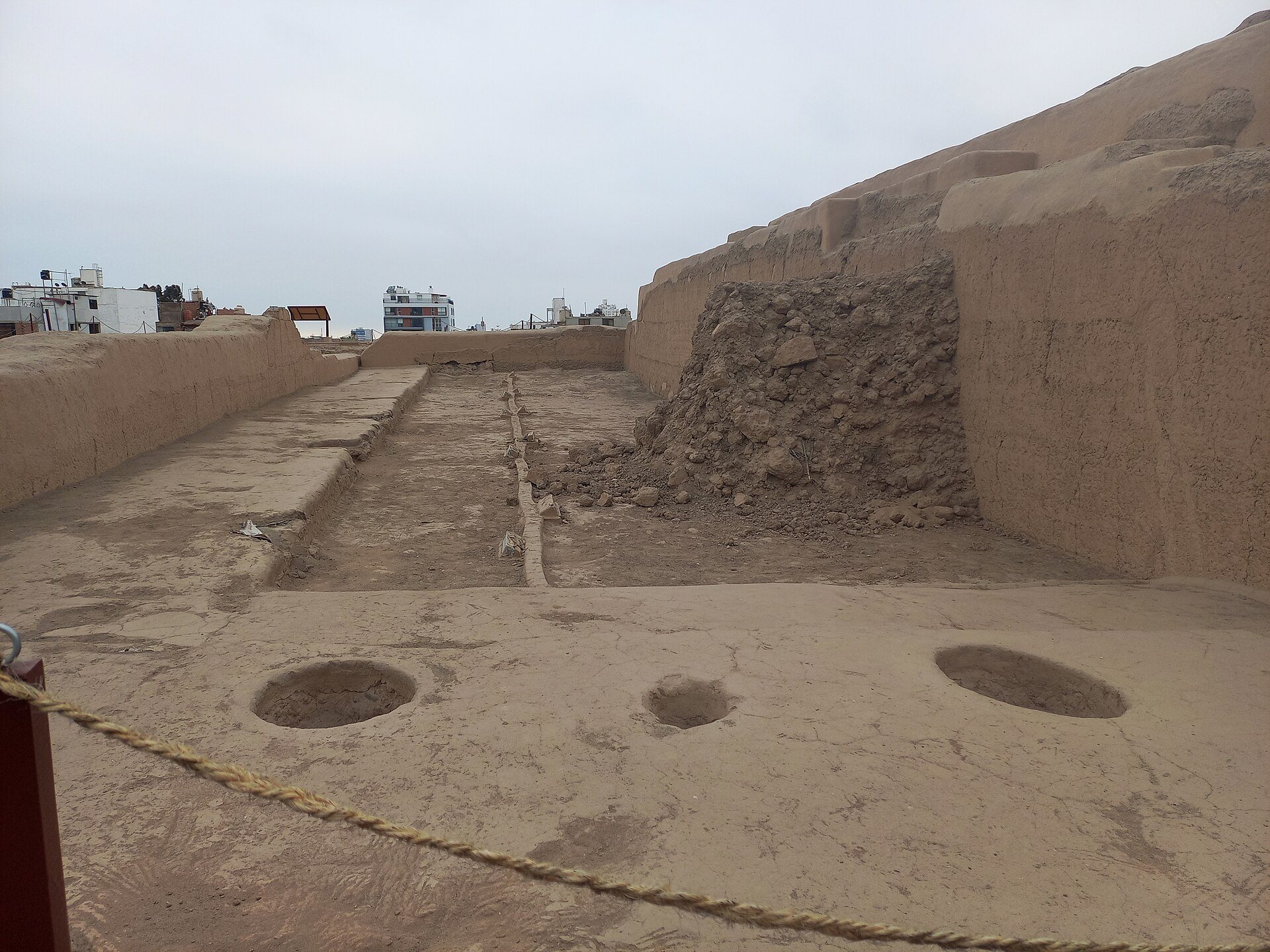
The monument was arranged as a connected sequence of enclosures with differentiated entrances. Its principal axis included a main plaza with L-shaped benches along its sides. A staircase connected the benches with the exterior. These spaces were used for assemblies of elites or governing groups concerned with production and distribution.
Rooms, patios, and painted walls
The central section contained rooms, patios, plazas, stairways, and passageways. Most interior walls were painted white, while other surfaces were yellow or carried red volute designs, especially in rooms that have not been fully excavated. Some walls were polychrome, using blue, gray, and white with geometric designs in low relief. Hearths on the platforms were associated with offerings of guinea pigs, camelids, peanuts, maize, and grasses.
Burials, offerings, and ceramics
Funerary bundles
Excavations during the recovery work uncovered several funerary bundles. One preserved mummy measured approximately 1.70 meters in length, while another bundle belonged to a child about three years old. Associated materials included ceramic vessels, decorated gourds, copper, silver, or gold pendants, and textiles. Ychsma burials placed individuals in a fetal position. Some included metal objects near the chest, vessels beside the body, or the deceased resting on large gourds. A second burial phase belongs to the period of the Spanish conquest, although its details remain limited.
Ceramic remains and offerings
Ceramics from construction fills and burial contexts include Chancay-style objects, indicating contact or exchange with other centers of ancient Peru. The assemblage contains fragments of large pitchers, vessels, jars, cooking pots, and small jars for pouring liquids, together with anthropomorphic and animal-shaped figurine fragments. Both utilitarian and ceremonial wares occur, including decorated and undecorated pieces. Necked effigy vessels are particularly common, while the larger vessels are often fragmentary and smaller objects tend to survive more completely.
Plant and marine materials also formed part of the site’s offerings. These included fruits, pacae leaves, peanuts, salt grass, crabs, and fish. Marine materials were placed in shallow pits, sometimes with peanuts and pacae leaves. Salt grass was put on damp surfaces or within construction fills, preserving evidence of ritual practices associated with the monument’s ceremonial spaces.