Sriwijaya Kingdom Archaeological Park: A Srivijaya-Period Landscape and Palembang Heritage Site
Site at a Glance
- Rating
- 4.4
- Popularity
- Medium
- Country
- Indonesia
- Primary era
- Modern
- Eras represented
- Medieval, Modern
- Civilizations
- Srivijaya
- Site type
- Infrastructure
- Remains
- Canal
On this page9 sections
History
Sriwijaya Kingdom Archaeological Park is an archaeological park near the northern bank of the Musi River in Palembang, South Sumatra, Indonesia, preserving a landscape occupied during the Srivijaya period, particularly in the ninth century. Srivijaya was a maritime empire centered in Sumatra that flourished from approximately the seventh to the thirteenth centuries and was linked to Buddhist religious and commercial networks in Southeast Asia. The site was formerly known as the Karanganyar archaeological site, but its precise political association remains uncertain.
Srivijaya-period occupation
Before excavations began, Karanganyar was considered a possible center of Srivijayan political power. The evidence associated with this period consists mainly of scattered surface finds, a few layers of ancient brick wall, and possibly one ancient canal. The nearby discovery location of the Kedukan Bukit Inscription and the archaeological area around Bukit Seguntang place Karanganyar within a wider Palembang landscape connected with Srivijaya. Other sites in the Karanganyar area include Kambang Unglen, Padang Kapas, Ladang Sirap, and Bukit Seguntang, although the secure identification of sites from the Srivijaya period remains difficult.
Excavations between 1985 and 1989 uncovered pottery, ceramic and bead fragments, and a brick structure. Aerial photographs taken in 1984 had already revealed the extent of the canal network, along with extensive landscape modification and artificial water structures. These discoveries changed the interpretation of the site, directing attention away from the idea of a clearly established Srivijayan political center and toward the later history of the landscape.
The Palembang Sultanate
The canals, reservoirs, and artificial islands were subsequently considered more closely related to Sultan Mahmud Badaruddin II, an early nineteenth-century ruler of the Palembang Sultanate, an Islamic sultanate based in Palembang. Mahmud Badaruddin II acquired the land and began developing it, probably in preparation for his own burial ground. This plan followed a Palembang royal tradition of placing members of the ruling family in burial grounds surrounded by water connected to the Musi River. The site therefore preserves a landscape whose physical form may reflect later royal planning as well as earlier occupation.
Archaeology and the modern park
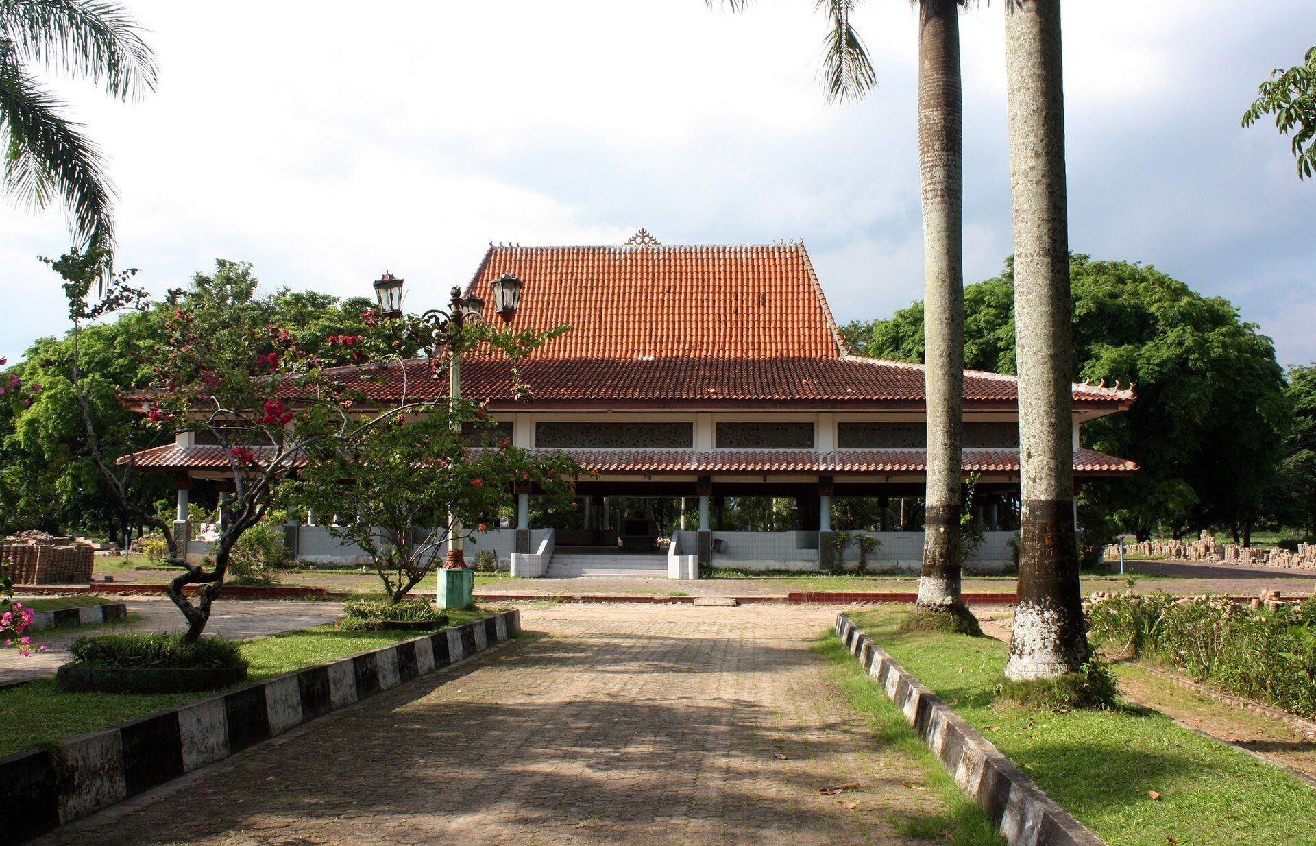
The South Sumatra provincial government renovated Karanganyar as an archaeological park. Construction was completed under the supervision of Indonesian President Suharto on 22 December 1994. The park includes the Sriwijaya Museum, planned as an information center for Srivijayan history and Palembang’s archaeological sites. Its central pavilion contains a replica of the Kedukan Bukit Inscription in a glass case. The inscription describes the Siddhayatra, or sacred journey, of Dapunta Hyang Sri Jayanasa, an early Srivijayan ruler associated with the beginnings of the empire.
The park did not develop the intended role as an information and educational center or as a tourist attraction. Limited information and promotion, poor maintenance, and restricted attention from local authorities and residents have left many Palembang residents unfamiliar with the site’s existence and purpose. The park is now poorly maintained and receives few visitors.
Remains
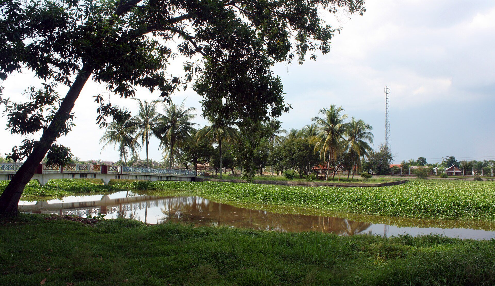
The archaeological area occupies an alluvial plain, flat land formed by river-deposited sediment, near the meeting point of the Musi, Ogan, and Kramasan rivers. It lies less than two meters above the Musi River, approximately four kilometers southwest of central Palembang and south of Seguntang Hill. Three sub-sites, Karanganyar 1, Karanganyar 2, and Karanganyar 3, are linked by seven canals. Together, the ponds, channels, and artificial islands form a large managed-water landscape. Their design indicates prolonged human habitation and probably served drainage and flood-prevention purposes while also allowing water transport between the Musi River and inland areas.
Ponds and artificial islands
Karanganyar 1 is the largest sub-site, consisting of a rectangular pond measuring 623 by 325 meters. Two artificial islands occupy its center. Nangka Island measures 462 by 325 meters and is surrounded by moats approximately 15 meters wide and 1,190 meters long. Cempaka Island is a smaller square island measuring 40 by 40 meters. Excavation there revealed a brick structure about 30 centimeters below the surface, aligned from east to west.
Karanganyar 2 lies southwest of the main pond and consists of a smaller pond with a square artificial island measuring 40 by 40 meters. Karanganyar 3 is a pond east of Karanganyar 1, measuring 60 by 60 meters. The artificial islands are water-associated structures known as balai kambang, a term for islands or platforms surrounded by, or closely connected with, water.
Canal network
Canal 1, locally called Parit Suak Bujang, is the longest and largest channel. It extends approximately three kilometers and is 25 to 30 meters wide, with both ends connected to the Musi River. Canal 2 runs parallel to it south of Karanganyar 1 and Karanganyar 3. It is approximately 1.6 kilometers long, ending at Karanganyar 2 on the west and joining the Musi River on the east.
Canal 3 links Canals 1 and 2 for approximately 700 meters along a north-south line between Karanganyar 1 and Karanganyar 3. Canals 4 and 5 run parallel to Canal 3 west of Karanganyar 1, with their southern ends connected to Canal 2. Canals 6 and 7 connect Canal 2 with the Musi River to the south.
Archaeological finds
Finds from the area include Buddhist statues, colorful beads, amber, ropes made from arenga-palm fibers, Chinese ceramics, pottery, a brick structure, and the remains of a wooden ship. Many of these discoveries were made during construction of the archaeological park. Reconstructed ceramic and pottery fragments represent household objects such as a vase, water vessel, bowl, plate, stove, clay pot, and roof tile. Together, these objects indicate dense habitation. Chinese ceramics date from the Tang, Song, Yuan, and Qing dynasties, covering the seventh to the nineteenth centuries.
The physical evidence is centered on the water system and the small brick structure excavated on Cempaka Island. Temples, palaces, and houses in the area were probably built from wood and brick, materials vulnerable to decay and humidity in the tropical rainforest environment beside the river. Repeated flooding may have destroyed such structures within less than 200 years.
Museum pavilion
The central pavilion is built in the traditional Limasan Palembang style, a local building form distinguished by its pyramidal roof profile. Inside, a glass case houses the replica of the Kedukan Bukit Inscription, connecting the park’s archaeological landscape with the early Srivijayan history represented by the inscription.