Hohenrätien Castle: A Church-Fortress and Alpine Way Station in Switzerland


Site at a Glance
- Rating
- 4.5
- Popularity
- Low
- Country
- Switzerland
- Primary era
- Medieval
- External website
- Open
- Eras represented
- Classical, Medieval
- Civilizations
- Holy Roman Empire, Roman
- Site type
- Military
- Remains
- Castle
On this page13 sections
History
Hohenrätien Castle is a historic church-fortress and way station in Switzerland, above the northern entrance to the Viamala gorge near Sils im Domleschg. Its origins extend from the Late Roman period into the early Christian era, and its position beside the routes over the Splügen and San Bernardino passes gave it a lasting role in transalpine travel.
Roman and Early Christian Origins
The plateau on the Crap Sogn Gion, 946 metres above sea level, was settled during the Bronze Age and Iron Age and later contained Roman buildings. It overlooked the confluence of the Hinterrhein, Albula, and Nolla, while the nearby Viamala formed a narrow and hazardous Alpine gorge on the north-south route between the northern and southern Alpine regions.
After Roman power declined, Hohenrätien probably came into the possession of the bishops of Chur. The church was likely functioning by the 4th or 5th century, although the nature of its earliest sacred building remains uncertain. It may have begun as a Christian church, or it may have been a Mithraic temple, a sanctuary of the Roman mystery cult centered on Mithras, later adapted for Christian worship.
A baptistery was added during Late Antiquity, the period of transition from the later Roman world to the early medieval centuries. Hohenrätien then became the principal parish and baptismal church for the Domleschg and Heinzenberg area. A parish church served a defined ecclesiastical district, while a baptismal church held the special right to administer baptism for a wider surrounding population. The site became the center of the large parish of Rialt and the seat of a representative of the bishop.
Medieval Church-Fortress and Way Station
Hohenrätien combined religious and practical functions. Travelers and goods could stop at the site before entering the Viamala, change to sure-footed mules, and obtain help from local guides and muleteers. The Hoch Rialt tower probably contained lodging and secure storage for merchants and their goods. Internal walls separated this secular area from the outer ecclesiastical zone.
Travelers could also have a votive Mass celebrated in the Church of St. John and Victor before attempting the gorge. The church’s parish and baptismal traditions continued for more than a thousand years. Its importance was connected to the wealth of the bishopric of Chur, which was partly supported by revenue from long-distance traffic across the Graubünden passes.
By the High Middle Ages, the site also served as a refuge during attacks. Fortifications associated with the bishop’s parish governor, or vogt, were constructed in the 11th century. This official represented the ecclesiastical lord and exercised administrative or protective authority over church possessions. The works included a two-storey stone building that later became the main tower, repairs and additions to the enclosing wall, and probably the South Tower and Priest’s Tower.
During the first half of the 13th century, the main tower was enlarged and the inner secular zone was developed with work areas and storage spaces. This expansion probably followed competition from the Gotthard route, which became passable around 1230. Hohenrätien continued to function as a protected intermediate station on the older Alpine route.
Earthquake, Abandonment, and Transfer
A severe earthquake in 1295 badly damaged the complex. The buildings were largely abandoned, and the way-station functions moved to the nearby episcopal castle of Fürstenau. Fürstenau later prospered and received town rights in 1354, while the bishop’s representatives also transferred there.
The precise reasons for Hohenrätien’s abandonment remain uncertain. The earthquake damage was severe, but the change may also have reflected the need for a nearby town to support the castle, a shortage of water, and declining traffic through the Viamala. A church-property register from 1410 already described Hoch Rialt as an abandoned fortress.
In 1359, the bishop of Chur transferred the unprofitable complex to the women’s monastery at Cazis in exchange for possessions in the Lower Engadine. Patronage over the monastery, and therefore rights connected with Hohenrätien, changed hands several times. The last parish priest left in 1505 as more village churches were established. This ended the site’s long role as a regional church and baptismal center, and the church subsequently decayed.
Names, Legend, and Modern Preservation
In the late 15th century, the ruins and associated rights passed by purchase or inheritance to the Jecklin family of Rodels. Emperor Maximilian I of Habsburg granted the family a noble title in 1504, after which it used the name Jecklin von und zu Hohen Rätien. A humanist writer first applied the name Hohenrätien to the castle in 1573, associating it with Raetus, the legendary ancestor of the Rhaetian people. In 1581, the von Hohenrealta family inherited the castle and surrounding lands.
Local tradition names the last lord of Hoch Rialt as Cuno, a former crusader and feared tyrant. The legend says that farmers stormed the castle after he abducted a girl, while Cuno escaped on horseback by leaping from the rock into the Viamala. Karl Jauslin and Ernst Stückelberg created well-known artistic representations of the episode.
A proposed aerial tramway from Thusis to Hohenrätien was considered in the late 19th century but never built. An alpine restaurant operated in an arched-roof basement among the ruins until 1914. Emergency stabilization began in 1970 and 1971 under the patronage of the Swiss Castle Association. A family foundation began supporting preservation in 1971, and an independent support association founded in 1973 helped secure, restore, excavate, and culturally reactivate the complex through work carried out in successive stages.
Excavations by the Archaeological Service of the Canton of Graubünden from 1999 to 2005 revealed earlier ecclesiastical buildings northeast of St. John and Victor Church. Investigations in 1997 and 2001 also examined Roman and early medieval remains around the castle. Hohenrätien is a Swiss heritage site of national significance. Since December 2025, ownership has been held by the Hohen Rätien, Stiftung von Jecklin.
Remains
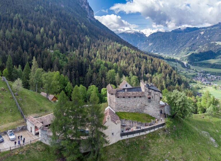
Hohenrätien occupies a plateau of approximately one hectare, enclosed in part by a surviving perimeter wall. Near-vertical rock faces protect three sides, while access is possible from the steep southern side across a saddle about 40 metres below the plateau. The site contains an outer sacred zone and a more densely built inner secular zone. Three buildings remain standing, while numerous other structures survive as ruins or below-ground traces. Ground-penetrating radar has also detected additional buildings that have not yet been fully investigated.
Inner Secular Zone
Hoch Rialt Tower
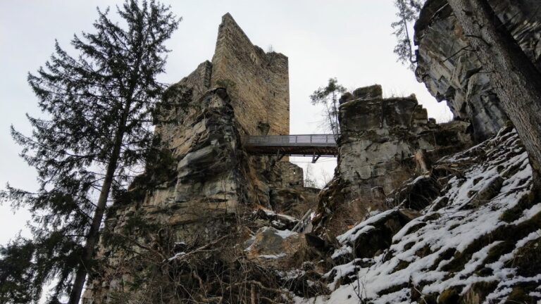
The Hoch Rialt tower stands on a projecting rock above the highest point of the plateau and forms the center of the inner zone. The outer enclosing wall bounds this area on the west, while internal walls separate it from the rest of the complex to the south and east. The steep northern slope probably caused the northern walls and foundations to collapse downward.
The tower survives as a ruin about 14 metres high. Its earliest phase was a two-storey stone house with a gabled roof, probably providing protected lodging for merchants and muleteers. A high entrance on the first storey of the east facade led to a lodging room with a latrine. The building was later raised by two storeys. The lodging room and latrine were moved to an upper floor, which also contained a large open fireplace. The main entrance and reception area occupied the third storey, while the fourth storey formed one large bedroom.
A rock-cut cistern fills the ground floor. Rainwater collected from the gabled roof supplied it, and its capacity was approximately 30,000 litres. The surrounding inner zone probably contained stables, workshops, goods stores, and other storage rooms. Damage in the east wall probably occurred when the masonry chimney above the fireplace broke away and collapsed into the tower. Part of the wall was pulled down, leaving the building too badly damaged for continued use.
In 1990 and 1991, a gallery-like internal support structure was installed to prevent further collapse. A concealed internal roof system protects the wooden structure from weather. It incorporates an impluvium, a roof opening and rainwater-collecting arrangement derived from ancient architecture, together with a glass pyramid. Rainwater leaves through a spout on the third storey. The exterior remains unchanged, while the interior has modern supports and wooden platforms at the approximate levels of the original floors. The open center admits light.
Priest’s Tower
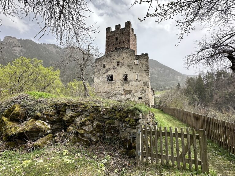
The square Priest’s Tower stands northwest of the church. It has three storeys and shows five phases of construction and alteration. Its original form, including a gabled roof, was restored in 1975. The building later served as accommodation for the family foundation and members of the Hohen Rätien support association.
South or Defense Tower
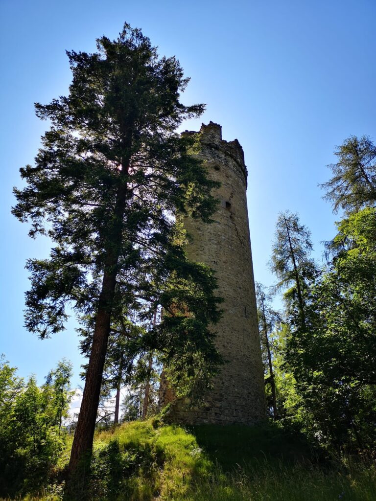
The square South or Defense Tower stands southeast of the complex against the enclosing wall, overlooking the approach to the castle hill. Tree-ring analysis of wood samples dates its construction to 1209. It originally contained two masonry storeys and probably a one-storey wooden upper structure with a projecting upper level. That wooden section most likely provided living quarters.
Fire traces in the masonry, burned floor-beam remains, and the loss of the entire southeastern corner show that the tower suffered extensive damage. The wooden upper structure apparently collapsed inward, caught fire, and burned out the remaining tower, probably during the earthquake of 1295.
Church and Earlier Sacred Buildings
Church of St. John and Victor
St. John and Victor Church stands at the eastern edge of the walled complex beside the entrance. It has an elongated nave and a slightly angled rectangular choir at the east end. The building is the final expansion in a sequence of churches whose beginnings reach back to the Late Roman period.
Joint lines on both sides of the bell tower show that the tower belongs to an earlier phase, before the earthquake of 1295. The originally separate campanile, or bell tower, belonged to a predecessor church first recorded in 1210 as the parish church of Rialt. During rebuilding around 1300, it was incorporated into the north wall of the new church.
After centuries as a ruin, the church received new roofs over the nave, choir, and tower, together with a simple wooden floor, in 1980. The restored building retains its late-Romanesque proportions, characterized by substantial masonry and rounded-arch forms. The church is used for cultural and ecclesiastical events.
Late Roman and Early Christian Complex
Excavations northeast of St. John and Victor Church exposed a group of earlier sacred buildings. Coins dated to AD 346 in wall foundations place the oldest visible building traces in the Late Roman period. The complex includes an attached baptistery with a large masonry baptismal basin. Early Christians used the basin for baptism during the 4th or 5th century, and later church buildings retained access to it.
A long building adjoining the church buildings on the east existed during Late Antiquity, before the baptistery was added. Its exact function is uncertain, but cup-shaped stove tiles support the possibility that it was a higher-status guest hostel. Such a Christian hostel, known as a xenodochion, provided accommodation or charitable shelter for travelers and pilgrims and had direct access to the church.
Nearby sites