Hochjuvalt Castle: A Medieval Hill Castle and Valley Stronghold in Switzerland


Site at a Glance
- Rating
- 5
- Popularity
- Very Low
- Country
- Switzerland
- Primary era
- Medieval
- Eras represented
- Medieval, Modern
- Civilizations
- Holy Roman Empire, Swiss
- Site type
- Military
- Remains
- Castle
On this page14 sections
History
Hochjuvalt Castle is a medieval hill castle in Switzerland, probably built in the twelfth century as the seat of the Lords of Juvalt. Timber dating places the construction of its tower in 1216. Also known as Juvalt, Ausserjuvalt, or Alt-Juvalt, it was one of two castles in the municipality of Rothenbrunnen, alongside Innerjuvalt. The name derives from the Latin expression Jugum altum, meaning “high yoke.”
The Lords of Juvalt
The Juvalt family appears in records by the early to mid-twelfth century, and Hochjuvalt is first mentioned in 1149. The family initially held the castle independently. Later, some members entered the service of the Bishop of Chur, the head of the historic ecclesiastical principality centered on Chur and a major territorial power in the region. These members served as ministerials, part of the medieval service nobility who held offices and estates in return for service to a lord. Among them were vicedomini, high administrative officials acting for the bishop in Domleschg, and judges of the palatine court at Chur. Other members of the family remained free lords who lived in their own castles.
Ulrich of Juvalt and his sons Heinrich II and Friedrich appeared as imperial judges at the peace treaty concluded in 1219 between the Bishop of Chur and the city of Como. Ulrich, who was also a cathedral canon, became provost of Chur Cathedral in 1242–43. These roles placed members of the family within both the regional nobility and the institutions governing the surrounding ecclesiastical territory.
Changes of ownership and lordship
Control of Hochjuvalt became increasingly divided during the fourteenth century. In 1340, Albrecht V and Berchtram, sons of Eglolf I of Juvalt, asked the Bishop of Chur to confirm the sale or pledge through which the castle had passed to the knights and episcopal ministerials of Rietberg. Johann of Rietberg, who died in 1349, then gave his fiefs and estates, including Hochjuvalt, to his uncles of Landenberg. This transfer apparently sought to prevent the property from passing to his father-in-law, Heinrich Brun of Rhäzüns.
In 1352, the Landenberg family renounced its claim to Hochjuvalt in favor of the Bishop of Chur in return for 3,500 gulden. The Freiherr of Lumbrein, another claimant, abandoned his claim for 250 gulden. Family rights were also divided internally. An arbitration in 1342 assigned the castle, its people, and its associated estates to Albert V of Juvalt, while his brother Bartholomew received the tithes and revenues. In an inheritance settlement in 1372, Eglolf II received the fortress called Juvalt, and Friedrich received one third of the lordly estates.
During the fifteenth century, the Bishop of Chur repeatedly pledged Hochjuvalt as security for loans. In 1423, the castle was pledged to the knight Uoli Faltzüllen, also called Frizschilg, who was married to Barbara of Juvalt. The pledge compensated him for expenses incurred while defending Chur Castle against the Lords of Matsch. After Rudolf II of Juvalt, the last free male member of his branch, died before 1456, his daughters Ursula and Barbara and his widow Elsine, also called Elisabeth, sold the castle and lordship of Innerjuvalt to Pedrutt of Wannis, Ursula’s husband. Hochjuvalt itself passed through several pledged ownerships, including to Eberhard Ringg of Baldenstein and Sophia Sarganserin, the wife of the knight Martin of Capol.
Conflict, abandonment, and road control
The Schams feud began in 1451 between inhabitants of the Schams valley and the Counts of Werdenberg-Sargans. The conflict affected several castles in the region, which were plundered, burned, or demolished. Hochjuvalt may have suffered damage during these events. Uoli Faltzüllen and Barbara of Juvalt may also have been killed, but the evidence does not establish that Hochjuvalt was destroyed in the same manner as Alt-Süns and Neu-Süns. Fire damage was found in the tower and hall building, while no evidence of undermining was identified.
Hochjuvalt was last granted to Eberhard Ringg of Baldenstein in 1454. By about 1500, the castle had been abandoned, and Ulrich Campell described it as a ruin around 1550. Its medieval importance also derived from its position within a customs and road-control system at the entrance to Domleschg. Traffic traveling between Ulm and Bregenz and Chiavenna and Milan, including routes from the Septimer, Splügen, and San Bernardino Alpine passes, was directed through the customs station below the castle. A customs station collected duties from traffic using an important road.
Twentieth-century military reuse and conservation
During the Second World War, the site was reoccupied and incorporated into the Swiss defensive system. Between 1940 and 1942, a tank barrier was built around the medieval customs station on both sides of the Rhine. Guns were positioned near the upper castle, and an infantry fortification was installed in the rock between the lower and upper castle, with its firing direction toward the south. The Swiss National Bank stored 140 tonnes of gold at the site during the war.
Pro Castellis, the cultural institution that owns Hochjuvalt, undertook research, stabilization, and repair work between 2010 and 2013. Major breaches in the masonry were closed, and the Rhine gate was reconstructed to its original dimensions using archaeological evidence. A new footpath to the upper castle was also added. After a serious accident in 2010, climbing the extremely dangerous rocky ridge was prohibited. Since June 2013, an information panel at the Porta Rhaetica defensive barrier has presented images, plans, and an account of the castle complex and its history. Hochjuvalt is listed as a Swiss cultural property of national significance.
Remains
Hochjuvalt survives as a stabilized ruin on a narrow rocky spur at 805 metres above sea level, approximately 200 metres above the Hinterrhein. The spur occupies a constricted point in the valley and provided a naturally strong defensive position controlling movement along the valley. The complex was divided into an upper castle on the rocky summit and a lower castle or forecourt at the foot of the rock beside the historic valley road. Both sections used the same rocky bottleneck as part of their defensive arrangement.
Upper castle
Keep and summit buildings
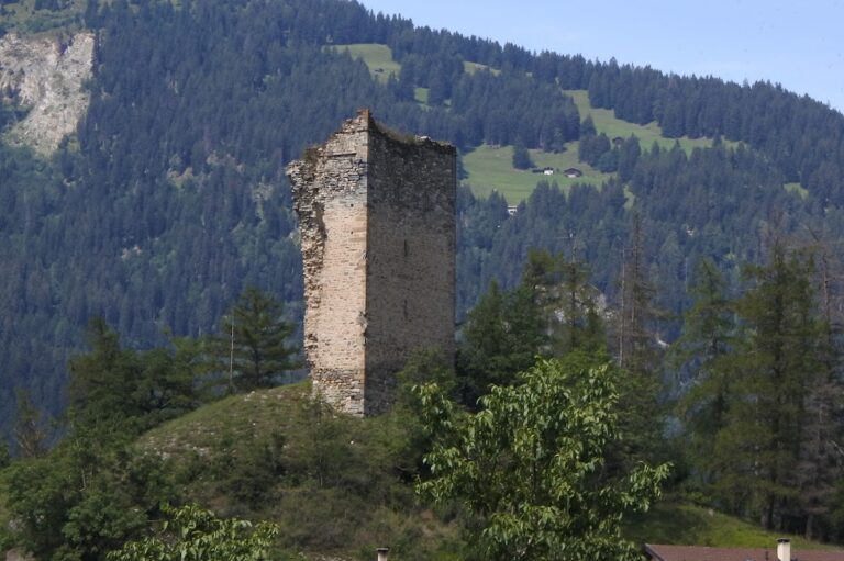
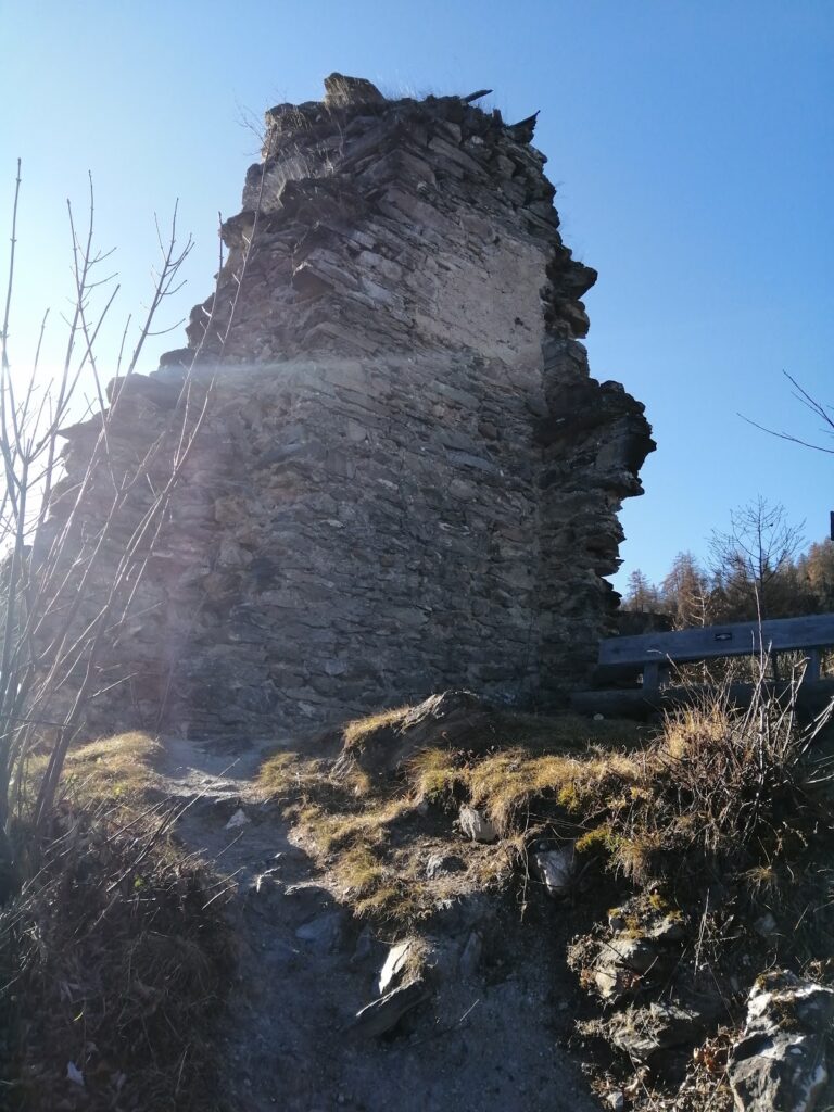
The upper castle was approached from the northwest through a passage cut into the rock. Its original approach is now buried, and the former access route is not open for climbing. The principal building was a five-storey residence tower, or keep, which combined residential, defensive, and administrative functions. Most of its walls have collapsed, leaving the western corner and an L-shaped remnant. The structure was built with ashlar blocks and rubble stone.
The surviving corner has dressed stones with chamfered edges and no bossing. Parts of the walls retain rough stone plaster marked by struck joint lines, together with areas of smooth plaster. Two-part building remains occupy the highest point of the narrow summit. A later rectangular structure on the southwestern forecourt survives only in a few wall fragments.
Tower annex
Entry to the main tower was provided through a southwestern annex with a lean-to roof, which slopes in one direction against a higher wall. Its high entrance connected visibly with the tower above the third storey. The annex retains two loopholes, narrow openings for observation or weapons fire, as well as a window and two smoke vents. Another window survives in the storey above.
Excavation in 2012 exposed the northern corner of the tower, part of the wall facing the likely direction of attack, and the southeastern annex, which had a palace-like form. The foundations of this annex extend deeply down the rock face. These remains show how the upper buildings occupied the restricted summit rather than a broad level plateau.
Summit defenses
A curtain wall, the enclosing defensive wall between stronger points such as towers, probably surrounded the entire summit of the spur. Only slight traces remain. Two ditches protected the side facing the mountain, adding obstacles where the natural rock offered less defense.
Lower castle and customs enclosure
Walled court and towers
At the foot of the rock, the lower fortification formed a walled court beside the valley road. A square tower stood at its southern corner, and the surviving structure measures approximately 9 by 9 metres. Foundations of a similar tower remain visible in the northwestern corner. The lower enclosure therefore combined a bounded court with corner defenses at the base of the upper rock.
Gates and road barrier
The lower enclosure had three gates or doorways, one facing Chur, one toward the Viamala road, and one toward the Rhine. Individual wall fragments and beam sockets survive from two of these gates. The customs and road barrier also included a gate system and a cross-wall placed across the road.
Archaeological evidence guided the reconstruction of the Rhine gate during stabilization work in 2010 and 2011. The height of its threshold and the dimensions of its locking beam also allowed the mountain-facing gate cheek to be reconstructed. That rebuilt section now supports part of the heavily breached curtain wall. Together, the lower court, gates, cross-wall, and upper rock defenses preserve the physical arrangement through which Hochjuvalt controlled passage along the valley road.
Later defensive installations
The medieval lower fortification and upper castle were incorporated into twentieth-century defenses. A tank barrier crossed the area around the former customs station on both sides of the Rhine, while guns occupied positions near the upper castle. Between the two castle sections, an infantry fortification was cut into the rock and directed toward the south. These installations form a later military layer within the surviving castle complex.
Nearby sites