Hizen Provincial Capital Ruins: A Nara- and Heian-Period Government Center in Japan
Site at a Glance
- Rating
- 3.5
- Popularity
- Very Low
- Country
- Japan
- Primary era
- Medieval
- External website
- Open
- Eras represented
- Medieval
- Civilizations
- Unclassified
- Site type
- Civic
- Remains
- Palace
On this page12 sections
History
Hizen Provincial Capital Ruins in Saga, Japan, are the remains of the administrative center of Hizen Province, established under the ritsuryo system during the early eighth century and used from the Nara period into the early Heian period. The ritsuryo system was a centralized form of government modeled partly on Chinese institutions, with appointed provincial governors overseeing administration, taxation, policing, and other official duties. The site preserves evidence of how this system was organized in northwestern Kyushu.
Foundation under the provincial government system
The provincial office was established in the early eighth century. Excavated Sue ware, Haji ware, large quantities of roof tiles, and other earthenware indicate activity beginning around this time. Some pottery belongs to the latter half of the seventh century, but most of the material dates to the eighth century, particularly its latter half. The Taika Reform, a program of political and administrative centralization begun in 645, helped create the provincial-government structure represented by this complex.
Hizen was a historical province in northwestern Kyushu. Its government office formed part of the Saikaido, the administrative and transportation region covering Kyushu and the western maritime approaches to Japan. An official station stood south of the provincial office on the Hizen Route. This network connected the area with Dazaifu, the principal government center for Kyushu and the western approaches, as well as with stations leading toward Matsuura, Kishima, and the southern end of the Shimabara Peninsula.
Rebuilding and later use
The provincial office developed through an early and a later construction phase. Its basic size and arrangement remained largely consistent between the two phases. The front hall, rear hall, and side halls were each rebuilt once, while the south gate was rebuilt twice. This pattern indicates repeated maintenance and alteration of the compound as the provincial administration continued to operate.
The archaeological evidence is concentrated in the eighth century, with relatively few finds from the ninth and tenth centuries. The wider location of the Hizen provincial capital remains uncertain. The Hizen Fudoki, an ancient provincial geographical and cultural record, does not identify it, while the Wamyosho, a Heian-period gazetteer and administrative reference work, places the provincial government at Ogi. This may reflect a later relocation, although the sequence of any move cannot be established clearly.
Archaeological investigation and preservation
The site was identified through archaeological investigation in the Kuchiike aza Gobonsugi area. Excavations carried out over approximately ten years from 1975 clarified the scale and internal organization of the provincial office. They also revealed surrounding buildings interpreted as tax storehouses, structures associated with the provincial governor’s residence, and three long, podium-based buildings connected with government administration.
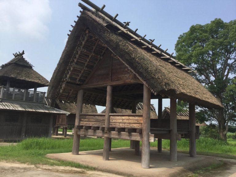
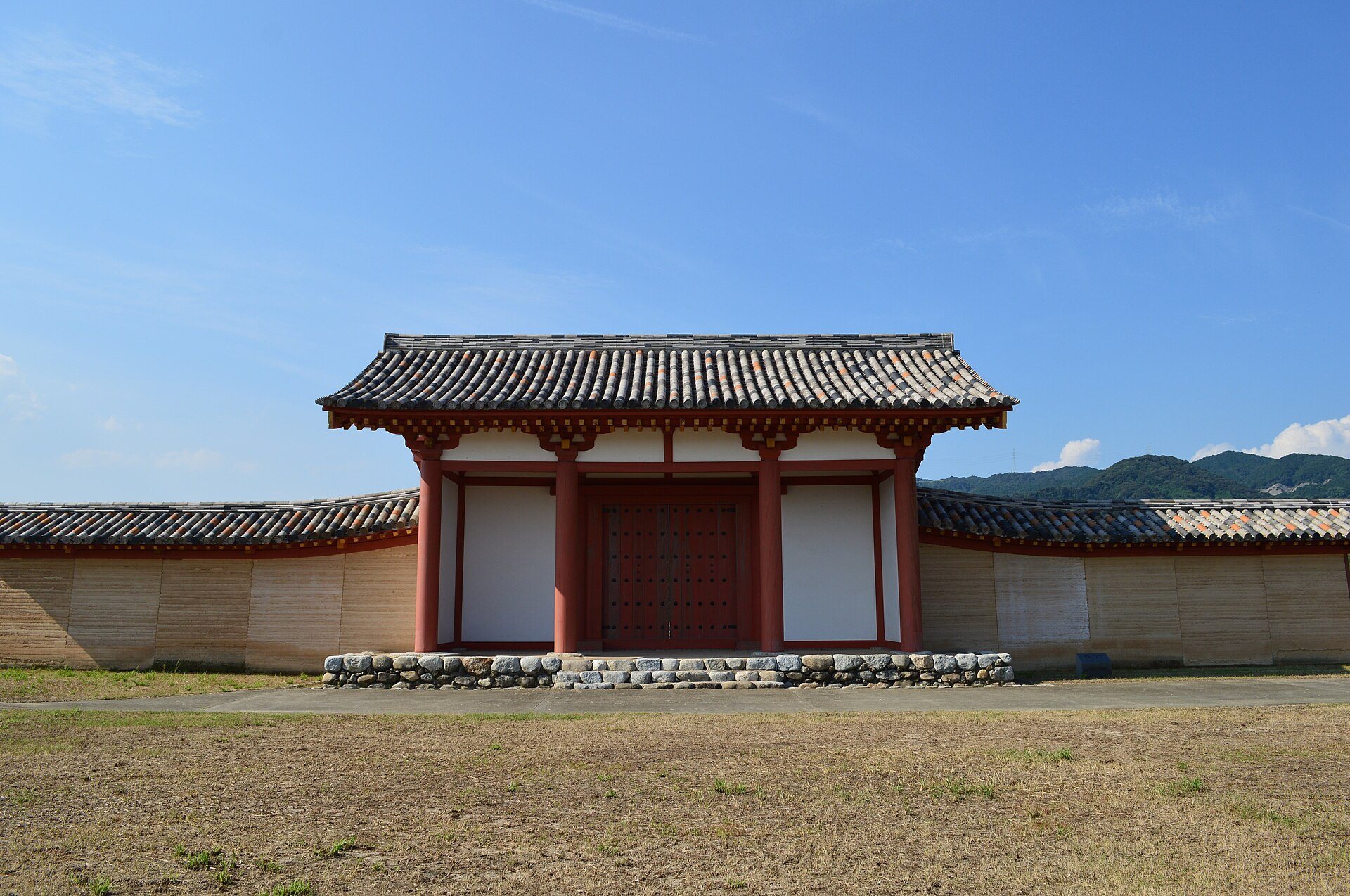
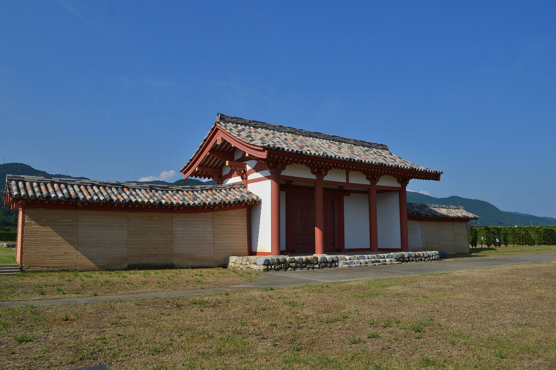
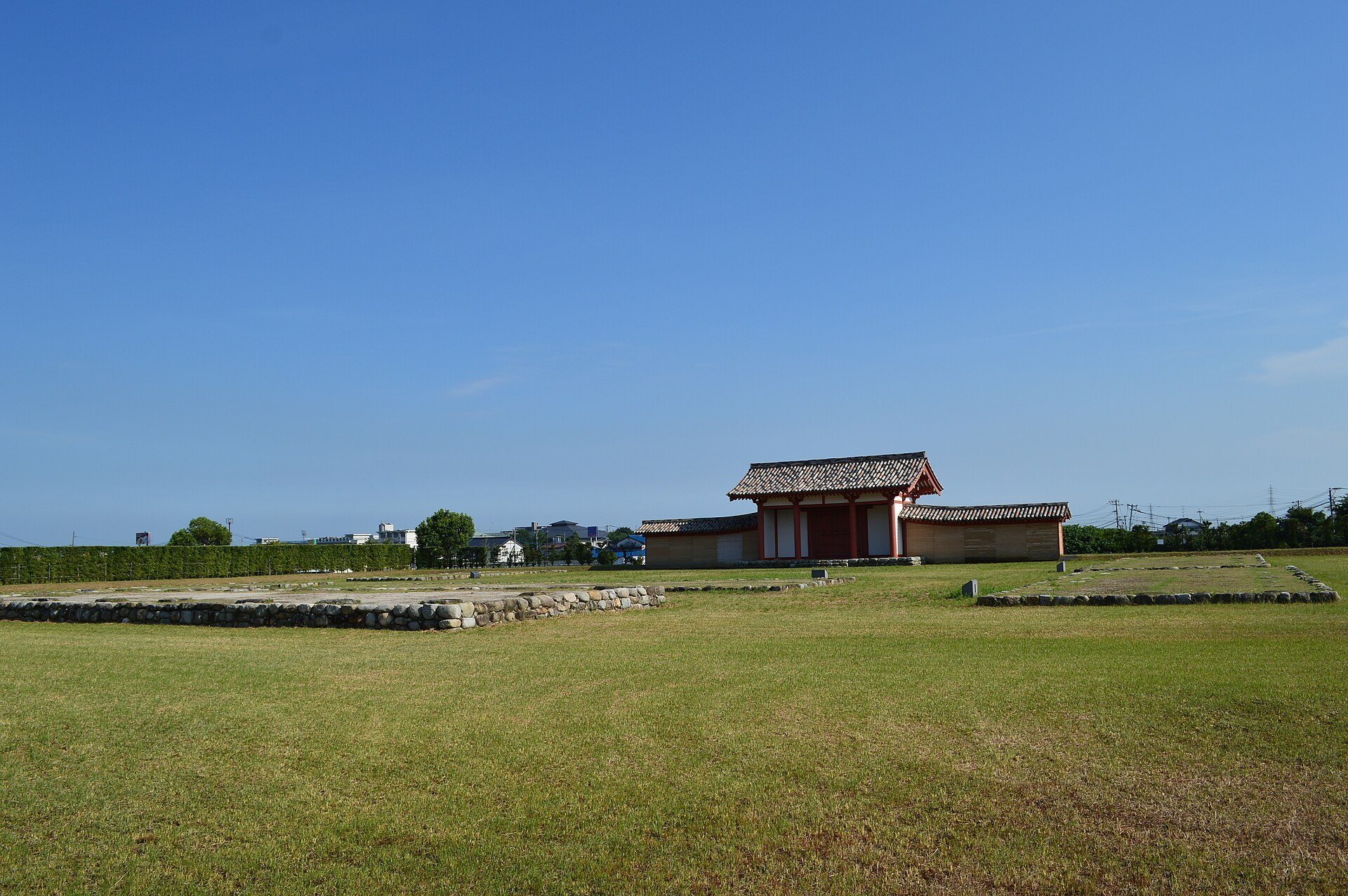
Hizen Provincial Capital Ruins became a National Historic Site of Japan in 1989. The remains have since been presented as a historical park, with a museum established on the site. A reconstructed south gate and restored sections of earthen wall help convey the form of the ancient compound.
Remains
Provincial-office enclosure
The provincial office occupied a rectangular enclosure on an alluvial terrace formed by the Kase River, which rises in the Sefuri Mountains in the western Chikushi Plain. The enclosure measured approximately 77.2 meters from east to west and 104.5 meters from north to south. Its main axis ran about seven degrees west of north, organizing the principal buildings in a south-to-north sequence.
South gate
The south gate marked the southern entrance to the enclosure. It measured approximately 9.7 by 5.3 meters and stood about 6.8 meters high. The structure was an eight-legged gate, while the earthen wall ran slightly inside the boundary line. It was first built as a post-hole structure and was later converted into a building on stone foundations. Parts of those foundation stones survive, and the gate was rebuilt twice during the history of the office.
Principal halls and corridors
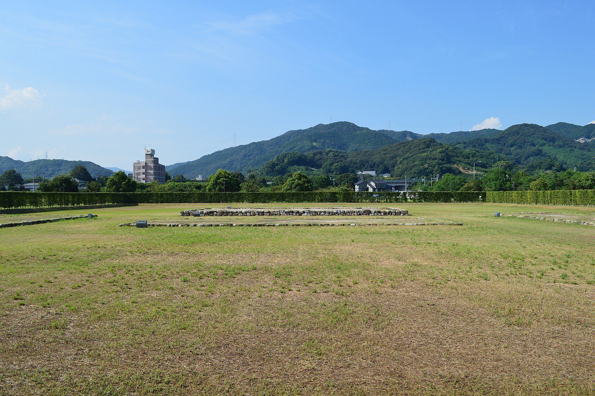
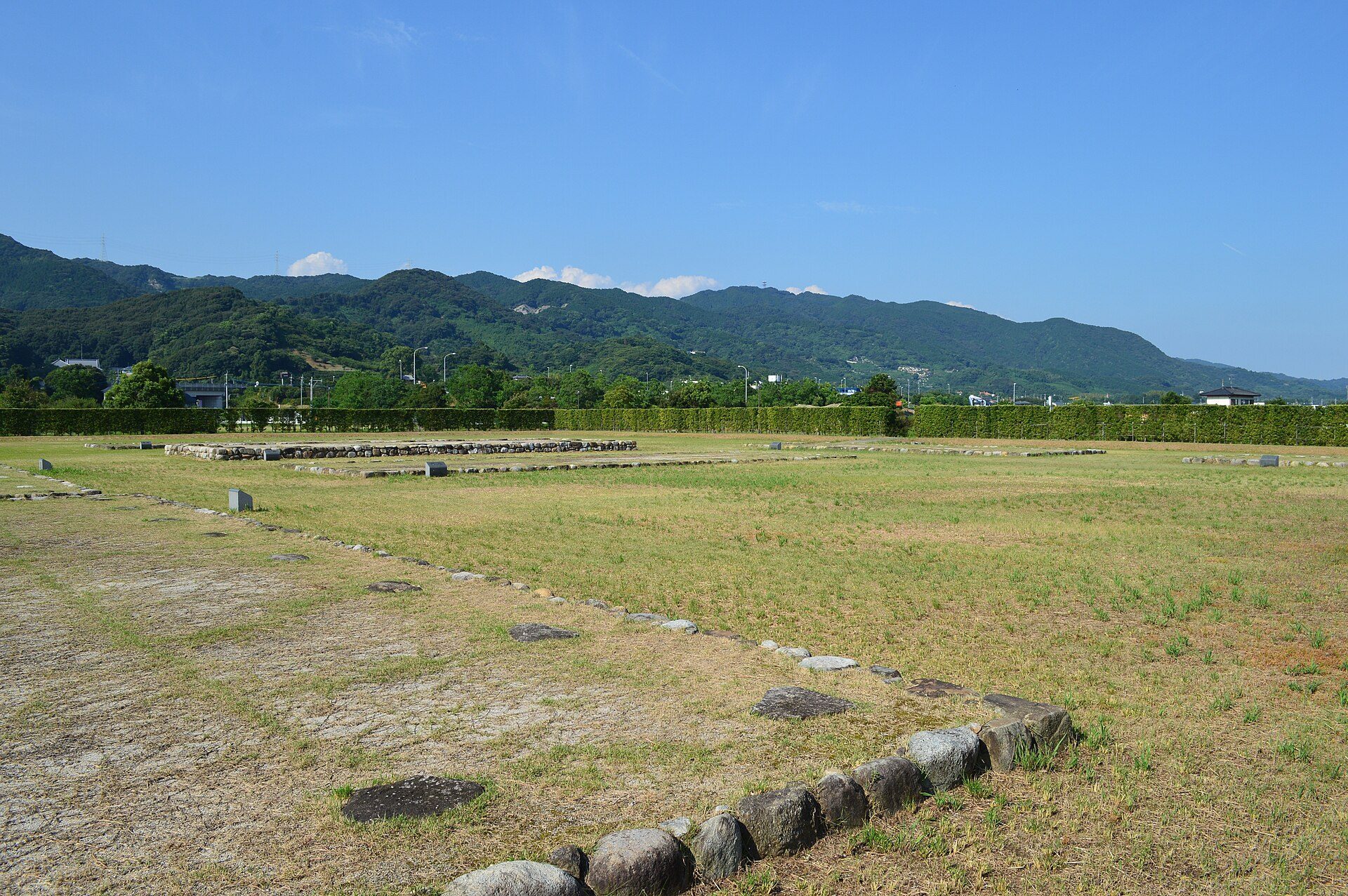
From the south gate, the main axis led to the front hall, main hall, and rear hall. The front hall and rear hall each measured seven bays by two bays. The main hall had a seven-by-two-bay central structure with a one-bay eave or veranda on all four sides, giving it an overall size of nine bays by four bays.
Two side halls stood on each side of the front hall, and all four measured seven bays by two bays. Corridors attached to the east and west sides of the main hall divided the compound into northern and southern sections. The halls and other buildings within the enclosure were constructed with post holes. The front hall, rear hall, and side halls were each rebuilt once, while the south gate underwent two rebuildings. The arrangement resembles the Dazaifu complex, but on a smaller scale.
Associated administrative buildings
Storehouses and governor’s residence
Buildings around the main enclosure include foundations interpreted as tax storehouses and structures considered to be the residence of the provincial governor. These remains reflect the practical functions of a provincial office, where administrative work was connected with the collection and management of taxable goods.
Long podium-based buildings
A group of three long buildings set on podiums is associated with government administration. Their position among the remains around the provincial office adds to the evidence for a wider administrative complex beyond the principal hall arrangement.
Reconstructed presentation
The present historical park includes a reconstructed south gate and restored earthen-wall sections extending for approximately ten meters on both sides of the gate. Together with the surviving foundations, pottery, roof tiles, and other earthenware recovered through excavation, these features convey the ordered layout and material character of the Hizen provincial office.