Gruuthuse Castle in Oostkamp: A Historic Estate and Noble Residence
Site at a Glance
- Popularity
- Medium
- Country
- Belgium
- Primary era
- Modern
- Eras represented
- Medieval, Early Modern, Modern
- Civilizations
- Belgian, County of Flanders, Habsburg
- Site type
- Domestic
- Remains
- Castle
On this page14 sections
History
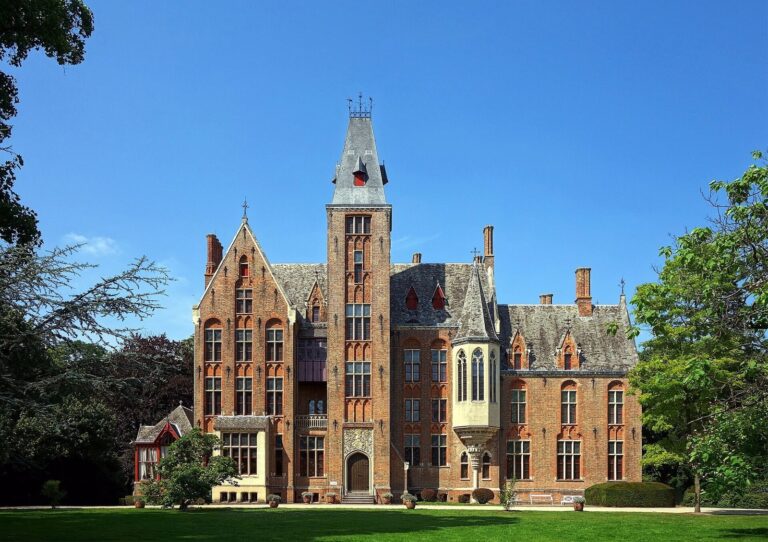
Gruuthuse Castle is a castle estate in Oostkamp, Belgium, whose present residence was commissioned in 1887 in the Neo-Flemish Renaissance style, a revival of Flemish Renaissance architecture. First mentioned in 1128, it was a medieval stronghold and later the seat of a lordship before becoming a country residence of the d’Ursel family.
The medieval castle and lordship
Galbert of Bruges, a medieval chronicler, recorded Gruuthuse in his account of events surrounding the 1128 murder of Charles the Good, Count of Flanders. William Clito, a Norman prince claiming the county, besieged the castle because its lord supported his rival, Thierry of Alsace, who later became Count of Flanders. Galbert also referred to the nearby Rivierbeek, the castle’s moats, and its fortifications.
In 1454, Jan Wittoen sold the lordship of Oostkamp to Louis of Bruges, Lord of Gruuthuse, with the approval of Philip the Good, Duke of Burgundy. Louis became the first member of the Gruuthuse family to own and govern the lordship, and married Margaretha van Borselen the following year. The estate comprised 700 gemeten of arable land, woods, and a lake; a gemet was a local land measure whose size varied by area. Its local court had seven aldermen, four appointed by the count and three by the lord, alongside a judicial officer and a clerk.
The castle also hosted prominent visitors. Edward IV, King of England, stayed there for a time in 1470. In September 1477, Mary of Burgundy and her husband, Maximilian of Austria, visited.
Transfer to the d’Ursel family
Catharina van Brugge, the last descendant of the Gruuthuse family, sold the lordship and castle to Cornelius Bertholf. In 1616, Bertholf sold them to Conrard Schetz, Baron of Hoboken and Lord of Hingene. Schetz was adopted the next year by his aunt Barbe d’Ursel and took the d’Ursel name and arms. An estate description from this period called the castle formerly “ten Thorre” and referred to the Rivierbeek as the “ghruijt.”
An inventory made in 1673 described the castle as ruined, and Spanish soldiers plundered it in October 1683. Late in the seventeenth century, François d’Ursel had much of the medieval castle demolished, keeping what remained as a country residence. The d’Ursel family attained ducal rank in 1716, but made limited use of the Oostkamp property. They lived mainly at Hingene and in Brussels, visiting Oostkamp during the hunting season and renting the castle and nearby land. In 1809, Duke Charles-Joseph d’Ursel’s estate covered 568 hectares, after 65 hectares had been sold shortly beforehand.
The village pillory was probably erected by Charles d’Ursel, the fourth Duke of Ursel, in connection with the restoration of the lordship. Its ducal heraldic decoration indicates that it was made after 19 August 1716. It was moved to its present position in the castle park during the nineteenth century.
Rebuilding and twentieth-century changes
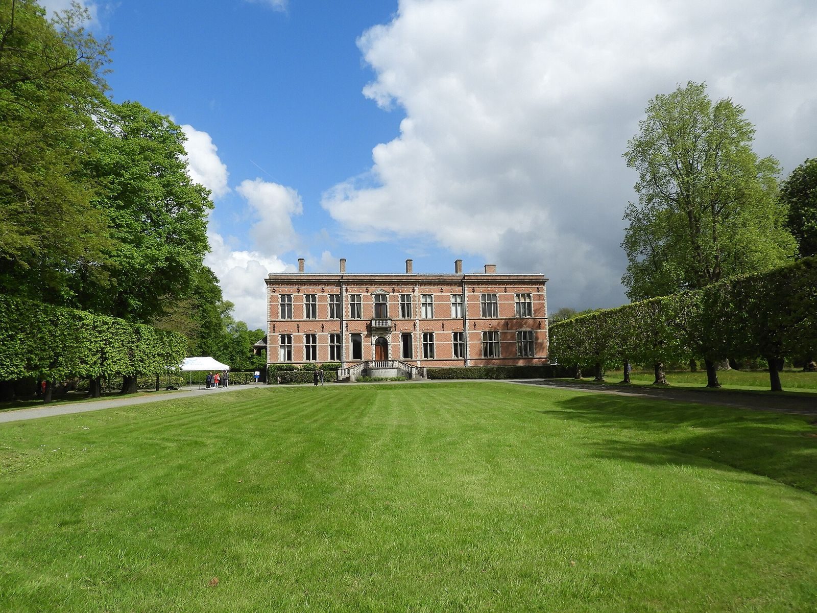
In 1887, Count Charles-Marie d’Ursel ordered the existing building demolished and commissioned a new castle from a provincial architect. The entrance gate and a small round tower were retained. The new residence was largely complete by 1890 and entered use in 1892, along with new stables and a carriage house. A redesigned park was laid out around the castle around 1890. After becoming governor of West Flanders, Charles-Marie lived in Bruges from 1901.
In the 1930s, Count Louis d’Ursel had the Hippodrome Gruuthuse built east of Gruuthuselaan. The racecourse opened in 1935 and was demolished around 1965, when its grounds were converted to woodland and meadow. Parts of the estate were expropriated for the Brussels–Ostend motorway in the 1950s and for Gruuthuselaan in 1969. On 17 August 1981, a fire destroyed the castle’s roof and a substantial archive depot. The roof was replaced with a flat one rather than reconstructed.
Remains
The estate brings together a castle precinct, entrance and service buildings, and a landscaped park with farmland and woods beyond. Historical plans show a triangular castle site, moats, and distinct upper and lower courts; the surviving buildings reflect the substantial rebuilding of the late nineteenth century.
Castle precinct and service buildings
Castle
Manuscripts owned by Louis of Bruges and dated 1473–1476 show a large castle with a triangular plan, substantial towers, and a wide moat. A 1703 map and later eighteenth-century maps depict a gatehouse flanked by small towers and a castle with at least one large tower. Plans from about 1835 show the triangular site enclosed by a moat that reached the Rivierbeek. A second moat divided the upper court and castle from the lower court, service buildings, and entrance gate. The same general arrangement appears in plans from about 1843 and 1846–1854.
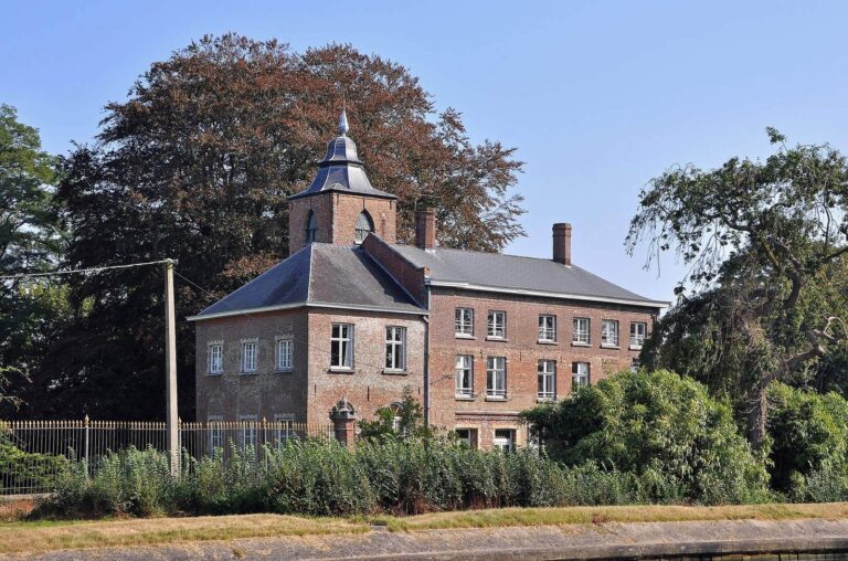
The oldest photograph of the site, dated 1860, shows three adjoining sections: one two-storey block, a slightly set-back three-storey block, and another three-storey block at right angles. A round stair tower between the latter two may preserve part of the medieval castle. The present residence occupies the site of the late-seventeenth-century castle and has a rectangular plan with slightly projecting sections of façade. Its brick walls are finished with pale sandstone details and blue limestone at the base. Continuous stone lintels and window sills, rough-faced arches above openings, and framed doorways articulate the façades. A double flight of steps with a landing leads to the front entrance.
Before the 1981 fire, the slate-covered roof storey contained three levels, with elaborate roof windows, two rows of dormers, slender chimneys, and a decorative ridge crest. On the pond side, a projecting three-bay section was topped by a stepped gable. The building now has a flat roof. Inside, a broad central passage runs through the basement, ground floor, and first floor, with rooms opening onto it.
Gatehouse
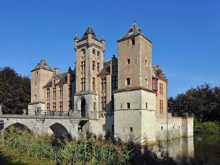
The gatehouse has an older core that may date to the sixteenth or seventeenth century, and its courtyard-facing section was added in 1890. The brick building has two storeys beneath a steep gabled roof, with stepped gables at the sides. A roof window and two dormers appear on both the front and rear. Since about 1890, two unequal, many-sided corner towers with tent-shaped roofs have flanked its castle side. Blue limestone frames the street entrance; sandstone is used for the cross-shaped window divisions and the stones from which the castle-side gate arch begins. Above the street entrance, a round-arched niche holds a statue of Mary. A carved stone panel on the castle side displays the d’Ursel arms.
Concierge’s house
The concierge’s house stands east of the gatehouse, beside the estate wall along the street. It entered use in 1891 and combines cottage-style design with Anglo-Norman influences. Its brick walls, slate roofs, and blue-limestone base are complemented by three-part windows and continuous stone sills.
Stables and carriage house
The carriage house and stables adjoin the gatehouse to the west. Designed around 1892, the red-brick building has two wings arranged in an L around a courtyard. The left wing served as a carriage shed and the right as a stable, where original horse stalls survive. Slate roofs cover the building; blue limestone frames the openings and three-part windows, while rough-faced arches and continuous lintels shape the exterior.
Park and estate landscape
Park design
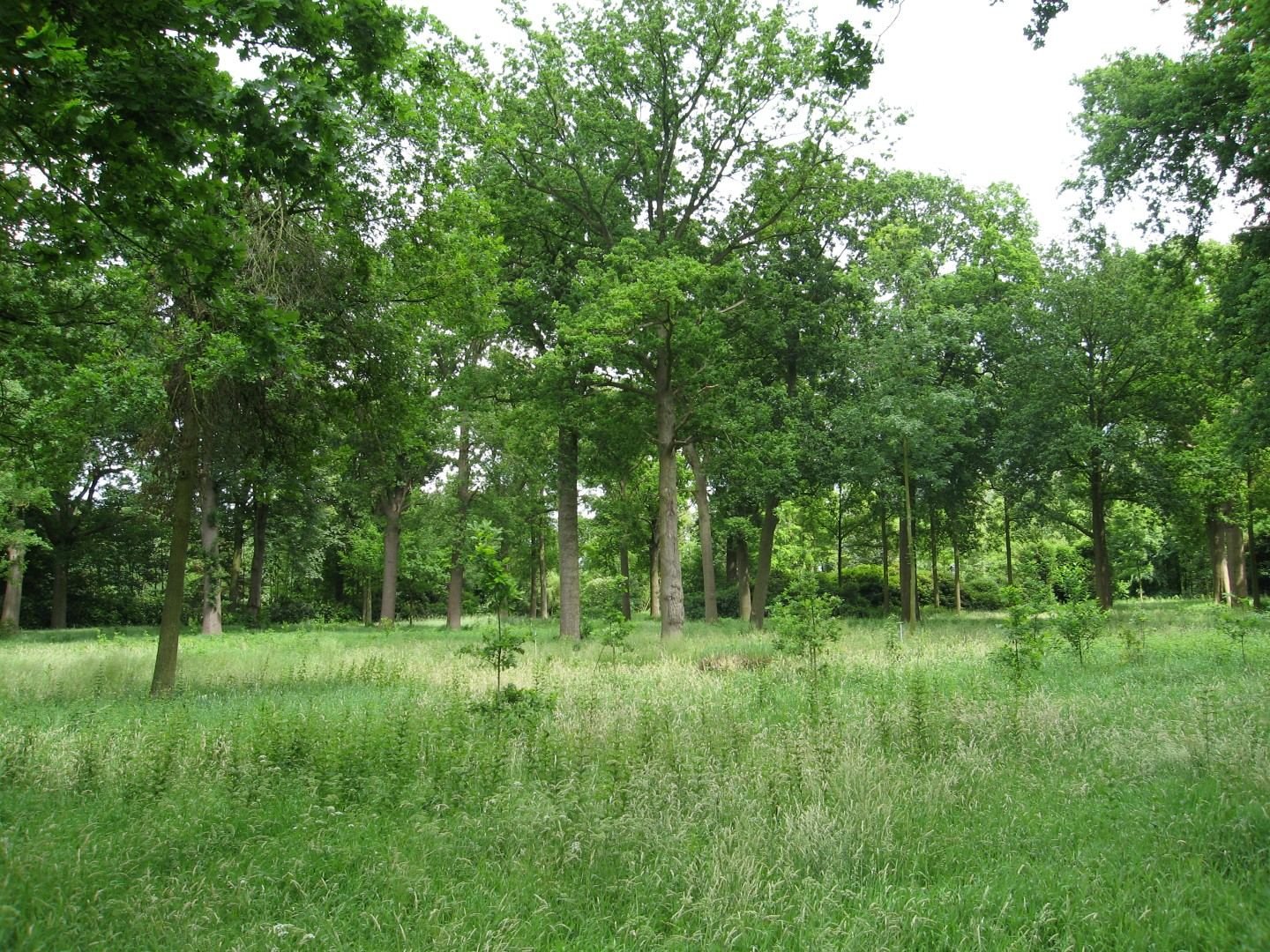
The late-nineteenth-century park combines formal geometry with more naturalistic landscaping. Its features include sunken lawns, a mirror pond with a water sculpture, a winter conservatory, a rose pergola, clipped forms, grasslands, tree groups, a tree meadow, avenues, a covered walk, and park woods. Sightlines from the garden room and sun terrace on the castle’s south side cross the tree meadow toward the Rivierbeek, a southeastern grassland, Sint-Antoniusdreef, and a southwestern grassland. From the entrance terrace, views extend toward Claer-, Nieuwenhove, and Hertendreef and across western grassland to a star-shaped wood.
North of Hogedreef, also called Kasteeldreef, an orchard and kitchen garden were laid out against a south-facing boundary wall. They once adjoined the gardener’s house at Gruuthuselaan 3; the area is now part of the landscaped park. Trees noted in the grounds include giant arborvitae, American sweetgum, bald cypress, weeping beech, common plane, silver maple, silver lime, American tulip tree, Weymouth pine, fern-leaved beech, giant silver fir, cut-leaved hornbeam, and black mulberry. An oil painting of the original park design survives, though the 1981 fire badly damaged it.
Avenues, farms, and racecourse remnants
Three major avenue lines remain legible in the surrounding landscape. The former western entrance avenue, Hogedreef or Kasteeldreef, once connected directly with Oostkamp’s village centre. The wider estate includes Warandebos and the Grote and Kleine Kwameers woods, farmland, and farm buildings: Hoeve “Joyeuse Pensée” at Warandestraat 1, Hoeve “Ter Lare” at Westdijk 20–21, and Coupure-hoeve at Westdijk 18. Some concrete structures from the former racecourse grandstands also survive. They were made by building-materials merchant Germain D’Hoore.
Pillory
The pillory stands at the central junction of the star-shaped wood. About 3.70 metres high, it is made of unpainted blue limestone. Its eight-sided shaft rises from a square base. A lion’s head is set into the front, with three stone projections on the sides; four holes around the head probably held two upright rods used to adjust the iron neck collar. At the top, two griffins support an oval d’Ursel coat of arms, draped with a mantle and surmounted by a ducal crown.