Grasburg Castle: A Medieval Imperial Rock Castle in Switzerland


Site at a Glance
- Rating
- 4.5
- Popularity
- Low
- Country
- Switzerland
- Primary era
- Medieval
- Eras represented
- Medieval
- Civilizations
- Holy Roman Empire
- Site type
- Military
- Remains
- Castle
On this page8 sections
History
Grasburg Castle is a ruined rock castle in Switzerland, built around 1220–1230 as a late-Staufen imperial fortress above the Sense Gorge. First recorded in 1223 as Grasburc, it controlled the surrounding region and medieval routes between Thun, Fribourg, and Laupen.
Origins and Staufen rule
The oldest surviving stone walls date from the eleventh or twelfth century, although the earliest castle may have been made of wood. A local legend attributes its foundation to a Roman hunter who killed a dragon on the sandstone rock and received the surrounding territory from a deer. The same tradition tells of a later robber from Valais who extended the castle eastward and mixed the blood of murdered workers into the mortar. Romans lived in the wider region, but no archaeological evidence confirms a Roman or early medieval fortification.
The castle was probably established by a Burgundian or Zähringen nobleman. Earlier interpretations linked it to the Zähringers, a major medieval dynasty in the region, but later research identifies Grasburg as a late-Staufen imperial castle. The Staufers were a German ruling dynasty whose imperial authority extended into parts of present-day Switzerland during the early thirteenth century. As an imperial castle, Grasburg was administered on behalf of the monarch rather than held solely as a private noble residence.
Its position gave it administrative and strategic value. The castle overlooked the surrounding territory, the Sense Gorge, and traffic on the medieval road between Thun and Fribourg, as well as the route toward Laupen. Around the time of its construction, the territories of present-day Bern and Fribourg had come under Staufen control.
Dynastic transfers and Savoyan control
Grasburg and its lands later passed to the Kyburgs, another major regional noble dynasty, and briefly to Savoy in 1263–1264. The estate then became a fief of Rudolf of Habsburg. Under Habsburg rule, several ministerial families held the castle as feudal officials. A ministerialis was a legally unfree knight who performed military, administrative, or governmental duties for a feudal lord.
In 1310, Henry VII, King of Germany, pledged Grasburg and its surrounding lordship to Amadeus V, Count of Savoy, to settle debts. Savoy and his descendants retained the estate for more than a century.
Bernese and Fribourg administration
The castle’s remote position and gradual decay reduced its importance. In 1423, it was sold to the cities of Bern and Fribourg, which governed the territory jointly in a condominium, a system in which two political authorities share rule. They appointed alternating bailiffs, officials responsible for administering the lordship. As the castle became increasingly costly to maintain, it was abandoned in 1575 and the administrative seat moved to Schwarzenburg Castle.
Abandonment and conservation
After abandonment, Grasburg fell into disrepair. The canton of Bern sold the ruins to a private owner in 1845, and the city of Bern acquired them in 1894 before beginning restoration. The main tower was close to collapse, prompting repairs around 1900–1904, followed by further work in 1928–1931.
A survey carried out during renovation in 1983–1984 contributed to the study of the complex, while later architectural and archaeological research identified its separate construction phases. Twentieth-century conservation secured the ruins, and a further two-stage renovation took place in 2022–2023. Grasburg is protected as a Swiss cultural property of national significance and is the largest castle ruin in the canton of Bern.
Remains
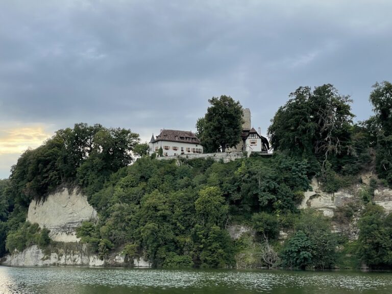
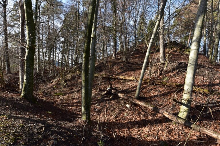
Grasburg Castle occupies a sandstone rock spur at about 696 metres above sea level, within a bend of the Sense River. The southern side falls more than 60 metres, while steep rocky slopes protect the other sides. A rocky saddle connects the southeast side to the surrounding land. The castle rock forms a roughly level area about 150 metres long and 50 metres wide, supporting an outer bailey, a main castle, and a main courtyard. The surviving stonework is ruinous but includes clearly recognizable Gothic forms.
Fortified rock and castle layout
The western tip of the rock is slightly higher and originally held the core castle. A neck ditch, about 16 metres wide, separated it from the rest of the rock. During a later construction phase, a keep was added at the eastern end. Together, these elements formed the principal fortified areas across the long sandstone spur. The surviving masonry preserves the relationship between the outer bailey, main castle, and courtyard, while conservation work has structurally secured the ruins.
Medieval roads and the gorge
A medieval road ran south of the castle between the Kyburg-controlled towns of Thun and Fribourg. It descended into the Sense Gorge and crossed the river about 600 metres south of Grasburg at a point known as Torenöli, which lay within the castle’s field of view. The present route toward Harrissteg also follows a medieval road, probably leading toward Laupen. Grasburg’s position enabled observation of these routes and of movement through the gorge.