Gediminas’ Tower: The Western Watchtower of Vilnius’s Upper Castle



Site at a Glance
- Rating
- 4.7
- Popularity
- High
- Country
- Lithuania
- Primary era
- Medieval
- External website
- Open
- Eras represented
- Medieval, Early Modern, Modern
- Civilizations
- Grand Duchy of Lithuania, Russian
- Site type
- Military
- Remains
- Castle
On this page15 sections
History
Gediminas’ Tower is the western defensive and watchtower of the Upper Castle in Vilnius, Lithuania, rebuilt in brick and stone in the early fifteenth century in the Gothic style. Standing on Gediminas Hill above the historic city, it formed part of the fortified centre associated with Vilnius’s establishment as the capital of the Grand Duchy of Lithuania.
Early settlement and the Upper Castle
Gediminas Hill may have been inhabited as early as the first millennium BC. A later phase began about 1,500 years ago during the Iron Age, when the area was also used for agriculture. Archaeological excavation has revealed a cultural layer approximately 6 metres thick, with its oldest level dated to the fifth to eighth centuries.
The earliest defences of the Upper Castle were made of wood and are traditionally connected with Grand Duke Gediminas, the ruler associated with the expansion of the Grand Duchy and the establishment of Vilnius as its capital. A first written reference to Vilnius or its castle may date to about 1323, appearing in Gediminas’ correspondence or diplomatic agreements.
The castle complex occupied two linked positions. The Upper Castle stood on the hill, while the Lower Castle was located beside the Vilnia. The Upper Castle developed further during conflicts with the Teutonic Order, a German religious-military order that launched repeated campaigns against Lithuania before the Christianization of the Lithuanian state. Between 1365 and 1402, these conflicts encouraged the strengthening of Vilnius’s fortifications.
Destruction and rebuilding in the fifteenth century
Crusaders attacked Vilnius in 1394. They burned the wooden Upper Castle and damaged the fortifications of the Lower Castle, but they did not capture the hilltop stronghold. In the early fifteenth century, Grand Duke Vytautas the Great rebuilt and restored the Upper Castle in stone and brick, including work after the major fire of 1419. The surviving tower belongs to this rebuilding phase. Earlier claims that Gediminas himself built the present tower are regarded as mistaken.
The rebuilt Upper Castle included defensive walls, three towers, palaces, and a chapel dedicated to Saint Martin. During the fifteenth century, rulers no longer used it as their main residential and representational complex. The growing use of artillery also reduced its value as a defensive position, and the castle was used mainly as an arsenal and military storehouse.
Military and administrative reuse
Under Alexander Jagiellon, a ruler of the Polish-Lithuanian dynastic state who also held the title of grand duke of Lithuania, a bell-casting workshop and a prison operated in the Upper Castle. His successor, Sigismund Augustus, restored parts of the castle and placed his library there. Sections of the complex served as a prison for nobles in 1610–1613 and for periods during the seventeenth and eighteenth centuries.
During the war between the Polish-Lithuanian Commonwealth and Russia, Russian forces captured Vilnius in 1655 and occupied the Upper Castle. A Russian garrison commanded by Voivode Danila Mišeski, a senior military and administrative governor, resisted a prolonged siege by Polish-Lithuanian forces. Mišeski reportedly intended to destroy the castle with ten barrels of gunpowder, but his soldiers prevented the explosion and surrendered. The Upper Castle had suffered heavy damage and was not rebuilt after its capitulation in 1661.
Russian fortress and twentieth-century damage
In the nineteenth century, the hill and the castle ruins became part of a Russian military fortress. In 1831, the Russian authorities ordered the remains to be adapted for military use under the architect Joseph Poussier. Ammunition cellars were excavated, the third storey of the western tower was demolished, the lower storeys were strengthened, and the remaining parts of the southern and northern towers were removed.
A wooden superstructure was placed on the tower for an optical telegraph station in 1832 or 1838. An optical telegraph transmitted signals visually between distant stations, and this installation formed part of the line between Saint Petersburg and Warsaw. The superstructure contained rooms for soldiers and officers, served as a fire lookout, and included an optical-telegraph lighthouse. A coffeehouse also operated in the lower brick storeys.
The wooden superstructure was removed after the First World War. In the 1930s, while Vilnius was under Polish administration, the tower’s third storey was rebuilt. The tower was seriously damaged during the Second World War, when the wider Upper Castle was destroyed and its roof collapsed. Restoration took place between 1948 and 1960, followed by further repair and renovation in 1995. Archaeological investigation continued during the Soviet period and after Lithuania restored its independence.
Flag, museum, and contested burials
The Lithuanian tricolour was first raised on the tower on 1 January 1919 by Lithuanian army volunteers commanded by Kazys Skirpa. As political control of Vilnius changed, the tower displayed Lithuanian, Polish, Soviet, and Lithuanian Soviet flags. On 7 October 1988, the pre-war Lithuanian flag was raised again on the initiative of Sąjūdis, the Lithuanian independence movement that became a major force in the restoration of statehood. The annual flag-changing ceremony on 1 January commemorates the earlier raising.
A branch of the Lithuanian National Museum has operated in the tower since the 1960s. Its exhibition presents the history of Vilnius and the castle, helping establish the tower’s place in the historical identity of the city. The building has also become a principal symbol of Vilnius and of the Lithuanian state.
Archaeological investigations during the period of Russian military control uncovered clandestine graves associated with leaders and participants in the 1863–1864 January Uprising, an armed revolt against Russian rule. Among those connected with the graves was Zygmunt Sierakowski, one of the uprising’s leaders. A tradition identifies the hill as the secret burial place of Kastuś Kalinoŭski and other executed insurgents, although that attribution remains uncertain. Excavations in 1915 recorded fifteen insurgents buried there. A wooden cross and marble plaque were installed in 1921, but the cross was burned and the plaque disappeared in 1940.
Instability and conservation of the hill
Gediminas Hill has been affected by slope instability for centuries. A landslide on the western slope in 1396 allegedly destroyed the palace of Voivode Montvidas and buried fifteen people. Around 1551, a supporting wall and a small fortification were built on the northern slope to help stabilize the hill.
Erosion and landslides were detected again in 2010. Major stabilization work was completed on the Lower Terrace by the end of that year and continued for two more years. About 200 trees were felled from late 2011, with around 80 initially left, and all trees on the hill had been removed by April 2013. Further landslides followed, and in 2017 the road built in 1895–1896 was noted to be collapsing. The tower was temporarily closed in 2016 because of the hill’s condition.
Remains
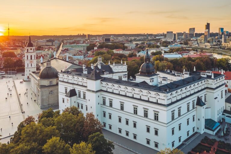
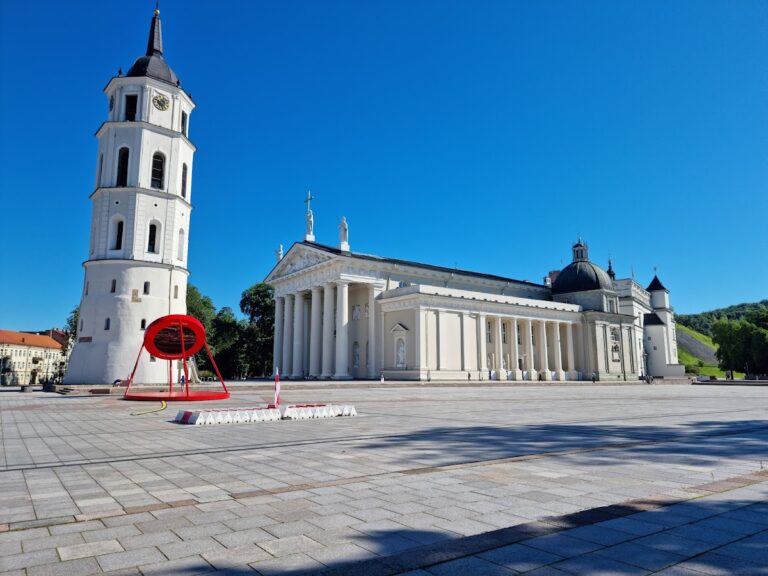
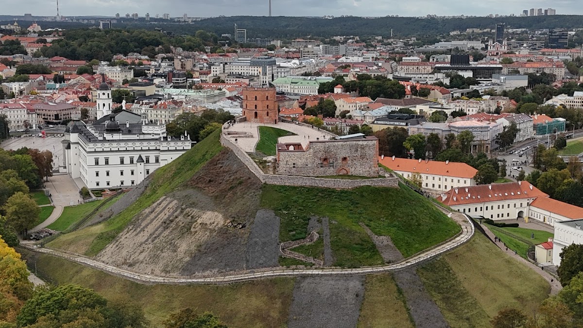
Gediminas’ Tower stands in the western part of Gediminas Hill, about 48 metres above the foot of the hill and approximately 142–143 metres above sea level. The hill rises behind Vilnius Cathedral, its belfry, and the former Palace of the Grand Dukes, near the edge of Cathedral Square. Its steep slopes are estimated at 35–40 degrees, reaching up to 60 degrees in the steepest areas, and consist largely of unstable sandy material.
The surviving tower and Upper Castle
Gediminas’ Tower
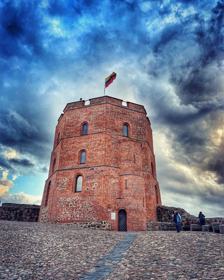
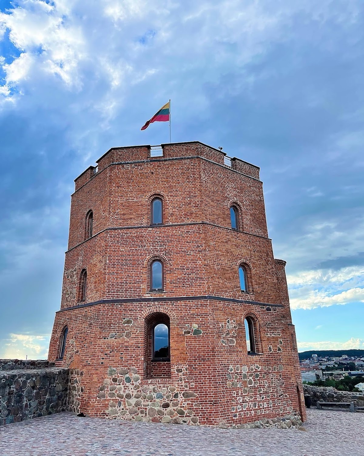
The tower is a three-storey brick Gothic building approximately 20 metres high. Its lower section is quadrangular, while the upper body is octagonal. Rough, unworked rubble stone and red brick make up its walls. Much of the structure has been rebuilt, but it remains the only substantially surviving building of the Upper Castle.
A flagpole rises from the roof and carries the Lithuanian state flag. The top platform is about 70 metres above the city and looks across Vilnius, the Old Town, and the Vilnia valley. The tower contains the Lithuanian National Museum branch exhibition, which includes archaeological finds, weapons and armour connected with the defence of the city and castle, models of Lithuanian castles and fortifications from the fourteenth to sixteenth centuries, and models of cathedrals, arsenals, barracks, and squares. Historical images of old Vilnius and a panoramic plan of the city from 1576 are also displayed.
Upper Castle remains
The surrounding Upper Castle remains include red-brick foundations, early-fifteenth-century brick structures built over earlier wooden construction, sections of sixteenth-century walls, the foundation of the southern tower, and a fragment of the defensive wall. The fortifications developed in stages around the hilltop, so the surviving archaeological material represents separate wooden, brick, stone, and masonry phases rather than one uniform building campaign.
The hill’s archaeological material includes fragments of domestic pottery, arrowheads, bullets, pieces of objects and jewellery, coins, and seals. These finds are represented alongside the exhibition’s weapons, armour, models, and historical plan, linking the physical remains with the castle’s defensive and administrative past.
Military alterations and underground structures
Nineteenth-century military works
The nineteenth-century fortress works altered both the hill and the tower. Ammunition cellars were excavated beneath the hill, the lower storeys of the tower were strengthened, and the tower’s upper storey was removed before later reconstruction. The surviving parts of the southern and northern towers were demolished. The wooden superstructure that followed held military rooms and communication equipment, while the lower brick storeys were also used for a coffeehouse.
Wartime shelter
During the Second World War, German forces excavated an underground shelter and command facility in the hill. Two tunnels were approximately 6 metres wide and 2 metres high, with lengths of about 88 and 79 metres. They were intended to connect with rooms and service spaces for bathing, water storage, lighting, heating, and ventilation. Soviet authorities used the complex after the war, but a fire in 1948 badly damaged its wooden structures, and the shelter was later filled with sand.
Hill approaches and landscape
A spiral path built on the hill slope in 1895–1896 leads toward the tower, and a funicular was added in 2003. The hill stands above the Neris and Vilnia river landscape, with a direct view toward the Hill of Three Crosses across the Vilnia. Its height and form have been altered over time by the construction of substantial structures, and the southern tower may have lost approximately half of its former height around 200–300 years ago.
The surrounding slopes were progressively landscaped with trees during the late nineteenth and twentieth centuries. Hundreds of maple trees were planted in 1955, but the trees were removed during stabilization work in the 2010s. The remaining tower and scattered castle foundations therefore stand within a hill whose physical form has been shaped by fortification, military reuse, erosion, landslides, and conservation.