Fujiwara-kyō: Japan’s Imperial Capital from 694 to 710


Site at a Glance
- Rating
- 4.2
- Popularity
- Medium
- Country
- Japan
- Primary era
- Medieval
- External website
- Open
- Eras represented
- Medieval
- Civilizations
- Yamato
- Site type
- City
On this page10 sections
History
Fujiwara-kyō was Japan’s imperial capital from 694 to 710, located in Kashihara, Nara, Japan. Planned during the Asuka period, an era of political centralization and cultural change from the sixth to the early eighth century, it was the first Japanese capital laid out with a Tang-style grid and designed as a permanent palace-centered city. Its construction accompanied the development of the ritsuryō system, an early state structure organized through penal and administrative law.
Planning and foundation
The idea of a new capital began under Emperor Tenmu. The Nihon Shoki records the selection of the site in 676, while archaeological interpretations place the first construction work in the late seventh century, possibly around 682. Work proceeded in stages, but Tenmu died before the project was complete. Construction resumed under Empress Jitō around 690.
Jitō moved the court from Asuka Kiyomihara Palace to Fujiwara-kyō in 694. The new capital incorporated or adjoined the earlier Asuka urban area to the south. As the grid and its boundary avenues were established, the expanded northern and western districts came to be treated as a separate capital space. The city was known in contemporary official records as Aramashi-kyō, a name meaning approximately “newly expanded capital.” The modern academic name Fujiwara-kyō was introduced by the historian Kida Sadakichi in 1913, based on the contemporary name of the palace, Fujiwara Palace.
Fujiwara-kyō represented a major departure from the earlier practice of moving the palace with every emperor, or several times during a single reign. The capital was occupied continuously by three successive rulers: Empress Jitō, Emperor Monmu, and Empress Genmei. An estimated population of roughly 40,000 to 50,000 included nobles, officials and their dependents, corvée laborers, and farmers. These residents relied on supplies from outside their self-sufficient home communities, forming an early urban population in Japan.
The capital and the centralizing state
The monumental city developed as Japan’s centralized legal and administrative government was taking shape. The Asuka Kiyomihara Code and the Taihō Code formed part of this wider transformation. The Taihō Code, issued in 701, was the most important early codification of the ritsuryō system. Fujiwara-kyō’s planned streets, central palace, government buildings, and regulated districts gave physical expression to this new political order.
The capital’s period is also associated with Hakuho culture, the predominantly imperial and aristocratic culture of late seventh- and early eighth-century Japan. Buddhist institutions, including Daikandai-ji and Yakushi-ji, were constructed during this period. Some temples later moved to Nara, and the relocated Yakushi-ji reportedly retained the arrangement of its former site.
A wooden tablet found at the palace in 1967 contributed to the resolution of the “gun-kōri controversy,” which concerned the development of Japan’s local administrative units. The tablet uses hyō for a district-level unit in 699, while tablets dating after the implementation of the Taihō Code in 701 use gun. This change indicates that the terminology developed under the Taihō administrative system rather than directly through the reform edict traditionally associated with the Taika era.
Transfer and later history
Empress Genmei ordered the transfer of the capital in 708, and the court moved to Heijō-kyō in 710. Wooden tablets show that construction around the palace audience-hall complex was still under way when the decision was made, raising the possibility that Fujiwara-kyō was abandoned before all of its planned work was finished.
The medieval chronicle Fusō ryakki records that Fujiwara-kyō and Daikandai-ji burned in 711. Excavation has not identified clear fire traces at Fujiwara-kyō, although fire damage dating approximately to the eighth century has been found at Daikandai-ji. The destruction of the capital therefore remains uncertain.
The palace location was established in 1934, and excavation has continued at both the palace and the wider capital. The palace ruins were designated a Special National Historic Site in 1952, with approximately 60 percent of the Fujiwara Palace ruins included in that designation. The Asuka-Fujiwara capital complex was placed on Japan’s tentative World Heritage list in 2007. The surviving palace area is maintained as a historic park. The Yamato Sanzan, the three mountains surrounding the capital, were designated a national Place of Scenic Beauty in 2005, although later road construction affected part of the protected historic landscape.
Remains
Capital plan and landscape
The fullest archaeological reconstruction places Fujiwara-kyō within an approximately 5.3-kilometer square area covering at least about 25 square kilometers. Its planned grid extended about 5.3 kilometers from east to west and 4.8 kilometers from north to south, with twenty east-west blocks and eighteen north-south divisions. Earlier scholarship proposed a smaller rectangle, approximately 2.1 kilometers east to west by 3.2 kilometers north to south, divided into twelve rows and eight blocks.
The palace stood almost at the center of the capital rather than along its northern edge. This arrangement differed from the northern court layouts later used at Heijō-kyō and Heian-kyō. It has been interpreted in relation to the Kaogongji, a section of the ancient Chinese Rites of Zhou describing ideal arrangements for cities, palaces, government offices, and streets, rather than as a direct imitation of Chang’an or Daxing.
Suzaku-ōji ran north to south from the palace, dividing the capital into a Left Capital on the east and a Right Capital on the west. The avenue measured just over 24 meters between the centers of its drainage gutters. Nine major avenues in each direction were planned apart from the east-west capital boundary avenue, producing an orthogonal street grid. A market occupied the northern side of the palace.
The city followed the existing terrain, with higher ground in the southeast and lower ground in the northwest. Drainage carrying waste is thought to have flowed from the southeastern area toward the palace surroundings. The Yamato Sanzan lay within the capital, and grid divisions were probably omitted where the mountains occupied the planned area. A group of burial mounds near the fourth division of the Right Capital was leveled, except for the traditional mausoleums of Emperor Jimmu and Emperor Suizei.
Fujiwara-kyō had no external defensive system. No enclosing city walls or fortified main gate have been identified. Earlier religious sites or their remains were incorporated into the planned area, including Wada Abandoned Temple, Tanaka Abandoned Temple, and Toyoura-ji, now associated with Mukōhara-dera. Their presence has been used to explain why the southern section of Suzaku-ōji and the southern Rajōmon may not have been fully developed south of the Asuka River.
Fujiwara Palace
Enclosure and gates
Fujiwara Palace occupied approximately one square kilometer. Evidence suggests that a street grid was laid out across the wider capital before the palace position was fixed. Matching street traces inside the palace indicate that some streets were later removed when the enclosure was established. Comparable evidence has come from excavations at the former Yakushi-ji site.
A wall about five meters high surrounded the palace enclosure. It used pillars spaced approximately 2.7 meters apart, with a tiled roof reaching about 5.5 meters and roughly 25-centimeter-thick rammed-earth infill. The enclosure had twelve gates, three on each side. The principal entrance was the central southern Suzaku Gate, also called Ōtomo Gate. Other recorded gates included Inoshishi-tsukai Gate at the center of the north side; Mamushiō Gate and Tajihi Gate on the north; Yamabe Gate and Tatebe Gate on the east; Saeki Gate and Tamate Gate on the west; and Ama-inukai Gate on the northwest. Excavation has examined some of these entrances, including Suzaku Gate.
Audience-hall complex
The audience-hall complex extended about 600 meters from north to south and 240 meters from east to west. It is the largest known Asuka-period audience-hall complex in Japan. Major buildings stood on stone foundations, including the Great Audience Hall, whose foundation platform measured approximately 52 meters east to west by 27 meters north to south.
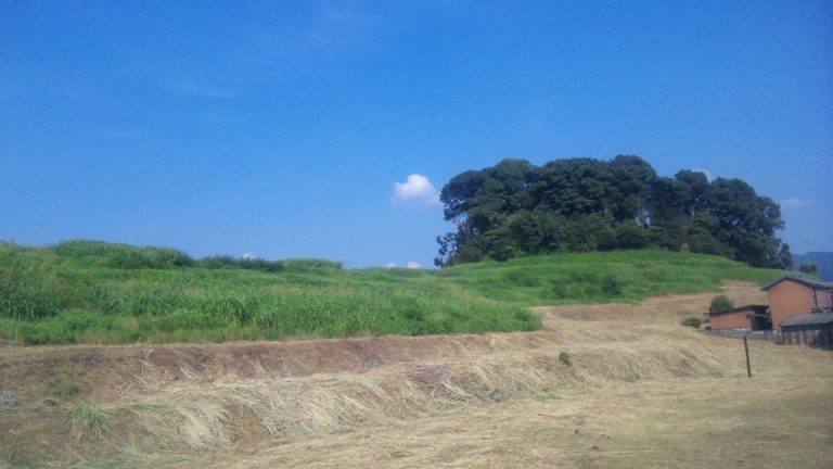
The Great Audience Hall and other principal buildings are regarded as the first Japanese palace architecture to use Chinese-style tiled roofs. The surviving palace site retains the earthen platform of the Great Audience Hall in Takadono, Kashihara, together with other archaeological remains and the surrounding historic park. Excavations have also revealed traces of palace gates, streets, the audience-hall complex, and additional palace installations.
Wooden tablets
Approximately 1,200 wooden tablets, or mokkan, have been excavated from the palace area. These tablets were used for administrative, economic, logistical, or ritual writing. The Fujiwara-kyō examples include administrative documents naming the Ministry of Central Affairs and the Ministry of the Imperial Household, references to the era name “Taihō,” names of high officials, and other information not preserved in later written histories.
The palace yielded six of Japan’s eight known seventh-century talismanic wooden tablets. Their spells or symbols were intended to repel harmful spirits and demons. Alongside the administrative tablets, these ritual objects provide evidence for the varied activities carried out within the palace precinct.
Nearby sites