Fracstein Castle: A Medieval Valley Fortress in Switzerland


Site at a Glance
- Rating
- 3.8
- Popularity
- Very Low
- Country
- Switzerland
- Primary era
- Medieval
- External website
- Open
- Eras represented
- Medieval
- Civilizations
- Holy Roman Empire
- Site type
- Military
- Remains
- Castle
On this page13 sections
History
Fracstein Castle is a ruined medieval cave and hilltop castle in Switzerland, at the entrance to the Prättigau valley in the municipality of Seewis im Prättigau. Probably established during the eleventh or twelfth century, possibly around 1200, it was extensively rebuilt in the thirteenth century. The castle stood beside the right bank of the Landquart at a narrow point on the route linking the Lake Zurich region with the Flüela Pass.
The Lords of Aspermont probably built the main castle while expanding their territorial lordship in the Maienfeld region and lower Prättigau. Fracstein’s position allowed its occupants to control movement through the valley and collect tolls on passing trade. The wider complex included a toll station and a defensive barrier that closed the route across the valley.
Aspermont, Toggenburg, and Matsch
Fracstein first appears in written records in 1338, when Eberhard and Ulrich von Aspermont sold the inherited lands of their uncle Ulrich in the Prättigau to Count Friedrich V von Toggenburg and Ulrich von Matsch. The Aspermont heirs retained the lands until 1344, when the Toggenburg and Matsch possessions were divided. Fracstein then remained jointly held by the two families.
After the death of Friedrich VII, the last Count of Toggenburg, in 1436, Fracstein passed entirely to the Matsch family. The Matsch sold the castle to Austria in 1466. The Austrian ruling dynasty, the Habsburgs, retained it until the Prättigau communities secured their independence in 1649. The buildings were no longer maintained after the sale and progressively decayed. By the sixteenth century, and by about 1570 at the latest, Fracstein was a ruin.
Chapel, conflict, and local control
The castle chapel, dedicated to St. Aper, a Christian saint to whom medieval churches were dedicated, was first recorded in 1370. It probably remained in use until the Protestant Reformation around 1530. Afterward, the chapel continued for a long period as the setting for a traditional rural spring festival.
During the Bündner Wirren, a series of seventeenth-century political and military conflicts in Graubünden involving local communities and foreign powers, the old valley barrier was repaired in 1621 by Colonel Alois Baldiron. A small Austrian force occupied the castle in 1622, but insurgent inhabitants of the Prättigau expelled it. Prättigau forces briefly garrisoned Fracstein again in October 1624.
In 1649, the Prättigau’s League of the Six Courts bought its freedom from Austria, and Fracstein became the property of the court of Schiers. The communities undertook to maintain the valley road and the castle’s bridge over the Landquart, while the castle itself was allowed to remain a ruin.
Destruction, interpretation, and protection
During the French invasion of Graubünden in 1799, Prättigau militia tried to defend the narrow passage at Fracstein but had to retreat. The valley fortifications were largely destroyed during the nineteenth century by stone quarrying and by the construction of a railway and a modern road along the valley floor.
The castle’s name has no certain explanation. Medieval records use forms such as Fragenstein, ze Fragstein, and Fragstein. Proposed interpretations connect it with the Latin phrase saxa fracta, meaning “broken rocks,” the Middle High German verb vragen, meaning “to ask” or “to investigate,” or a name derived from a rock rising above the site. By about 1573, the original meaning was apparently no longer understood. Fracstein is protected as a Swiss cultural property of national significance.
Remains
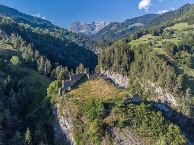
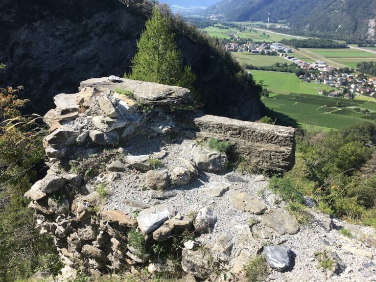
Fracstein was arranged at the foot of a cliff, beneath a broad natural rock overhang that sheltered the main building from behind. The complex combined residential, religious, administrative, and defensive elements. It included the principal residential building, a priest’s house, a church or chapel, a valley wall, a gate, a tower, and a toll station. The surviving remains reflect both the cliffside setting and the castle’s control of the narrow valley route.
Residential buildings
Main residential building
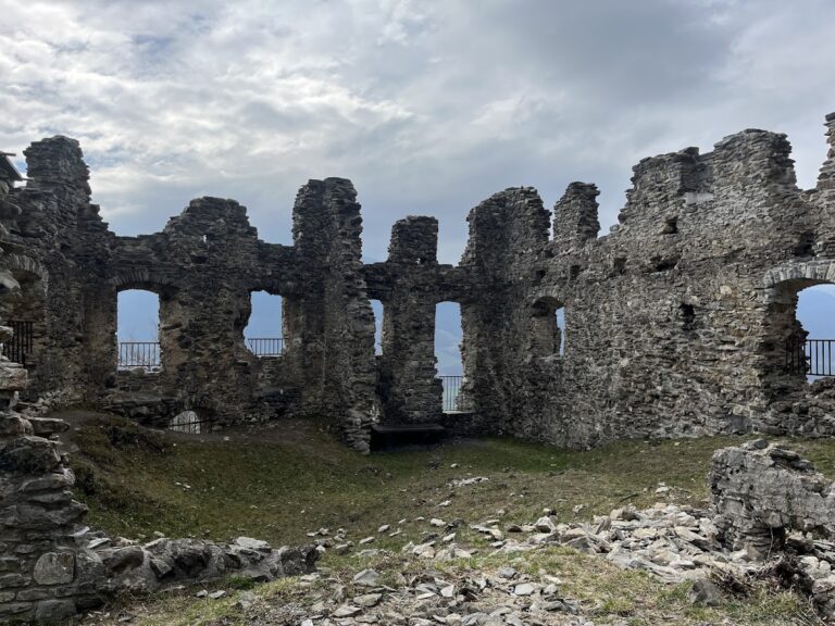
The principal residential building, or palas, was a long rectangular block with a recessed extension at one northern short end. A palas was the main residential and representative building of a medieval castle. The structure was built from rubble stone, with some masonry arranged in opus spicatum, a herringbone pattern. An irregular vertical joint inside the building indicates that it was erected over the ruins of an older structure.
The building had four storeys, with the third serving as the principal residential level. Its main living rooms had large windows facing the valley, and one window retains a seating niche. Holes and recesses in the interior plaster show where wooden partitions divided the floors and rooms. On the third floor, a wooden partition separated the living area into two rooms.
The elevated entrance remains well preserved on the eastern short side at second-storey level. A staircase on the east side led to it. The wall facing the valley was topped by widely spaced battlements. The roof probably rested against the cliff and sloped downward toward the south. Water was captured above the cliff west of the castle and brought to the building through wooden pipes, since a well or cistern could not be constructed at the site.
Incised plaster drawings
Numerous drawings cut into the plaster survive on the eastern interior wall of the residential building. Dating from the High Middle Ages or around 1300, they show helmets, coats of arms associated with local noble families including the Aspermont, Belmont, and Rhäzüns, castles with wooden superstructures, palisades, and other designs. Some of the carvings were discovered during renovation work in the main tower.
Priest’s house
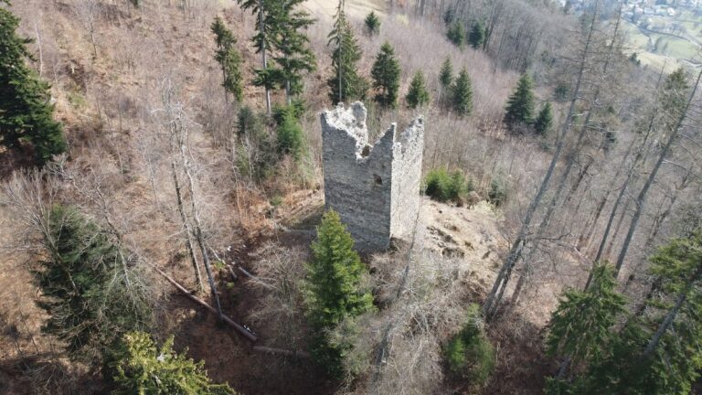
A small castle priest’s house stood about 80 metres east of the main building, built directly against the cliff. Formerly three storeys high, it had a plan divided across its width and a steep roof that leaned against the rock. Living quarters occupied the second floor. Wall niches, remains of a sink, and part of a heating installation survive, although only one wall remains standing.
Religious and defensive structures
Church or chapel of St. Aper
A small church or chapel dedicated to St. Aper stood beside and east of the priest’s house, approximately 10 metres away. Only scant remains of the building are visible today.
Valley barrier
The Letzi, a fortified barrier intended to block passage through a restricted route, extended from the foot of the cliff to the Landquart and closed the gorge across the valley. Its wall contained loopholes and battlements. Most of the structure has disappeared, although small remains survive.
Gate and gatehouse
A drawing made by Wolf Huber in 1552 shows Fracstein already decaying, including the chapel, fortified wall, and a gate on the valley road. The gate had a pointed arch and a gatehouse measuring approximately 6.5 by 6.5 metres. A projecting machicolation, an opening used for defense above an entrance, extended from the gatehouse. Wooden gate leaves were reinforced with iron plate and iron bars, leading to the designation “Ferraporta,” meaning “iron door.” The name was later transferred in altered form to the nearby castle complex.
Rockfall, stone quarrying, and the construction of the railway and modern road along the valley floor destroyed the valley wall, gate, gatehouse, and much of the associated fortifications.
Nearby sites