Fort d’Émines: A Belgian Fort of the Fortified Position of Namur


Site at a Glance
- Rating
- 4.2
- Popularity
- Very Low
- Country
- Belgium
- Primary era
- Modern
- External website
- Open
- Eras represented
- Modern
- Civilizations
- Belgian, German
- Site type
- Military
- Remains
- Fort
On this page14 sections
History
Fort d’Émines is a Belgian fortress near Namur, built by the Belgian state between 1888 and 1892 in the late-nineteenth-century system known as the Fortified Position of Namur. Designed by General Henri Alexis Brialmont, a Belgian military engineer noted for massive concrete forts with retractable armored artillery positions, it formed part of a defensive ring intended to protect Belgian neutrality by blocking invasion routes through the Meuse region.
Construction and defensive role
Construction began in 1888, and Belgian troops occupied the completed fort in 1892. Fort d’Émines defended Namur from the north, covering roads and railway lines towards Wavre and Brussels as well as routes towards Leuven and Tienen. It also protected the intervals between Fort Suarlée to the southwest and Fort Cognelée to the northeast. Although relatively small and less exposed than Forts Marchovelette and Cognelée, it remained an important part of the northern defenses.
The fort’s artillery belonged to the seventh fortress-artillery battery. Its guns used black powder, whose smoke and gases were intended to hinder attackers in the ditches. The same gases could also spread into the enclosed firing rooms and other parts of the fort, creating a serious danger for its defenders.
The Battle of Namur in 1914
At the beginning of the First World War, several hundred Belgian soldiers served at Fort d’Émines under Captain-Commandant Arthur Lallemand. The Battle of Namur began on 21 August 1914, as German forces attacked the fortified position. On 23 August, after the eastern forts had been neutralized, General Michel ordered the evacuation of Namur to prevent encirclement. Fort d’Émines and the forts to the west and south continued to resist.
At about 8:00 on 23 August, Fort d’Émines opened fire on German formations near Bouge that had passed through the interval between Forts Cognelée and Marchovelette. It later engaged assault troops from the 38th Division of the Prussian Guard and continued to cover Belgian troops withdrawing along a nearby road.
German artillery first used 150 mm and 210 mm weapons against the fort. Heavier siege artillery was then brought forward, including 305 mm Škoda mortars and approximately 420 mm guns of the type known as “Big Bertha,” a name used for German heavy siege artillery employed against Belgian forts in 1914. On the morning of 24 August, a shell exploded outside an infirmary window and injured personnel gathered for a religious service. Ten more hours of bombardment made the air inside the fort almost impossible to breathe.
After more than 2,000 heavy-artillery projectiles struck the position and much of its artillery had been disabled, the garrison raised the white flag at about 16:00 on 24 August 1914. One soldier was killed when falling rubble crushed him. The fort’s resistance was later recognized in a Belgian army citation issued in 1914.
Occupation, storage, and later defense
During the German occupation in 1914 and 1915, the fort was altered to improve its protection and operation. Corrugated metal was installed inside, reinforced-concrete rings were added around the turrets, and sentry shelters and forced ventilation were introduced. A tunnel connected the counterscarp, the outer side of the ditch opposite the main fort, with the central massif. A diesel generator replaced the original steam engine.
Fort d’Émines was one of only two forts in the Namur position that were not rearmed or modernized between the world wars. Instead, it became a munitions depot. A second entrance through the counterscarp was added during the interwar period to move vehicles and supplies, and two bunkers were constructed in 1939 and 1940 for close-range defense with automatic weapons.
During the Second World War, the fort was not substantially converted into a modern artillery position. It was lightly occupied when German forces advanced and was captured with little fighting. After the war, it remained largely abandoned while still belonging to the Belgian Ministry of Defence.
Preservation and proposed new uses
In 1991, the municipality of La Bruyère proposed using the site as a landfill for rubble and earth. Protests by the local historical society, La Maison de la Mémoire Rurale, helped bring the proposal to an end. In 1994, the Belgian army placed the fort and other unused military properties on the market. The municipality could not purchase it, and a private individual acquired the fort for passive preservation, using its approximately six hectares of wooded land as a hunting ground.
A heritage project in 2014 linked the fort with centenary commemorations of the First World War. Because the central bastion was considered unsafe for group visits, the planned heritage use concentrated on the exterior areas and counterscarp rooms. Namur Province financed clearance work, restored lighting powered by a generator, and installed explanatory panels. In 2015, several hundred people illegally entered the fort for a rave party, damaging historic walls and inscriptions, explanatory installations, and other elements. Graffiti, including swastikas, was also sprayed on the site.
Namur Province organized an artistic occupation in 2018, with temporary installations by Georges Rousse, Renato Nicolodi, and Juan Paparella. In early 2021, a shooting club proposed firing ranges in the ditches while retaining the possibility of heritage and leisure use. The planning application was rejected, particularly following negative responses during the public inquiry. The private owner later sought to end regular local-history visits because he considered them an obstacle to resale, and Magellan Leisure subsequently acquired the site.
In early 2025, La Bruyère and Namur received a planning application from Magellan Leisure for a mixed-use leisure center. The proposal combined nature-based activities, including climbing and tree-top courses, with conservation and restoration of the military buildings. It received a generally positive assessment with reservations.
Remains
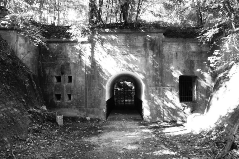
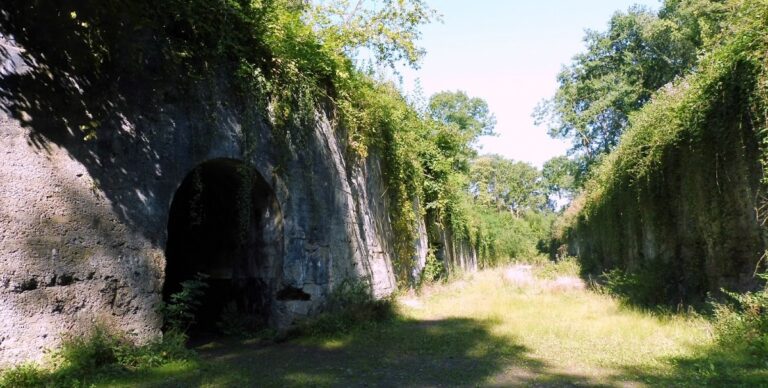
Fort d’Émines is a small, triangular, semi-buried fortress on an agricultural plateau between Émines and Saint-Marc, about 5 km northwest of Namur and approximately 190 m above sea level. Ravines formed by the Houyoux and Risle rivers border the plateau. A ditch about 6 m deep and 8 m wide surrounds the fort. Its triangular plan includes a straight gorge barracks line and a main entrance on the rear side.
Fortress plan and defensive works
Ditch and entrances
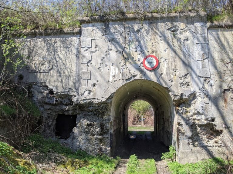
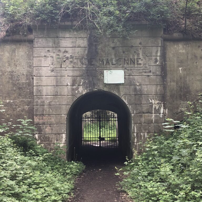
The ditch forms the principal outer boundary of the fort. Its defenses included flank fire from weapons placed in counterscarp casemates, protected positions in the outer side of the ditch that could cover the ditch and the rear entrance. Light-masonry barracks built within the ditches for munitions storage remain visible around salient II and salient III. The later second counterscarp entrance served the movement of vehicles and supplies.
Concrete construction
The fort was built entirely from unreinforced concrete, an innovative material for its period. A central concrete massif protected the fire-control office, magazines, and artillery cupolas. The concrete surrounding the main artillery positions was approximately 4 m thick, while the less exposed casemate walls were about 1.5 m thick. German alterations remain part of the structure, including corrugated-metal interior lining, reinforced-concrete rings around the turrets, forced-ventilation equipment, and the tunnel joining the counterscarp to the central massif.
Artillery and communication systems
Main artillery cupolas
The main artillery was housed in four retractable cupolas, armored rotating or lowering turrets that could be withdrawn into the protective concrete. Two cupolas each carried a 120 mm gun, one carried two 150 mm guns, and another mounted a 210 mm howitzer. The 150 mm guns had a stated range of about 8.5 km, the 120 mm guns about 8 km, and the 210 mm howitzer about 6.9 km.
The 150 mm turret measured approximately 4.8 m across, weighed about 224 tonnes, and required a crew of roughly 25 people, including ammunition personnel. Each 120 mm turret had the same diameter and crew requirement and weighed approximately 188 tonnes. The 210 mm howitzer turret measured about 3.6 m across, weighed approximately 100 tonnes, and required about 13 crew members.
Close-defense guns
Close defense was provided by 57 mm guns in retractable cupolas and turrets, including three small turrets placed at the projecting points of the fort. The 57 mm Nordenfelt guns had stated barrel lengths of 1.5 m and a range of about 300 m. Their cupolas were approximately 2.1 m in diameter, weighed about 34 tonnes, and were operated by six people. Additional flank-fire weapons in the counterscarp casemates protected the ditches and rear entrance.
Observation and signaling
The roof of the central massif carried a retractable searchlight cupola. It could send Morse-code signals by light to neighboring forts. Telephone links and observation posts on nearby church towers, crossroads, and elevated points supplemented the fort’s communication and observation system.
Service spaces and preservation
The counterscarp contained facilities for daily use, including latrines, showers, a kitchen, and a mortuary. The fort is regarded as relatively well preserved. Because it was not rearmed before the Second World War and underwent less later alteration than many other forts in the Namur position, much of its First World War appearance and equipment arrangement survives, alongside the later adaptations of the ditches for munitions storage.
Nearby sites