Eski-Kermen: A Byzantine Fortified Town in Crimea
Site at a Glance
- Country
- Ukraine
- Primary era
- Medieval
- Eras represented
- Medieval
- Civilizations
- Byzantine
- Site type
- City
On this page27 sections
History
Eski-Kermen was a medieval fortified town on a limestone plateau in Crimea, Ukraine. Its fortress was probably built by Byzantine specialists in the late sixth century, although activity at the site may have begun earlier. The town later became a religious, administrative, craft, and trading center for communities in southwestern Crimea.
Origins and Byzantine rule
The town’s original name is uncertain. Eski-Kermen means “old fortress” in Crimean Tatar and is a later name. Kut or Kut-Eli, interpreted as “fortress of the Goths” or “town of the Goths,” has been suggested as the earlier name, but the identification remains disputed. The ruins were also called Cherkes-Kermen from the late eighteenth to the early nineteenth century, after a nearby settlement that no longer survives.
The plateau may have served as a refuge or settlement before the fortress was built. Some activity may date to the fifth or sixth century. While Byzantine specialists are generally considered responsible for the late sixth-century fortress, another interpretation emphasizes local building traditions and the possibility of an earlier fortified refuge. The fortress may have protected routes toward Cherson, a Byzantine city in Crimea, and served nearby Alan and Gothic communities allied with Byzantium, the eastern Roman Empire centered on Constantinople.
In the early Byzantine period, Eski-Kermen belonged to Dori, a region of southwestern Crimea associated with the Crimean Goths. It developed into a fortified town and housed a local archon, or ruler or official. Its garrison answered to the commander of Byzantine forces at Cherson. The town’s churches first fell under the Diocese of Cherson, a territorial unit of church administration; by 754, they were under a diocese based at Doros. Eski-Kermen may itself have been Doros, an early center of Crimean Gothic political and religious life, but that identification is not certain.
Khazar control and Byzantine return
Khazar control began by the late eighth century and ended around the 830s. The Khazars ruled a powerful medieval polity across parts of the Eurasian steppe and Black Sea region. During this period, the town’s walls and earlier Byzantine defenses were deliberately dismantled, probably in connection with the revolt associated with John of Gothia around 787. Occupation nevertheless continued, and the town’s life does not appear to have been fundamentally disrupted.
Byzantine control later returned. In 841, Emperor Theophilos established Klimata, a military-administrative district that included Eski-Kermen. The town subsequently spent a period as a sparsely populated fortress before settlement expanded again from the later tenth century.
Growth and destruction
Eski-Kermen reached its greatest prosperity in the twelfth and thirteenth centuries. It was then a substantial Byzantine town and may have formed part of the Principality of Theodoro, a medieval Christian polity in southwestern Crimea. A local bishop served the town, which combined religious and administrative functions with craft production and trade. Its economy relied chiefly on agriculture, including grain, vineyards, gardens, and livestock. Goods also arrived from Cherson. At its height, the population is now estimated at no more than about 2,000; Goths and Alans may have been among its inhabitants.
The town’s decline and destruction are generally placed in the late thirteenth or early fourteenth century. A commonly proposed cause is an attack around 1298–99 by Nogai, a military leader of the Golden Horde, the Mongol-led state that dominated much of the region. Burned buildings and unburied human remains support an interpretation of catastrophic destruction. A later tradition attributed Nogai’s raid to revenge for the killing of a relative who had come to Crimea to collect tribute.
Other proposed chronologies include destruction around 1278, abandonment after the plague of 1347, and a final attack by Edigei, another Golden Horde leader, in 1399. Churches in the area appear to have remained in use into the fourteenth century, even as the town declined.
The ruined town and its study
Martin Bronevsky provided the first known written description of Eski-Kermen in 1578, when the town was already in ruins. He described its rock-cut buildings and remains of a richly furnished temple, including fragments of marble and serpentine columns, and noted that the town’s name was unknown.
Systematic recording began in the 1920s. Nikolai Ernst surveyed the site and undertook early protective work, while expeditions led by N. Repnikov and F. Schmidt carried out substantial investigations from the late 1920s through the 1930s. Excavations resumed in 1978–82, and archaeological research has been led by A. Aibabin and E. Khayredinova since 2003.
The site became a reserve in 1938 and forms part of the Bakhchisaray Historical and Cultural Preserve. It entered Ukraine’s register of immovable monuments in 2001 and received national-level cultural-heritage status in 2020. It was also designated a federal-level heritage site in Russia in 2015. In 2012, the wider cultural landscape of Crimea’s cave towns was added to UNESCO’s Tentative List.
Remains
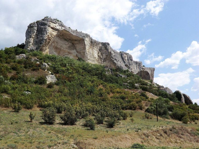
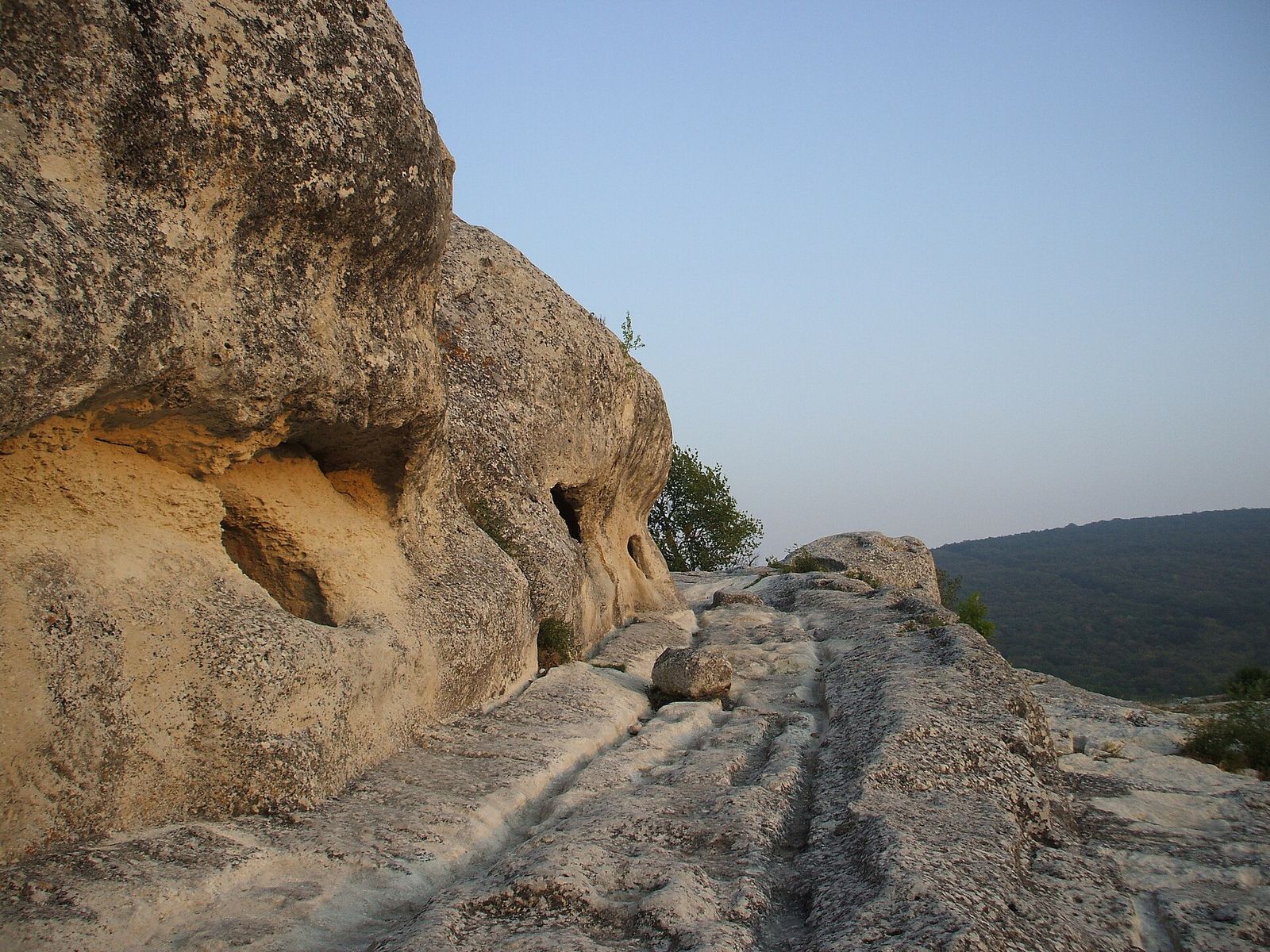
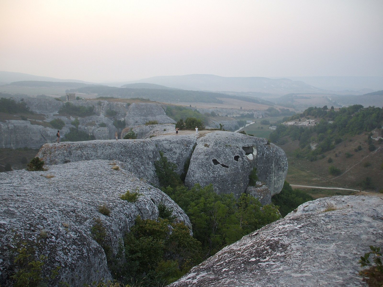
The ruins occupy a north–south plateau of nummulitic limestone, a rock rich in coin-shaped fossil organisms, on the Inner Ridge of the Crimean Mountains. The plateau is about 1,040 metres long and up to 200 metres wide. Its highest point is about 341 metres above sea level, and the ground falls roughly 80 metres toward the north. Cliffs, locally about 30 metres high, edge the plateau, with ravines on its eastern and western sides and a narrowing promontory at the northern end. The walled town covered approximately 81,600 square metres, with streets, houses, churches, defensive works, and rock-cut spaces arranged across this steep terrain.
Streets and residential areas
Streets and blocks
The southern half of the town was arranged in rectangular blocks separated by streets and lanes, generally about 2–2.5 metres wide. A principal street climbed north from the southern entrance toward the central square and basilica. It widened from about 2.5 metres near the entrance to as much as 4.8 metres farther along. Another lengthwise route ran inside the western defenses. Side streets often served pedestrians and could include steps. A cross street approached the central square from the west, with a step between the street and the square.
Houses and cave-cut rooms
Residential blocks usually contained one to three estates and may sometimes have held four. Estates included several buildings, with estimated areas ranging from about 85–150 square metres to 150–200 square metres. Houses commonly had two storeys. The lower, usually stone-built level was used for work or storage, while the upper dwelling was timber-framed or made of sun-dried earthen blocks on a wooden structure. Wooden supports carried tiled roofs. Some houses had cellars cut into the rock, and street-facing walls could be finished with carefully worked stone slabs.
Recorded surveys give different totals for the cave rooms. Early inventories counted about 400, including 359 on the plateau and 49 below the southern cliffs or in separate rocks. A mapping project in 2006–08 recorded 607, mostly spaces for storage and other practical uses. More than 80 percent of the rooms were utilitarian, and about 85 percent of those were livestock pens. Rooms range from about 6 to 100 square metres. Other recorded uses include storerooms, cellars, cisterns, wells, defensive chambers, churches, and burial rooms; some spaces may have been adapted for habitation.
Defenses and approaches
Walls and southern entrance
The defenses combined the plateau’s steep cliffs with walls, gates, towers or tower-like positions, and chambers cut into the rock. Archaeologists have distinguished four defensive sectors. Wall foundations were at least 1.7 metres thick. Estimated wall heights range from about 2.8 to 3.2 metres, with a raised defensive edge that may have brought some sections to about 5 metres. The walls had outer faces of large local limestone blocks, with rubble set in lime mortar between them, and flat stone slabs along the top.
The main wheeled approach wound up the southern slope along a road cut into the rock, about 2.5 metres wide. Its surviving final three flights led to the principal gate. Near the turn before the entrance, a raised strip of bedrock, about 25 centimetres high and 80 centimetres wide, may have obstructed a battering ram. The gate passage had a vaulted stone roof. A proposed reconstruction includes an inner rectangular tower measuring about 7.2 by 10.4 metres and double doors that opened inward. The doors may have been about 6.5–7 metres high and secured from inside with a wooden beam.
Footpaths and northern watch complex
Footpaths approached the town from the east and west. Another route led to the northern promontory through a watch complex, where rock-cut steps and a tunnel connected with a lookout position. Small rooms beside the lower stairs had narrow openings for weapons. A larger chamber partway up the stairs contained a deep water receptacle. Cuttings and post-holes on the rock platform mark the position of a guard post or shelter.
Kiz-Kule fortress
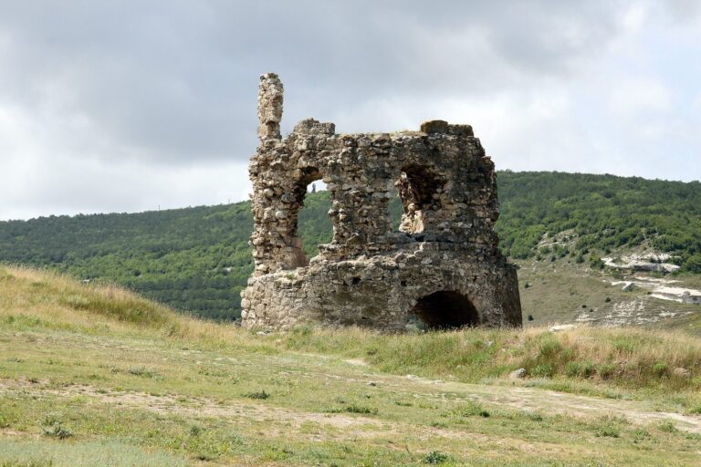
A separate fortress occupied the northern promontory in the fourteenth and fifteenth centuries. Known as Kiz-Kule, it survives as a gate tower. A shallow ditch cut into the rock and a road carved into the rock formed part of its approach.
Water infrastructure
Rock-cut siege well
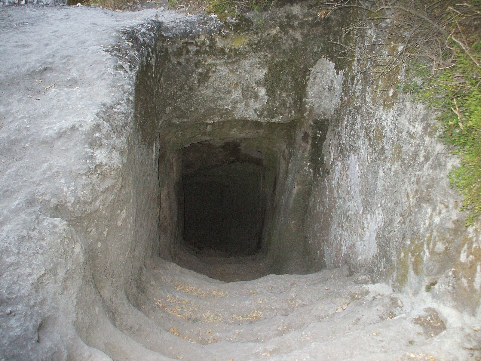
Beside the eastern cliff, a rock-cut well has a stairway of six flights and 89 steps, now partly damaged. The stairs descend to a water-collection gallery about 10 metres long, with an estimated capacity of up to 80 cubic metres. The source of the water and the precise operation of the collection basin remain uncertain. A guard’s chamber was cut near the first flight.
Ceramic pipeline and other water features
A separate pipeline made of ceramic pipes was intended to carry water about 2 kilometres from springs on a neighboring ridge toward the southern side of the plateau, possibly near the main gate. The well-fired red-clay pipes were about 0.40–0.42 metres long and fitted together with lime mortar. They lay in a lined trench covered with sand and stone slabs. Excavations in 1929 uncovered sections, but the full route and destination have not been established, and some parts may have been dismantled for reuse. The town also had cisterns and wells cut into the rock.
Churches and the central square
Basilica and square
The central basilica, a church with a long hall divided into aisles, stood beside a public square. It measured about 24 by 13 metres and was built directly on rock, without foundations. The building was reconstructed in the eleventh century, while its initial date and the sequence of its other alterations remain uncertain. Its builders may have come from Syria. A chapel added against the north wall in the thirteenth or fourteenth century had frescoes, paintings made on plaster. Tombs and burial chambers lay nearby.
On the southwestern side of the square stood an estate with a two-storey house and a tiled roof. Its windows facing the square and basilica were glazed. Stone benches lined part of the open space. A stone obelisk opposite the basilica entrance served as the pointer of a sundial. Excavations in 2020 exposed the square’s slab paving and an enclosure made from large stone blocks, some about 2 metres long. Finds from the square include pottery, roof-tile fragments, bronze ornaments and clothing fittings, iron tools, and a bronze dish decorated inside with a plant design.
Sanctuaries beside the southern approach
Near the final stretch of the southern approach, a small sanctuary with three rounded ends was cut into the rock. It lay above a larger cave with three entrances, probably used for storage or work. Tombs cut beside the road yielded objects dated to the tenth–twelfth centuries. A separate church by the city gate consisted of a sanctuary and a small room for a sacristan, where church vessels and vestments were kept. Beside its threshold, a shallow basin with a leaf design drained toward the street. It was used for washing feet before entering.
Court complex
The largest cave church, known as the Court complex, covers about 140 square metres. Rock-cut pillars divide its interior into four roughly semicircular areas, although some pillars survive only as bases. An altar and a cracked baptismal font occupy the center. Along the south side, a stepped semicircular bench includes a bishop’s seat; tombs of prominent townspeople occupy the northern area. Two side altars were cut beside the cliff, including a small chapel with a rounded altar end. An opening beside that chapel faces a drop of about 10 metres. Wooden stairs formerly provided eastern access so services could be held at both altars. The floor contains ten tombs and two grain pits.
Church of the Three Horsemen
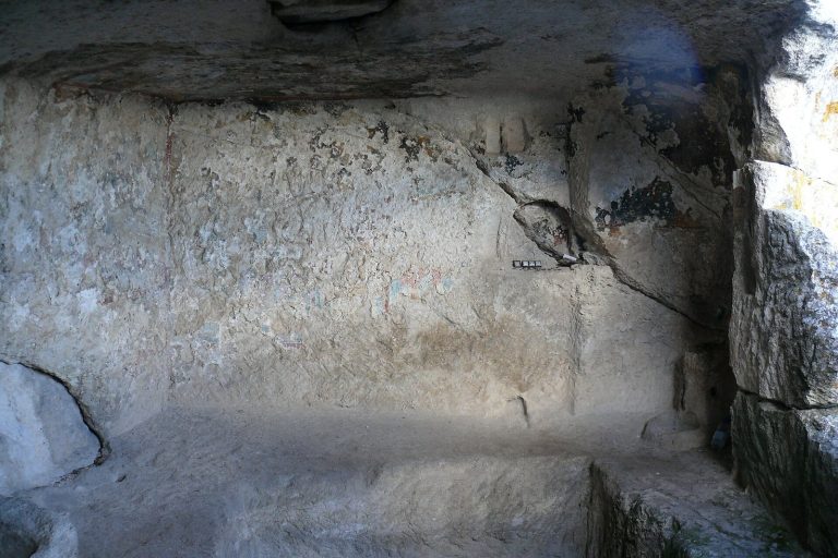
The Church of the Three Horsemen, dated to the twelfth or early thirteenth century, was cut into two limestone blocks on the southeastern slope. Its three-lobed plan has an altar and two doorways in the larger block, with a sacristy in the smaller one. A badly damaged fresco on the north wall depicts three mounted figures. The central rider, probably Saint George, spears a dragon, while the other two hold their spears upright. A child appears behind one rider, and a fragment of an inscription refers to holy martyrs and the salvation of a soul. Graves of an adult and a child cut into the floor may have been objects of veneration. The church served as a place where soldiers received blessings before campaigns.
Church of the Dormition
The small cave Church of the Dormition dates to the late thirteenth or fourteenth century. It was adapted from a space that had contained a grain pit, wine press, recesses for large storage jars, and partitions. An altar was installed in its eastern corner. Fragments of frescoes survive, including a scene of the Dormition, the Christian tradition concerning the death of the Virgin Mary.
Church of the Donors
The Church of the Donors lies in a neighboring ravine. Its frescoes, dating from the late twelfth to the fourteenth century, include Christian subjects and images of a richly dressed man and woman. The pair are interpreted as donors who may have paid for the church’s excavation and decoration, and may have been associated with the nearby Kiz-Kule fortress.
Other churches
Six cave churches have been identified in the town and its immediate surroundings, and at least nine churches are associated with the approaches and gate area. Two cave churches preserve traces of frescoes dated to the twelfth and thirteenth centuries. The dating of some churches beside the gates remains uncertain: some may have begun as defensive spaces, while other interpretations place the start of cave-church construction in the late tenth century or later.
A rectangular Christian church uncovered in 2019 probably dates from the tenth century to the late thirteenth century. Its surviving remains include masonry about a metre high, a floor paved with slabs, a tomb containing human remains, and fragments of multicolored frescoes. The remains were conserved.
Cemeteries and archaeological finds
Burial grounds
A cemetery occupies the southern and southeastern slopes, and another early medieval cemetery lay below the eastern side of the plateau. Excavations in 2003 at the eastern cemetery revealed numerous burials from the Khazar period. Burial rooms also form part of the cave spaces across the site, while tombs occur beside several churches.
Work and domestic life
Finds from the town illuminate agricultural and household activities. They include large storage jars and grain stores cut into rock, hand mills, livestock feeders, iron sickles, vineyard knives, animal-grooming tools, hoes, and cattle bells. Wine presses were found in two estates. A woman’s burial contained a writing stylus. Together with the rooms, houses, churches, and waterworks, these objects show the range of activities carried out within the fortified town.