Kalamita Fortress: A Crimean Stronghold Protecting Avlita Port
Site at a Glance
- Country
- Ukraine
- Primary era
- Medieval
- Eras represented
- Medieval, Early Modern, Modern
- Civilizations
- Byzantine, Genoese, Ottoman, Russian
- Site type
- Military
- Remains
- Fort
On this page18 sections
History
Byzantine beginnings and disputed chronology
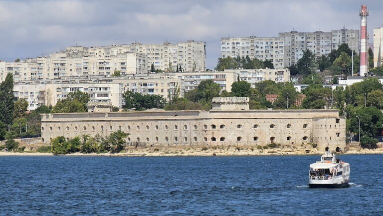
Kalamita Fortress is a medieval stronghold on Monastyrska Rock, beside the Black River near its mouth in Ukraine. Its defenses were used in successive phases from the late sixth or early seventh century until the late eighteenth century. The earliest works are generally associated with the Byzantine Empire, the eastern continuation of the Roman Empire. Local people may have built them and supplied a garrison to guard the northern approach to Chersonesus, an ancient Greek city that later came under Byzantine rule, and to shelter inhabitants from nomadic raids.
The fortress’s beginnings remain debated. Excavations led by Soviet archaeologist E. V. Veimarn in 1948–50 led him to date its foundation to the second half of the sixth century. Other interpretations place construction in the late sixth or early seventh century, while some researchers question whether remains from the sixth to eighth centuries belong to the site. Reconstructions propose anywhere from two to at least seven building phases; excavations in 1984–88 produced a three-phase interpretation. The Byzantines may have abandoned the fortress in the seventh or eighth century, perhaps as the Khazars, a medieval Turkic people with power around the Black and Caspian Seas, arrived in Crimea. Another interpretation places a settlement on Monastyrska Rock from the eighth through the eighteenth century, although quarrying later destroyed much of its remains.
The origin of the name Kalamita is uncertain. Suggested meanings include “beautiful cape,” a Byzantine Greek word for “reed,” and “beautiful dwellings.” One explanation treats the Italian word for “magnet” as a later alteration of an older name connected with reeds. The fortress appears as Gazaria or Kalamira in descriptions of the twelfth to fourteenth centuries, while “Kalamita” features on fourteenth-century Genoese nautical charts. Under Ottoman rule it was called Inkerman, a name associated with caves in the surrounding rock.
Theodoro, Avlita, and the Genoese conflict
From around 1400, Kalamita and its surrounding settlement belonged to the Principality of Theodoro, a medieval Crimean state centered on Mangup. In the 1420s, Prince Alexios the Elder rebuilt the defenses, apparently to protect Theodoro’s port of Avlita. An inscription associated with the fortress bears the date 1427. A settlement and port probably already existed nearby.
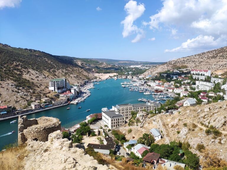
Avlita became a transfer point for commerce between southern and northern markets, competing with the Genoese port of Cembalo, now Balaklava. After Theodoro’s conflict with Caffa, now Feodosia, ended in 1424, Avlita connected the principality with Trebizond, Sinope, Venice, and Moldavia. Trade along east–west routes enriched Theodoro and helped its town grow. Commerce also included the sale of enslaved people.
On 10 June 1434, during the war between Genoa and Theodoro, an expedition led by the Genoese military leader Carlo Lomellino reached Kalamita. The inhabitants had left, and the Genoese captured and burned the town. They later made repairs and added defenses. Theodoro regained the site after the conflict ended in 1441, and Avlita’s importance in local and transit trade grew further. By the later fifteenth century, Kalamita had a fortified center and an outlying settlement. The Black River valley suburb, Avlita’s warehouses and shipyards, and nearby monasteries and hermitages formed part of the wider settlement. A further defensive line was planned, but work completed included only a detached entrance tower and a road cut through rock.
Ottoman Inkerman
Ottoman forces took Kalamita in 1475 during the conquest of Crimea led by Gedik Ahmed Pasha. The port helped supply the army besieging Mangup. Kalamita became part of the Ottoman Sanjak of Kefe, an administrative district centered on Caffa. Inkerman was administered as a nahiye (subdistrict) and, by the early sixteenth century, was included in the Mangup kaza (larger administrative district) while retaining its subdistrict status. Ottoman authorities adapted the defenses for firearms, particularly in the late sixteenth and early seventeenth centuries.
Tax registers counted 179 Muslims and 1,153 non-Muslims in Inkerman in 1520, and 194 Muslims and 958 non-Muslims in 1542. A register from 1634–35 lists 12 non-Muslim households; in 1651–52, five households paid the jizya, a poll tax imposed on non-Muslim subjects. During at least the sixteenth and seventeenth centuries, Inkerman also served as a residence for the Crimean Khanate’s Nureddin Sultan, a senior princely title, who received foreign envoys. In 1578, a settlement of about 300 houses stood northwest of the fortress. By 1666, the fortress itself held ten houses but was uninhabited; its commander and 50 soldiers lived below the rock beside the river.
Russian rule, monastery, and modern conflict
After Russian troops occupied Crimea in 1771, Kalamita lost its military importance. The 1774 Treaty of Küçük Kaynarca recognized the Crimean Khanate, a Turkic Muslim state in Crimea, as independent from the Ottoman Empire. In 1775, Inkerman was assigned to the Mangup judicial district within the Khanate’s Bakhchisaray administrative division. Russia annexed Crimea in 1783, and a quarry opened in the area after Sevastopol was founded in 1784 to supply building stone.
In 1850, at the initiative of Innokenty, Archbishop of Kherson and Tauride, a monastery in the cliffs was revived and dedicated to Saint Clement, an early Christian saint and bishop. Russian reserve troops were stationed in the fortress during the Crimean War. On 24 October 1854, during the Battle of Inkerman, artillery and rifle fire badly damaged monastery churches. Anglo-French forces also looted a monastery church. Work on a church commemorating the Crimean War and Sevastopol’s 1854–55 defense began in 1901. Dedicated to Saint Nicholas, a fourth-century Christian bishop venerated in Eastern Christianity, it was completed in 1905. Two monastic residential buildings were also erected nearby, one containing a church dedicated to the Annunciation, the Christian commemoration of Gabriel’s message to Mary.
The monastery was liquidated in 1926 after its religious community relinquished its cathedral in 1925 because it could not afford to maintain it. The 1927 Crimean earthquake opened large cracks in the Saint Nicholas and Annunciation churches. Some former monastic residences later housed railway and farm workers. Kalamita became part of the Inkerman Cave Cities Museum in 1937. During the defense of Sevastopol in 1941–42, the fortress and monastery housed the headquarters of the Red Army’s 25th Chapayev Division and sustained serious damage in the fighting.
An Inkerman shell-limestone quarry was established in 1944, and extraction near the fortress began in 1947. By that year, Towers 1, 3, 5, and 6 had been almost completely dismantled, Tower 2 was partly damaged, and four sections of the defensive wall remained. Stone removal left large heaps of rubble inside the enclosure. Excavations in 1948, 1950, and 1952 investigated the upper suburb and a late-medieval cemetery. Tower 5 was restored in 1968, while conservation and repair proposals prepared in 1983, 1985, and 1990 were not carried out. The fortress and surrounding architectural remains became part of a state historical-architectural preserve in 1948. Kalamita is listed as a national-level architectural monument in Ukraine and, since 2015, as a monument of federal significance in Russia. It is also a branch of the National Preserve of Tauric Chersonesus.
Remains
The fortified area occupied the southwestern part of the plateau and measured about 215 by 110 metres, covering approximately 1.2–1.3 hectares. Cliffs around 40–80 metres high protected the southern and western sides, while the main defenses faced the more accessible northern and eastern approaches. The enclosure’s principal landward wall extended about 234 metres; traces along the cliff edges bring the total defensive wall length to more than 500 metres. Walls and towers were built of rubble stone and limestone blocks set in lime mortar.
Fortress enclosure
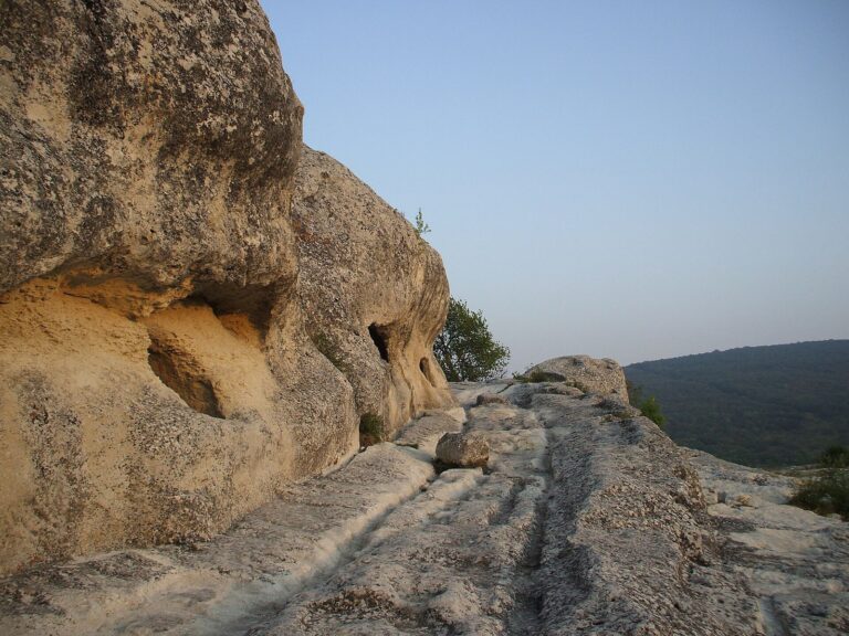
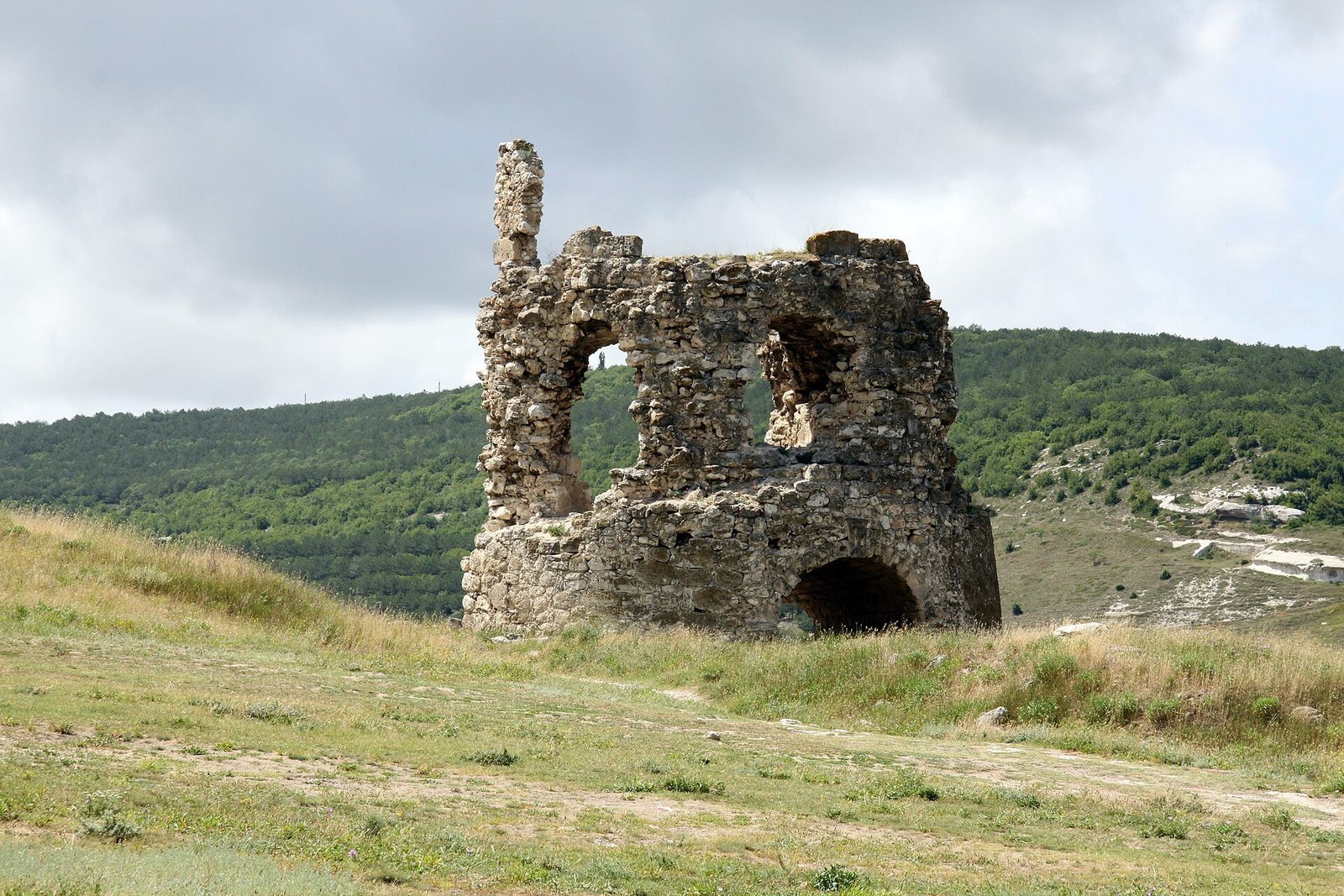
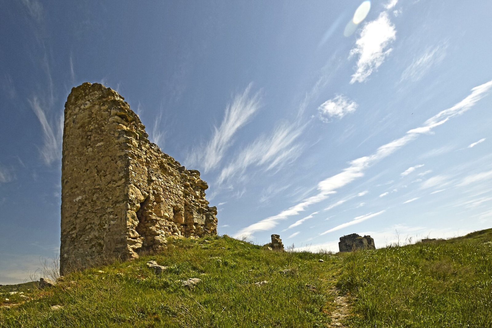
The defenses included six towers, a ditch, an outer rampart, and curtain walls, meaning defensive walls that join towers. The main wall was between 1.2 and 4 metres thick, and the towers were about 12 metres high. The ditch, up to 3.7 metres deep and about 9 metres wide, is now a shallow stone feature with cave casemates, protected chambers cut into rock. Several wall and tower foundations rest on rock that was cut or levelled. A railway embankment runs below one side of the rock, while a deep, terraced quarry occupies the other.
Towers and outer defenses
The main towers
Tower 1 incorporated the entrance gate, and Tower 2 stood about 12 metres away. The ruined corner Tower 3 measured about 12 by 13 metres and projected beyond the wall to flank the ditch. Tower 4 stood beyond the ditch and was joined to the enclosure by a wall across it, allowing movement between the tower and fortress. It functioned as an entrance-protecting outwork and housed a prison in the eighteenth century. A small gate for sudden attacks lay at the base of Tower 5. Three of the six towers survive to roughly two-thirds of their height, and Tower 4 is the best preserved.
Ditches, entrances, and outer defenses
Proposed reconstructions of the earliest defenses differ. One shows two walls, 1.1–1.2 metres thick, meeting at an obtuse angle, with a tower of about 14 by 14 metres near their junction and a probable entrance close by. In another reconstruction, a 234-metre main wall, 2.3–2.4 metres thick at its base, had four towers and one gate, while a lower, thinner wall followed the cliffs. The ditch may have been formed as stone was quarried for construction. A deep well was also cut to provide water to a garrison under siege.
The Theodorite defenses reused earlier foundations and shifted and strengthened the entrance. A further tower and an opening for quick attacks are also associated with that phase. A separate square entrance tower stood beyond the main defenses, reached by a road cut into the rock. Plans and drawings from 1773, 1775, and 1783 show it about 13–14 metres high, with an open fighting platform and a notched protective wall. Ottoman alterations added a glacis, a sloping earthwork outside a fortification, a dry ditch cut into the rock, thicker outer wall faces, and reinforced towers. A new tower north of the ditch, connected to the walls by a six-metre passage, was built in the late sixteenth or early seventeenth century.
Caves and religious remains
Cliff caves and hermitage
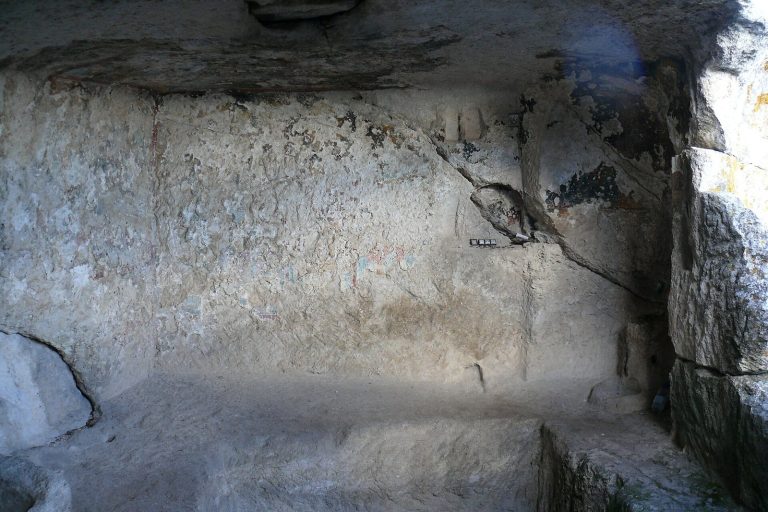
More than 100 artificial caves survive in the southern and western cliff faces. They served chiefly for residence and economic activity, as well as religious and defensive purposes. A Christian hermitage, a retreat for a small religious community or solitary religious life, had three entrances, one low on the cliff. From that entrance, a corridor continued forward and upward. Windows and two balcony doors opened on its right side; to the left were bone-storage chambers and a room with stairs leading to an upper level of cells and a belfry.
Cave churches and medieval church
The hermitage complex included three cave churches. Foundations of a medieval Christian church also remain within the fortress. Its construction is attributed to the Theodorites, while its destruction has been tentatively linked to the Ottoman period. A large wooden cross marks the church’s former location.
Monastery buildings
The surrounding cliffs contain cave and above-ground buildings belonging to the Inkerman monastery. The monastic complex included two residential blocks, one with a church dedicated to the Annunciation.
Settlement and cemetery evidence
Fortress and town plan
A 1773 plan shows six towers, five curtain-wall sections, a ditch, a sloping outer earthwork, and a fortification by Tower 1. It also depicts two quarters and three separate buildings inside the fortress, along with a well. A large dining hall on the town wall may have had painted walls; an inscription was positioned above the gate, and a small church stood on a tower. A former audience hall within the fortress had been converted into a mosque.
Suburbs and watermills
The same plan depicts eight quarters, a large mosque, and a cemetery outside the fortress. An eastern Muslim quarter included a congregational mosque built in 1522 and an Islamic school. The lower suburb contained a bathhouse, an older mosque with a stone minaret, a palace, and a Christian church. Foundations of watermills were noted beside the river.
Later cemetery
A small cemetery dating from the nineteenth and twentieth centuries lies between Tower 4 and the next tower. A bullet-scarred granite obelisk topped by a propeller commemorates aircraft mechanic M. T. Medvedev, who died at his post on 14 July 1938. A concrete marker commemorates machine-gunner Dmitrichenko, killed on 2 May 1942 while covering the retreat of wounded people, women, and children.