Edzná: Maya Archaeological City in Campeche, Mexico
Site at a Glance
- Rating
- 4.8
- Popularity
- Medium
- Country
- Mexico
- Primary era
- Medieval
- External website
- Open
- Eras represented
- Classical, Medieval
- Civilizations
- Maya
- Site type
- City
On this page22 sections
History
Edzná is a Maya archaeological city in the Edzná Valley of Campeche, Mexico, whose earliest settlement dates to about 600–400 BC. Its inhabitants cultivated crops and practiced some animal husbandry before developing the centralized society, monumental architecture, and water-management systems that made the city an important regional center.
From Settlement to Urban Center
By about AD 200–300, Edzná had become a large, organized city with central government, expanded public buildings, a central acropolis, and extensive drainage works. Its rulers reinforced their authority through relationships with the gods. The name Edzná is commonly interpreted as “House of the Itzaes,” although “House of Echoes” and “House of Grimaces” have also been proposed.
During the Early Classic period, an independent kingdom formed around the city. Its emblem glyph has been read as “Waywal.” Unen-K’awiil, the earliest known ajaw, a Maya ruler or lord, held a commemorative ceremony in AD 633. Siyajchan-K’awiil succeeded him and ruled for less than two decades. Other recorded rulers included Kal-Chan-Chaak, Hanaab-Yook-K’inich, Hul-Hanaab-Chan, Chan-Chuwaah, and Ah-Koot-Chowa-Nah-Kan.
Alliances and Regional Power
In the seventh century, Edzná entered the sphere of the Kanul kingdom. Kal-Chan-Chaahk acknowledged the authority of Yuknoom-Che’en II, a kalo’mte, or high-ranking Maya ruler whose title indicated superior authority over other lords. Edzná remained allied with Kanul after that kingdom began to decline in the 690s.
The city later fought the kingdom centered at Cobá and the kingdoms of Chan and Suutz’. It regained full independence during the first half of the eighth century, maintained trade with states across the Yucatán Peninsula, and later formed a favorable alliance with Chan. During the Late Classic period, Edzná was connected with the political influence of Calakmul and is also described as allied with Calakmul and Piedras Negras while controlling neighboring centers such as Lubná, Xcacabcutz, Kayal, and Pich.
Edzná reached its greatest prosperity before about AD 850, when its population has been estimated at approximately 25,000. A broader estimate places its population at about 70,000 during its period as a regional cultural center between approximately AD 400 and 1000. A defeat by Cobá or Suutz’ during the 760s disrupted this development, although recovery began around AD 790.
Decline and Abandonment
Maya-Itza groups established supremacy over Edzná in the early ninth century, but Edzná’s rulers and other states defeated the Itza in the tenth century. The last recorded Long Count date at the site is AD 810. After the Toltec invasion of Yucatán and the subjugation of Chichen Itza in the eleventh century, Edzná declined in political importance and successively became dependent on Chichen Itza, Mayapan, and Uxmal. In the fifteenth century, it became part of the Ah Canul kingdom.
Monumental construction decreased between about AD 900 and 1000. Warfare, epidemics, and the movement of political and religious centers to other Yucatecan cities contributed to the city’s abandonment between approximately 1450 and 1500.
Rediscovery and Archaeology
The ruins were identified in 1907. Organized excavations began in 1958 and continued intermittently until 1986, while archaeological research resumed in 1988. From 1986, Guatemalan refugees participated in excavation, restoration, and maintenance through a project supported by international organizations. These efforts exposed and conserved substantial parts of the city’s monumental architecture, including work on the Edificio de los Cinco Pisos completed in 2018.
Remains
Edzná covers approximately 25 square kilometers and contains temples, administrative buildings, palaces, residences, and six major architectural groupings. The ceremonial center, covering about 6 square kilometers, was organized around the Great Acropolis and the Principal Plaza. Limestone construction includes platforms, stepped pyramids, vaulted rooms, moldings, finely cut ashlar facing, stucco decoration, reliefs, stairways, roof combs, and recessed panels. Architectural traditions represented at the site include Puuc, Petén, Chenes, and Maya-Toltec forms, along with reported Early Classic influence from Teotihuacan.
Water Management and Central Precinct
Edzná stands in a low, humid valley subject to seasonal flooding. Its inhabitants built drainage and irrigation canals, retaining walls, reservoirs, and chultúnes, bottle-shaped or underground cisterns that collected rainwater for drinking. Canals drained the valley toward a lagoon converted into a reservoir and supported irrigation, fishing, transportation, and in some cases defense.
Principal Plaza
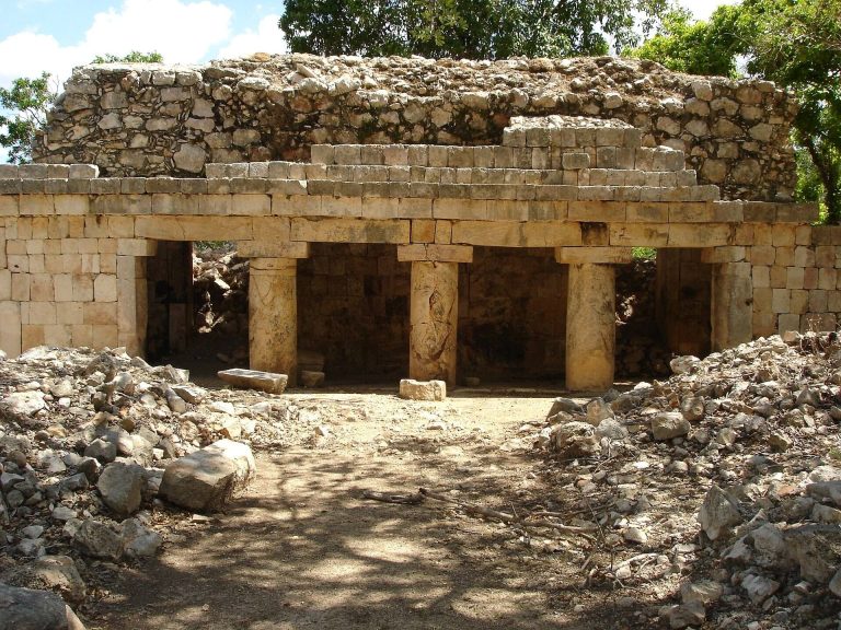
The Principal Plaza is a broad rectangular space surrounded by monumental buildings. Raised Maya roads called sacbés extend from its northern and southern sides, while another causeway leads from the plaza. The Plataforma de los Cuchillos and Patio de los Embajadores stand near this central area. Patio de los Embajadores is bounded on its western side by two buildings with four columns each, dated to approximately AD 1000–1200.
Nohochná
Nohochná, or the Great House, is a large structure with four long upper galleries reached through openings between heavy pilasters. It probably served administrative purposes and may also have provided seating for spectators during important ceremonies held in the Principal Plaza.
Acropolises and Palace Architecture
Great Acropolis and Edificio de los Cinco Pisos
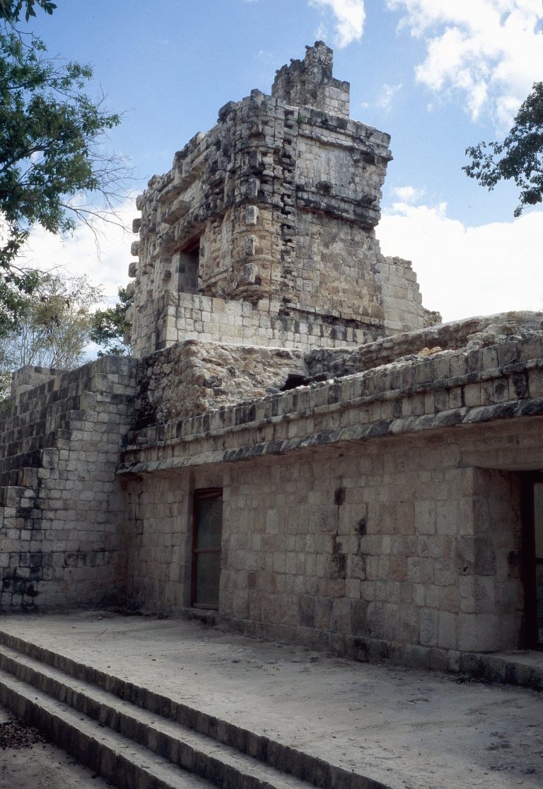
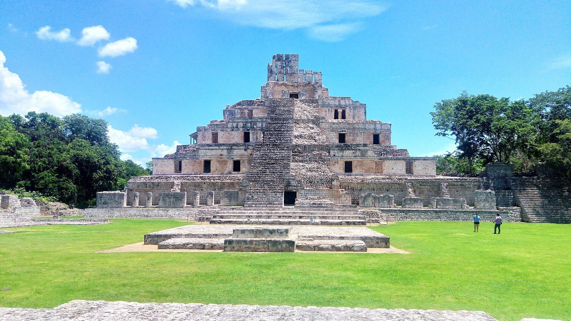
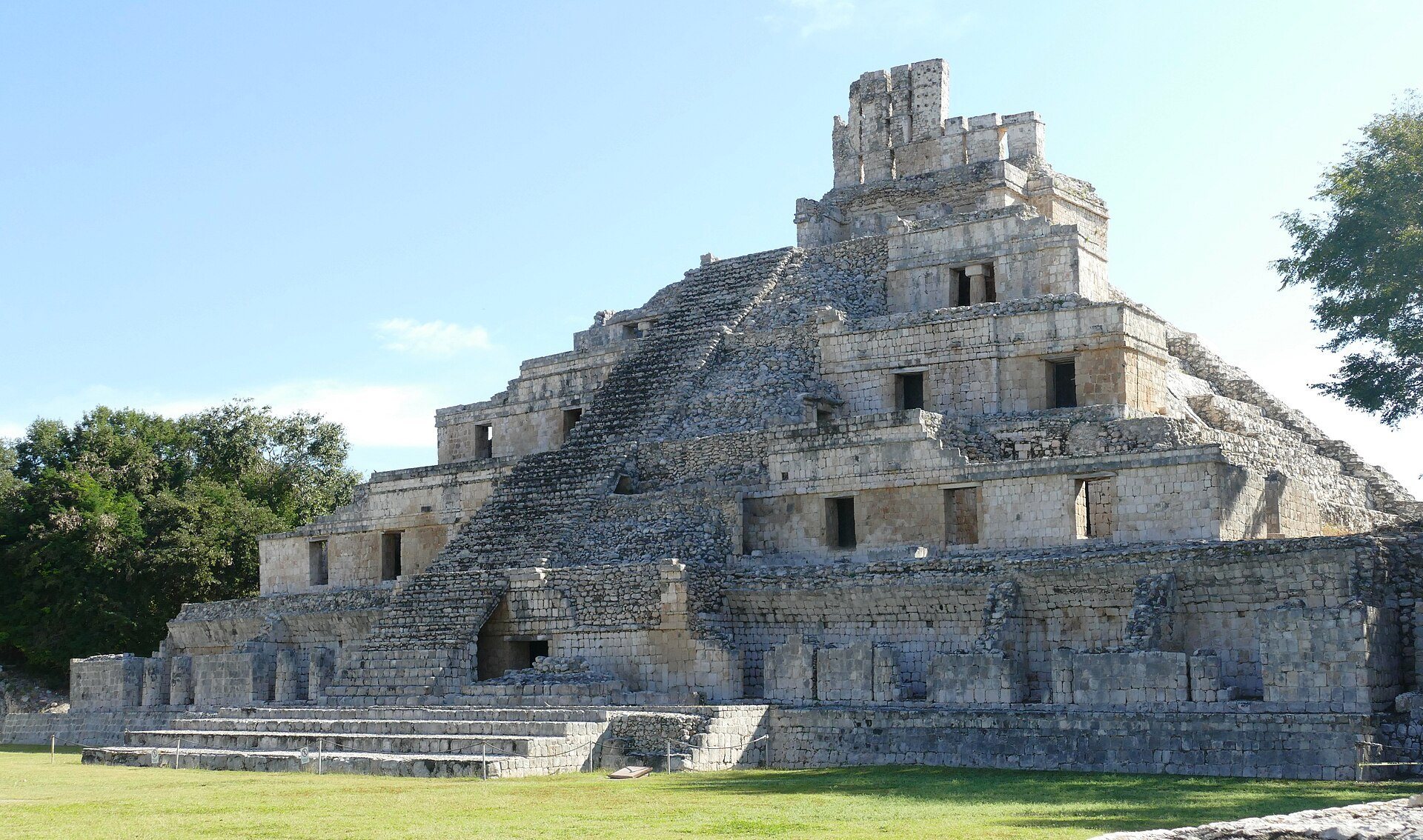
The Great Acropolis is a large rectangular precinct in the eastern part of the site, opposite the royal palace. Its principal monument is the Edificio de los Cinco Pisos, or Building of the Five Levels, a stepped structure approximately 40 meters high. Its five levels contain numerous rooms, including chambers with corbelled vaults, roofs formed by masonry courses projecting inward. A temple with a cruciform plan occupies the summit.
Partly double doorways in the facade are unusual and have led to the interpretation that the building combined features of a temple pyramid and a palace pyramid. A tall, multipart roof comb rises above the temple, and portions of the roof construction and former stucco figures survive. Hieroglyphic marks and traces of stucco remain on the stepped levels, while the building’s overall arrangement indicates a religious function.
Royal Palace
The royal palace extends approximately 135 meters from north to south and contains four large rooms in its upper part. It faces the Great Acropolis across the principal ceremonial area.
Small Acropolis
The Small Acropolis stands on a platform approximately 8 meters high. Four buildings surround a central court on its summit, while the platform is generally dated to about 200 BC. The area has produced ceramics dating to approximately 400–250 BC, a large Preclassic stucco mask, and three stelae from the eighth baktun, a major unit of time in the Maya Long Count calendar, dating between AD 41 and 435.
Temples and Ritual Structures
Temple of the Masks
The Temple of the Masks contains two small stucco representations of a solar deity, one on its eastern side and one on its western side. The figures have crossed or squinting eyes, modified teeth, nose and ear ornaments, and large animal-like headdresses associated with the elite art of the period. They were once painted red and blue. The temple was discovered in the late 1980s.
South Temple
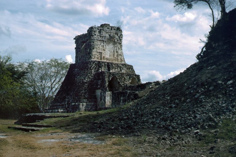
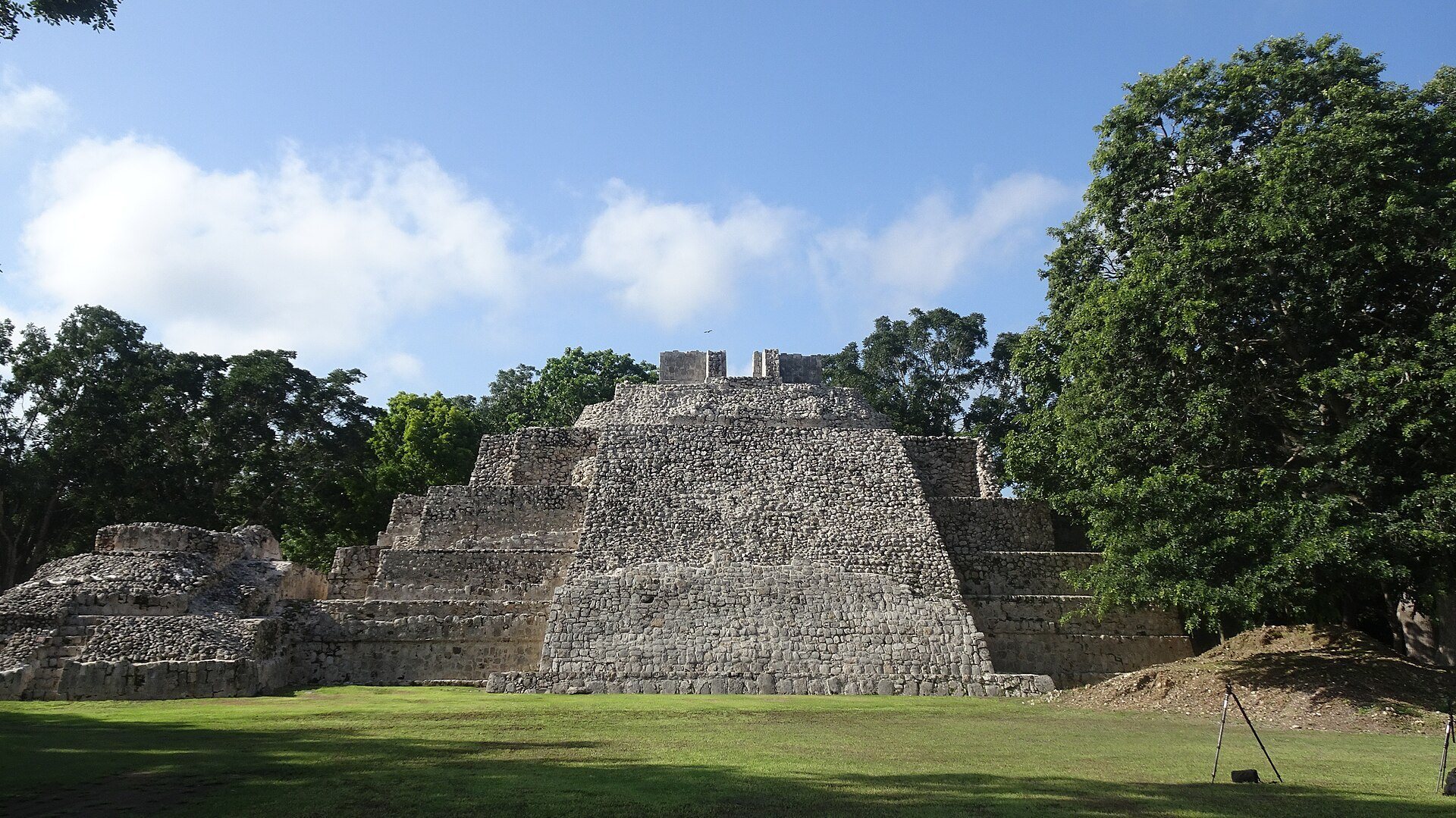
The Templo del Sur, or South Temple, dates from approximately AD 600–900. It consists of five building bodies with projecting moldings, whose lower corners converge into a broad sloping talud, an inclined architectural wall supporting the temple.
North Temple
The Templo del Norte, or North Temple, has a broad base and wide stairway. Its summit sanctuary was altered at least four times. Earlier elongated chambers were later closed and supplemented with recessed panels, some decorated with small drums and broad sloping surfaces. A C-shaped platform in front of the temple belongs to Edzná’s latest occupation, dated to approximately AD 1200–1400.
Patio Puuc
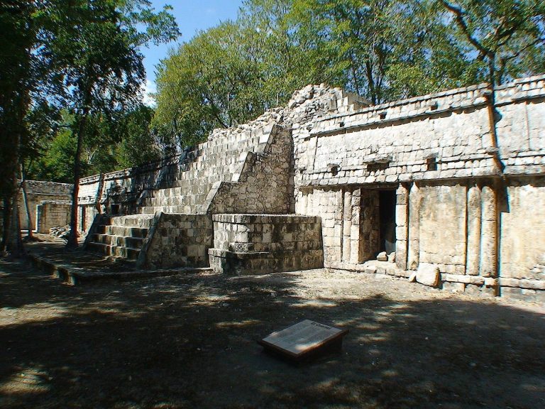
Patio Puuc is enclosed by structures faced with carefully worked square, rectangular, and cylindrical ashlar blocks. The northern building contains blocks decorated with triangles and circles arranged within large frames. Related reliefs represent Chaac, the Maya rain deity, and include calendrical information referring to the day Imix and the month Yax. A steam bath near the entrance to the principal court had restricted access because of its religious importance.
Other Monumental Features
Ball Court
The ball court consists of two parallel structures. Upper rooms may have stored equipment and images of deities associated with the ball game, although that use remains probable rather than certain.
La Vieja Hechicera
La Vieja Hechicera, or Old Witch, lies approximately 800 meters from the Edificio de los Cinco Pisos. Its building base has rounded, recessed corners, a stairway on the eastern side, and a small sanctuary at the top.
Hieroglyphic Stairways and Stelae
Two hieroglyphic stairways and 32 stone stelae have been found at Edzná. Most are associated with commemorative ceremonies dating from AD 633 to 810. Notable examples include Stela 23 from AD 633, Stela 22 from AD 652, Stela 21 from AD 662, and Stela 9 from AD 810.