Altavista: A Chalchihuites Ceremonial and Political Center in Mexico
Site at a Glance
- Rating
- 4.8
- Popularity
- Low
- Country
- Mexico
- Primary era
- Classical
- External website
- Open
- Eras represented
- Classical, Modern
- Civilizations
- Unclassified
- Site type
- City
On this page13 sections
History
Altavista, also called Chalchihuites, is a pre-Hispanic archaeological site in Rancho Colorado, near Chalchihuites in Zacatecas, Mexico. Associated with the Chalchihuites culture, it was occupied from approximately AD 100 until about AD 1400 and reached its cultural peak between AD 400 and 650, during the Mesoamerican Classic period, when large ceremonial, political, and trading centers flourished across the region.
Chalchihuites culture and regional networks
The site may have been developed by the Súchil branch of the Chalchihuites culture, which occupied a corridor along the eastern flank of the Sierra Madre Occidental from western Zacatecas into Durango. This society formed part of a northern or transitional zone of Mesoamerica, where settled communities maintained civic and ceremonial centers, practiced mining, conducted long-distance exchange, and used astronomical knowledge.
At its height, Altavista was the northernmost extension of Mesoamerican ceremonial culture. It functioned as a major ceremonial and political center in a Chichimec region, a broad northern Mexican zone associated by Mesoamerican writers with both mobile hunter-gatherers and other communities outside the main sedentary societies. The center also participated in the turquoise trade route linking Mesoamerica with turquoise-producing areas of Oasisamerica, probably including mines in New Mexico more than 1,000 kilometers to the north. More than 750 pre-Hispanic mines have been identified in the wider Chalchihuites region.
Between approximately AD 450 and 850, religious and civic construction accompanied local economic activity, external exchange, mining, and political control. The ceremonial center was planned and built around AD 450 to 470. Its placement followed deliberate astronomical alignments involving Chapín hill, about seven kilometers away, and Picacho hill. These arrangements indicate participation in wider ritual and exchange networks that connected traders, priests, merchants, and emerging regional elites, and may have linked Altavista with Teotihuacan, the major central Mexican urban and ceremonial center whose influence and exchange connections extended widely during the Classic period.
Decline, abandonment, and investigation
Population declined toward approximately AD 800, apparently after a severe dry period damaged agriculture in the Mexican semi-desert. Altavista later declined further, and its final abandonment may have occurred sometime between about AD 1200 and 1400. The original pre-Hispanic name is unknown. The name Altavista comes from a nearby ranch that existed when archaeologist Manuel Gamio visited the area.
Gamio conducted the first scientific investigations at the site in 1908. He excavated the Columns Hall and its associated stairway and made preliminary soundings in nearby caverns, which he interpreted as possible defensive refuges. J. Charles Kelley began extensive excavations in 1971, with major work continuing through 1976. Kelley and his associates then carried out roughly three decades of research across Zacatecas and Durango, shaping modern understanding of the Chalchihuites culture and Altavista.
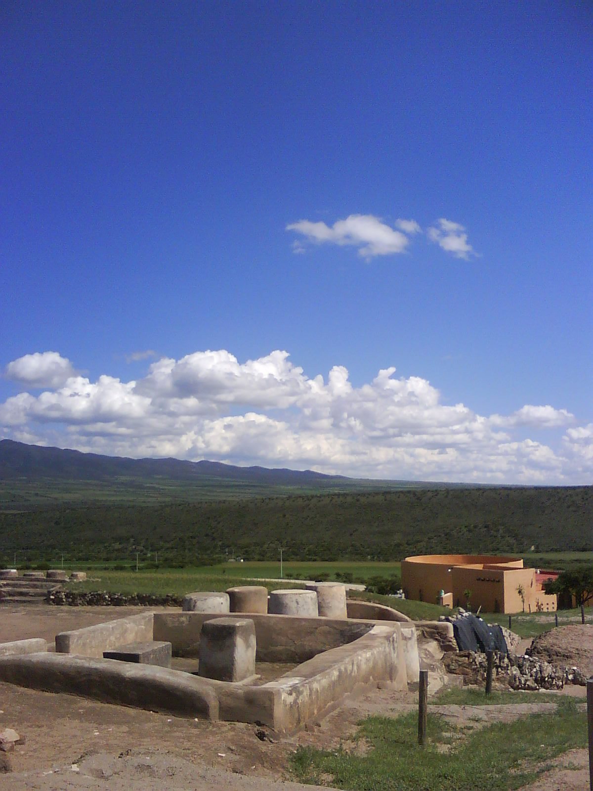
An archaeological museum opened beside the ruins in 2007 and displays finds from Altavista and neighboring sites. Concerns have been raised about inadequate security for the archaeological collection held there. A church dedicated to Saint Peter the Apostle was built at the edge of the present excavation area in 1879 and 1880.
Remains
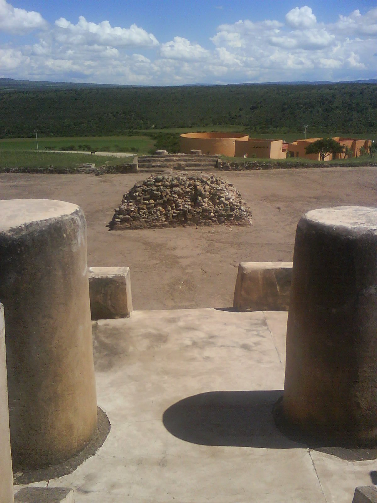
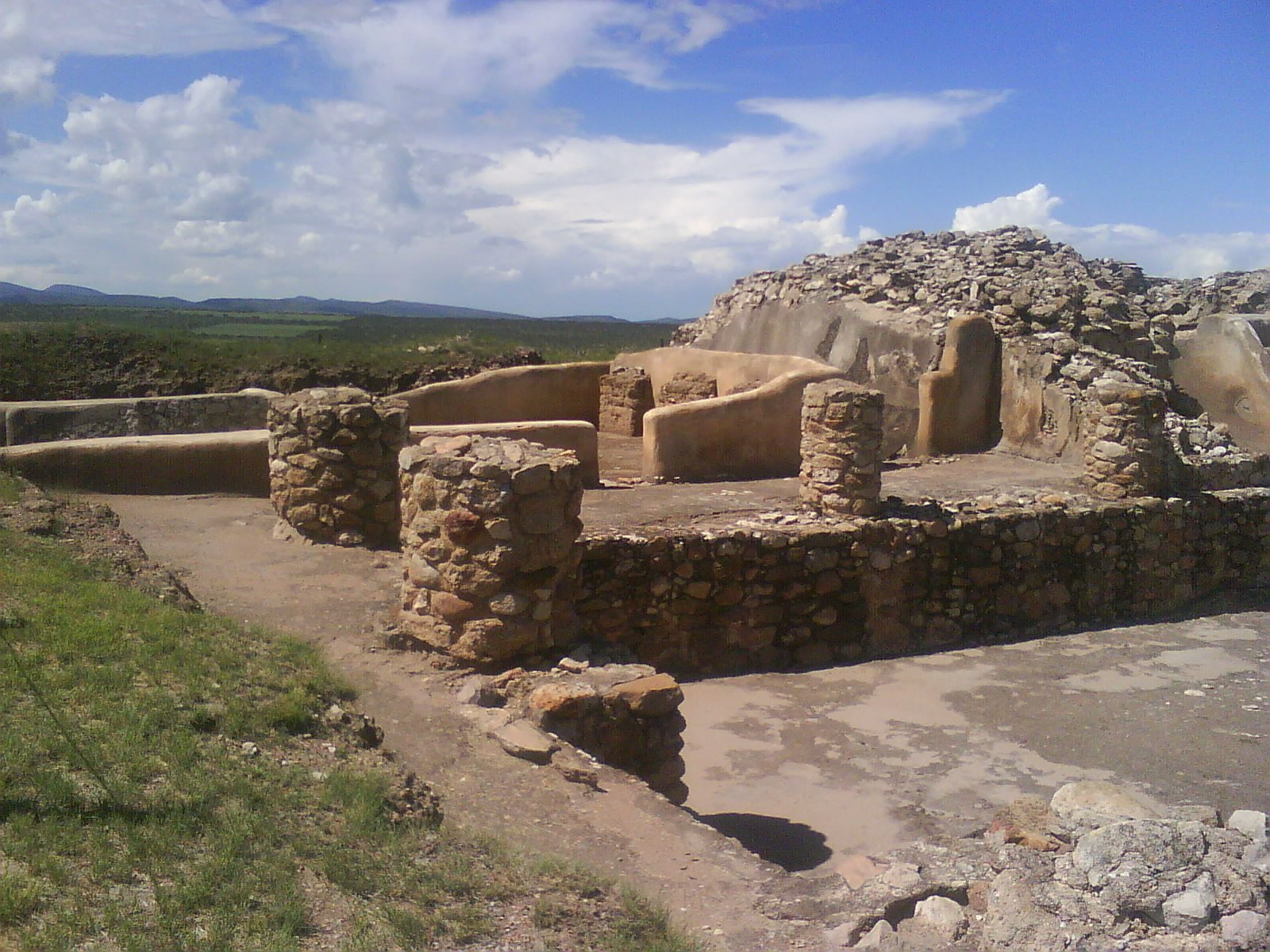
Altavista lies at an elevation of approximately 2,300 meters, almost exactly on the Tropic of Cancer and about 500 meters southeast of Chalchihuites. The civic and ceremonial center was laid out along the cardinal directions, with the corners of principal structures, plazas, and internal routes closely following north-south and east-west axes. Buildings were constructed mainly from plastered stone, while adobe was also used. Two sunken civic plazas form the central layout, each with a central mound or platform. The eastern plaza contains more hierarchical spaces that may have been reserved for representatives of regional groups during ceremonies or other events.
Principal ceremonial buildings
Columns Hall and Gamio Stairway
The Columns Hall is considered the earliest structure at Altavista. It is a square enclosure on a masonry platform, integrated with a patio containing a central altar and an elevated walkway around its edge. Inside, 28 plastered or masonry columns stood in four parallel rows of seven, probably supporting a roof. Builders used a system of posts to establish the dimensions and lines of the lower and outer walls, then retained and covered those posts with stucco. The building may have begun with an open central patio, later received columns and a complete roof, and was eventually filled to create a platform for a higher structure.
The Gamio Stairway probably led to that higher structure. Some columns were reinforced, and buttresses or other supports were added to the exterior walls, probably after structural failures. A multiple burial near the stairway’s northern lower corner contained four ceramic offering vessels. Their decoration shows an eagle holding serpents and lightning in its beak and claws. The vessels were associated with the four cardinal directions, and the building has been tentatively interpreted as a temple connected with Tezcatlipoca, a major deity associated with rulership, night, conflict, destiny, and supernatural power. In the local interpretation, this was a nocturnal jaguar deity of the northern skies.
Sun Pyramid
The Sun Pyramid represents the final stage of three construction phases. Remains of a temple with battlements were identified on its summit. A crypt inside the pyramid contained three individuals accompanied by elaborate offerings. They have been interpreted cautiously as priest-rulers associated with a solar cult.
Skull Temple
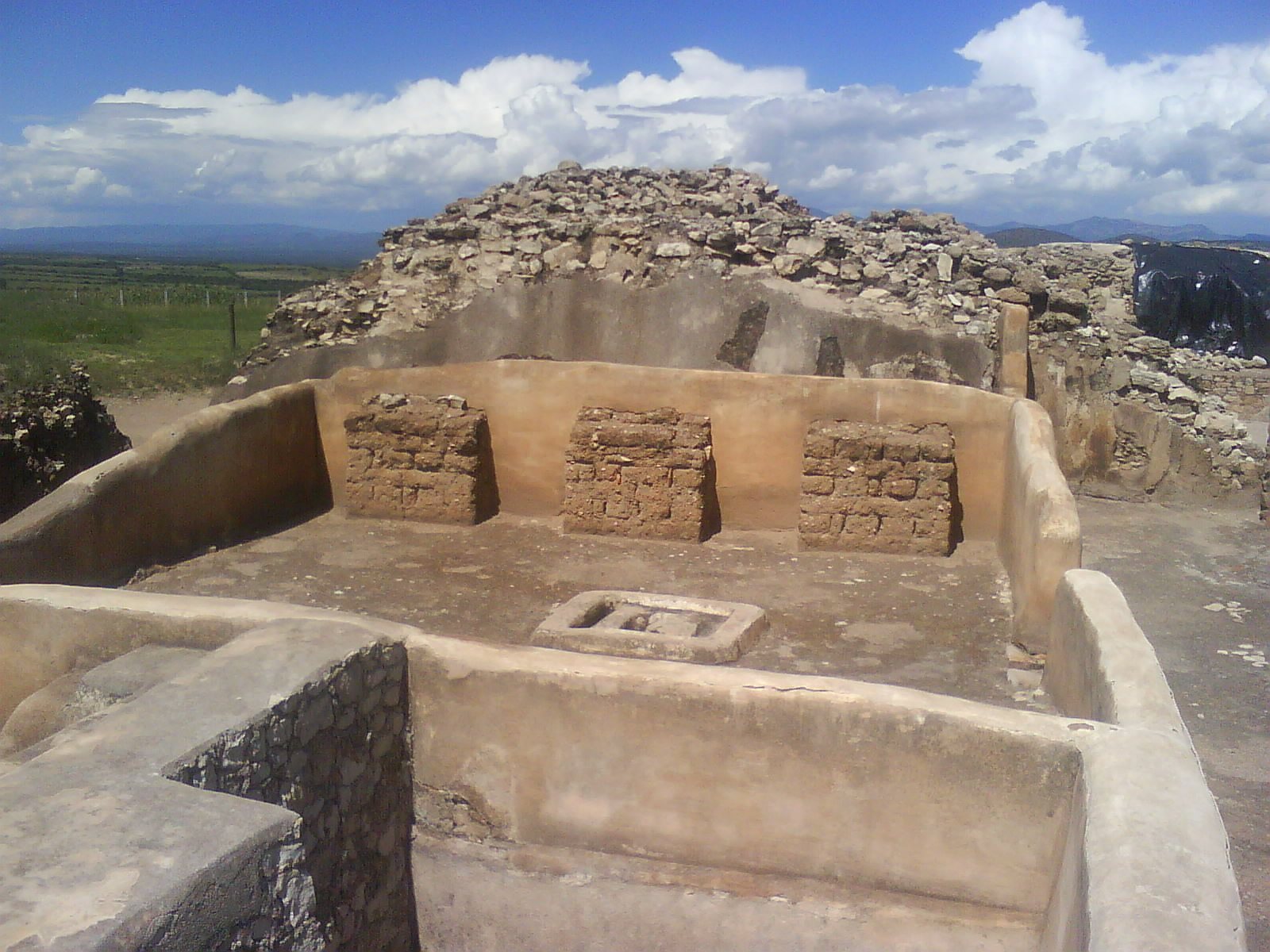
The Skull Temple stands southwest of the Sun Pyramid. Its adobe walls and floors received repeated coatings of stucco, and its southeastern wall contains an entrance about 70 centimeters wide. Two holes in the floor, each about 40 centimeters across, probably held wooden posts supporting a roof frame. A central stone-and-adobe hearth covers approximately two square meters.
Disarticulated human bones found on the floor include skulls, jaws, and long bones. Most skulls have perforations at the top, while two leg bones retain traces of rope tied around their ends. These remains have been interpreted as suspended trophies or offerings associated with human sacrifice, although that interpretation remains uncertain.
Labyrinth and astronomical structures
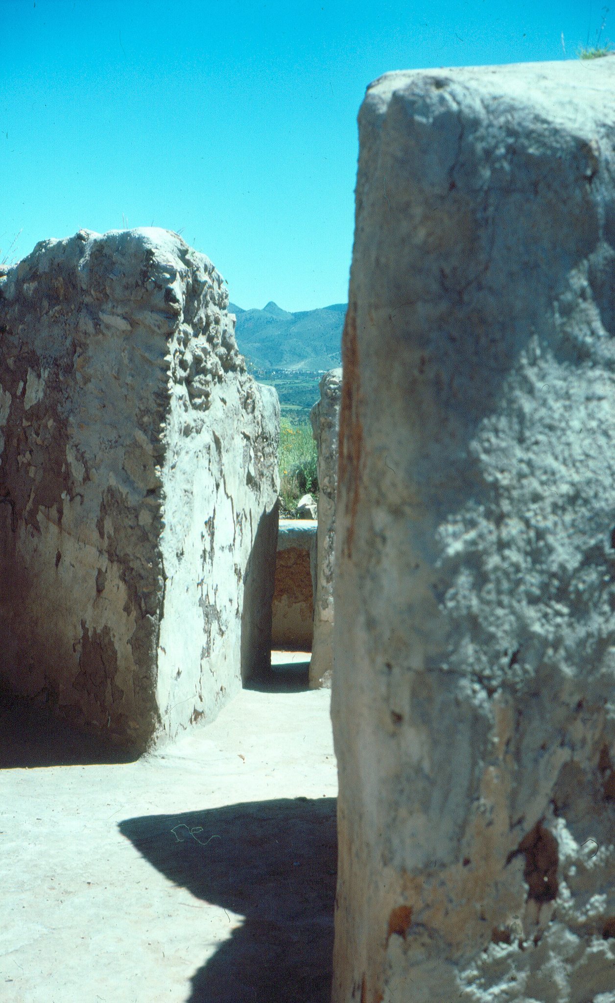
Labyrinth
The Labyrinth is a long corridor beside the Columns Hall. Masonry walls enclose its repeated turns, pillars, and varied angles, and several additions or corrections followed its initial construction. Its eastern extension aligns with the summit of Picacho when the equinoctial sun rises. Direct sunlight enters and illuminates the corridor at sunrise, leading to its interpretation as a solar path and possible solar-calendar instrument.
Astronomers’ Palace
A group of rooms, a hall, and an atrium beside the Labyrinth is known as the Astronomers’ Palace. The Labyrinth and nearby structures have also been interpreted as closely spaced buildings associated with the local elite. Together with the site’s orientation and position, these features support the possibility that Altavista served as a major astronomical observatory, allowing observations of solstices and equinoxes in relation to the rising sun over Chapín, Pedregoso, and Picacho hills.
Chapín hill alignments
Chapín hill, approximately seven kilometers from the ceremonial center, contains two circle-cross petroglyphs. These are rock engravings formed from a circular shape divided by a cross-like design, and they resemble examples at Teotihuacan. From the hill, a solar alignment extends toward the summit of Picacho and is associated with the Labyrinth and seasonal observations of the sun.
Other excavated areas
Many structures remain unexcavated or have received limited investigation. On a platform southwest of the main patio are the remains of three structures, consisting of a central pyramid flanked by smaller enclosures. This group forms part of the wider civic and ceremonial complex, whose surviving buildings preserve evidence of stone, adobe, stucco, astronomical planning, ritual activity, and changing construction phases.