Ebersburg Castle: A Medieval Hill Fortress in Germany
Site at a Glance
- Rating
- 4.5
- Popularity
- Low
- Country
- Germany
- Primary era
- Medieval
- External website
- Open
- Eras represented
- Medieval, Modern
- Civilizations
- German, Holy Roman Empire
- Site type
- Military
- Remains
- Castle
On this page14 sections
History
Ebersburg Castle is a ruined medieval hill castle in Germany, built on the Ebersberg above the village of Ebersberg in the municipality of Ebersburg. Its foundation date remains uncertain. Traditional accounts associate it with a castle built around 1100, while archaeological and comparative research places its origin between 1200 and no later than 1250. Other interpretations connect its construction with the Staufer period, when the ruling dynasty shaped castle administration across the German lands, during the reigns of Frederick Barbarossa or Henry VI, or shortly after 1200.
Origins and the first castle
The fortress was probably established by the Lords of Ebersberg and was connected with the Staufer imperial palaces. It also belonged to a regional network that included Osterburg near Bischofsheim in the Rhön and Wartenberg Castle in the Vogelsberg. Although the surviving written record begins later, archaeological evidence and historical traditions indicate that an earlier castle probably stood on the mountain.
Ebersburg was first mentioned in 1396, when members of the Ebersberg, Steinau, and Weyhers families petitioned Fulda Prince-Abbot Johann of Merlau for permission to build a fortress and castle on Ebersberg. A Prince-Abbot was the head of a religious foundation who also held the political rank of a prince within the Holy Roman Empire. Because the mountain belonged to Fulda Abbey, the petitioners had to hold the castle as a male fief.
The 1396 petition does not refer to an earlier castle or ruin, but the fortress had probably already existed and was rebuilt and enlarged before or by that date. Later traditions linked its destruction to a conflict involving Hermann of Ebersberg and the killing of Fulda Prince-Abbot Bertho II of Leibolz. Johann Friedrich Schannat attributed the destruction to troops of Bertho III of Mackenzell, while Christoph Brower assigned it to Bertho II. Both chronicles contain unreliable details elsewhere, yet the existence and destruction of an earlier Ebersburg remain probable.
Co-heirs and castle truces
After the rebuilding, several branches of the Ebersberg and Steinau families held the castle jointly. The family increasingly adopted the additional name “of Weyhers” during the decades after 1300, partly because its many branches lived at the moated castle of Weyhers. Ebersburg formed a defensive group with the moated castles at Weyhers and Poppenhausen.
Castle truces, agreements regulating the rights and duties of joint owners and occupants, survive from 1430, 1446, 1463, and 1478. The 1430 agreement required one co-heir to live at the castle and oversee the tower men, gatekeepers, and guards. All eight co-heirs had to provide money and grain for maintenance, and each was required to send four armed men in wartime.
The 1446 truce, involving 17 co-heirs, provides the first surviving evidence of a chapel at Ebersburg. A document from 1456 required the castle chaplain to celebrate Mass each week. In 1452, Fulda Prince-Abbot Reinhard of Weilnau joined the truce to exercise closer control over the fortress and its owners. Claims that the castle was conquered or destroyed in 1449, 1460, or 1465 are considered poorly credible. The last recorded truce dates from 1516, and the last indication of active use is a prisoner held there in 1533.
Abandonment and wartime refuge
Ebersburg was abandoned in the following years as its defenses became obsolete and ownership grew increasingly divided. The lack of a well also made the castle unsuitable as a permanent residence. For almost two centuries, the ruin mainly supplied building stone and continued to deteriorate under exposure to wind and weather.
The fortress was briefly reused as a refuge during the closing years of the Thirty Years’ War, the European conflict that caused widespread military devastation between 1618 and 1648. In 1646, Lukas of Ebersberg leased the ruin to farmers from the surrounding area. They sheltered their families and livestock there during renewed military danger, paid rent, and repaired damage to the walls. The arrangement continued until the Swedish army withdrew in 1650 and probably helped preserve the complex in comparatively good condition.
In 1664, Johann Philipp Breidung, the bailiff of Weyhers, built a half-timbered residential house within the ruin for Wilhelm Rudolph and Gottfried of Ebersberg. It was divided between two households, with the upper and lower apartments and their cellars assigned by lot. Rain quickly damaged the building, and Breidung was already reporting its deterioration in 1671. The attempted reoccupation ended after only a few years.
Ownership and preservation
In 1777, the Lords of Ebersberg sold their share in the Lutter vor der Hart court and its associated land, including Ebersberg and the castle ruin, to the Prince-Bishopric of Fulda for 85,000 Rhenish gulden. Ownership changed repeatedly afterward. Between 1803 and 1815 alone, the castle was sold five times. From 1819 to 1867, while the area belonged to the Kingdom of Bavaria and lay within the Weyhers district-court territory, Ebersburg was state property. It is now owned by the State of Hesse and administered by the Hofbieber Forestry Office of Hessen-Forst.
Christoph Brower produced the first documented research report in 1612, followed by Johann Friedrich Schannat in 1724, although both early accounts are partly unreliable. Georg Landau’s description of 1835 provides important evidence for the ruin’s condition before its first restoration. In 1852, the Bavarian district judge Leonhard Geiger requested funds for preservation work, while the master mason Johann Klüber prepared drawings of the ruin and possible restoration methods.
Restoration in 1852–1854 created the accessible stairway in the South Tower and adapted the tower for use as a lookout. The work rebuilt its crenellated parapet and timber-and-metal-clad roof, but removed the original vaulted ceiling to make room for the stairs. The North Tower was restored in the 1920s, when its collapsed western side was largely rebuilt using the original masonry technique and crenellations were reconstructed at their presumed original height. The State of Hesse undertook further restoration in 1963. Repairs to the masonry and wooden stairway followed between 1993 and 1995, together with renovation of the outer-ward shelter roof.
Excavations led by Fritz Luckhard and Gotthold Wagner between 1956 and 1958 substantially changed understanding of the castle’s original layout. Wagner directed the archaeological work, while Luckhard examined the records of the Lords of Ebersberg and related them to the excavated remains. Ebersburg is protected as a cultural monument in Hesse.
Remains
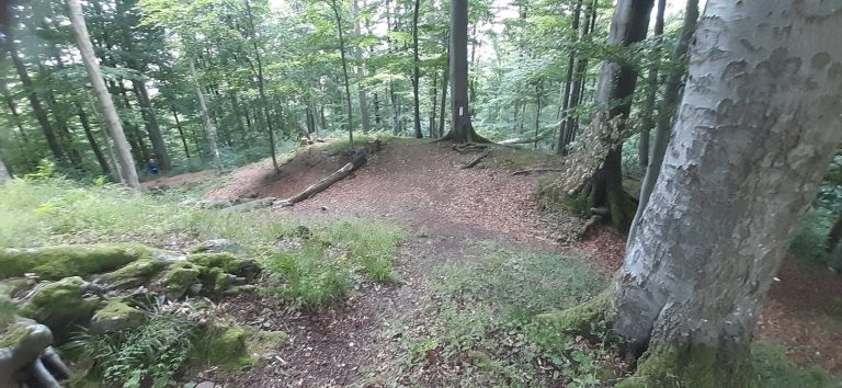
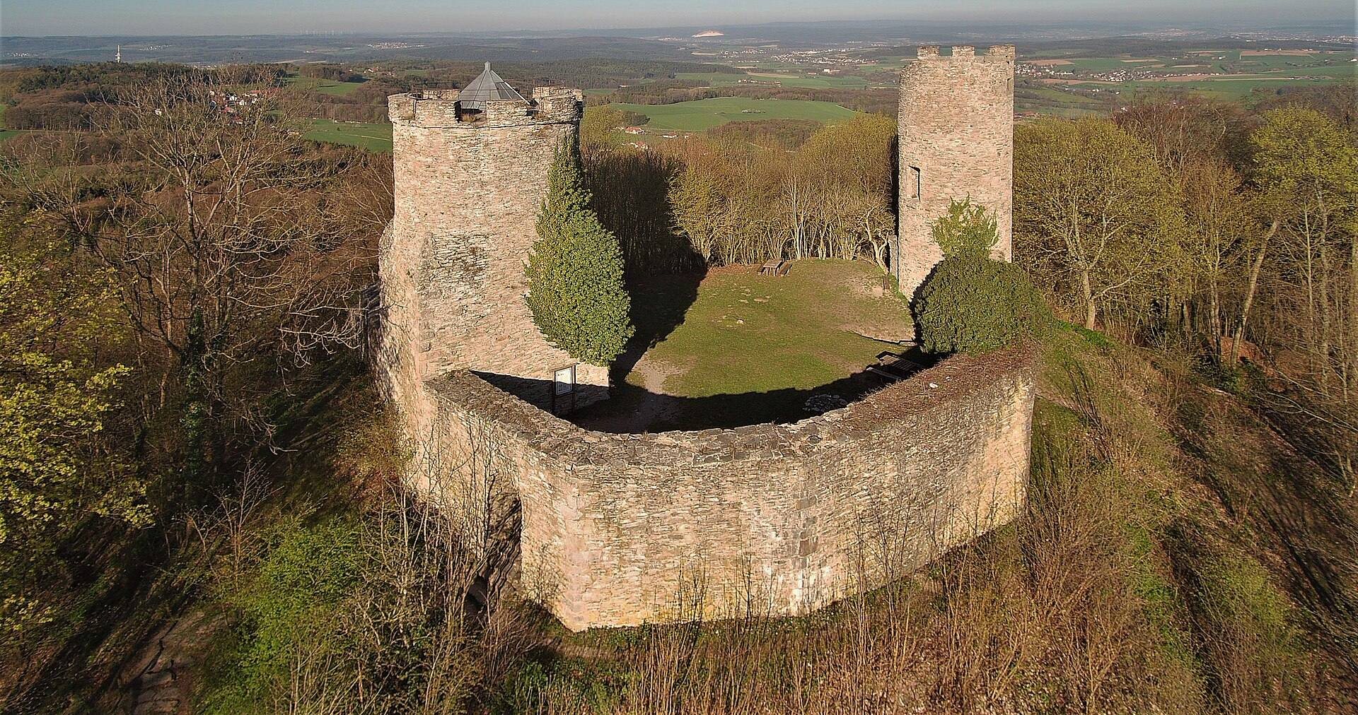
Ebersburg occupies the 689-meter summit of the wooded Ebersberg, on a ridge between the Fulda valley and the valley of the Lütter, a right-bank tributary of the Fulda. The polygonal main castle covers the summit plateau, while the outer ward occupies a lower terrace on the eastern slope. An approximately encircling ditch and outer bank protect the eastern side, and steep natural slopes provide additional defense to the south and west. The first builders cleared much of the summit and quarried phonolite locally, leaving spoil heaps around the ruin.
Main castle and towers
South Tower
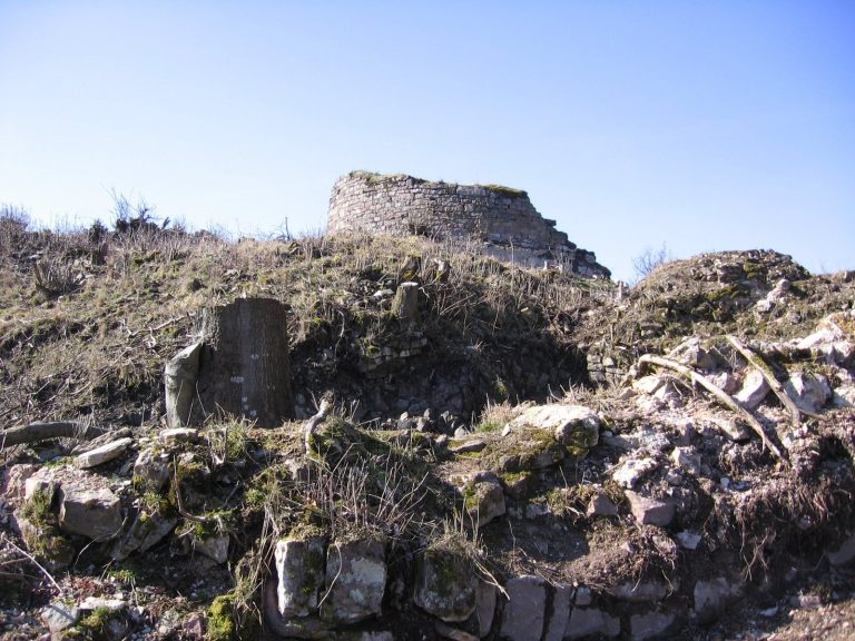
The oldest surviving part of the fortress is the lower, square section of the South Tower, together with the adjoining western section of the tower wall. The tower’s lower story measures about 6.80 by 6.95 meters externally. Its corners use sandstone bossed blocks, while the principal walls are built mainly of anthracite-colored phonolite rubble. The basement originally had a barrel vault and no ordinary entrance. A narrow light slit in the 2.30-meter-thick western wall survives as a small Romanesque window.
The basement probably served as a dungeon and was reached through an “anxiety hole,” an opening probably placed in the vaulted ceiling. The original vault was removed during the nineteenth-century restoration to install the present stairway. During the late medieval rebuilding, a cylindrical upper section was added to the earlier tower, probably after the original structure had been destroyed above its vaulted basement. This upper section has a single opening about seven meters above ground, which served as an entrance. The original access system cannot now be reconstructed precisely because most of its corbels were removed during the period of abandonment.
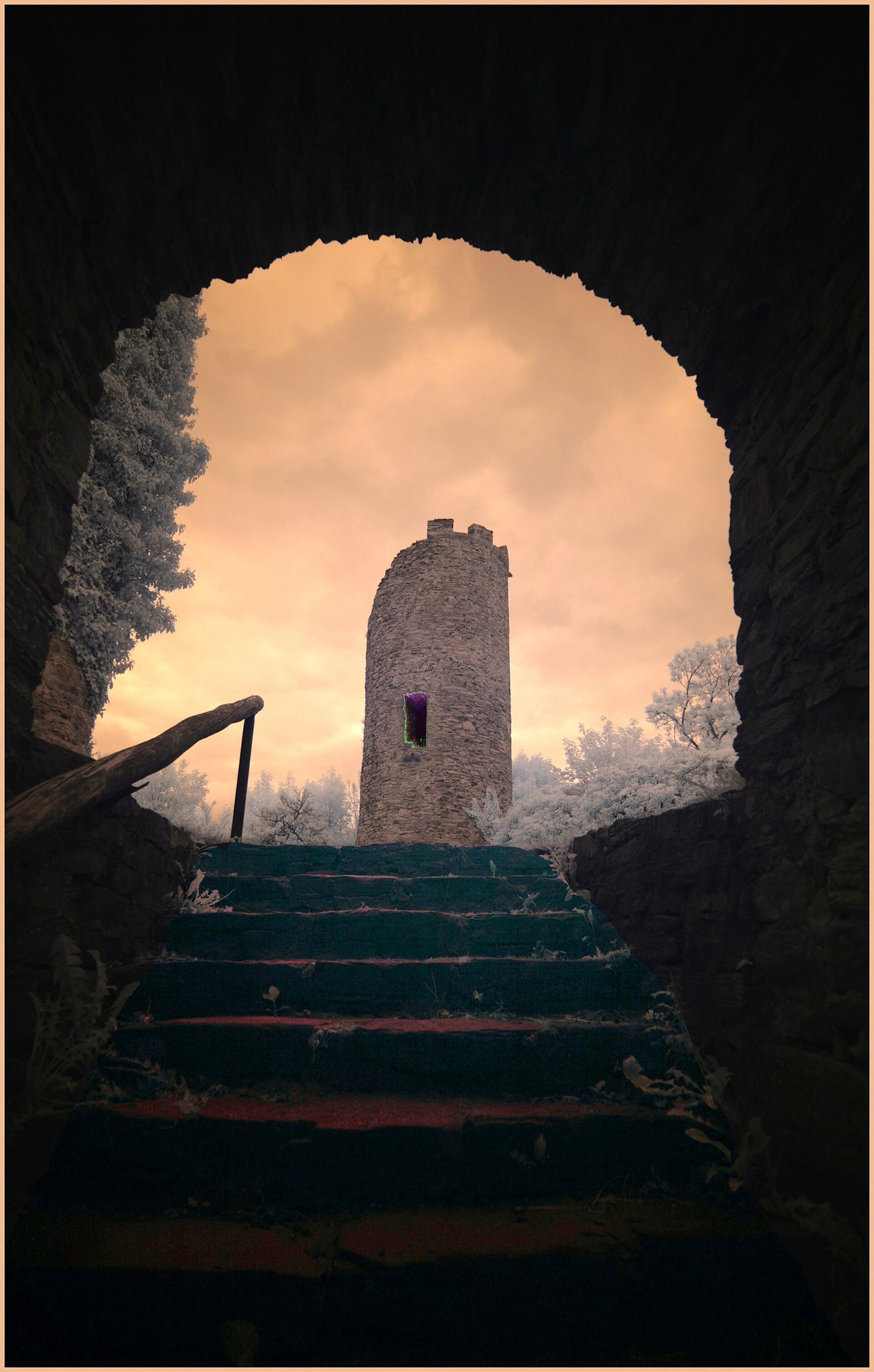
The present South Tower stands about 16.5 meters high and functions as a lookout tower. Its upper platform has nine crenellations. A drawing from 1721 shows the tower with a conical roof rather than its present parapet, while the 1852–1854 restoration rebuilt the crenellated top and added the roof structure then required for the restored tower.
North Tower
The round North Tower belongs to the late medieval expansion. It is approximately 5.80 meters in diameter and rises from a section of castle wall about two meters thick. Its entrance is 6.25 meters above ground and originally had a pointed arch. Another opening served as a viewing slit toward the north. The tower originally ended in a slightly projecting defensive platform, of which one waterspout survives.
The North Tower suffered extensive damage, reportedly from a lightning strike, and was filled with rubble before its twentieth-century restoration. Its collapsed western side was largely rebuilt in the 1920s, and crenellations were reconstructed at the presumed original height.
Walls, gate, and residential buildings
The earliest castle formed a strictly geometric rectangular enclosure. It consisted of the original principal fortified tower, a Romanesque residential building, and enclosing walls. Excavations in 1957–1959 revealed enough masonry to reconstruct the original curtain-wall line. In the northern area, the earliest wall lay inside the present castle wall; in the eastern area, it lay outside it. The original gate probably stood on the eastern side, beyond the present curtain wall.
The later expansion joined the two towers with a newly built polygonal eastern wall. Excavators found what was probably the original, and possibly only, gate beside the North Tower toward the western wall. It may have been blocked when the 1664 building work began and replaced by a covered recess for the gatekeeper. The present gates were installed during the nineteenth-century restoration and do not reproduce the original access points. The former South Gate had already collapsed by 1646, after which a northern passage was created. The reasons for the present round-arched South Gate and pointed-arched North Gate are unknown.
A cellar residential building stood one to two meters from the western wall and had a side length of at least 11 meters. Another building on the eastern side measured at least nine meters along a side. Their cellars were connected by a passage only 1.45 meters high. Gray dressed sandstone framed windows and doors and formed the corner quoins, while smooth sandstone ashlar became common in the masonry from about 1400 onward.
Outer ward and later structures
Outer ward
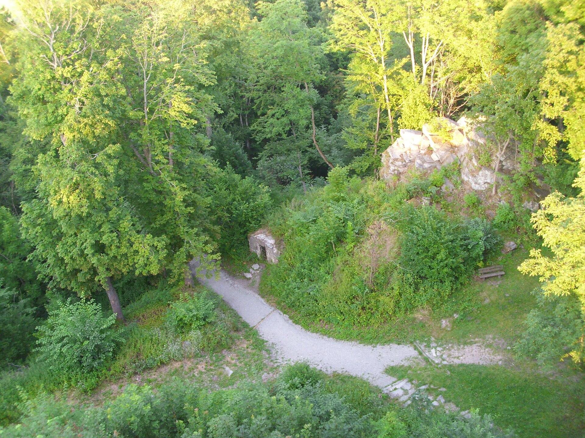
The surviving outer-ward walls belong to the late medieval building phase. Its straight southern wall extends for about 35 meters and is approximately 1.50 meters thick. For topographical reasons, the outer-ward gate probably stood near the level of the present entrance. The outer ward also preserves part of the old castle wall and a mass of phonolite rock. The present area includes a covered rest shelter and a fire site.
Later residential house
The half-timbered house erected in 1664 occupied the site of the earlier western residential building, which had collapsed. Records describe 14 windows, two stoves, and 14 doors, with different forms assigned to the two apartments. A cistern was planned to collect rainwater because the castle had no well. The eastern house, whose walls were apparently still largely intact in 1664, was also considered for rebuilding, but no completion is recorded. Excavated foundation strips only 40 centimeters wide indicate that the 1664 residence was constructed in half-timber.
Entrance structure
The building near the outer-ward entrance is commonly called the “Donkey Stable.” It was probably erected in the nineteenth century from older wall remains. Its irregular masonry combines walls of different thicknesses with stones of different forms, and its ceiling is too low to have housed an animal. Around the turn of the twentieth century, it was sometimes used as a beer cellar during festivities.