Dernberg: A Medieval Fortified Hill Earthwork in Austria
Site at a Glance
- Popularity
- Very Low
- Country
- Austria
- Primary era
- Medieval
- Eras represented
- Medieval
- Civilizations
- Duchy of Austria, Holy Roman Empire
- Site type
- Military
- Remains
- Castle
On this page10 sections
History
Dernberg is a former fortified hill earthwork at Nappersdorf-Kammersdorf in Lower Austria, Austria. It enters the written record in 1208, when Hadmar von Kuenring gave the place to Zwettl Abbey, a Cistercian monastery in Lower Austria, linking the site to noble and monastic landholding.
Medieval records and lordship
A Seefeld document from 1285 names the nobleman Witig von Ternberch. His family is thought to have held its seat at a farmstead in nearby Trenau. By 1311, Zwettl Abbey owned several houses at Dernberg, evidence of its presence in the settlement.
The hill and the settlement
After the fortified hill lost its purpose and was abandoned, Dernberg became the name of a settlement immediately to its west. The settlement was inhabited in 1457 and still had around 12 houses in about 1590. During the seventeenth century, its residents were relocated to Haslach.
Folklore and local memory
Local tradition kept the fortress alive in stories long after its abandonment. One tale said two kind-hearted maidens had owned it and that a stone stairway passed through a hollow in the ground to a neighboring village. Both places were said to have sunk. A mass for Dernberg’s sunken people was once regularly held in Haugsdorf.
Other tales warned of a ghostly carriage that led late travelers astray and of cherry pickers who wandered for a long time after taking fruit from a tree by the hill, only to find cherry pits in their pockets when they reached home. Stories also told of a small white figure and a light appearing at Christmas, when the hill was said to open and expose treasure. In Kleinweikersdorf, adults used the Körbelweibel, a folkloric bogey figure, to frighten misbehaving children with the threat of being taken into Dernberg.
Remains
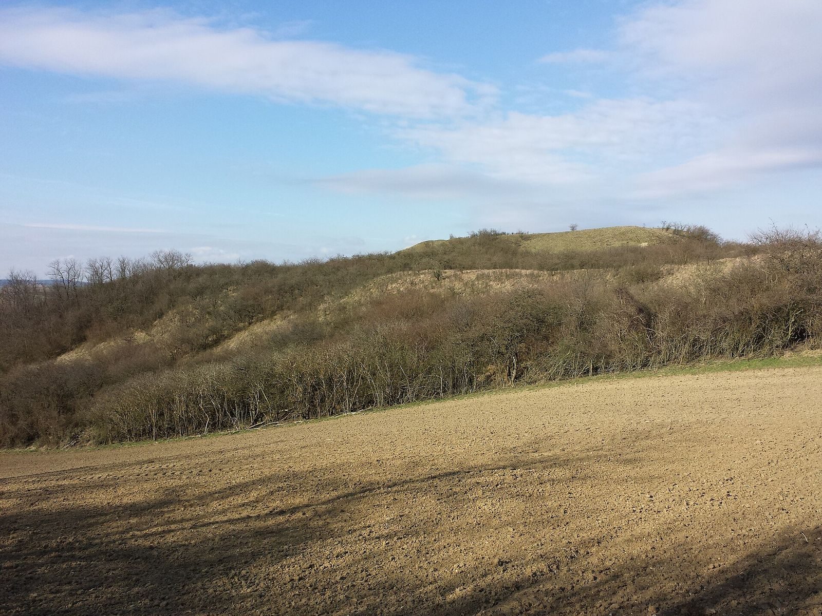
The earthwork occupies a north-south ridge amid cultivated farmland, between Nappersdorf, Haslach, Aschendorf/Hart, and Oberstinkenbrunn. Its northern ground is relatively level, while the terrain falls about 26 metres to the west and south and 12 to 18 metres to the east. An intermittent stream rises west of the hill and flows north. The site stands at 281 metres above sea level on loess, a fine windblown soil, and quartz gravel.
Overall form and defenses
The complex is aligned north to south and measures about 180 by 140 metres. Its central feature is a mound roughly 8 to 9 metres high, shaped like a truncated pyramid and set on a trapezoidal base partly enclosed by banks. The summit is approximately triangular, with its point facing south, a northern edge about 20 metres long, and a north-south height of roughly 46 metres. Its steep, regular slopes may have been shaped or steepened by people.
The relatively level northern approach was strongly defended. A deep neck ditch, separating the fortified core from an outer bank, divides the mound from a substantial rampart with a broad crest sloping outward. Beyond it, a berm, or level strip outside a defensive bank, extends about 16 metres before ending at a slope roughly 3 metres high. The rampart continues into banks along the eastern and western sides, apparently enclosing the complex. Landforms in the northeast suggest an outwork, an outer defensive structure, and a likely former entrance. South of the core, a raised terrace about 40 metres across may have supported buildings.
Archaeological finds
Small finds from the surrounding area point to possible prehistoric settlement and include material from the Bronze Age and the Hallstatt period, an Iron Age period in Central Europe. Finds from Dernberg also date to the ninth or tenth century. On the hill itself, archaeological investigator Kurt Bors collected thirteenth-century surface finds. Pottery from the thirteenth through sixteenth centuries came from a former estate area about 150 metres east of the hill. Bors interpreted the finds as evidence that the seat’s function shifted to a settlement farther east during the later Middle Ages.
Grassland and plant life
Plant communities
The higher ground supports nationally significant dry grassland, chiefly fescue and feather-grass communities, alongside small areas of tor-grass semi-dry grassland. Rabbit burrows open patches in the grass, while smooth brome forms dense stands in places. Blackthorn, hawthorn, and rose scrub grows lower down. Plants recorded at the site include Austrian milkvetch, Ruthenian globe-thistle, Christ’s-eye elecampane, goldilocks aster, shaggy flax, and Dolliner’s flaxwort, as well as small patches of willow-leaved elecampane. Ruthenian globe-thistle is rare and endangered in Austria’s Pannonian region; Christ’s-eye elecampane is threatened and scattered to rare in eastern Austria. Shaggy flax and Dolliner’s flaxwort are rare and strongly endangered. Shaggy flax needs open loess soil to germinate, while Dolliner’s flaxwort occurs in Austria only in the Pannonian region. Knapweed broomrape, which parasitizes greater knapweed, also grows here. Nearby fields support rare arable plants, including three-horned bedstraw, which is threatened with extinction.
Management and pressures
Grazing ceased after the Second World War, allowing some grassland to become overgrown. Parts of Dernberg belong to Naturschutzbund Niederösterreich, a nature-conservation association in Lower Austria. Volunteers now mow the site and clear scrub each year to maintain open grassland and reclaim areas that became wooded. Fertilizer and pesticide drift from the intensively farmed surrounding land remains a threat to these habitats.