Condercum: A Roman Auxiliary Cavalry Fort on Hadrian’s Wall
Site at a Glance
- Popularity
- Medium
- Country
- United Kingdom
- Primary era
- Classical
- Eras represented
- Classical
- Civilizations
- Roman
- Site type
- Military
- Remains
- Fort
On this page19 sections
History
Construction and military garrison
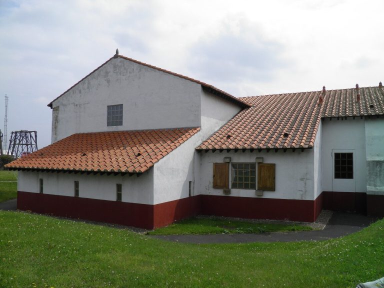
Condercum was a Roman auxiliary cavalry fort on Benwell Hill in Newcastle upon Tyne, United Kingdom. Built by Roman soldiers around 122–124, it occupied the third fort position along Hadrian’s Wall, a frontier barrier across northern Britain. Emperor Hadrian ordered the Wall’s construction in 122 to protect the Roman provinces from incursions from the north. Soldiers from Britain’s three legions carried out much of the work, alongside the British fleet. Condercum helped secure the Wall’s eastern sector and overlooked the Denton Burn valley, the Derwent’s meeting with the Tyne, and river traffic.
Soldiers of Legio II Augusta built the fort. Marines from the Channel fleet constructed its granaries, as an inscription found in the double granary records. A detachment of Legio XX Valeria Victrix undertook further building or repairs in the late second century. The second-century garrison included an auxiliary force from Upper Germany combining infantry and cavalry. It was nominally 1,000 strong, though probably only about half were based at Condercum. From 205 to 367, a 500-strong cavalry unit recruited from northern Spain was stationed there, after serving at South Shields. The fort remained in military use for about 300 years, probably from its foundation until around 400, and was abandoned by the early fifth century. In the late second century the area was part of Britannia Inferior; from the fourth century it belonged to Britannia Secunda, successive Roman provinces in Britain.
The settlement and the Vallum
A settlement may have existed at the foot of Benwell Hill before the fort was built. A civilian settlement, known as a vicus, later developed around the fort, particularly near its southern exit and the crossing of the Vallum, the ditch and earthwork south of Hadrian’s Wall. The settlement suffered a major fire around 296 and was rebuilt. Its eventual abandonment date is unknown.
The Vallum curved around Condercum, and its crossing controlled movement between the fort and the land to the south. During the governorship of Lollius Urbicus, from 138 to 144, wooden gates at the crossing were apparently taken down and later rehung. The crossing probably remained in use throughout the Roman occupation.
Religion and burial
A temple dedicated to Antenociticus, a local Brittonic deity, was probably built around 178–180. Altars from the sanctuary include an inscription naming a prefect of the Vangion cohort and the provincial governor Ulpius Marcellus, supporting that date. The sanctuary was probably used by the people who dedicated its altars, perhaps in fulfilment of vows, rather than serving as a place of worship for the whole local community. Burnt beams and roof tiles point to a fire in the late second century, although the temple’s precise fate is uncertain. Three skeletons were found in its apse, and the area later served as a cemetery. A cemetery near the civilian settlement remained in use into the early Anglo-Saxon period.
Other religious evidence includes numerous dedications to deities. An inscription to the “three Lamiae” may reflect a Roman interpretation of figures from Celtic mythology; comparisons with the Bodbs or Morrígains of Irish mythology have also been proposed. An inscription found at Benwell in 1789 records the restoration of a temple to the Mother Goddesses.
Names, investigation and later change
The name Condercum is understood to derive from a Brittonic word meaning “lookout” or a place with a far-reaching view. It appears in the Notitia Dignitatum, a late Roman administrative document listing offices and military commands. The seventh-century Ravenna Cosmography, an early medieval geographical compendium, gives the form Condecor, meaning “steep hill”; this may preserve an earlier name for the site.
The fort’s remains were still conspicuous in 1732. Road construction in 1751 led to the identification of heated floors in the commander’s house and bathhouse. By 1789 the fort remains north of West Road had been removed, and by the end of the eighteenth century its last visible masonry had disappeared. John Collingwood Bruce examined the southern area in 1851. Excavations began in the 1860s, and George Wightwick Rendel uncovered the temple in 1862.
Construction of the Benwell High Reservoir destroyed the fort’s northern section in the mid-1860s. Housing development affected the southern remains between 1926 and 1937, while investigations examined parts of the commander’s house, headquarters, barracks, bathhouse, temple and other buildings. Excavations in the 1930s located the Vallum crossing and explored the southern fort and civilian settlement. Further work in 1958 added evidence about the fort’s internal arrangement. A water-pipe installation in 1990 cut through part of a double granary. Investigations in 2013 revealed a stretch of Roman military road and showed that the civilian settlement extended farther south than previously recognized. Excavations in 2017 and 2020 exposed further settlement and fort foundations. The reservoir, housing and Newcastle-to-Carlisle road now obscure much of the fort and Hadrian’s Wall. Finds from the excavations are displayed at the Great North Museum and the Black Gate Museum in Newcastle.
Remains
Fort plan and defences
Condercum occupied a roughly 127-metre-high hill, about 3–4 kilometres west of Newcastle city centre. Its rounded-corner plan was approximately square, oriented northeast, and measured about 170 metres north to south by 120 metres east to west. Including the rear earth rampart, the fort covered about two hectares. The rampart supported the perimeter wall and provided a walkway. Archaeological remains have been detected as little as 0.4 metres below ground.
The fort probably had six gates: three on its north side, a main gate to the south, and one side gate on each of the east and west walls. The side gates had single passageways onto an east–west road within the fort. The southern gate had two passageways divided by a central pier and flanked by towers set inside the wall. A northeast–southwest road ran through it toward the Vallum crossing. Towers strengthened the corners, with those at the southwest and southeast confirmed by excavation. Traces of a double ditch were found along the east and west sides, while the southern side probably had a single ditch.
Hadrian’s Wall at Benwell is thought to have followed roughly the line of West Road. On this reconstruction, the Wall met the fort’s east and west sides, leaving its northern portion projecting beyond the frontier line. West Road probably also covers the fort’s east–west main street.
Buildings inside the fort
Commander’s house
The commander’s house stood beside the eastern side gate. It probably had a courtyard surrounded by columns and several heated rooms. Its underfloor heating system, a hypocaust, was identified in 1751.
Headquarters
The headquarters lay west of the commander’s house. It included four administrative rooms, a courtyard bordered by chambers, and a portico, or covered walkway, open to the north. East of the shrine was a rock-cut strongroom for the unit’s treasury, lined with stone and fitted with a sloping window in its south wall. A pipe supplied a basin in the forecourt.
Granaries
A freestanding double granary stood west of the headquarters. The long rectangular building measured 34.75 metres. A canopy on its southern side was probably carried on six square supports; steps led to both entrances, and pilasters, or flat projecting strips of masonry, strengthened its outer walls. A further double granary was partly exposed during water-pipe work in 1990.
Workshop and barracks
A workshop stood just inside the west gate, with a smithy’s rubbish heap against its east wall. South of it was a large double barrack block whose two sections shared a rear wall. The two larger buildings at its western end housed officers; 18 smaller rooms accommodated ordinary soldiers. The block could house about 128 men, roughly the strength of four cavalry troops.
Hospital and stables
East of the barracks stood a building of uncertain use, possibly an animal hospital, and the camp hospital. The hospital may have contained as many as 12 rooms arranged around a courtyard. Two stable buildings occupied the remaining southern part of the fort, one on each side of the road leading toward the Vallum.
Vallum crossing
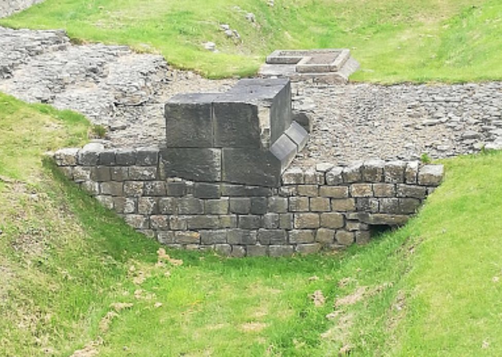
In Denhill Park, south of the fort, the Vallum ditch curved around 55 metres from the southern defences and ran roughly parallel to them. It was about 6 metres wide and 3 metres deep; today it retains about half its original depth. Earth banks formed from the excavated soil bordered the ditch, and an overflow channel east of the crossing carried away excess rainwater. The ditch was levelled in the late second century and partly built over by the settlement. A stone causeway crossed it, with a monumental gateway about halfway along. The gate was originally spanned by an arch and could be shut with wooden doors. Facing blocks lined the causeway, and large blocks from its western base and threshold stones survive. Pivot stones for the gates came from Hadrianic and Severan layers. A pivot block appears to reuse stone from above the arch, suggesting the arch was partly damaged while wooden doors remained in use as late as the third century.
The approach road, surfaced with broken stone, climbed northward toward the fort in steps. Its surface was renewed six times, and the upper layer contained a coin dating to around 270. The ditch and banks may also have marked a legal or administrative boundary.
Civilian settlement and religious remains
Vicus
The civilian settlement extended on both sides of the Vallum. Its earliest buildings were wooden and date to the reign of Septimius Severus; stone buildings replaced them in the first half of the third century. Stone structures stood east and west of the crossing, with pottery placing them in the late second or early third century. Excavations have also exposed part of a double granary in the settlement.
Temple of Antenociticus
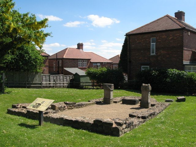
The temple stood about 100 metres east of the fort, within the civilian settlement. It measured approximately 15.3 metres east to west by 18.8 metres north to south. A semicircular recess, or apse, about 5.4 metres wide projected roughly 2 metres from its southern end. An entrance east of the apse was used, while the principal entrance may originally have been on the north. A life-size statue of Antenociticus stood in the apse. Recovered parts include a curly-haired, horned head with a neck ring, and fragments of an arm and lower leg; the statue was probably mostly wooden. Three altars to the deity were also found. One inscription names a cohort prefect and Ulpius Marcellus; another records a dedication by a centurion of Legio XX to Antenociticus and the deified emperor. Replicas of two altars were placed at the display site. The temple remains have been visible since their discovery in 1862.
Other buildings beyond the fort
The bathhouse stood about 274–300 metres southwest of the fort. A plan made before its demolition in 1751 showed eight rooms, including an identified cold bath and changing room. South of the Vallum crossing, a larger nine-room building probably served as an inn for official travellers. Its arrangement may have been captured in a plan made before the building was destroyed.
Cemeteries and finds
One Roman cemetery lay between the fort and Milecastle 6, south of Hadrian’s Wall. The cemetery near the civilian settlement continued into the early Anglo-Saxon period. Two brooches dating to the sixth or early seventh century and a glass vessel, probably associated with Anglo-Saxon graves, were recovered immediately west of the temple in 1935. Other finds include altars to several deities, a dedication to the “three Lamiae,” square-headed and cruciform brooches, pottery, a silver spoon and the fort’s strongroom or treasury vault.