Cistern of Mocius: A Byzantine Water Reservoir in Istanbul


Site at a Glance
- Rating
- 4.3
- Popularity
- Very Low
- Country
- Turkey
- Primary era
- Medieval
- Eras represented
- Medieval
- Civilizations
- Byzantine
- Site type
- Infrastructure
- Remains
- Cistern
On this page6 sections
History
The Cistern of Mocius is a Byzantine water reservoir in Istanbul, Turkey, constructed at the turn of the fifth and sixth centuries under Emperor Anastasius I, who reigned from 491 to 518. It stood in the twelfth region of Constantinople, in the area known as Exokionion, and was built as the city’s water-supply system expanded.
Construction and Byzantine water supply
The reservoir served new quarters that developed between the earlier Wall of Constantine and the Theodosian Walls, the major fifth-century land defenses of Constantinople. Its water came from the Aqueduct of Valens, a major Byzantine structure that carried water into the city and its reservoirs.
The cistern took its name from the nearby Church of Saint Mocius, a Christian church dedicated to the saint and positioned near the reservoir’s southwestern corner. The Monastery of Olympus lay to the north, while the Monastery of Saint Philip stood to the east. The church and both monasteries have since disappeared from the urban landscape.
After Constantinople
Following the Ottoman conquest of Constantinople in 1453, the reservoir was empty. Around 1540, the French traveler Pierre Gilles recorded this condition. During the Ottoman period, the basin was converted into a vegetable garden, a use reflected in the Turkish name Altımermer Çukurbostanı, meaning “sunken garden.” Agricultural use continued until the end of the twentieth century.
Modern transformation
By the mid-twentieth century, wooden houses covered the eastern part of the former reservoir. A football field was created in the western part during the 1980s, followed by major reconstruction. The site is now partly occupied by residential buildings and is used mainly as a recreational area with a local park, sports facilities, and other amenities. In 2014, it had the status of Fındıkzade Educational Park in Istanbul’s Fatih district.
Remains
The former cistern occupies a rectangular area in Istanbul’s Fatih district, in the Altımermer quarter and the Seyyid Ömer neighborhood, northeast of the Seyyid Ömer Mosque. It lies between Ziya Gökalp Sokak to the north and Cevdet Paşa Caddesi to the south, on the highest part of Istanbul’s seventh hill, overlooking the Sea of Marmara. Residential structures cover part of the former basin, while much of the remaining area has been adapted into a park and recreational landscape.
Reservoir structure
The cistern measured approximately 170 by 147 metres, covering about 24,900 to 25,000 square metres. It was the largest open-air water reservoir built in Constantinople. Earth now fills part of the basin, so its original depth is unknown. Estimates place it between approximately 10.5 and 15 metres, with about 2 to 4 metres still visible. Its estimated capacity ranged from roughly 260,000 to 370,000 cubic metres of water.
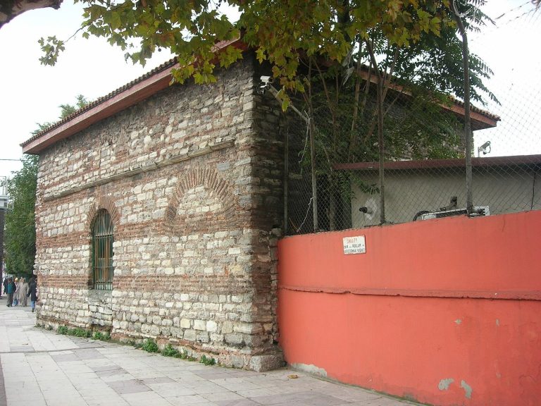
The walls were approximately 6 metres thick and were built with alternating courses of brick and stone. This Roman construction method, which strengthened and regularized large structures, was also used in the Cisterns of Aetius and Aspar. Sections of the original walls survive within the modernized landscape, preserving the scale and construction technique of the former reservoir.