Château du Hugstein: A Medieval Residence and Fortress in France
Site at a Glance
- Rating
- 4.4
- Popularity
- Low
- Country
- France
- Primary era
- Medieval
- Eras represented
- Medieval
- Civilizations
- Holy Roman Empire
- Site type
- Military
- Remains
- Castle
On this page12 sections
History
Château du Hugstein is a medieval hill castle in France, built for Hugo von Rothenburg, prince-abbot of Murbach, around 1230. It served as a residence for the abbots and helped control Guebwiller, the Lauch valley, and the entrance to the Murbach valley. The castle occupied a central position within the possessions of Murbach Abbey, whose abbots combined religious leadership with territorial and feudal authority.
Foundation under the Murbach Abbots
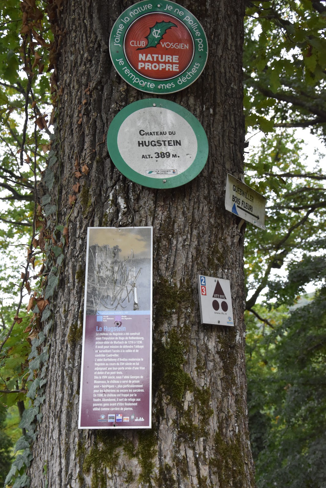
The foundation is traditionally dated to 1227, while the chronicle of Murbach Abbey gives 1230, the more securely documented date. Hugstein is described as the oldest castle belonging to a monastery in Alsace with documentary evidence for its existence. Hugo von Rothenburg served as prince-abbot from 1216 to 1236 and was made a prince of the Holy Roman Empire by Emperor Frederick II of Hohenstaufen. The castle therefore expressed the abbots’ dual position as heads of a monastery and rulers of surrounding lands, fortifications, and dependent settlements.
In 1313, Abbot Konrad Wiedergrun von Stauffenberg consecrated the castle chapel to Saint Benedict and the Holy Cross. During the abbacy of Bartholomew von Andlau, from 1447 to 1476, the castle underwent substantial strengthening. Repairs were ordered, a gate tower was probably commissioned, and two additional towers and an outer enclosing wall were added. These measures reinforced the residence even though its principal function remained residential.
Prison, Dispute, and Destruction
In the early sixteenth century, under Georg von Masmünster, Hugstein was used as a prison for Protestants or Lutherans and for women accused of witchcraft. Some of those accused may have been burned in front of the castle.
The castle became the scene of a succession dispute within Murbach in 1542. Heinrich von Istetten, dean of Murbach, opposed the election of Rudolf Stoer von Stoerenberg, who had gained the abbacy claimed by Heinrich. Heinrich occupied Hugstein, but Rudolf’s supporters besieged it. After surrendering, Heinrich was imprisoned in the great tower. The castle may have been destroyed later that year, perhaps by the abbot of Murbach himself.
Hugstein was subsequently abandoned and suffered further damage when lightning struck it in 1598. During the Thirty Years’ War, vandalism removed much of the remaining fabric of its buildings. Murbach Abbey definitively abandoned the site in the eighteenth century. The ruins later sheltered poor people and were used as a stone quarry, with facing stones from the keep reused in houses in Buhl.
Rediscovery and Conservation
A seismic shock on 31 January 1852 destroyed part of the castle. Clearance of the overgrown ruins began in 1862, followed by restoration work focused particularly on the gate tower. Wall paintings were discovered during nineteenth-century repairs. The ruins have been protected as a French Monument historique since 1898 and are owned by the municipality of Buhl, although the boundary between Buhl and Guebwiller crosses the keep. In May 2006, the Pro Hugstein initiative was founded to preserve the remains and organized repeated cleaning and maintenance campaigns within the castle area.
Remains
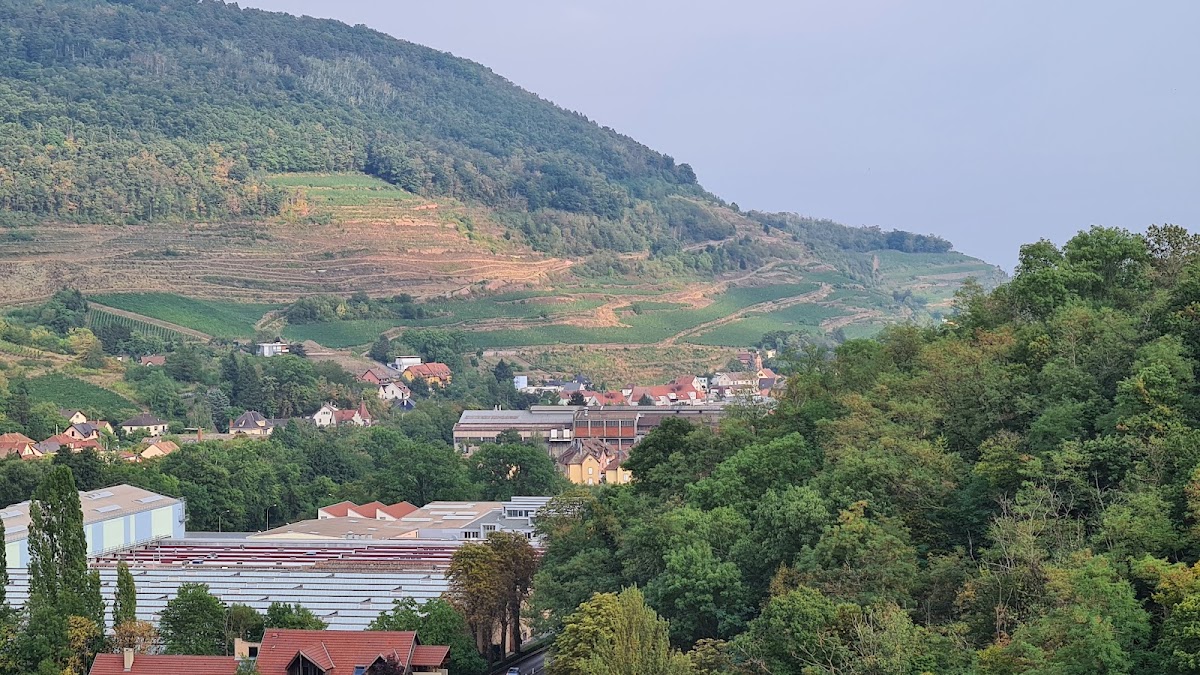
Château du Hugstein stands at approximately 389 metres above sea level on a rocky spur of the Liebenberg, above Guebwiller in the Florival and at the entrance to the Murbach valley. The ruins overlook the Lauch valley and lie about five kilometres from Murbach. The castle comprised a northern outer bailey and a central castle enclosed by two curtain walls. A ditch protected the southern and western sides, where isolated remains may belong to an outer defensive enclosure. Local gneiss forms most of the rubble masonry, while locally quarried sandstone was used for ashlar facing and architectural details.
Castle Layout and Walls
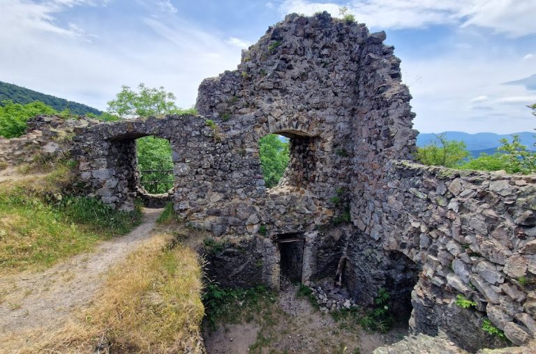
The outer bailey lay north, and probably also east, of the central castle. Its position is suggested by relatively level ground north of the nearly rectangular castle area, which measures about 50 by 100 metres. A presumed entrance to the central castle stood at the northwestern corner of its curtain wall. The outer curtain wall and the two towers incorporated into its western side have been almost completely dismantled. Much of the residential building and the western wall attached to it have also disappeared, while nearly all of the sandstone door and window reveals were forcibly removed.
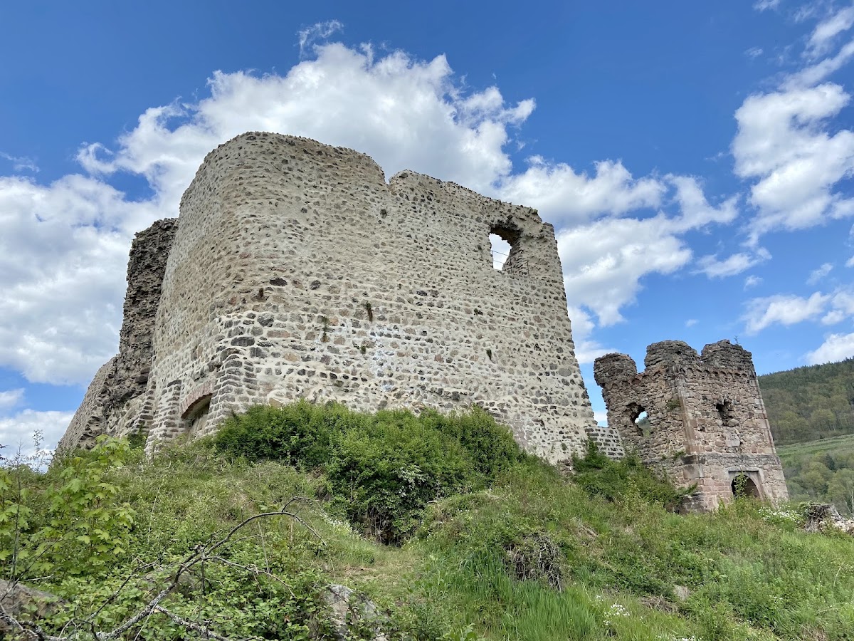
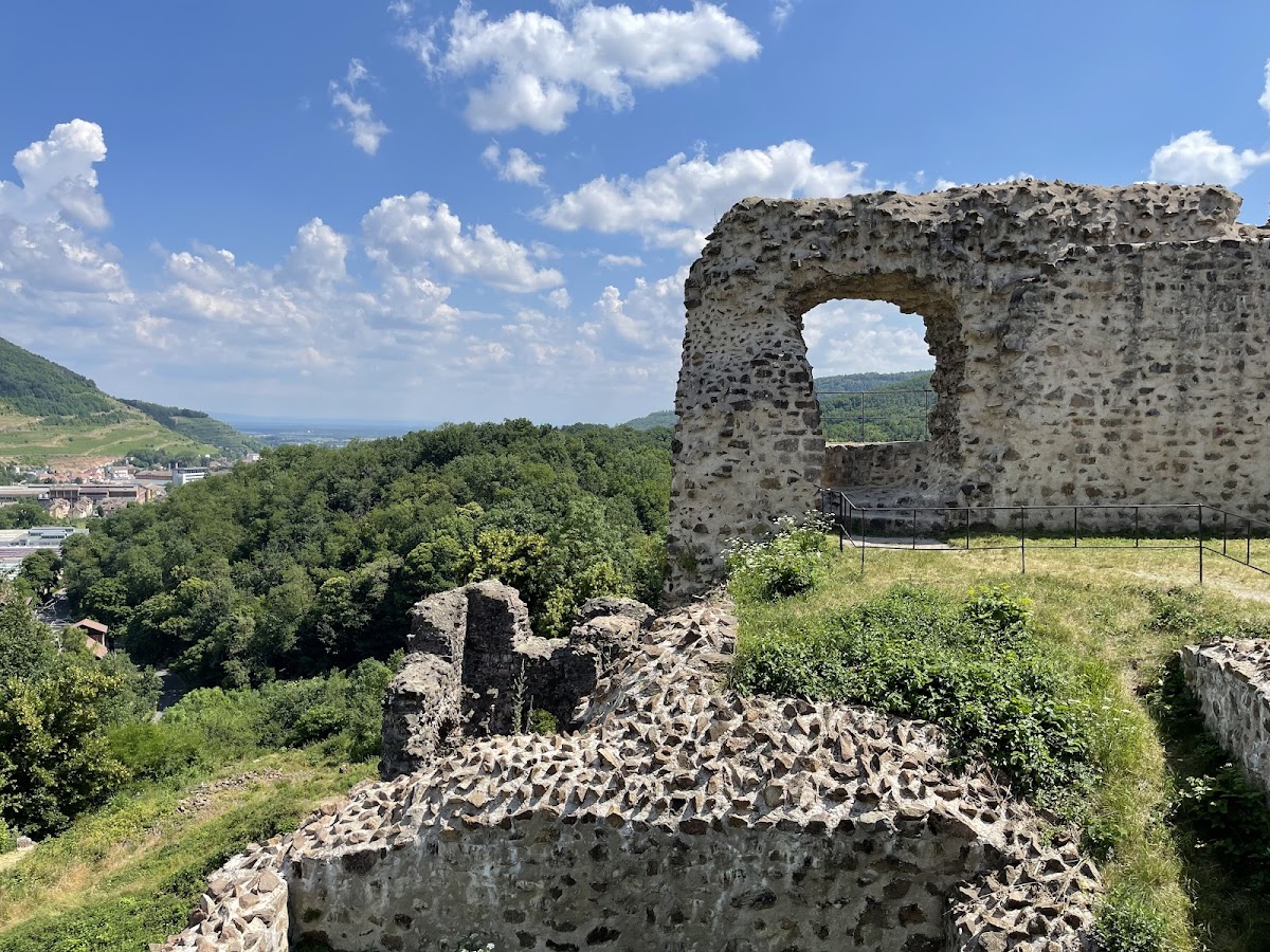
The central castle forms a rectangle measuring approximately 18 by 25 metres and rises about four to five metres above the northern outer bailey. An inner curtain wall encloses it, reaching up to ten metres in height and measuring approximately 2.6 metres in thickness. Three corners are rounded, giving attackers the impression that the castle had round corner towers. Wall faces were built mainly of gneiss rubble and were formerly plastered, while the ditch also supplied stone for construction.
Entrance and Principal Tower
Gate Tower
Access to the central castle passed through a fifteenth-century gate tower, originally three storeys high, of which two survive. Built from rubble stone and brick, it has ornamental sandstone decoration. A former drawbridge led to its round-arched entrance, and the drawbridge recess remains visible on the exterior. The passage once had a groin vault, a ceiling formed where two barrel vaults intersect, and the tower also contained a small pedestrian entrance. Arrow slits and firing windows pierce its outer face. A brick round-arch frieze marks the top of the first storey, while sandstone corner blocks carry simple blind tracery, shallow decoration that does not open through the wall.
Round Keep
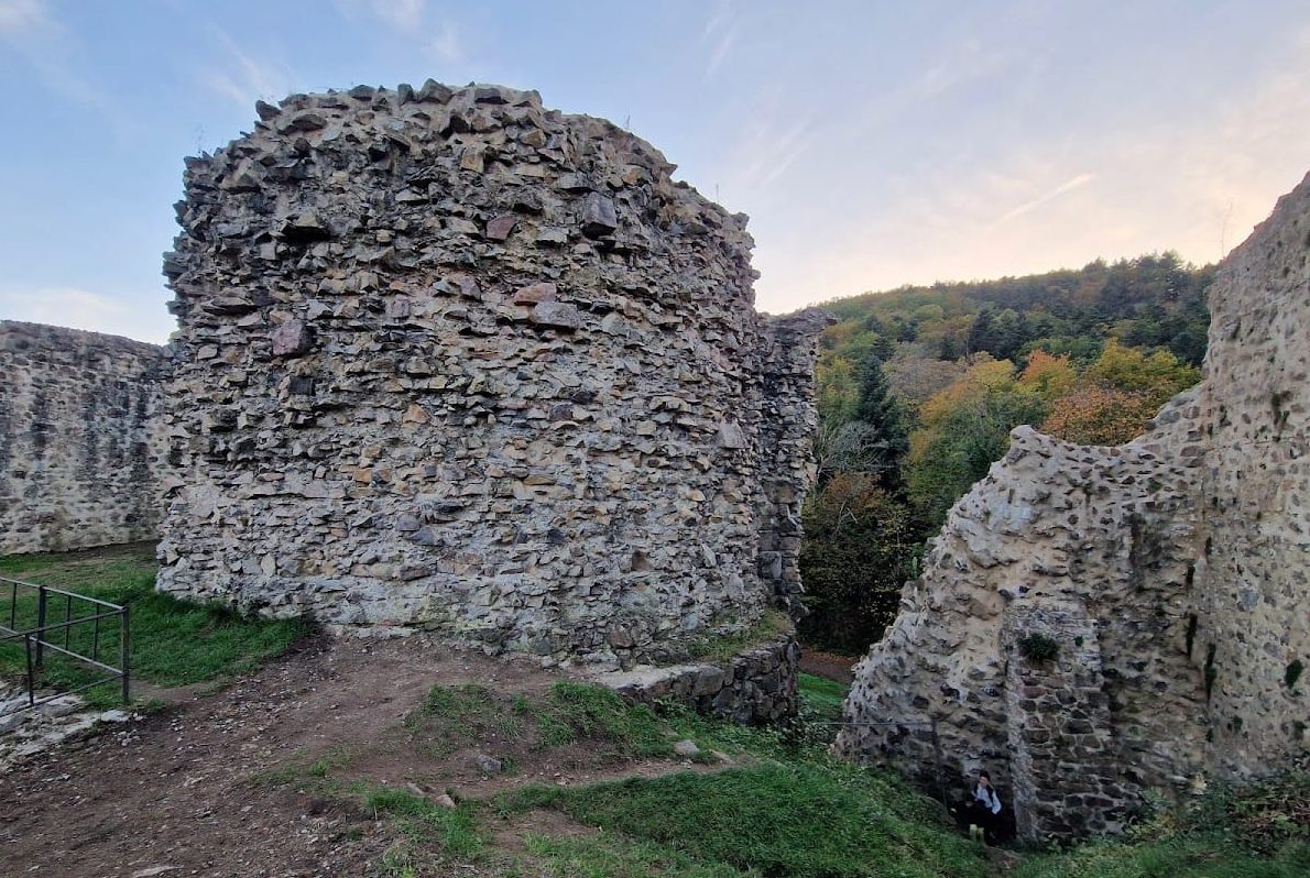
The round keep stands on the western side, in the centre of the castle’s principal line of attack. With a diameter of approximately ten metres and surviving height of up to ten metres, it represents an unusually rare form in Alsace. Its interior contained a single room with a rectangular ground plan. The wall is considerably thinner toward the courtyard than on the attack side. The keep projects slightly from the curtain wall and was built with bossed ashlar, while the adjoining curtain wall used smooth ashlar. Much of the facing disappeared when its blocks were removed for construction in Buhl during the eighteenth century.
A breach immediately north of the keep resulted from blasting or undermining. It was formerly, but incorrectly, interpreted as a postern or sortie gate. The boundary between Buhl and Guebwiller runs through the keep, giving the surviving tower a position within both municipal territories.
Residential and Religious Buildings
Residence
The keep was once connected to the residential building by a passage. The residence probably stood south of the central-castle area and had two or three storeys. Repairs in the second half of the nineteenth century revealed red-brown foliage paintings on the surviving passage walls. The passage can no longer be located, and the paintings are no longer discernible. The residential building and its attached western wall survive only fragmentarily.
Chapel
The medieval chapel’s exact position remains uncertain. It is thought to have occupied a rectangular building on the eastern side of the central castle, although it may have adjoined or formed part of the residence. Its surviving Gothic keystone bears a relief of the Agnus Dei, the Lamb of God, a Christian symbol representing Christ and commonly shown with a cross or banner. The keystone is displayed at the Musée Théodore Deck in Guebwiller, formerly known as the Musée du Florival.
Today the castle survives as a ruin. The keep is only partly preserved, while the outer walls, residential building, passage, and chapel survive in fragmentary or uncertain form.
Nearby sites