Montréal-de-Sos Castle: A Comital Fortress in France


Site at a Glance
- Rating
- 4.5
- Popularity
- Low
- Country
- France
- Primary era
- Medieval
- Eras represented
- Medieval
- Civilizations
- Unclassified
- Site type
- Military
- Remains
- Castle
On this page10 sections
History
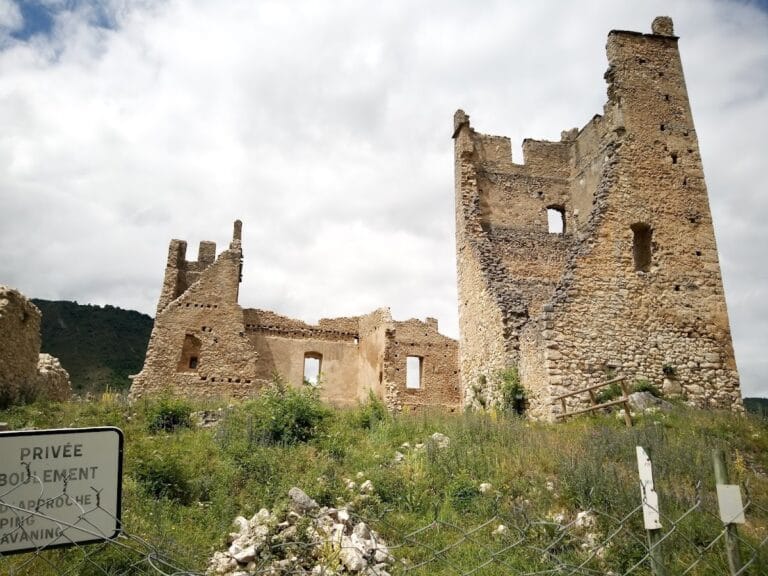
Montréal-de-Sos Castle is a medieval comital fortress in France, built by the counts of Foix at the end of the twelfth century on a rocky spur above the Vicdessos valley. The counts of Foix were the medieval rulers of the County of Foix, a Pyrenean principality, and the castle helped establish their authority in the upper valley. Further construction took place in the early thirteenth century and the mid-fourteenth century.
Earlier occupation and comital foundation
The summit had been occupied for more than two millennia before the medieval fortress was built. The oldest installation identified there belongs to the final phase of the La Tène period, the later Iron Age associated with Celtic cultural developments. It may have been an oppidum, meaning a fortified settlement or hilltop enclosure, although that interpretation remains uncertain.
At the end of the twelfth century, the counts of Foix consolidated their authority in the upper Vicdessos valley and established Montréal-de-Sos as a comital stronghold. Its position supported control of the important Vicdessos iron market and activities connected with the Rancié mine at Sem. In 1272, Raymond Bataille de Mirepoix held the castle as its lord and castellan.
Occupation, demolition, and archaeological research
The fortress remained occupied until the beginning of the fifteenth century. During a reorganization of the castles belonging to the County of Foix, the counts feared that enemies might seize Montréal-de-Sos. They therefore deliberately disarmed and levelled it. Several metres of stones, rubble, and other material later covered the remains.
The municipality of Auzat launched an archaeological research programme in 2000, with the historian Florence Guillot responsible for the work. Field investigations began in 2001 and continued until 2017. Surveys in 2001 and 2002 were followed by work in the central keep, investigations around its northeastern perimeter from 2003 to 2005, and further excavation in the keep quarter from 2006 to 2010. Research resumed in 2012, 2013, and 2015, reaching the lower level and the Campanal cave. The programme was coordinated by the Patrimoines service of the Auzat-Vicdessos intercommunal authority and formed part of a wider 2004–2012 study of medieval fortifications in the counties of Foix, Couserans, and Comminges.
Zone 1, the first area to be fully excavated, preserved an undisturbed sequence covering the castle’s two centuries of occupation. Its collections became reference material for the medieval archaeology of Haute-Ariège. The excavations also recovered a hand mill and led to study of ceramic, worked-bone, metal, coin, and slate material.
Remains
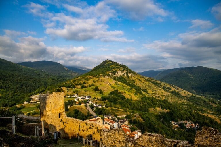
The ruins occupy a limestone spur at 881 metres above sea level, north of Olbier and opposite Auzat on the southeastern side of the Vicdessos valley. The spur projects from the northern face of Pijol de Brosquet, at the end of the northwestern ridge of Pique d’Endron. Its karstic terrain, shaped by the dissolution of limestone, includes cliffs, caves, and underground passages. Dry calcareous grassland covers the rocky formation.
Summit layout and outer defences
The archaeological site covers more than 8,000 square metres and extends for more than 150 metres from northwest to southeast. Its outer enclosure forms an elongated parallelogram. The summit is arranged as broad, gently sloping levels separated by short, nearly vertical rises. The upper level, known as the caput castri, or chief part of a castle site, reaches 978.30 metres a few metres north of the keep. A lower level lies several metres below it to the east and southeast, with a relatively steep eastern slope and a second gently sloping southeastern terrace.
The outer enclosure belongs to the first medieval construction phase, dating from the end of the twelfth century or the very beginning of the thirteenth. Its wall-walk was supported by posts. At the summit’s lowest point on the southern side, the wall obstructed water drainage, eventually contributing to the washing out and mixing of earlier archaeological layers. Before the enclosure was built, the exposed southeastern approach was defended by a series of stepped notches cut along the slope.
The summit was approached principally from the southeast, the only side suitable for a mule track. This route led downstream and westward toward Vicdessos or upstream and southward toward Goulier. Other openings and porches penetrate the cliffs, sometimes passing short distances through the rock. They connected the foot of the escarpment with the summit and could be adapted both for movement and for blocking access.
Fortified towers and inner quarter
Barri Tower
The Barri Tower survives in part at the northwestern end of the fortress and its platform. It overlooks the Auzat basin and forms one of the two towers associated with the large outer enclosure.
Campanal Tower
The Campanal Tower stands at the southeastern end of the site, where it guarded access to the inner fortified area. Beneath the castle, the Campanal cave was also fortified and formed part of the castle complex.
Keep and aristocratic quarter
The aristocratic quarter was grouped around a central keep built on a motte, a raised artificial or adapted mound supporting a fortified structure. This arrangement is unusual in the Haute-Ariège. Zone 1 lies at the northeastern foot of the keep, where excavation revealed the complete sequence of occupation layers belonging to the castle’s two centuries of use.
Caves and painted imagery
The caves around the summit contain wall paintings associated with the site’s later interpretation. Paintings depicting the Holy Lance and the Holy Grail were found there in the late nineteenth century. Some interpretations identify the images as representations of the Grail, while another regards them as the amusement of a shepherd.
The Campanal cave was investigated as part of archaeological work on medieval cave occupation in the Haute-Ariège. Together with the excavated keep quarter and the recovered hand mill, it forms part of the physical and archaeological evidence for the fortress and its long occupation.
Nearby sites