Castra of Böhming: A Roman Frontier Fort in Germany
Site at a Glance
- Popularity
- Low
- Country
- Germany
- Primary era
- Classical
- Eras represented
- Classical, Medieval
- Civilizations
- Holy Roman Empire, Roman
- Site type
- Military
- Remains
- Fort
On this page16 sections
History
The timber fort and stone rebuilding
The Castra of Böhming is a Roman fort near Kipfenberg, Germany, built in stone in 181 CE as part of the Roman frontier system known as the Limes. The Limes was Rome’s fortified boundary. The fort had been occupied since the first half of the second century, and an earlier timber-and-earth installation stood on the site before the stone defenses were built.
The earlier fort contained half-timbered buildings and was destroyed by fire. Its foundation date is uncertain, but it cannot predate the reign of Hadrian, who ruled from 117 to 138. The fire may have occurred during the Marcomannic Wars, conflicts between Rome and the Marcomanni and other groups from 166 to 180. Pottery from the fire layer has prompted debate about when it formed.
In 181, a detachment from the Legio III Italica, a Roman legion, built the stone defenses, gates, and towers under the provincial governor Quintus Spicius Cerialis. The detachment was led by the centurion Iulius Iulinus, a commander of a smaller military unit. Once the defenses were finished, members of the Cohors I Breucorum, an auxiliary army unit based at nearby Pfünz, carried out construction inside the fort under centurion Aelius Fortis. The fort is classified as a base for a legionary detachment, but its own garrison is not known. It may have held about 200 soldiers; proposals include a smaller separately organized unit or a detachment from the cohort at Pfünz.
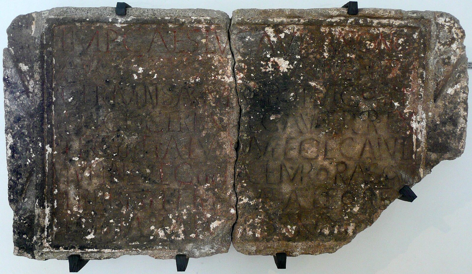
A building inscription records the work under Emperor Commodus, who ruled from 177 to 192, and names the military units and commanders involved. Commodus’s name was later removed as part of an official condemnation of his memory. A damaged dedication to Fortuna Redux, a form of the goddess associated with safe return from a journey or campaign, dates to 215. It may have commemorated a successful military action and has been tentatively linked to Emperor Caracalla’s campaign of 213, although that connection is uncertain.
Military use and abandonment
Böhming appears to have remained in use after the Alamannic attack of 233, which probably destroyed the fort at Pfünz. The Alamanni were a confederation of Germanic peoples who raided Roman territory. Böhming’s abandonment may have followed another incursion around 242 or 244; an alternative proposal places the end of the frontier in 254. The fort was certainly abandoned by 259 or 260, during a major attack that brought the mid-imperial frontier to an end. Its garrison may have burned the buildings before withdrawing.
Reuse and archaeological investigation
Stone from the Roman fort was reused in the first church at Böhming, consecrated at the same location around 1182. The site’s Roman character was recognized in the early nineteenth century. Archaeologist Friedrich Winkelmann undertook targeted excavations in 1898 and 1905. In 1959, another gate tower was identified on the southeast side, and a cremation cemetery came to light during work on a water main.
A large survey using magnetic measurements mapped structures inside the fort in 2007 without excavation. Since 2005, the fort and related frontier installations have been part of the UNESCO World Heritage Site of the Upper German-Raetian Limes. The area is also protected as an archaeological monument under Bavarian law.
Remains
Enclosure and landscape
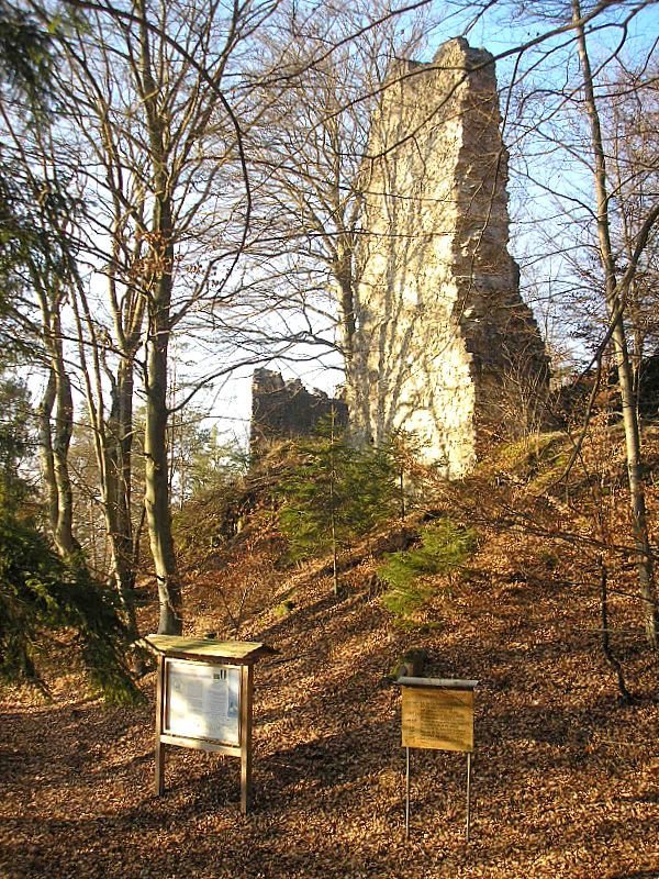
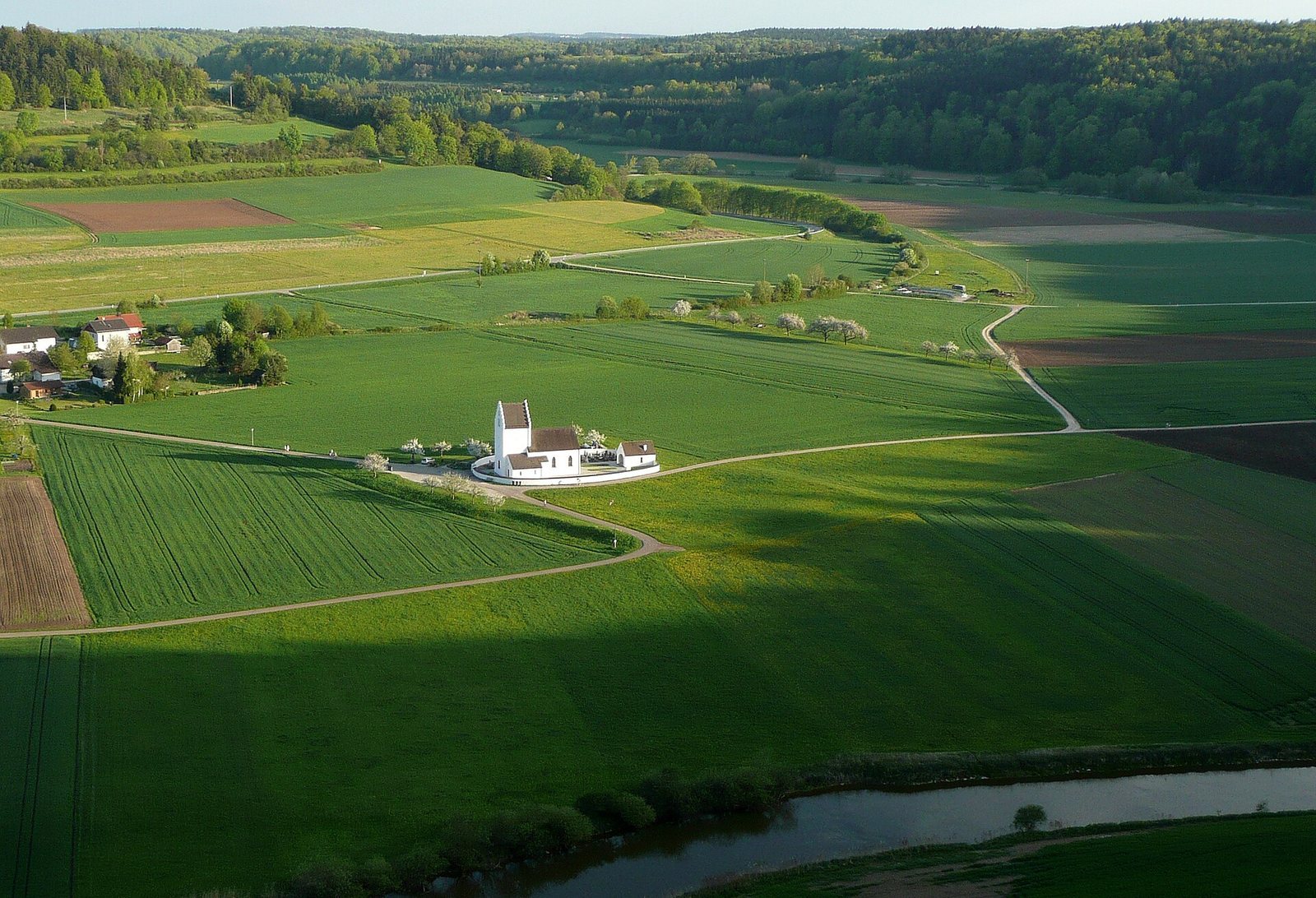
The fort forms a rectangular enclosure measuring 95 by 85 metres and covering 0.73 hectares. It is aligned southeast to northwest, with its main-gate front facing northwest. Its defenses combined stone structures with an outer earthwork, whose banks still rise about 1.5 metres above the surrounding ground. The unbuilt parts of the site are now used for agriculture.
The fort lies on the Kirchfeld, about 400 metres west of Böhming in the Altmühl valley and approximately 375 metres above sea level. The Altmühl flows around 200 metres away, while aerial photographs indicate that floodwater does not reach the fort. The Limes ran about 900 metres to the east across the wooded Pfahlbuck promontory, where steep rock faces formed part of the landscape. An ancient road connected the fort to the frontier and watchtowers Wp 14/74–78. Kipfenberg lies 2.5 kilometres away, the small fort at Hegelohe to the northwest, and Güßgraben to the east-southeast.
A double ditch with a V-shaped profile surrounded the fort. Openings 10 to 12 metres wide interrupted it at the southwest and northeast gates; wooden bridges crossed the ditches at the northwest main gate. Three two-lane gates are confirmed, each flanked by a pair of towers. A southeast rear gate is considered likely, supported by a tower excavated there in 1959. Two corner towers are confirmed, with two more considered possible. The building inscription refers to gates and four towers, although the number four may refer to gates instead. The 2007 survey also suggested a possible short ditch north of the southwest gate, a feature that remains unconfirmed.
Buildings within and around the fort
Headquarters
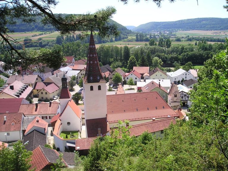
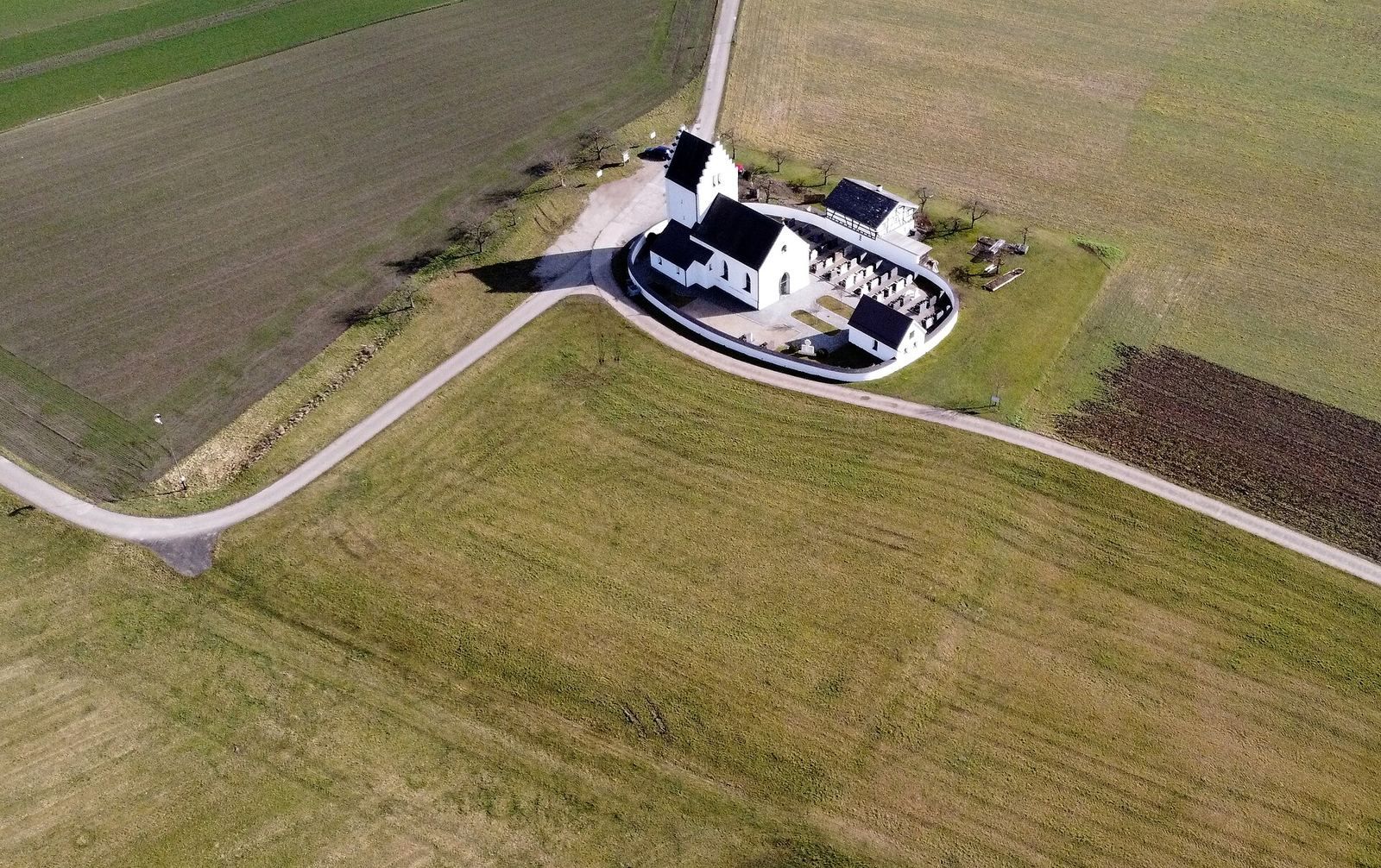
The headquarters building occupied the smaller southeast half of the fort. Excavations in 1898 exposed part of a transverse hall measuring 22 by 4.9 metres, with a room or corridor of equal length and 1.3 metres in width behind it. A low wall divided a four-metre stretch of that space. The building’s walls were about 0.9 metres thick, but only limited remains survived above their foundations. St John the Baptist’s church, its sexton’s house, a cemetery, and an outbuilding now partly cover the area, and the 2007 survey could not distinguish the previously excavated stonework.
Timber buildings and barracks
The front part of the fort was densely arranged around its main transverse road. Four timber buildings, each about 18 by 25 metres, stood on either side of the road. Their interiors are heavily disturbed, and their purpose is uncertain. Three timber barracks, approximately 6 to 8 metres wide and 35 metres long, are visible along the fort’s long sides between the corner and gate towers. A fourth barrack is possible but unconfirmed.
Bathhouse
The bathhouse stood about 100 metres from the southwest gate, beside the road leaving the fort. It measured 25 by 9 metres, with exterior walls about 0.9 metres thick. Its rooms followed a common plan for baths at forts along the Limes, placing cold, sweat, warm, and hot bathing spaces in a row. The purpose of some rooms remains uncertain. A small semicircular projection on the southeast side was probably added later: its masonry was not bonded to the main building, and it sat slightly off the adjoining room’s axis. A water basin may have occupied this raised space.
Rooms were heated by a hypocaust, a raised floor that carried hot air beneath it. In the hot bath, the central floor area had collapsed, while supports along the walls survived. These supports were 1.10 metres high and built from square bricks, with 20 bricks in each support; their base plates measured up to 0.24 metres across and their capstones up to 0.45 metres. The waterproof layer above was 0.20 metres thick. A vaulted opening, 0.40 metres high and 0.55 metres wide, linked the heating spaces beneath the hot and warm rooms. Supports in the warm bath stood 0.95 metres high and were made from 10 to 12 courses of limestone slabs.
The heating space beneath the rooms between the warm and cold baths, including the later projection, formed a single area with limestone supports 0.60 metres high. A wall 0.50 metres thick separated the rooms above the heated floor, and a surviving doorway linked the heating area to the warm bath. The larger room may have served as a passage, while a smaller northwest room may have been the sweat bath, warmed in part by heated basins. The furnace for the hot bath stood outside the building at its short end.
Nearby settlement building
A civilian settlement associated with the fort extended especially to the south and southwest. Between the fort and the bathhouse, excavators found a poorly preserved rectangular building measuring 4.6 by 5.2 metres. Its walls were 0.60 metres thick and survived to a height of up to 0.30 metres. It may have been a small temple. A damaged dedication to Fortuna Redux, dated to 215, was recovered there.
Burial ground and finds
Cremation cemetery
A cemetery lay about 200 metres southeast of the fort along the Roman road to Kipfenberg, and now extends beneath Böhming village. Its excavated burials date from the second and third centuries. Fifteen recovered graves had modest furnishings.
Inscription and bronze statuette
The complete sandstone building inscription was found in 1898 in front of the left-hand side gate. It had originally been fixed above the southwest gate and was later altered by removing Commodus’s name. The inscription and the torso of a cast-bronze statuette of Jupiter Tonans, meaning Jupiter the Thunderer, are now held at the Museum of Prehistory and Early History at Willibaldsburg in Eichstätt. Other finds from the site are held at the Roman and Bavarian Museum at Kipfenberg.
Pottery and military diploma
Pottery from the fire layer beneath the stone buildings includes fine Roman tableware of forms identified by the catalogue numbers 37 and 33. The first is generally dated to 150–230, and the second to 150–300. Two decorated fragments from Rheinzabern, attributed to the makers Belsus I and Comitialis V, complicate the dating because their production is generally placed after 175 or 180. An earlier start to their production has also been proposed.
A small military diploma fragment found in the fort area around 2010 or 2011 preserves nine letters from a witness list. Such diplomas recorded a soldier’s grant of privileges. This one appears to have been issued in Britain and is dated to 156–160, with 24 June 160 as the latest possible date. The names C. Belli(us) Urbanus and Tiberius Julius Felix help establish that range. The fragment may not have been connected with the fort and could have been brought there for its metal.
Frontier wall on Fuchsberg
In 2015, a 7-by-35-metre excavation on Fuchsberg examined a stretch of the Limes between Böhming and the small fort at Güßgraben. The trench crossed a ditch belonging to an earlier palisade and the later frontier wall, as well as pits where material had been extracted. These pits form a line along the frontier.
The wall’s construction adapted to the local ground. On a downhill section, builders used weathered local clay as binding material. On Fuchsberg, they laid a wall about 1.25 metres wide, made of two dry-stone faces, on local rock and Jurassic limestone slabs lying around 10 centimetres below the forest floor. At least the lowest courses that could be examined used a herringbone arrangement of masonry.