Castle of Vilar Maior: A Frontier Fortress in Portugal


Site at a Glance
- Rating
- 4.4
- Popularity
- Low
- Country
- Portugal
- Primary era
- Medieval
- External website
- Open
- Eras represented
- Classical, Medieval, Early Modern
- Civilizations
- Crown of Castile, Crusader, Kingdom of León, Knights Templar, Portuguese, Roman
- Site type
- Military
- Remains
- Castle
On this page13 sections
History
Castle of Vilar Maior is a mountain fortress in Portugal, occupying a site with prehistoric, Roman, Leonese, and Portuguese phases of occupation. Its medieval form combines Romanesque and Gothic elements and reflects the settlement’s strategic position on the frontier between Christian kingdoms and Muslim-ruled territory.
Prehistoric and Roman Occupation
Archaeological discoveries made in 1956 at Quinta da Formiga and Fraga included a sword, axes, geometric rock art, tiles, ceramics, coins, mosaics, and Roman pavement. These finds indicate occupation from the Neolithic and Late Bronze Age through the Roman period, and point to an earlier castro, a fortified settlement associated with prehistoric or pre-Roman communities in western Iberia, on or near the site.
Around AD 60, Roman forces conquered the Lusitanian fortification, then reconstructed and strengthened it. An earlier Muslim phase has also been proposed, although it remains an interpretation rather than an established period of the site’s history.
Leonese and Portuguese Frontier Rule
During the Christian Reconquista, the centuries-long expansion of Christian-ruled kingdoms across parts of the Iberian Peninsula formerly governed by Muslim powers, Vilar Maior occupied an important frontier position. Leonese forces captured it from Muslim rule in 1139, after which the castle was reconstructed. The medieval foundation or rebuilding has also been attributed to Alfonso IX of León, who ruled from 1188 to 1230, while another tradition connects the work with the wider expansion of the Leonese kingdom.
Vilar Maior later became associated with the Order of São João do Pereiro, a medieval military-religious order involved in the defense and settlement of Iberian frontier territories. A Latin document of 1227 provides the first recorded reference to both Vilar Maior and the settlement’s name.
Control changed between Leonese and Portuguese forces in 1230. A foral, or settlement charter defining local rights, duties, administration, and incentives for colonization, was issued in 1232. Its attribution, along with the precise sequence of later annulment and rebuilding, remains uncertain. In the second half of the thirteenth century, Alfonso X of Castile issued another settlement charter. An inscription indicates that the town’s perimeter wall, or at least the section ending at Rua do Arco, had been completed by 1280.
The introduction of cannon artillery reduced the defensive value of the site’s natural position. In 1296, forces loyal to King Dinis of Portugal captured the castle from its Leonese commander, Sancho Peres de Ledesma. Dinis granted Vilar Maior a charter in November of that year, and the keep, or at least its principal construction phase, is attributed to him with assistance from the Knights Templar, a medieval military-religious order involved in frontier defense and the administration of fortified territories.
The Treaty of Alcañices incorporated the territory definitively into the Portuguese kingdom in 1297. Further interventions followed under King Fernando between 1367 and 1383, and additional work was begun by King John I in 1398. These late-medieval changes helped create the couto of homiziados, a privileged settlement intended to attract inhabitants through legal protection or exemptions. Vilar Maior had approximately 1,000 inhabitants by 1440.
Charters, Decline, and Modern History
King Manuel I renewed the town charter in 1510 and ordered further work at the castle. Around 1509, the military draughtsman Duarte d’Armas depicted the settlement and its defenses in the Livro das Fortalezas, an early-sixteenth-century record of Portuguese castles. On 16 May 1516, the judges of Vilar Maior and Ciudad Rodrigo formally demarcated the frontier between Portugal and Spain.
By the seventeenth century, the castle no longer held the same defensive importance. Its defenses were reconfigured in relation to those of the neighboring castles of Almeida and Penamacor. On 27 January 1653, Fernando Teles de Meneses Silva was created Count of Vilar Maior. He later became Marquis of Penalva and Alegrete and commander of the Order of Malta, the later Catholic military order descended from the medieval Hospitallers.
The castle was unaffected by the Lisbon earthquake of 1755. In the 1758 parish inquiries, however, it was described as enclosed but offering little defense because it had become ruinous. The reports also described its three watchtowers, tiled and timber elements, buildings, water supply, and two-level tower as being in poor condition. The local alcalde, a municipal administrative or judicial official, was Joaquim José Nobre de Miranda.
During the French invasions of the Iberian Peninsula, the settlement was invaded and pillaged and may also have been burned. It suffered further consequences during the Liberal-Miguelist conflicts of 1834 to 1853, the Portuguese civil struggles between constitutional liberals and supporters of Miguel’s absolutist claim. Vilar Maior lost its municipal status on 24 October 1855 and was incorporated into the municipality of Sabugal.
The settlement’s population and housing changed considerably over the following centuries. It had 234 residents in 1496, 60 dwellings and 422 inhabitants in 1527, 160 dwellings and more than 679 inhabitants in 1864, 199 dwellings and 742 residents in 1890, and 267 dwellings and 745 inhabitants in 1940. In the twentieth century, the former communal kiln or earthen stove was restored and converted into a tourist post and handicrafts shop. The Portuguese Republic owns the castle, while operational responsibility was ceded to the Municipality of Sabugal on 28 July 1941. The castle was classified as an Immovable Property of Public Interest in 1996 under Decree 2/96.
Remains
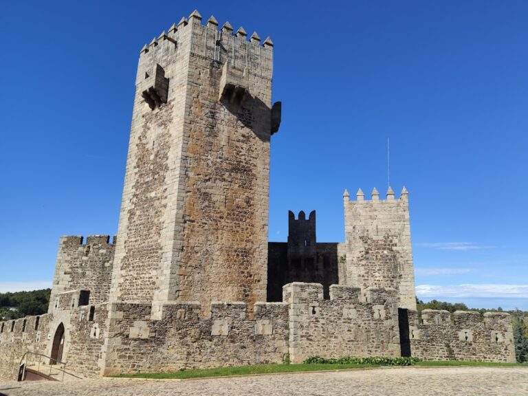
The castle occupies a cliff-top plateau at the edge of the settlement above the valley of the River Cesarão. Rocky river cliffs protect it to the east, steep slopes protect it to the west, and the elevated position provides a view toward the Castle of Guarda. Built principally of granite, the fortress has an irregular oval enclosure with walls and a wall-walk, a passage along the top of a fortification used by defenders. Its defenses were organized historically in two principal lines, with evidence of a third line near the town.
Castle Enclosure
Main Southeastern Entrance
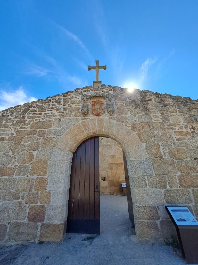
The principal entrance on the southeastern side has a pointed arch and a broken barrel vault. Monumental hinges survive in the opening, while the original defensive design included a barbican, an outer work protecting the gate and strengthening the approach.
Northwestern Entrance
A smaller entrance opens on the northwestern side. Its exterior has a broken arch, while the interior has a full arch and a broken barrel vault. Stone hinges remain at the gateway, preserving evidence of its former doors and defensive operation.
Perimeter Walls
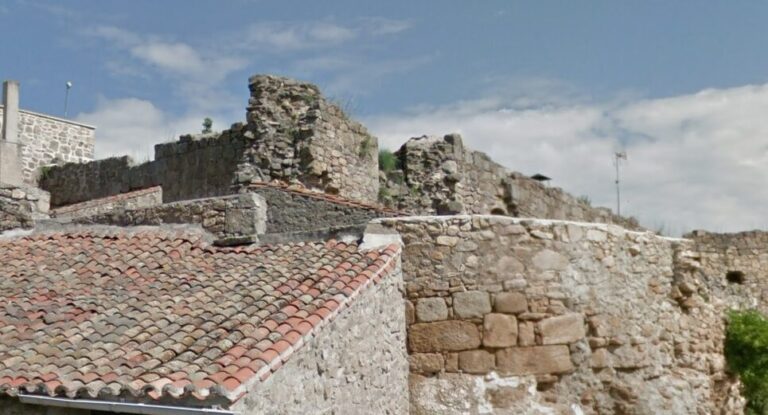
Sections of the town’s perimeter wall survive near the staircase by the former municipal building, along Rua da Costa and Rua do Castelo, within the Museum of Vilar Maior, and on the stairs leading to the old town hall. Much of the town wall was destroyed when the cemetery walls were built. Remnants of a third defensive enclosure remain near the stairs leading to the former hall and in other areas associated with the old town walls.
The wall at the gate of Rua do Arco preserves an inscription commemorating the completion of the wall or part of its perimeter. The castle’s parade ground formerly contained additional buildings, although little of their visible fabric survives.
Keep and Defensive Features
Rectangular Keep
The rectangular keep stands almost against the outer wall and rises approximately 35 metres. It has three internal levels, no roof, and an elevated pointed-arch entrance reached from within the wall at wall-walk level. Most of its stones bear Templar abbreviations, and the principal facade carries the royal five-shield coat of arms.
The keep’s interior is almost entirely destroyed. Surviving elements include stairways on the northern and eastern sides and corbels, projecting blocks that supported floors or paving. The northern facade has straight arrow slits on each level. The eastern facade contains successive lines of embrasures, openings through which weapons could be operated, including openings framed by projecting rectangular stonework and a half-round frame. An embrasure survives on the third level of the southern facade. On the western side, a first floor is almost attached to the wall, while a second-floor door has a pointed arch.
Upper Defense and Cistern
The keep’s battlements have a rounded profile. It was historically surrounded by scaffolding or a timber fighting platform that protected archers and allowed vertical volleys comparable to machicolations, projecting defensive structures with openings for directing fire downward. In the courtyard, a circular cistern is described as approximately 35 metres across and has no covering.
Surrounding Archaeological Features
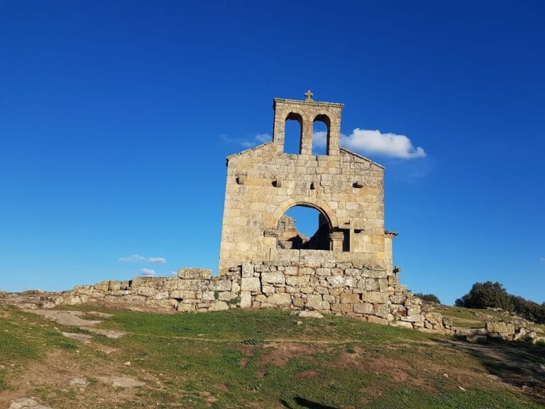
The area around the castle includes the ruins of the Church of Nossa Senhora do Castelo and anthropomorphic tombs at Correia, near the cemetery. Together with the surviving enclosure walls and the archaeological material recovered at Quinta da Formiga and Fraga, these features place the fortress within a wider landscape of settlement, burial, and religious remains.
Nearby sites