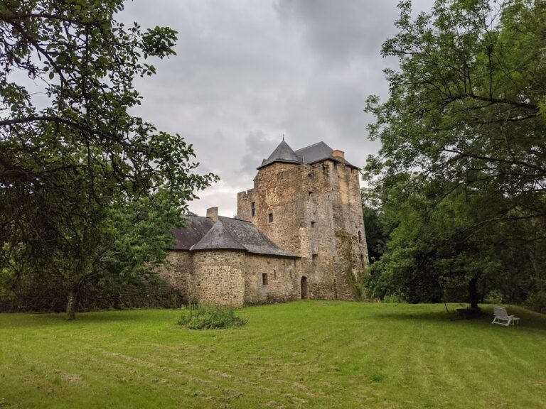
Castle of Pouancé: A Medieval Frontier Fortress in France
Site at a Glance
- Rating
- 4.1
- Popularity
- Low
- Country
- France
- Primary era
- Medieval
- External website
- Open
- Eras represented
- Medieval
- Civilizations
- French
- Site type
- Military
- Remains
- Castle
On this page20 sections
History
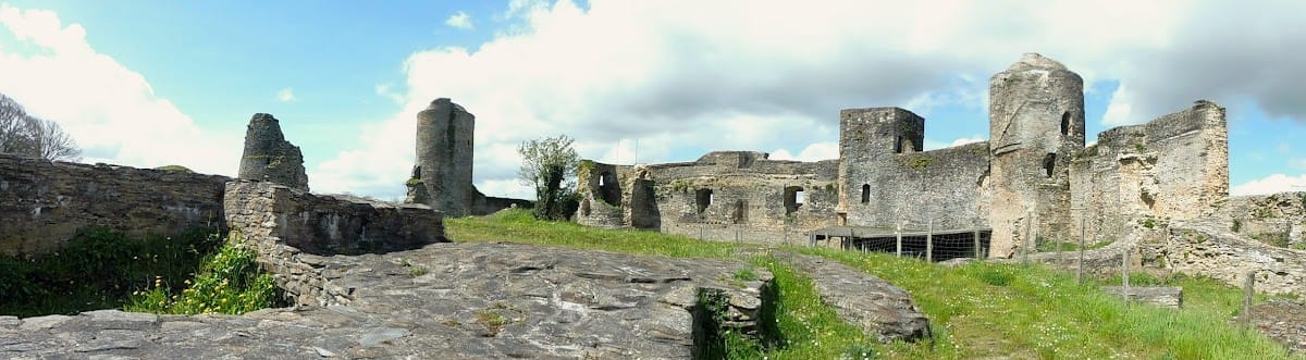
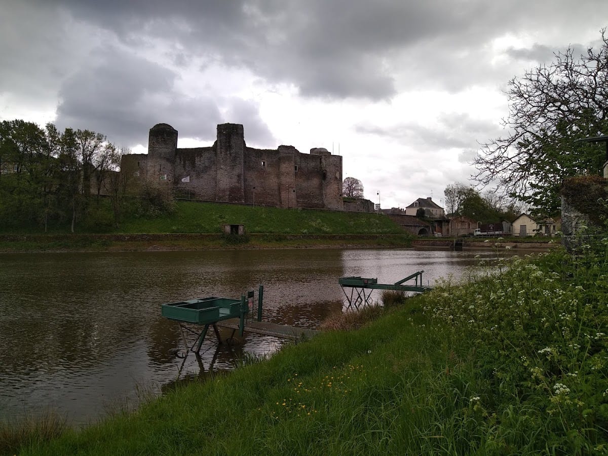
The Castle of Pouancé is a medieval fortress in Pouancé, France, built and expanded on the western edge of the former province of Anjou. Fortification was established there by at least the eleventh century, while the present castle began to take shape in the thirteenth century. Facing Brittany, it formed part of the Marches of Brittany, a militarized frontier where castles served as both defensive strongholds and centers of lordship. Together with surviving sections of the town walls, the fortress occupies approximately three hectares and was intended to protect the Angevin frontier from the Breton stronghold of Châteaubriant.
Early fortification and the lordship
The first written mention of the castle dates from 1049 to 1060. At that time, the count of Anjou maintained troops there and was represented by Landri, a vicarius, or official acting for a higher authority. Settlement in the area began earlier than the castle. Fragments of early medieval sarcophagi incorporated into the walls of Saint-Aubin church point to habitation before the fortress was built.
The identity of the first builder remains uncertain. Alain Racineux attributed the construction to Manguinoë, considered the first lord of Pouancé, between 990 and 1037. Jean-Louis Ormilières instead suggested that Fulk Nerra may have built the original stronghold. After Landri’s death, Pouancé passed to Hervé de Martigné, who had been closely associated with him and was a vassal of the count of Rennes. Hervé also controlled the nearby territory of Lourzais.
In 1066, Conan II, duke of Brittany, besieged and captured Pouancé. Hervé died around 1084 and was succeeded by his son Gautier Hay. Around 1130, Gautier’s heir Emma married William I of La Guerche, uniting the lordships of Martigné-Pouancé and La Guerche. Their family connections placed Pouancé within a wider network of territories extending across the Angevin and Breton borderlands.
Expansion of the medieval fortress
The lords of Pouancé became involved in struggles with the Plantagenets, the dynasty that ruled England and held extensive territories in France. Around 1172, Geoffroy I, the grandson of Emma and William, joined a rebellion against Henry II. After the Breton rebels were defeated at Dol-de-Bretagne and their castles were destroyed, Geoffroy took refuge in the surrounding forests. His son allied with Breton lords in 1196 and took part in their victory at Carhaix over the seneschal of Anjou’s army.
At the beginning of the thirteenth century, Pouancé was the political center of a large lordship that included Pouancé, Martigné, La Guerche, and Segré. The first towers and enclosing walls of the present fortress were probably raised during this period. William III, lord of Pouancé, also created a dam on the Verzée, forming the Pouancé pond and strengthening the western side of the site, which was particularly exposed.
The lordship passed through the Beaumont and Valois-Alençon families during the thirteenth and fourteenth centuries. After Geoffroy III died in 1263, his daughter Jeanne inherited Pouancé and married Jean de Beaumont. Their grandson, Jean II de Beaumont, had a son named Louis, who died at the Battle of Cocherel in 1364. Marie Chamaillard, the granddaughter of Jean II’s first wife, Isabeau d’Harcourt, then recovered Pouancé and added it to the territories held by her husband, Pierre de Valois, a close associate of Charles V of France.
Between 1371 and 1379, Pierre II de Valois, also known as Pierre II d’Alençon, commissioned a substantial tower, probably the present Grosse Tour, and added machicolations, projecting defensive galleries or openings used to attack enemies below. Other thirteenth-century towers, including the Saint-Antoine Tower, were altered during the fourteenth century. Spiral staircases were inserted, and the Grand Logis and the structure traditionally identified as an ice house probably date from the fourteenth or fifteenth century.
Sieges and the Franco-Breton frontier
A Breton army under John IV, duke of Brittany, besieged Pouancé in 1379. The fortress may have been captured through treachery. Pierre exchanged Pouancé and La Guerche with Bertrand du Guesclin for lands in Normandy. John IV placed the fortress in the hands of Olivier du Guesclin in 1381, but Olivier sold it in 1390. Through the marriage of John I of Alençon and Marie of Brittany, Pouancé and La Guerche later entered the Alençon family as Marie’s dowry.
In 1432, Jean II of Alençon imprisoned Jean de Malestroit, bishop of Nantes and chancellor of Brittany, to pressure John V, duke of Brittany, to pay the remaining part of his mother’s dowry. John V responded with a five-week siege beginning in January. More than 6,000 Breton and English troops employed seven cannons against the fortress. Jean II negotiated, and the siege ended around 19 February.
An English army led by John Beaufort, duke of Somerset, besieged Pouancé again in 1443. Jean II of Alençon and allied lords, including Louis du Bueil and André de Lohéac, attempted to attack before English reinforcements arrived. They were surprised at night by an English force. The fortress and town resisted, but the suburbs and urban industries were devastated. The English withdrew after two or three weeks.
In 1467, Jean II of Alençon plotted with Francis II, duke of Brittany, against Louis XI of France. Breton forces then besieged Pouancé, which was defended for the French king by the lord of Villiers without Jean II’s approval. The fortress fell after three days, and the town and castle were pillaged and burned. A French counterattack expelled the Bretons in July 1468.
After 1468, Pouancé became an important base in the French defensive and offensive system against Brittany. Louis XI stayed there in 1472 with more than 5,000 men when Breton forces were reportedly gathering near La Guerche. In 1488, Louis de la Trémoille assembled 12,000 men at Pouancé before besieging Châteaubriant. This campaign contributed to Brittany’s annexation by the French kingdom.
The defensive rebuilding of the second half of the fifteenth century probably included the Heptagonal Tower, the moineaux, the caponnière, the bastion, and the beaked tower in the baileys. A bailey is an enclosed court within a castle. A moineau is a fortified structure projecting into or protecting a moat, while a caponnière is a covered defensive work protecting a ditch or approach. These additions reflected the increasing militarization of the fortresses along the Marches of Brittany during the conflict between France and Brittany.
Religious wars and decline
In 1562, the lordship passed to the Cossé-Brissac family, particularly Charles II de Cossé. A fervent Catholic, he joined the Catholic League in 1590. This alliance of militant Catholic forces opposed Henry IV during the French Wars of Religion. Around fifty soldiers serving the duke of Mayenne occupied the town and castle in 1593, despite an attempted policy of neutrality. After Mayenne reconciled with Henry IV in 1596, the duke of Mercœur continued the war. In September 1597, Chanjus, captain and commander of Pouancé Castle, surrendered it to Mercœur, who probably installed a garrison. Mercœur submitted in March 1598, bringing the eighth French War of Religion to an end.
The castle had long ceased to function regularly as a seigneurial residence, and the Cossé-Brissac family visited only rarely. Some rooms remained habitable during the seventeenth and eighteenth centuries. A gardener lived there in 1620, a lieutenant of the bailliage died there in 1671, and an officer occupied part of the complex between 1756 and 1767. A room in the lower part of the castle was used for tax collection at the beginning of the seventeenth century. François de Cossé died at Pouancé in 1651, and his body was temporarily displayed in the castle.
From 1541, sections of the old walls were breached and abandoned. During the second half of the eighteenth century, residents probably demolished the entrance gatehouse, filled the moats, and built houses and workshops inside the high court against the enclosing walls. The castle then entered a prolonged period of abandonment and deterioration. Where residents owned sections of the walls, they were also permitted to dismantle them for building stone.
Collapse, preservation, and archaeological work
A Catholic private school was built between the bastion and the northern postern in 1911, requiring the destruction of the upper part of the northern wall. In 1915, the Mill Tower and part of the curtain wall collapsed, creating a major breach. The remaining residents were evacuated in 1929 after a survey identified the risk of further collapse, and the abandoned houses in the high court were demolished in 1934. The upper part of the Criminal Tower collapsed in 1936 while the tops of the towers and walls were being cemented to limit deterioration.
The castle has been protected as a monument historique since 7 July 1926. A survey carried out in 1929 preserved a record of the ruins. Louis Bessière began campaigning for preservation in 1960, and his first “Bois-Dormant” youth work operation took place in 1964. About 200 young people cleared vegetation and debris, with annual operations continuing until 1974. Bessière acquired the castle in 1976 and arranged restoration work in 1977 and 1978. After his death in October 1978, he left the castle to the commune.
The C.H.A.M. association, founded at Pouancé in 1981, carried out excavations, renovation, and presentation work. Consolidation and safeguarding begun around 1980 did not prevent further collapses in 1982 and 1995. Between 1992 and 1994, archaeological work cleared sections of the moats, exposed supports for the entrance bridge and the southern gatehouse tower, examined the northern tower, revealed the northern moineau, and identified postholes inside the court. C.H.A.M.’s final season took place in 1996, after which the Compagnons Bâtisseurs de Bretagne continued volunteer renovation projects.
More than four decades of intermittent excavation and restoration have improved understanding of the site, although a comprehensive archaeological study has not yet been completed. Research during the 2010s, including a thesis and building studies connected with consolidation work, further clarified the surviving structures. In 2010, a scientific committee placed Pouancé and its castle among 21 communes considered for a possible UNESCO World Heritage nomination concerning the Marches of Brittany. The commune now owns the castle, whose current functions include tourism and archaeological interpretation.
Remains
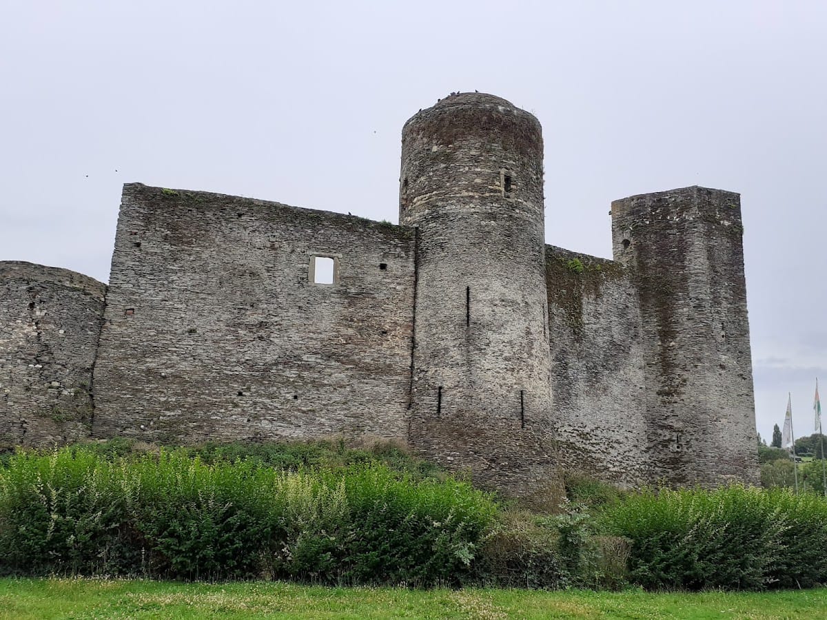
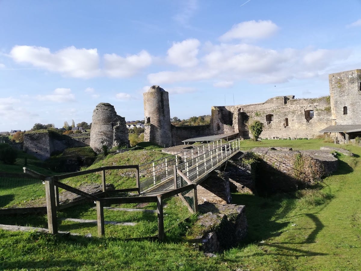
The castle stands on a natural shale promontory overlooking the Saint-Aubin pond to the west and the Verzée River. Its oval enclosing wall contains six cylindrical towers and three accesses. Dry moats divide the fortress into a high court and a low court, while the village developed behind it on the plateau. Shale rubble and granite are the principal building materials. The castle and the surviving urban enclosure together cover approximately three hectares.
Courts, entrances, and moats
Gate Tower
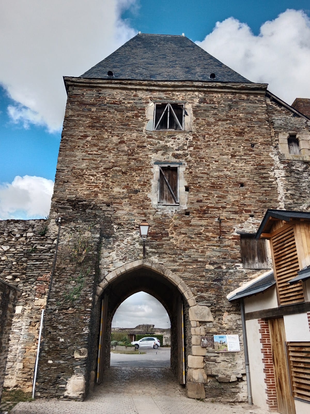
The fifteenth-century Gate Tower provided the only known passage from the town into the low court. It contains a carriage entrance and a pedestrian entrance, the latter blocked on the town side. Both passages have pointed barrel vaults. In the seventeenth century, the northern side was enlarged and its two floors and attic were converted into lodgings with windows, removing much of the tower’s defensive character. A stone hinge reinforced with iron survives at the entrance. Traces of portcullises and a drawbridge were noted in 1878, although they are no longer discernible.
High-court gatehouse and bridge
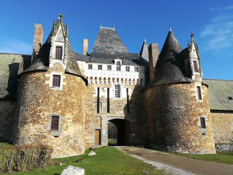
The entrance to the high court was controlled by a gatehouse formed by two U-shaped towers founded directly on the shale bedrock. Their interiors are extremely narrow, measuring no more than approximately 3.5 metres on a side. Each tower had a small circular annex, probably for a spiral staircase. The bridge between the two courts developed through several phases. In the thirteenth century, it rested on three support piers and may have included a drawbridge operated from the gatehouse. During the fifteenth century, the first pier on the low-court side became an abutment. The first pier on the high-court side was later converted in the same way, indicating that the drawbridge was eventually abandoned.
Moats and posterns
The dry moats separating the courts were probably cut into a natural fault in the rock and later modified. They were completely filled during the nineteenth and early twentieth centuries and used as a communal dump. The northern and southern posterns opened from the enclosing wall into the moats. A third postern at the foot of the Grosse Tour led into the caponnière.
The northern postern is a simple pedestrian passage with a door fitted with stone hinges and a securing bar. It opens directly into the moat and was blocked from the interior in the fifteenth century when the northern moineau was built. The southern postern is better preserved. Constructed from red shale with a granite arch, it was defended by a portcullis operated from a room above the passage and by a double-leaved door. Hinges and sockets for the closing bar remain visible. A spiral staircase connected the portcullis room to the wall walk, while a bridge and straight staircase linked it with the firing rooms of the southern moineau.
Towers and artillery defenses
Dame Blanche and Criminal Towers
The Dame Blanche Postern lies in the curtain wall between the Grosse Tour and the Dame Blanche Tower, at the foot of the Grosse Tour. Probably contemporary with that tower in the fourteenth century, it retains the guide for its portcullis. The mechanism was operated from a room reached through the ground floor of the Grosse Tour. Rounded corbels above the outer entrance indicate former machicolations.
The Dame Blanche Tower probably dates from the thirteenth century or possibly the late twelfth century. It has no firing openings and contains no internal arrangements apart from a spiral staircase running from one floor to the top. Its original covered dome survives and was cemented at the end of the twentieth century to prevent water infiltration and further deterioration. The Criminal Tower probably belongs to the same period and was built on a similar model. It collapsed in 1936 and probably had a stone-vaulted floor pierced at the center.
Mill and Saint-Antoine Towers
The Mill Tower probably dates from the thirteenth century. Its upper section collapsed in 1915 together with part of the curtain wall. The Saint-Antoine Tower also probably dates from the thirteenth century and was altered in the fourteenth century to include a spiral staircase. Three levels survive, along with a masonry-covered dome and five arrow slits arranged in a staggered pattern over two levels. Traces of an earlier roof remain visible in the exterior masonry.
Heptagonal and Grosse Towers
The Heptagonal Tower probably dates from the fifteenth century and may have been built over an earlier tower. Its base contains a lower room called the Couleuvrines Room, with three openings for gunpowder artillery. Above it are four levels, a ground floor and three upper floors, served by a spiral staircase made of shale and tuffeau. Four further firing openings are set within the tower.
The Grosse Tour probably dates from the fourteenth century and has been reduced in height. It contains a ground floor and two upper floors, where remains of a fireplace and a latrine survive. Its plan is circular at ground level but becomes heptagonal from the first floor upward. The Dame Blanche Postern and the adjoining caponnière are connected to this tower.
Bastion, moineaux, and caponnière
The low court contains the remains of a bastion with walls approximately 2.3 metres thick. It probably had three levels: a blind room, a ground floor with three firing openings, and an upper floor, now reduced, with at least one firing opening. A spiral staircase served the defensive rooms and the wall walk.
Two moineaux protected the northern and southern ends of the moats. The northern moineau, fully cleared in 1994, rests against the northern postern. It has two firing openings for light artillery and a vent for the smoke and gases produced by firing. The southern moineau has three levels. Its lower pointed-vaulted room, beneath the southern postern, has one firing opening. A room above contains two more openings and a smoke vent. Two additional openings lie along the corridor connecting these rooms with the portcullis room of the southern postern, giving the structure five firing openings in total. Much of the southern moineau remains buried beneath the filled moat.
The caponnière adjoins the Grosse Tour and contained at least three defensive levels, although its upper part has been reduced. The lower room has two firing openings, while the middle level contains a double gun loop and a loophole. A fifth opening lies along the staircase leading to the lost upper level. Together, these arrangements created a bent approach to the Dame Blanche Postern. The doorway incorporates reused material, including fragments of red-granite quatrefoil openings similar to those found during clearance work in the 1960s.
Residential and underground structures
Grand Logis
Excavations in 1991 exposed the seigneurial residence, or Grand Logis. The rectangular building measures approximately 24 by 8 metres and had one floor. Marks where the roof slopes were anchored remain on the curtain wall. Inside are the remains of a central fireplace, several window seats, and a surviving floor paved with glazed terracotta tiles arranged in a staggered pattern. The upper level retains two external openings framed in granite and a spiral staircase leading to the wall walk.
Underground room
Beneath the Grand Logis is a completely windowless underground room traditionally identified as an ice house. It has a pointed barrel vault and is reached through a vaulted corridor approximately 13 metres long. The room measures about 20 metres in length and 4 metres in width. Its floor is cut into the shale, and a channel around the room collected infiltration water. Impressions of the original wooden formwork remain in the mortar.
Archaeological finds
Clearance operations during the 1960s exposed door and window frames, shouldered or accoladed lintels, and remains of spiral staircases. More than twenty artillery balls made of shale or granite were also found, weighing up to 70 kilograms. The work revealed a series of probably fifteenth-century quatrefoil openings in red granite and a silver coin of Aquitaine dated between 1468 and 1474. These finds add material evidence to the fortress’s changing residential and artillery defenses.
Nearby sites