Castle of Mértola: A Historic Fortress in Portugal


Site at a Glance
- Rating
- 4.5
- Popularity
- Medium
- Country
- Portugal
- Primary era
- Medieval
- External website
- Open
- Eras represented
- Medieval
- Civilizations
- Almohad, Crusader, Order of Santiago, Portuguese, Taifa Kingdoms, Taifa of Mértola
- Site type
- Military
- Remains
- Castle
On this page13 sections
History
The Castle of Mértola is a historic fortress in Mértola, Portugal, founded by Phoenicians in 318 BC during the period of Alexander the Great’s invasion and sack of Tyre. The settlement was known as Myrtilis, or “New Tyre,” and its position on river and land routes helped it develop as a trading centre for Phoenicians and Carthaginians.
From Phoenician foundation to Roman rule
Under Roman rule, the settlement became a regional centre for mineral extraction and agriculture in the Baixo Alentejo. In 44 BC, Julius Caesar renamed it Myrtilis Julia. A chronicle by the Swabian bishop Idácio records an episode dated to AD 440 and indicates that the fortified settlement was occupied by Swabians and Visigoths, Germanic peoples who established kingdoms in the Iberian Peninsula as Roman authority weakened.
Islamic reconstruction and fortification
The settlement was destroyed and sacked before Muslim Umayyad rulers reconstructed it. Its name was shortened from Myrtilis to Martula. Defensive work at the castle probably took place during the rule of Ibn Qasi, governor of the Taifa of Mértola from 1144 to 1151. A taifa was an independent Muslim principality, characteristic of the period when Islamic Iberia was politically divided.
A ribat, an Islamic religious and military establishment often associated with frontier defence, was built in the mid-twelfth century on the southern dungeon tower. During the last third of that century, the Almohad dynasty repaired the site, built walls around the settlement, and constructed or rebuilt parts of the castle complex, including the semi-cylindrical tower. In 1171, Abu Háfece, the Emir’s brother, ordered repairs and improvements to the fortress tower.
Portuguese conquest and the Military Order of Santiago
In 1238, during the Reconquista, Mértola was conquered by Sancho II of Portugal, ending centuries of Islamic rule. The Reconquista was the centuries-long Christian conquest of territories governed by Muslim powers in the Iberian Peninsula.
Between 1240–1245 and 1316, Mértola served as the seat of the Military Order of Santiago, a Christian military-religious order founded to defend and expand Christian territories in Iberia. In 1254, D. Paio Peres Correia, a leading military figure and master of the order, issued the region’s first foral, a charter defining a town’s rights, obligations, and administrative privileges.
João Fernandes, master of the order, ordered the construction of the keep in 1292. His role was recorded in an inscription above the entrance. During the final decade of the thirteenth century or the beginning of the fourteenth, the dungeons were rebuilt using the older gate and Carocha Tower. Further improvements to the dungeons and walls were completed in 1373.
Royal control and declining military importance
After the Treaty of Monção in 1386, the military territories of Mértola, Noudar, Castelo Mendo, and Castelo Melhor returned to the Portuguese Crown in exchange for Olivença and Tui. Additional improvements to the fortifications followed in 1404.
At the end of the fifteenth century, an alcalde’s residence was built against the keep. An alcalde was a local municipal or judicial official in the Iberian Peninsula. The residence led to the demolition of much of the northwestern battlements, while work on the dungeons and walls continued on a reduced scale.
On 25 February 1510, Nuno Velho, a Portuguese royal official, wrote to the king about the condition of the fortifications. In 1512, King Manuel issued a royal foral, and Duarte de Armas depicted the castle in the Book of Fortresses. A royal letter dated 15 October 1513 ordered the payment of 94,260 reis to Francisco de Anzinho for lime supplied for work on the castle.
Until the eighteenth century, the castle formed part of Portugal’s first defensive line along the Spanish frontier. Its military importance gradually declined, and the fortress was eventually abandoned. The town and castle also lost importance during Portugal’s era of maritime expansion and colonization. By 1758, the site was semi-ruined and without a garrison.
Modern preservation and interpretation
From the nineteenth into the twentieth century, Mértola’s economy depended on the Santo Domingo mines, a major centre of cupric-pyrite extraction. The castle was classified as an Imóvel de Interesse Público, or Property of Public Interest, by Decree 32/973 on 18 August 1943. An earthquake on 2 February 1969 damaged the old fortress.
The adjacent grounds had been ceded to the Municipality of Mértola on 18 January 1941, while the property remained owned by the Portuguese Republic. On 1 June 1992, its administration passed to the Portuguese Institute for Architectural Patrimony under Decree-Law 106F/92. A twentieth-century revitalization project transformed the site into a village museum, with areas devoted to the castle’s history and an interpretive centre in the keep. Its collections include Roman, Visigothic, Christian, and Islamic material, including Portuguese Islamic art.
Remains
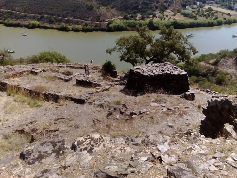
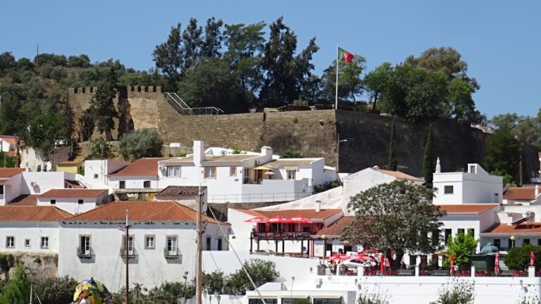
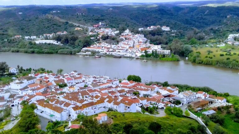
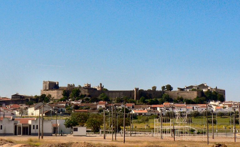
The castle occupies an urban hilltop in a rocky landscape divided by the Guadiana River and the Ribeira de Oeiras. It has an irregular rectangular plan, with a keep at the northern angle and a network of towers, walls, gates, and interior features. The documented construction materials include stone masonry, tile, cornerstones, and taipa, an earthen building material.
Castle towers and interior structures
The keep
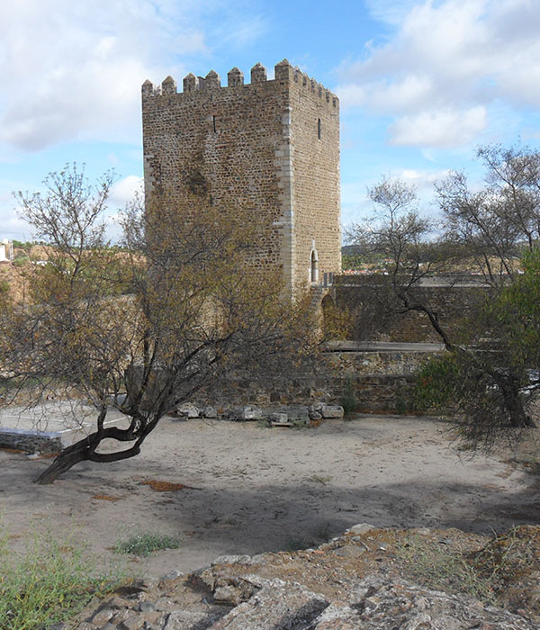
The rectangular keep rises 30 metres and has a slightly battered base, meaning that its lower walls slope outward. It contains two floors, and its entrance opens onto a staircase attached to the southeastern walls. Along the northwest side are several friezes, while the upper parts include machicolations, projecting openings through which defenders could attack people below, together with parapets, prismatic merlons, and pyramid-shaped decoration.
The first floor contains an arms hall covered by a ribbed vault. A staircase along the southern wall leads to the second floor. Beside the keep is a sculpted white-marble relief bearing the coat of arms of António Rodrigues Bravo, the town’s senior postal official.
The Carocha Tower
The Carocha Tower stands in the southwest of the fortress as a cubic structure 4.7 metres wide. It is accessible from the battlements and is covered by a terrace interrupted by a door and a window. Inside, a hemispherical cupola rests on pedestals.
The principal gate and corner towers
Two corner towers flank the principal gate. They have different forms: the left tower is prismatic and the right is semicircular. Neither rises above the level of the battlements. The northwest wall contains the Traitors’ Gate, positioned after the keep and protected by a barbican, an outer defensive work protecting an entrance.
The courtyard cistern
Within the courtyard, a covered cistern has a vaulted roof supported by three arches. Its position inside the fortified complex forms part of the castle’s internal infrastructure.
Walls and settlement enclosure
The walls surrounding the settlement remain identifiable as a sub-rectangular enclosure extending along a north–south axis. Rectangular towers reinforce the circuit, including a substantial northern section. Most of the surviving wall line extends southward from the Carocha Tower, with part of it oriented along the Guadiana. The southwest side is strengthened by a tower with large buttresses supporting several battlements.
Of the former gates, the Misericórdia Gate survives and provides access to the river. The nearby former Islamic mosque was converted into the Church of Nossa Senhora da Assunção, adding another surviving element to the historic setting around the fortress.