Castilviejo de Guijosa: A Celtiberian Hillfort in Spain

Site at a Glance
- Rating
- 4.2
- Popularity
- Low
- Country
- Spain
- Primary era
- Iron Age
- External website
- Open
- Eras represented
- Iron Age
- Civilizations
- Celtiberian
- Site type
- Military
- Remains
- Fortified Town
On this page9 sections
History
A hillfort shaped by its landscape
Castilviejo de Guijosa is a Celtiberian hillfort in Spain, near the villages of Cubillas del Pinar and Guijosa in the municipality of Sigüenza. Built in the fourth century BC, it remained in use during Antiquity. The boundary between the two villages crosses the summit, where the settlement occupies a naturally defensible hilltop.
The hillfort overlooked agricultural land extending toward the Henares River and, more particularly, the highland grazing grounds rising above 1,200 metres. These pastures were an important regional resource and probably influenced the choice of location. A traditional livestock-driving route still passes nearby as a branch of the Royal Soriana route, which followed the Henares valley toward the province of Soria and the pastures around Morón de Almazán and Maján. Other routes continued toward the Duero valley near Almazán or toward the Ebro valley through Torralba and Medinaceli and along the Jalón valley.
The Celtiberian Wars and later investigation
The routes crossing from the southern plateau over the Central System toward the Iberian System gave the settlement strategic value. During the Celtiberian Wars, a series of conflicts between Rome and Celtiberian communities during Rome’s expansion in Hispania, the hillfort probably helped watch these lines of movement.
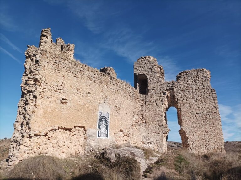
Castilviejo de Guijosa is now recorded as an archaeological site, and archaeological excavation has taken place there. The surviving remains preserve evidence of a fortified settlement whose defenses were closely adapted to the cliffs, slopes, and approaches of the summit.
Remains
Summit enclosure and defenses
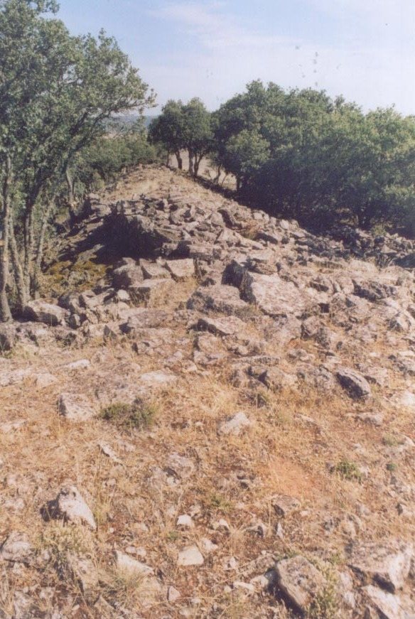
The hill is formed of Triassic limestone and rises from approximately 1,090 metres to about 1,150 metres. The remains occupy a small summit platform. The enclosure has an approximately triangular, isosceles plan and covers about 3,000 square metres. Cliffs and steep natural slopes protect two sides, while a wall closes the more vulnerable base of the triangle.
Perimeter walls
The base wall runs north to south for about 90 metres. Along the western perimeter, the wall follows a bent or angled plan divided into five sections, each measuring roughly 7 to 25 metres in length. Its average thickness is about 2 metres. Construction used two rows of better-worked stones, particularly on the outer face, with the space between them filled with generally large stones of varying sizes. The wall stands on a raised area that may have been artificial and is accompanied by a small ditch. These features may have increased the apparent height of the defenses, some sections of which still reach about 1.20 metres.
Entrance and approach obstacles
The entrance lies in the northern section of the enclosure. It had no special protective structure and was shielded on its northern side by a cliff. The most vulnerable approach was guarded by two regularly arranged fields of upright stones, defensive obstacles intended to impede horses, wheeled vehicles, and attackers on foot. Both groups ended at the cliff edge, leaving a passage approximately 4 metres wide. Approaching horses and carts were forced through this opening and then turned north toward the gate, passing alongside the wall within reach of the defenders. At the southern end, the perimeter wall finishes at the edge of a precipice.
Southern tower
A tower closes the southern end of the wall at its final angle and reaches the edge of the cliff. It measures approximately 13 by 6 metres and was built in successive stepped courses that remain visible. Its position blocked access from the south and provided an observation point over the valley and the natural route leading east.
Interior settlement
The interior is heavily eroded, but the surviving evidence includes structures that were probably square or rectangular. The houses appear to have been quadrangular, with their rear walls forming part of the defensive perimeter and strengthening the natural escarpments of the promontory.