Castelliere: A Late Roman Fortification in Switzerland


Site at a Glance
- Rating
- 4.6
- Popularity
- Very Low
- Country
- Switzerland
- Primary era
- Classical
- External website
- Open
- Eras represented
- Classical, Medieval
- Civilizations
- Roman
- Site type
- Military
- Remains
- Fort
On this page8 sections
History
Castelliere is an archaeological site in Switzerland, on the hill north of Tegna, whose principal fortification was built at the beginning of the fifth century during Late Antiquity. Also known as Castello di Tegna, it occupied a promontory controlling routes into the Maggia Valley and the Centovalli, and later formed part of a defensive system protecting the Alpine passes.
Prehistoric and Iron Age settlement
Human activity on the hill began by the Neolithic, the period when settled communities spread more widely across Europe. Stone and flint tools belong to this early phase. The largest body of early evidence dates from the Bronze Age, when ceramic vessel fragments, loom weights, spindle whorls, and other objects indicate domestic activity. A permanent or seasonal settlement existed there during this period and probably continued through the Iron Age.
Objects connected with both the Golasecca culture, an Iron Age tradition of the western Alpine and northern Italian region, and the later La Tène culture, associated especially with Celtic Europe, have been recovered from the site. During the first centuries of Roman rule, occupation on the hill became sparse, possibly as activity shifted toward Muralto, an important center in the region.
Late Roman fortification
During the upheavals of the later Roman Empire, the promontory was permanently reoccupied and fortified to control routes through the region. In Late Antiquity, a period covering the later Roman world and its immediate aftermath, the hill was incorporated into defenses associated with the Alpine passes. After the Rhine frontier collapsed, the Alps became a front-line zone, and the defenses were strengthened under the Comes Italiae, a senior Roman military commander responsible for Italy’s defense.
At the beginning of the fifth century, a square-plan principal building was erected on the level central area of the hill. A curtain wall, a continuous defensive wall linking towers, enclosed the promontory and was reinforced at regular intervals. The fortification remained occupied into the early Middle Ages, while the wider complex probably continued in use until the end of the sixth century.
Archaeological investigation and conservation
The site was discovered in 1927. Archaeological work began in the 1940s, including excavations conducted between 1941 and 1945 under Alban Gerster and Aldo Crivelli. Targeted interventions followed during the 1960s, and further excavation took place in 2021. A site-improvement project carried out in 2017 by several local institutions restored the principal remains and improved the presentation of the archaeological and landscape setting.
Remains
Castelliere occupies a 41,000-square-metre promontory at an elevation of 529 metres, about 275 metres above the valley floor. Its position at the entrance to the Maggia Valley and the Centovalli gave the hill a strategic setting. Two steep rock faces make the southern and eastern sides naturally difficult to approach. Nearby Lake Maggiore, also called Lake Verbano, provides access to routes leading toward the Alpine passes of San Bernardino and Lukmanier.
Defensive enclosure
A curtain wall follows the promontory and is regularly interrupted by towers. Together with the rocky faces, this enclosure created the main defensive boundary of the settlement. Its position allowed the fortification to control movement through the surrounding valleys and toward the Alpine routes. The wall and towers form the surviving framework within which the central buildings and other archaeological remains were arranged.
Principal building
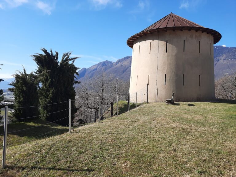
The largest surviving structure stands on the flat central area of the hill and has a square plan. Its most substantial feature is an underground room 3 metres deep, covered by two barrel vaults supported by an arched structure. The arches were constructed from tuff transported from northern Lombardy, while brick roof tiles point to the fortification’s connection with the road network around Lake Verbano.
The underground chamber is coated throughout with cocciopesto, a mortar made from lime and crushed ceramic material that provides waterproofing and insulation. These qualities suggest that the room served as a cistern, although that identification remains an interpretation. Diagonal buttresses cross the principal structure, strengthening its corners and the underground chamber while probably also supporting the roof timbers.
Other archaeological features
Two burials of very young individuals were found east of the principal building. They were probably contemporary with the building, placing them within the period of the fortification’s construction and early use.
A triangular-plan building stands on the rocky spur overlooking the interior of the site. Its date may belong to the medieval period, providing evidence for activity on the promontory after the main Late Roman phase.