Castell de Siurana: A Medieval Frontier Castle in Spain

Site at a Glance
- Rating
- 4.6
- Popularity
- Low
- Country
- Spain
- Primary era
- Medieval
- External website
- Open
- Eras represented
- Medieval
- Civilizations
- Crown of Aragon, Umayyad
- Site type
- Military
- Remains
- Castle
On this page16 sections
History
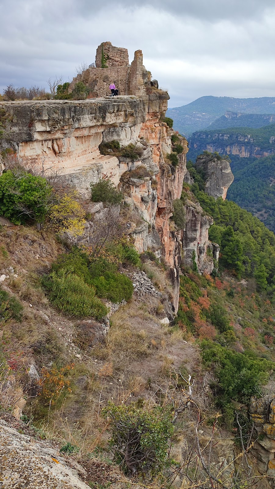
Castell de Siurana is a medieval castle in Spain, situated east of Siurana de Prades in the municipality of Cornudella de Montsant. Its surviving Christian structures overlie an earlier caliphal fortification, a defensive work associated with a Muslim state ruled by a caliph. The castle occupied a frontier position from the eleventh century and became the last Muslim stronghold in New Catalonia before its capture in 1153–1154.
Muslim Origins and Territorial Rule
Muslim authorities appear to have organized the territory between the eighth and mid-ninth centuries. The area governed from Siurana probably extended across much of the Priorat, parts of Alt Camp and Baix Camp, the Conca de Barberà, Les Garrigues, and possibly the Ribera d’Ebre. The Muslim settlement was probably arranged in two parts, with an upper castle enclosure and a lower refuge area where the settlement stood.
Christian expansion through the Conca de Barberà and Camp de Tarragona turned Siurana into a frontier stronghold during the eleventh century. In 1146, Ramon Berenguer IV, a medieval ruler of Barcelona and Aragon, granted the castle, town, and associated territories to Berenguer Arnau and his sons, while reserving one-fifth for the Order of the Temple, a military-religious order involved in territorial defense and administration. No immediate conquest followed, since Ramon Berenguer IV first focused on taking Tortosa and Lleida in 1148–1149.
Conquest and Royal Administration
Ramon Berenguer IV’s forces took Siurana after a siege in 1153–1154. During the siege, in 1153, he issued a settlement charter for the existing inhabitants and future settlers. After the conquest, the castle and territory entered the royal patrimony. Bertran de Castellet first held the office of castellan, the official responsible for a castle, and Albert de Castellvell later succeeded him. Both men had taken part in the conquest.
Under Alfonso I, most of the former Islamic territory of Siurana, apart from Montblanc and Escornalbou, became the royal bailliage of the Mountains of Siurana. A bailliage was an administrative district governed by a bailiff. The territory was later known as the Mountains of Prades, and its general bailiff resided at the castle. From 1174, the bailliage belonged to Queen Sancha, Alfonso I’s wife, and later passed to Eleanor of Castile, Violant of Hungary, and Constance of Sicily. At different times, the lordship served as security for agreements or loans, including one involving the Order of the Hospital in 1246. This territorial administration formed the basis of the County of Prades, created by James II in 1324.
Declining Frontier Role
During the early Christian period, Siurana gained a substantial population and became a refuge for Catharism, a medieval Christian movement regarded as heretical by the Catholic Church. Its elevated location later contributed to the transfer of regional importance to Prades, which offered better living conditions and communications.
By the thirteenth century, Siurana was distant from the frontier and the castle no longer had the same military role. It was converted into a prison for high-ranking aristocrats. Roger Bernat de Foix was detained there after the siege of Balaguer in 1280. Charles II of Anjou, Prince of Salerno and later King of Naples, was imprisoned at Siurana from 1286 to 1288. His release required the delivery of three sons as hostages and a large quantity of silver. Charles, Louis, and Robert of Anjou remained at Siurana until 1295.
Tradition connects Franciscan influence at Siurana with Louis of Anjou’s decision to enter religious life. He later became Bishop of Toulouse and was canonized. During the war against John II of Aragon in 1462–1472, the fortress served as a base for attacks on Camp de Tarragona by Joan Ramon Folc III of Cardona, Count of Prades, and Pero de Urrea, Archbishop of Tarragona.
Destruction and Protected Status
Philip IV of Castile ordered the castle’s destruction in 1651, at the end of the Reapers’ War. Napoleonic troops caused extensive further damage in 1812 during the Peninsular War. Castell de Siurana was later declared a Cultural Asset of National Interest as a historic monument.
Remains
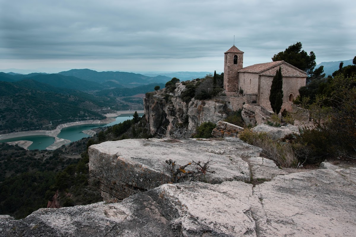
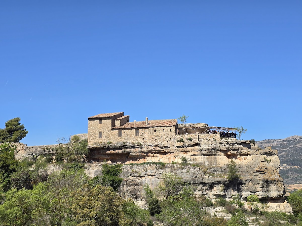
The castle stands at about 748 metres above sea level on a cliff-edge hill opposite the settlement. Its position protected the settlement’s only possible natural access. The remains are divided into an upper enclosure and a lower enclosure. The architecture combines Romanesque features with vernacular construction, and the site includes walls, a tower base, and a vaulted chamber reinforced by arches. Large, carefully made ashlar blocks, or squared stone blocks, appear in several parts of the complex.
Upper Enclosure
Rectangular Tower
The principal feature of the upper enclosure is a rectangular tower measuring about 1.7 by 3.4 metres. Approximately 3 metres of its height survives, while its walls are around 1.4 metres thick. The structure uses relatively small, roughly worked stones, about 15 by 30 centimetres, laid in courses and bonded with lime mortar. Its construction resembles shuttered formwork. Although this method may indicate Islamic construction, the tower is more probably a Christian-period building from the second half of the twelfth century, shortly after the conquest.
Vaulted Chamber
The enclosure also preserves a room covered by a half-vault strengthened by two transverse arches. Its walls and vault are built from carefully squared ashlar. The room has been interpreted as a possible prison, but it may instead have improved the comfort of the upper enclosure. It may also have functioned as a cistern, since a water reserve would have been important at this elevated site. The chamber is dated approximately to the thirteenth century.
Perimeter Walls and Eastern Structures
Fragments of a perimeter wall protect the western side of the upper enclosure. Built from roughly worked stones, it retains a loophole at the pointed spur above Salt de la Reina Mora. The wall was probably rebuilt and adapted from an earlier structure. The eastern side was enclosed by walls of more irregular workmanship. At the northeast corner, remains of a gate survive alongside parts of several ancillary spaces.
Silos
Several rectangular openings in the eastern ground may be storage silos. The westernmost has a square opening about 1.4 metres across, a rounded interior, and a depth of 1.6 metres. These installations were probably connected with ancillary buildings belonging to the earliest castle, although those buildings no longer survive. Their date remains uncertain, and an Islamic-period origin is possible. The eastern-sector walls and most interior walls probably belong to the later Middle Ages or the beginning of the early modern period.
Lower Enclosure
Open Area and Enclosing Walls
The lower enclosure contains a rocky open area about 70 metres long and 15 metres wide, with a broad sloping extension on its southern side that reaches roughly 15 metres farther. Several wall fragments enclose this space. In the east, a second wall stands directly on the edge of a deep ravine. Building remains survive in the northwest and at the southwestern end, below the upper enclosure. A wall projecting from the northern side blocked the path toward the settlement.
Large Defensive Wall
The most substantial feature is a wall about 60 metres long and up to 3.6 metres thick. It begins at the eastern facade, runs north toward a possible polygonal tower, turns west, then angles north again before reaching another structure that may also have been a tower. The wall is constructed from ashlar blocks measuring approximately 50 by 60 centimetres. Some sections are joined with gypsum, while others use pink lime mortar.
Additional Walls and Storage Areas
Two other walls resemble the large defensive wall, and one may have reached a thickness of 5 metres. On the southern side, another wall uses smaller, roughly worked stones set in earth without mortar. The stones are arranged either in a herringbone-like pattern known as opus spicatum or in alternating courses, one laid lengthwise and the next vertically. Silos and other storage facilities also survive within the lower enclosure.
Gate and Outer Wall
About 4 metres outside the lower enclosure stands a second wall made from large, roughly worked ashlar blocks bonded with lime mortar. A gate jamb survives on the northern side, and a bridge probably stood before it to cross the deep ravine below. The thickest lower-enclosure walls belong to the Islamic period. Other structures in this enclosure may date from the twelfth or thirteenth century, while the outer second wall is later.