Caños de Carmona: Roman and Almohad Aqueduct of Seville


Site at a Glance
- Rating
- 4.3
- Popularity
- Low
- Country
- Spain
- Primary era
- Medieval
- Eras represented
- Classical, Medieval, Modern
- Civilizations
- Almohad, Roman, Spanish
- Site type
- Infrastructure
- Remains
- Aqueduct
On this page19 sections
History
Caños de Carmona is a Roman aqueduct in Seville, Spain, built in the period traditionally dated to approximately 68–65 BC to carry water to Hispalis, the ancient Roman city on the site of Seville. Its exact origins remain debated. A Roman cistern in Plaza de la Pescadería has been interpreted as a castellum aquae, a reservoir that received aqueduct water before urban distribution, associated with a second-century AD aqueduct. A minority interpretation holds that the aqueduct was constructed entirely anew under the Almohads.
Roman and Almohad phases
The aqueduct was extensively restored and partly rebuilt in 1171–1172 under Abu Yaqub Yusuf, an Almohad caliph. The Almohads were a North African Berber Muslim dynasty that ruled much of al-Andalus during the twelfth and thirteenth centuries. The engineer al-Hayy Yacis carried out the work after excavations near the Puerta de Carmona revealed remains identified as Roman by the Almohad historian Ibn Sahib al-Salat al-Bayi. The renewed aqueduct was inaugurated on 13 February 1172. It first supplied the Buhaira palace and its gardens, then was extended into Seville.
Repairs continued in the thirteenth century, including work connected with the war with Granada, a conflict between the Christian kingdom of Castile and the Nasrid kingdom of Granada. In 1398, 103 arches were rebuilt. The aqueduct was reconstructed and extended again toward the end of the fourteenth century, when it reached its greatest stated length.
Water, mills, and urban distribution
Caños de Carmona supplied the Real Alcázar, the Buhaira palace, royal gardens, aristocratic residences, religious institutions, houses, and public fountains. It probably also served 17 public baths. Water powered numerous mills along the course. After Ferdinand III conquered Seville in 1248, many mills operated in the channel, and in 1254 Alfonso X granted the city’s municipal chapter the revenues from nine mills in return for maintaining the aqueduct.
In 1254 the aqueduct supplied two public fountains. Later outlets included the pillar at the Puerta de Carmona, recorded in 1398; the fountain in Plaza de San Francisco, recorded in 1411; and pillars near San Juan de la Palma and on Calle San Esteban, recorded in 1518. Other supply points included the Alfalfa and Magdalena fountains, the pillar opposite San Benito installed in 1672, the fountain near the Convent of the Encarnación installed in 1720, the pillar in La Calzada installed in 1760, two eighteenth-century pillars in San Bernardo, the Laguna fountain, the Cuadra pillar, and the Hierro basin, which closed at the end of the sixteenth century. A fountain in Plaza del Duque de Medinaceli was installed in 1758.
From the late Middle Ages, the Crown authorized nobles and religious institutions to establish private fountains connected to the aqueduct. The cathedral of Seville, the collegiate church of El Salvador, and the Convent of San Francisco had their own supplies by the late medieval period. During the first third of the sixteenth century, Seville had 20 public fountains and more than 300 private ones. In the seventeenth century, the network included 19 principal urban pipes and 12 pipes outside the walls serving country houses and monasteries.
Water rights were granted to religious houses and public institutions over several centuries. The Catholic Monarchs granted supplies to San Benito in 1477; San Pablo el Real and Santo Domingo de Porta Coeli in 1478; San Jerónimo in 1500; Santa Paula, San Leandro, and Santa Inés in 1502; and the College of Santa María de Jesús in 1505. Philip II later granted supplies to the Royal Audiencia in 1574, the Casa Lonja of the Consulado de Cargadores a Indias in 1582, and the Customs House in 1586.
Under Philip III, supplies went to San Diego in 1600, San José in 1607, El Carmen in 1611, and Santo Ángel in 1614. Philip IV granted them to La Trinidad in 1625 and San Antonio de Padua in 1629. Charles II granted water to the University of San Telmo in 1683, the tobacco factory in 1685, the Convent of La Consolación in 1687, and several hospitals between 1677 and 1695. Philip V granted supplies to Santa Rosalía in 1701, the Oratory of San Felipe Neri in 1706, the Monastery of San Clemente in 1710, the prior of the Consulado de Cargadores a Indias in 1703, and the new tobacco-factory site in 1728. Ferdinand VI granted water to the Colegio de Niños Toribios in 1755, the Royal Artillery Factory and the saltpeter factory in 1759. Charles III granted supplies to the Atarazanas in 1776 and the cavalry barracks at the Puerta de la Carne in 1788.
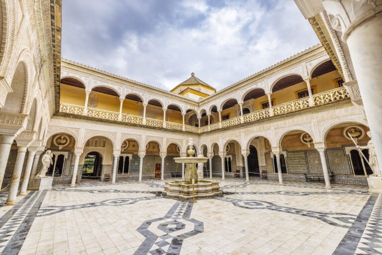
A branch known as a marco, meaning a connection to a separate reservoir and distribution system, served the Huerta del Rey. Its water reached mills and cultivated land. A pipe belonging to the Duke of Medina Sidonia ran from the Puerta de Carmona to his palace in present-day Plaza del Duque, while the Casa de Pilatos also had a connection.
In 1494, the traveler Hieronymus Münzer described 390 arches, some doubled by an upper arcade. He also noted the large quantities of water used for gardens, street cleaning, and homes. The aqueduct’s name came from the Puerta de Carmona, where it ended, rather than from the town of Carmona. Its exact starting point is disputed. An 1810 map shows an old aqueduct linking Carmona and Seville, but the documented water source was the Santa Lucía spring near Alcalá de Guadaíra.
Reform, decline, and demolition
José Manuel de Arjona, Seville’s chief municipal official, ordered a major reform in 1827 to improve water supply and quality. Melchor Cano designed the project, which shortened the route by three kilometers and removed most of the mills. Work was interrupted by a cholera epidemic in 1833, resumed afterward, and was 73 percent complete by 1842. Plans drawn in 1846 by the inspector general Gabriel Gómez Herrador show a revised route between Hacienda La Red and Cruz del Campo, replacing the winding road of the mills with a shorter straight section. An intramural distribution network was being installed in 1856.
The Puerta de la Carne and the adjoining wall were demolished in 1864, destroying two pipes embedded in the wall. The Puerta de Carmona followed in 1868. In 1882 the municipal government commissioned George Higgins Winfield to renew the aqueduct. Winfield had worked on potable-water improvements in Argentina and later transferred the work to James E. Shaw. In 1884, The Seville Waterworks Company Limited took over the city’s water supply, which became known as “the English water.” Caños de Carmona remained in use until the early twentieth century.
Seville began demolishing the arches between the city and the Tagarete in 1908. A plan prepared in 1910 proposed removing the arches along Calle Oriente, now Avenida Luis Montoto. Rodrigo Amador de los Ríos, sent by the Royal Academy of Fine Arts of San Fernando, identified Roman and Arab remains and judged that selected sections should be preserved. The Provincial Commission of Historic and Artistic Monuments approved demolition, while José Ramón Mélida, Fidel Fita, and the Marquis of Cerralbo opposed it.
Demolition of the Calle Oriente section took place in 1912, beginning on 26 January. Residents had complained about danger, sanitation, and the use of the arches as shelter. Urban expansion also influenced the decision, while central authorities characterized the aqueduct as lacking artistic and archaeological importance. A section in Los Pajaritos was demolished in 1959 for the development of La Candelaria and Los Pajaritos, and part of the nineteenth-century arcade was removed between 1964 and 1966.
Preservation and later interpretation
Three sections survived after Carlos Serra y Pickman, Marquis of San José de Serra and a member of Seville’s Provincial Commission of Artistic Monuments, intervened on their behalf. One remained because it stood within the privately owned Alcantarilla de las Madejas orchard. The orchard’s closure in 1911 prevented the demolition team from reaching it, and a later attempt to expropriate part of the property from Borrero Blanco was postponed.
One preserved section was incorporated into the Puente de la Calzada railway bridge, built in 1929–1930. It was exposed when the bridge was demolished in 1991. The surviving remains are managed by Emasesa, Seville’s public water-distribution service. The double arcade on Avenida Luis Montoto was restored in 1951 and 1982, and a later intervention replaced its supporting trestles with a metal structure.
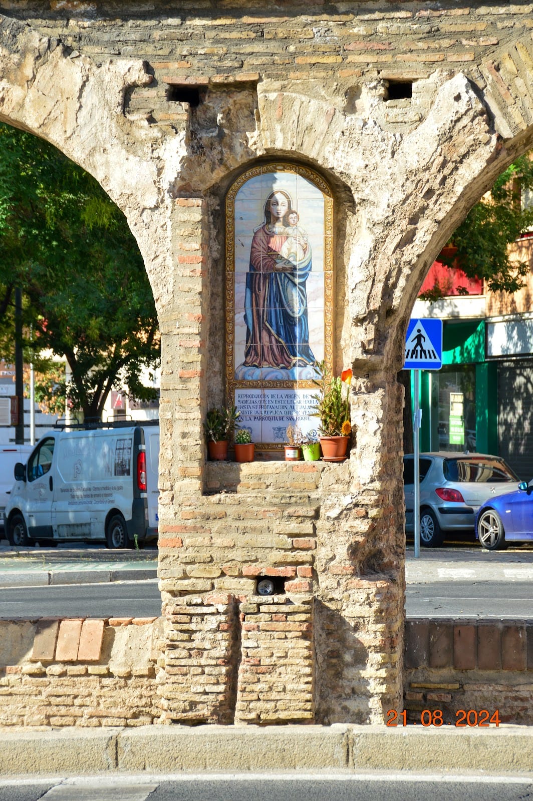
The Virgin of las Madejas was venerated in a niche where the aqueduct crossed the Tagarete. The original image, traditionally attributed to Alfonso X, was attacked during the Revolution of 1868 and transferred to San Roque in 1869. It was destroyed when that church burned during the Spanish Civil War in 1936. An azulejo, a glazed ceramic tile used in the Iberian Peninsula for religious images and architectural decoration, was installed in the niche in 1993. Most of the aqueduct has disappeared, but the surviving portions retain principal remains of the Roman and Almohad water-supply system.
Remains
Caños de Carmona extended approximately 17.2–17.5 kilometers from the Santa Lucía spring near Alcalá de Guadaíra to Seville. Its route combined underground galleries, open channels, elevated brick arcades, urban pipes, cisterns, and branches serving major palaces and estates. The system could carry approximately 5,000 cubic meters of potable water per day. The underground galleries also filtered water naturally before it reached cisterns and fountains.
Water source and underground route
Subterranean galleries
The route began about 600 meters southeast of the houses of Alcalá de Guadaíra and passed underground through the town. The first approximately three kilometers were formed by a conduit cut through limestone. Inspection shafts appeared every 50–60 meters, and 104 covered shafts were recorded in 1653, including 17 within Alcalá de Guadaíra. Outdoor shafts had stone covers, while those providing access from houses had wooden covers.
The underground galleries continued for roughly 15 kilometers before emerging near the Molino de Guevara, at the present SE-30 motorway. Some galleries were cut into rock, while others were built or reinforced with brick, with some bricks weighing up to six kilograms. Along one section, about 20 shafts allowed workers to enter and ventilate the conduit. A later survey counted 130 surviving ventilation shafts. Brick consolidation, access shafts, and niches that may have held lamps used by miners have been cited as evidence for Roman construction.
Open channels
After the underground route, an artificial open channel crossed areas later occupied by the Polígono de San Pablo, Ciudad Jardín, Santa Clara, the Carretera Amarilla industrial estate, and Mercasevilla. Water in these open channels also powered watermills. The system’s branch connection to the Huerta del Rey formed a separate cistern-and-channel arrangement that distributed water to mills and cultivated land.
Elevated aqueduct and urban entry
Brick arcades
Near Cruz del Campo, the conduit rose into an elevated brick aqueduct that extended approximately 1.2 kilometers to the Puerta de Carmona. Depending on its phase of construction and repair, it contained approximately 390–430 arches, generally carried on pillars. Some sections had two levels of arcades. The twelfth-century brick arches probably reused Roman foundations and pillars.
Puerta de Carmona cistern
At the Puerta de Carmona, the aqueduct discharged into a large cistern. From there, urban pipes carried water to fountains and private connections. The Roman cistern in Plaza de la Pescadería, in the Alfalfa district, has been considered a possible castellum aquae associated with a second-century AD aqueduct.
Alcázar and Buhaira branches
Within Seville, an approximately 820-meter pipe was inserted into the city wall and supplied the Torre del Agua of the Alcázar. Parts of this pipe survive along the wall in the Callejón del Agua in the Santa Cruz district. A separate branch to the Buhaira palace measured approximately 1.56 kilometers. Its water was stored in a channel beside the palace, which survives.
Surviving sections
Avenida Luis Montoto arcade
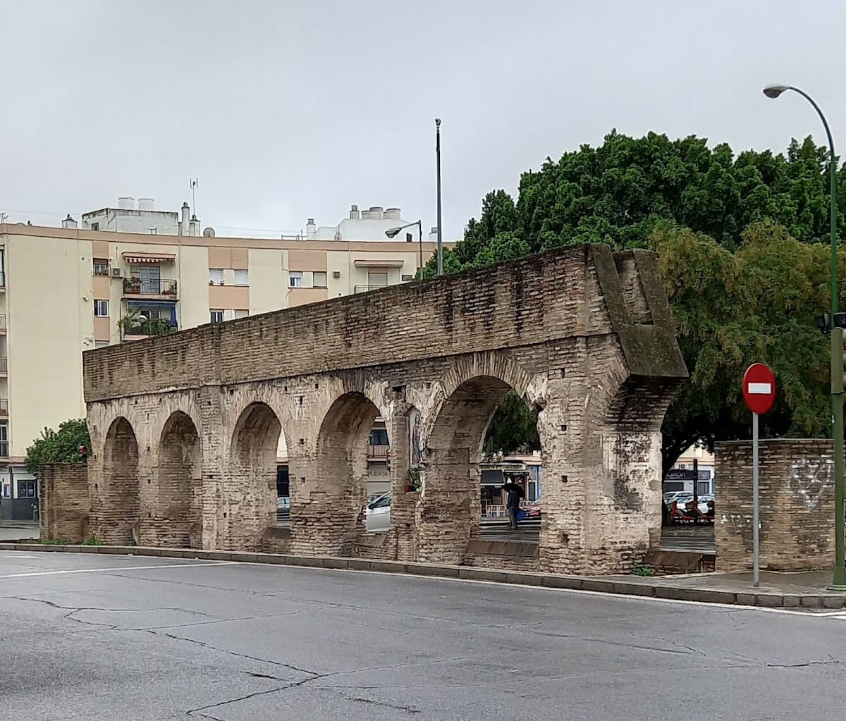
A restored double arcade from the twelfth-century aqueduct stands in front of number 28 Avenida Luis Montoto. Its preserved masonry is primarily brick. The arcade represents an isolated surviving part of the elevated route rather than a complete standing aqueduct.
Former Puente de la Calzada section
Another arcade stands where Avenida Luis Montoto meets Calle Juan Antonio Cavestany, Calle José María Moreno Galván, and Calle Amador de los Ríos. It formed part of the former Puente de la Calzada and was exposed after the railway bridge was demolished in 1991. This section is regarded as the best-preserved of the surviving remains and includes a niche for the Virgin of las Madejas. The original image has been replaced by a ceramic tile depicting the Virgin. The symbol associated with Seville’s NO8DO emblem that was formerly represented there has not survived.
Los Pajaritos arches
Five early nineteenth-century brick arches survive in the Los Pajaritos district, in front of number 10 Calle Cigüeña. They belong to the later phase of the aqueduct’s elevated construction and preserve a small part of the nineteenth-century route.
Buhaira branch
The branch serving the Buhaira palace preserves 33 complete arches and the remains of three additional arches. Together with the surviving channel beside the palace, these remains show the separate route by which water reached the palace and its gardens.
Alcalá de Guadaíra remains
Subterranean sections survive around Alcalá de Guadaíra, including stretches between Alcalá, the La Red industrial estate, and Torreblanca. At least 3,080 meters of underground galleries have been surveyed, and substantial portions remain. These galleries preserve the conduit’s rock-cut and brick-reinforced construction, along with shafts and other features associated with access, ventilation, and maintenance.