Cagliatscha Castle: A Medieval Hill Castle in Switzerland


Site at a Glance
- Rating
- 4.7
- Popularity
- Very Low
- Country
- Switzerland
- Primary era
- Medieval
- External website
- Open
- Eras represented
- Medieval
- Civilizations
- Holy Roman Empire
- Site type
- Military
- Remains
- Castle
On this page7 sections
History
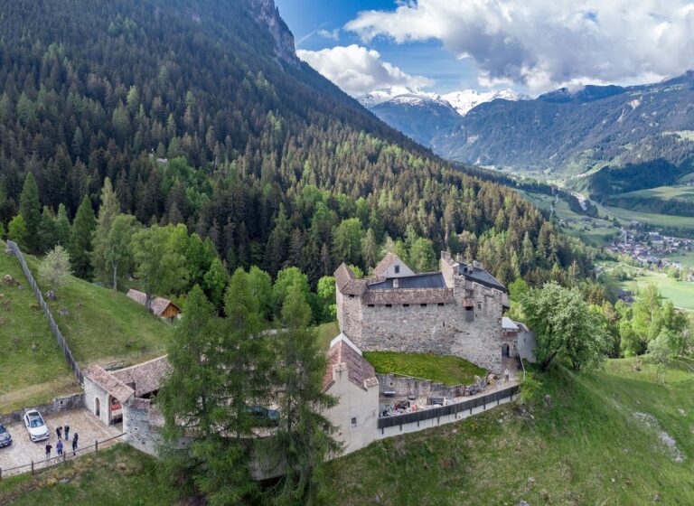
Cagliatscha Castle is a ruined hill castle in Switzerland, above the village of Clugin in the municipality of Andeer. It was probably built around 1265, during the medieval period, on territory held by the Bishop of Chur and later granted as a fief to the Freiherr von Vaz family.
Construction and Vaz Rule
The Vaz family established several small castles on its lands, including Cagliatscha. Dendrochronology, which dates timber through its annual growth rings, places the construction of the castle around 1265. A roof beam produced a date of 1266, while a larch beam indicated construction around 1265.
The castle was probably occupied by ministeriales, medieval service nobles who carried out administrative and military duties for higher-ranking lords. Possible occupants included members of the Panigad or Stainbrugg families. The Panigad family held property in Clugin, and its coat of arms was carved into plaster on the third storey. Cagliatscha may also have helped protect the trade road through the Schams valley.
Werdenberg-Sargans and Destruction
When the Vaz line became extinct in 1338, its lands and castles passed to the Counts of Werdenberg-Sargans. In 1424, the inhabitants of the valley joined the Grey League, a late-medieval political and military alliance that later formed part of the region of Graubünden.
In 1451, the count led an army into the valley in an attempt to force its inhabitants out of the Grey League and back under his authority. The campaign failed. He then sold the territory to the Bishop of Chur, while the valley bought its freedom from the bishop by 1458.
Several castles were destroyed during the 1451 campaign, and Cagliatscha was probably one of them. Fire weakened much of its foundations, causing three of the four walls to collapse. The castle was not rebuilt, and stone debris from the destruction remains in the ravine below the ruin.
Conservation
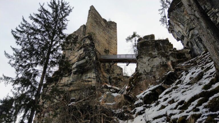
In 1984 and 1985, the Burgenverein Graubünden catalogued and secured the remains. The conservation work included building a bridge across the neck ditch, helping to preserve the surviving structure and its immediate setting.
Remains
Cagliatscha stands at about 1,182 metres above sea level on a rocky spur between Andeer and Clugin, roughly 200 metres above the Hinterrhein valley. Its principal structure was a five-storey stone keep with a square footprint measuring approximately 8.5 to 8.6 metres on each side. The keep’s walls were about 2.2 to 2.3 metres thick at the base and narrowed to approximately 1.75 to 1.8 metres higher up.
The Keep
Only the roughly 8.5-metre-long southeastern wall survives, together with the stubs of adjoining walls. The remaining wall rises about 20 metres, corresponding to five storeys. It was built from large, uneven stones of different colours, with square blocks at the corners. The long corner blocks have projecting faces and precisely dressed edges. Larger, more regularly squared stones were used on the third storey, including individual blocks weighing more than 700 kilograms.
Plaster on the inner face preserves the divisions between the storeys. The Panigad coat of arms and other markings were incised into the plaster on the third storey. The original high entrance stood at second-storey level, an elevated doorway reached from outside by a ladder, stair, or bridge. It was later moved to the third storey, probably for strategic reasons, and part of this later entrance survives beside the collapsed wall.
The upper two storeys were enclosed by widely projecting wooden defensive galleries, or hoardings, which provided covered fighting positions outside the walls. A pyramidal roof covered with slate completed the keep. Its timber is identified as the oldest surviving original roof structure in Switzerland.
Surrounding Area
The area northwest of the ruin is known as Padnal. The name has been interpreted as evidence of a prehistoric settlement in that area, extending the archaeological interest of the site beyond the medieval keep.