Burg Haselstein: A Medieval Hill Castle in Switzerland

Site at a Glance
- Rating
- 4.2
- Popularity
- Very Low
- Country
- Switzerland
- Primary era
- Medieval
- Eras represented
- Medieval, Modern
- Civilizations
- Holy Roman Empire
- Site type
- Military
- Remains
- Castle
On this page19 sections
History
Burg Haselstein is a medieval hill castle in Switzerland, standing above the village of Zillis-Reischen in the canton of Graubünden and generally dated to around 1270. Timber used in its construction was felled in spring 1273, when Henricus de Rexene, a member of a peasant ministerial family serving the bishop of Chur, built the castle above his village. It combined a residence with a small administrative center and the working focus of the Lords of Reischen’s agricultural estate.
Construction during the end of the interregnum
The castle was probably built in anticipation of the end of the long interregnum, the period without a recognized emperor in the German kingdom. Rudolf of Habsburg was unanimously elected German king on 1 October 1273. The approaching restoration of royal authority may have encouraged the rapid construction of Haselstein while the royal right to authorize new castles again lacked an active holder.
Haselstein replaced a cramped tower on the far side of the Vidosschlucht. Construction proceeded quickly, probably over several months. A workforce of about thirty men may have completed the work, although the exact building time is unknown. The castle’s sequence of construction belonged to one overall plan rather than to a series of later additions.
The Lords of Reischen
For roughly a century, Haselstein was the socially appropriate residence of the Lords of Reischen, as well as the center of their local authority. They held a repeatedly confirmed fief from the bishop of Chur. A fief was a right or income granted by a superior lord in return for loyalty and service. The family led its small village community, used its own seal, and was invited by the bishop to witness contracts.
The family remained closely tied to agriculture rather than separating fully from the land or rising above the community around it. Its members also handled administrative and negotiating duties for the wider Schams valley community, which did not have a seal of its own. Their income included agricultural production and, by the early fifteenth century, a share of the local tithe.
In 1419 Bishop Johann granted, or probably confirmed, a fief for Hans von Reischen and his brothers consisting of one-third of the Reischen tithe. The tithe included grain, lambs, and kids. In return, the family owed loyalty, military service, obedience, and the duty to keep its house open to the bishop. This income supplemented the family’s farming rather than replacing it.
Fourteenth-century decoration and abandonment
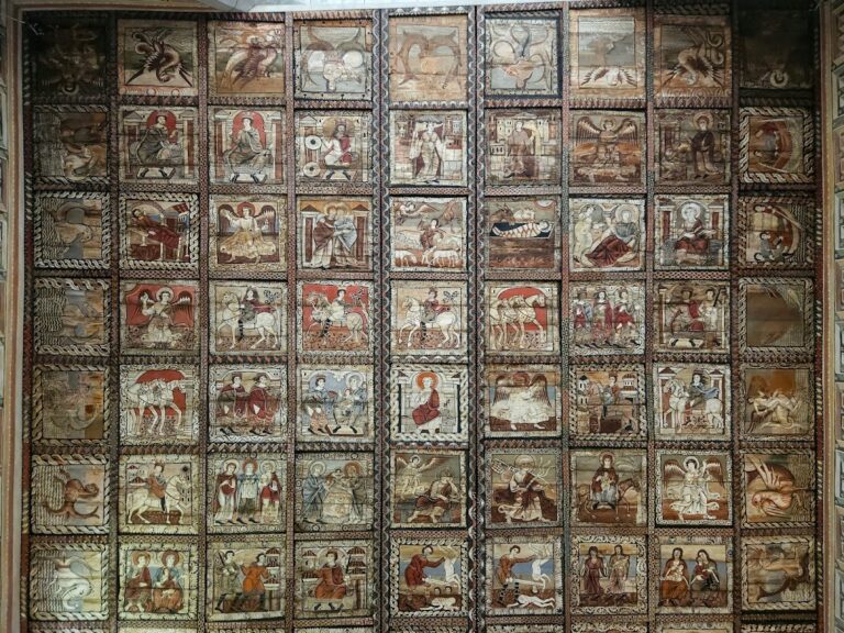
During the first half of the fourteenth century, the Waltensburger Master also worked at Haselstein. This is the conventional name for an unidentified medieval mural painter associated with Gothic wall paintings in the Waltensburg region and neighboring parts of Graubünden. The painter decorated a room in the castle, and fragments of the painted plaster survived in the later rubble.
Toward the end of the fourteenth century, prolonged rainfall probably saturated the slope beneath the south palace. Its unfounded western front slid downhill and collapsed. The castle was abandoned rather than rebuilt, and the Lords of Reischen constructed a more comfortable fortified house at the edge of the village.
After the abandonment, Haselstein became a thoroughly cleared partial ruin. Reusable elements, including the tuff door and gate surrounds, were taken to the replacement building. The remaining walls gradually decayed beneath hazel and aspen growth. The Reischen family appears under forms such as de Rexene, Rexno, Rosin, Reischen, and Reyschen between 1218 and 1446. Ulrich and Hans von Reischen appear as episcopal vassals in 1377 and 1395, Hans was confirmed in possession of the Reischen tithe in 1419, and Junker Hans von Reyschen appears in a contract in 1446. The family then disappears from the historical record, shortly before the Schams conflict of 1451.
Investigation and reconstruction
Interest in the ruined castle preceded modern excavation. Johann Rudolf Rahn produced a plan and bird’s-eye drawing in 1891, Erwin Poeschel prepared a measured plan and description in 1930, and Werner Meyer photographed the site in 1969. Archaeological investigation and building research followed from 1968 to 1977.
The excavations showed that fire had not destroyed Haselstein. Instead, the site was systematically abandoned after the collapse of the south palace. The removal of even valuable iron fittings is indicated by the lack of metal objects. Reconstruction and conservation continued from 1972 to 2023, using complete excavation, building analysis, detailed photographic and stone-by-stone records, and locally available stone. The historic ground plan was followed, original fabric was preserved, and new masonry was clearly distinguished from the old. A large well in the outer courtyard completed the reconstruction in 2023.
Between 1993 and 1997, an atelier, a timber and wagon shed, an underground shelter for cultural property, and a workshop building were added around the reconstructed castle. Their materials and forms were adapted to Haselstein while remaining subordinate to it. The project was permitted by the Graubünden Small Council. The monument-preservation authorities did not fund the work, but they did not oppose it. The castle is now owned by Pro Castellis, a charitable cultural institution concerned with history and monument preservation.
Remains
Haselstein occupies a terrace at 1,167 metres on the marginal moraine of the Tasping glacier. Unlike the nearby predecessor site of Reischen I, it was placed on a step in the moraine’s descending profile rather than on a conical summit. A man-made neck ditch cuts across the uphill side. Sand and stone used in construction were extracted from this depression. The irregular castle plan contains no true right angles and combines residential spaces with defenses adapted to the steep and uneven ground.
Defensive circuit and entrances
Ring wall
The ring wall, the enclosing defensive wall of the castle, occupied the highest and most exposed uphill side of the site. It certainly carried a wall walk. At the northeastern corner, two blunt angles made the wall difficult to breach. The residential section was placed on the western side, away from the principal direction of attack and above ground that fell steeply toward the valley.
Gate I and the outer enclosure
Gate I directed an approaching attacker with a battering ram onto a narrow path immediately below the ring wall, where defenders could throw stones down from above. Beyond the gate lay a narrow, elongated outer enclosure. Its shape restricted the movement of a battering ram and made it difficult to turn the weapon through ninety degrees. The enclosure wall survives to heights of up to two metres, while the first gate is heavily eroded and its threshold has disappeared. A rainwater outlet remains on the southern side. The ground rises gently from Gate I toward Gate II, although the western part of the enclosure lies 0.8 metres lower, and its connection with the corner of the south palace has been lost.
Gate II and the inner enclosure
Gate II led at a right angle from the outer enclosure into the inner enclosure. Its large granite threshold remains in place. The pointed arch that supported the masonry above the passage collapsed into the rubble, while the dressed jamb stones were removed. The imprint of the right jamb, including broken tuff surfaces, survives in the masonry. A matching tuff jamb stone was later recovered near Reischen III.
Gate III
Gate III led at another right angle from the inner enclosure into the south palace. The walls west of the inner enclosure have no openings apart from this entrance. On the eastern side are parts of the ancillary building’s west wall and sections of the retaining wall that supported the courtyard at a higher level. The northern end wall contains a drain or outlet.
Residential buildings
North palace
The two-part residential palace stood on the safer, valley-facing side of the castle. The north palace was built first. Projecting bonding stones at its corners were left ready for attachment of the south palace, and seven projecting tuff blocks remain at the northwestern corner. Its building platform was cut about four metres into the moraine.
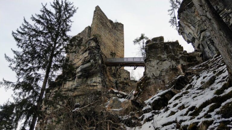
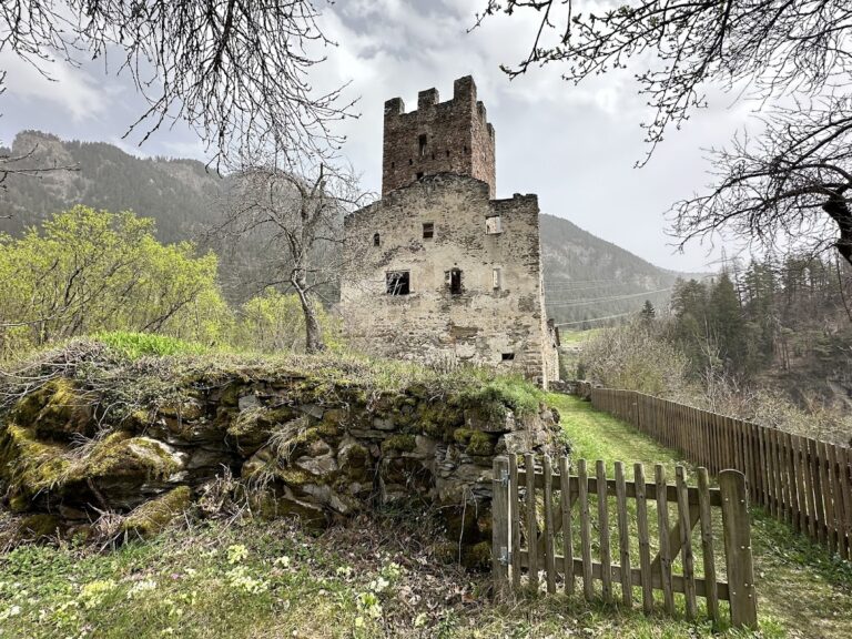
The north palace is the highest surviving part of Haselstein, with walls rising more than nine metres. Its four walls are bonded together. Two narrow arrow slits, defensive openings for ranged weapons, were placed on the second floor. The third floor contained three light niches and a drain or outlet. Excavation also revealed two further arrow slits and two further light niches on the first floor. The lower floor had no horizontal connection with the south palace because no basement was excavated beneath the relevant area. The first-floor remains preserve the arrangement of a room below the arrow slits, clarifying an earlier interpretation of the building.
South palace
The south palace was included in the original plan but was built after the north palace. Its valley-facing wall was not bonded into the north palace. Instead, individual projecting stones, known as toothings, were left to receive the later attachment. The building stood directly on the sloping ground. The builders placed its lowest stones on the thin humus layer without removing it, and the palace had no basement.
This hurried construction produced technically poor masonry in several places. Hundreds of tonnes of stone rested on the sloping humus layer of the valley front. Rainwater from the courtyard was also drained inadequately. These conditions contributed to the later collapse of the wall after prolonged rainfall, an event that led to the castle’s abandonment.
Courtyard and ancillary spaces
Inner courtyard
The ring wall enclosed a large open courtyard to the east. The courtyard surface consists of natural moraine rather than a deep accumulation of rubble. In the southeastern corner, behind the ancillary building, masonry probably belonged to small stalls for animals. A relatively thick layer of carbonized manure indicates a manure heap in this area.
Ancillary building
A small ancillary building stood beside Gate II, at the same ground level as the two gate enclosures. The courtyard to its north and east was one storey higher. Much of the building’s eastern and northern walls survives. It was not bonded to the southern section of the ring wall, and each surviving wall contains two light niches.
Materials and construction
The castle’s arches and other carefully shaped door surrounds were made from tuff, a porous volcanic rock, brought from the Foppa source about 700 metres away. Limestone and granite came from the moraine. Nearby wood supplied fuel for burning lime, while a nearby stream provided water for slaking it. The masonry became progressively less careful during construction. The first stage followed established building practice, whereas the south palace lacked a basement and proper foundations, and later stages used fewer carefully dressed corner stones and less regular masonry.
The identifiable building stages were the north palace, the south palace with Gate III, the ring wall with Gate II, the eastern retaining wall of the inner enclosure with the ancillary building, and finally the outer enclosure with Gate I. The last two stages cannot be placed in a certain order. The rebuilt castle follows this historic ground plan, uses locally available stone, and visibly separates original rubble masonry from replacement work without destroying original fabric for new uses.
Archaeological finds and painted plaster
Excavation recovered thousands of animal-bone fragments, many marked by butchery. The inhabitants’ principal meat supply came from domestic pigs, cattle, sheep, and goats rather than elite game. Butchery waste from aurochs and wisent was also identified, the first finds of these animals from a Graubünden castle.
Three sherds from two ribbed soapstone mortars of different sizes were recovered and transferred to the Rhaetian Museum. Painted plaster fragments from the south palace rubble preserve a recurring design associated with the Waltensburger Master, consisting of vine-black and oxide-red stars. Together, the plaster, animal bones, and small number of other finds provide evidence for the castle’s domestic life, decoration, and later collapse.
Nearby sites