Burgwall Hollenstedt: A Ninth-Century Ringwork Fortification in Germany


Site at a Glance
- Rating
- 4
- Popularity
- Very Low
- Country
- Germany
- Primary era
- Medieval
- Eras represented
- Medieval
- Civilizations
- Carolingian
- Site type
- Military
- Remains
- Fort
On this page8 sections
History
Burgwall Hollenstedt, also known as Alte Burg, Karlsburg, or Burg Hollenstedt, is a ninth-century lowland ringwork fortification in Germany, near Hollenstedt in Lower Saxony. Its construction belongs to the late ninth century and may have been undertaken by the Counts of Stade, although another interpretation attributes it to the Slavs. The fort existed for only a few decades before it was destroyed by fire and abandoned.
Construction and Attribution
Archaeologist Claus Ahrens dated the fortification to the late ninth century. Several construction timbers received dates around 892 through dendrochronology, the dating of wood by matching tree-ring patterns with established chronological records. These dates make construction by the Counts of Stade plausible, and the nearby field name Grevenhorst, meaning “Counts’ Grove,” supports that interpretation.
A different reconstruction places the building of the fort between 804 and 817, after the Abodrites received the area from Charlemagne. The Abodrites were a Slavic tribal confederation in the southern Baltic region, while Charlemagne ruled the Frankish Empire during the late eighth and early ninth centuries. Archaeological interpretation has rejected identifying the site with Holdunsteti, a place mentioned in the Frankish Royal Annals in 804. That reference is instead understood as describing Charlemagne’s summer camp before the fortification was built. The connection nevertheless helped establish the commonly used name Karlsburg.
Destruction and Abandonment
Repairs apparently took place in the mid-tenth century. The fort was later destroyed by fire, although responsibility for the event remains unknown. The circumstances do not point clearly to a deliberate burning. A building attached to the rampart held substantial quantities of rotten grain and the remains of a millstone, suggesting that the fort’s final destruction occurred in a setting connected with storage and everyday activity.
After abandonment, the wooden structures along the rampart continued to stabilize the earthwork for a period. As they decayed, the rampart gradually eroded. In 1968, a tenant flattened the entire northern half and the eastern part of the fortification while creating fishponds. Emergency excavations followed when the damaged areas were drained, but only about 40 linear metres of the lowest rampart construction could still be documented.
Investigation and Reconstruction
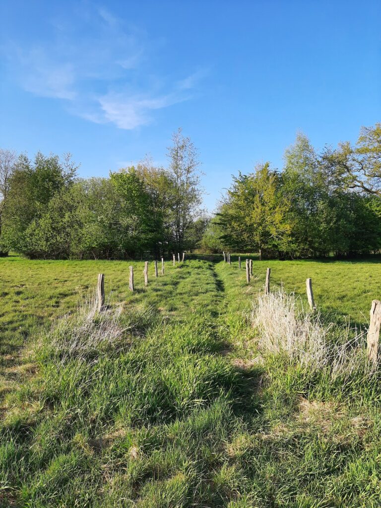
Excavations continued from 1968 to 1972 and were hindered by frequent flooding from the Este and by groundwater. Hamburg acquired the site in 1970 for permanent protection. In 1980, the ringwork was reconstructed from the excavation results of the 1970s. The work reproduced the form and general impression of the abandoned earthwork rather than rebuilding its former wooden and stone superstructures.
Burgwall Hollenstedt is an outpost of the Archaeological Museum Hamburg, a museum and archaeological institution based in Hamburg. In 2011, teachers and pupils from Estetal School, working with the Estetal local and tourism association and the museum, established a medieval kitchen garden inside the ringwork. A wattle fence encloses the garden as part of a long-term educational project.
Remains
Setting and Earthworks
The fortification stands about 1.5 kilometres south of Hollenstedt, in the floodplain of the Este on a sandy peninsula along the river’s west bank. It is a ringwork, a roughly circular fortification enclosed by a rampart, with an internal diameter of about 80 metres and an enclosed area of approximately 0.5 hectares. Including the outer ditch system, the complete defensive circuit measured about 120 metres across.
The original rampart was approximately 8 metres thick and reached up to 4 metres in height. It used a timber-and-earth construction faced on both sides with heath sods. A berm, or narrow level strip between rampart and ditch, extended about 0.8 metres outside the rampart. Beyond it lay a ditch roughly 5 metres wide and 1 metre deep. Wooden stakes and woven branches formed fascines, bundles used to reinforce the ditch slopes.
Rampart Structures and Interior
The reconstruction proposed by Claus Ahrens and E. Matthies places a wooden palisade about 3.4 metres high on the rampart crest. A palisade is a defensive fence made from upright wooden stakes. A chest-high sand embankment supported it from the rear, while fieldstones held the inner side of the upper rampart structure in place.
Casemate-like wooden buildings, meaning enclosed spaces incorporated into a fortification, were attached to the inner face of the rampart. They were about 3.3 metres deep and had sod roofs resting on the stone packing of the upper structure. Several houses occupied the interior. They measured approximately 4 to 5 metres in width and at least 16 metres in length.
Entrance and Archaeological Evidence
The presumed entrance lay on the western side, where a plank road curved gently across marshy ground toward a gate. A pronounced ground depression, a charcoal layer differing from the material elsewhere in the rampart, and deeply rutted trackways in the southwestern exterior area support this interpretation. The tracks ran tangentially toward the presumed gate. An unusually large stone on the outer slope of the ditch may have supported a bridge, although the form of the gate and its crossing cannot be reconstructed in detail.
Excavations recovered many timbers with fire traces of varying intensity according to their position within the fortification. A tree-ring study of 90 construction-timber samples could not provide dates because the trees had grown under exceptionally wet or dry conditions that could not be matched with existing reference sequences. The surviving site is therefore a reconstructed earthwork, presenting the abandoned fortification’s form rather than its former timber and stone defenses. An information panel inside the ringwork explains the fort and its excavations, while the enclosed kitchen garden occupies part of the interior.