Burg Vohburg: A Medieval Hilltop Fortress in Germany


Site at a Glance
- Rating
- 4.5
- Popularity
- Low
- Country
- Germany
- Primary era
- Medieval
- Eras represented
- Medieval, Early Modern, Modern
- Civilizations
- Duchy of Bavaria, Holy Roman Empire
- Site type
- Military
- Remains
- Castle
On this page15 sections
History
Burg Vohburg is a hilltop fortress in Germany above Vohburg an der Donau, developed on a site settled from the Early Bronze Age and occupied through the La Tene and Roman periods. By the late tenth century, a larger fortified court stood on the castle hill. The fortress later became a stronghold of noble dynasties and an administrative center for the dukes of Bavaria.
Early settlement and the counts of Rott-Vohburg
The castle hill and the surrounding urban area once lay within the bed of the Danube. Settlement began during the Early Bronze Age, while later communities occupied the area during the La Tene period, an Iron Age era associated with Celtic material culture across much of central Europe, and during the Roman period.
By the end of the tenth century, the hill was occupied by a substantial fortified court. The Counts of Rott-Vohburg held the fortress by 1040 and received the title of counts palatine from 1055. After the death of the last count, Kuno II, son of Count Palatine Kuno I of Rott, the lordship passed through Kuno II’s widow to Count Rapoto V of Cham after 1081. Rapoto died during an epidemic in 1099.
The Diepoldinger stronghold
From about 1120, Vohburg belonged to Diepold III of the Diepoldinger family, a medieval high-noble house closely related by marriage to the Rapotones. The castle became a principal stronghold of the dynasty. Castlemen and ministeriales, dependent nobles or officials serving a lord in military, administrative, or court roles, are associated with Vohburg in contemporary documents.
The family’s influence declined after the lord’s sister divorced King Frederick in 1153. When the childless Berthold II died in 1204, the dukes of Bavaria occupied the fortress and made it the administrative center of the Vohburg office. Duke Ludwig of Kelheim, Berthold’s brother-in-law, asserted his claims to the lordship and enforced them by force.
Bavarian administration and medieval decline
During the mid-thirteenth century, the Bavarian dukes developed nearby Ingolstadt as a political and administrative center. The legitimate lords continued to claim the imperial estate of Vohburg until the death of the last Diepoldinger in 1257. The dukes enlarged and remodeled the fortress, strengthened its administrative role, and established the market settlement of Vohburg around the castle hill.
Vohburg also entered the dynastic history of the period. Conrad IV of Hohenstaufen married Elisabeth of Wittelsbach at Vohburg in 1246. The Hohenstaufen were a major medieval German and imperial ruling dynasty, while the Wittelsbachs were the Bavarian ruling dynasty that held the ducal title for much of the medieval and early modern period.
The settlement’s position between Ingolstadt and Neustadt restricted its development. The market and castle did not become a prominent ducal center on the Danube, and the question of whether the settlement had already received town status during the Middle Ages remains disputed.
Destruction, rebuilding, and later use
Troops of Ludwig the Bavarian destroyed the castle in 1316. The site was later pawned to the burgraves of Nuremberg, and rebuilding began only in 1414 under Duke Ernst. Swedish forces destroyed the castle again in 1641 during the Thirty Years’ War, the seventeenth-century conflict that involved religious, dynastic, and territorial struggles across much of Europe. An engraving by Matthaus Merian, published in Topographia Bavariae in 1648, nevertheless depicts the town and castle as intact.
In 1721, district administrator Johann Kastl added the Pflegerschloss to the castle wall. A Pflegerschloss was the residence or administrative seat of a local ducal official responsible for a district. Emperor Napoleon spent one night there in 1809.
The northwestern keep was reconstructed in 1959 and served as a water tower until the end of 2009. Repairs to the castle wall followed between 1971 and 1975, including partial renewal of its inner facing. Cracks first identified in 1976 enlarged, and several wall sections collapsed in 1978. The town council dismantled the especially endangered section between the Pflegerschloss and the staircase leading toward Pfarrhofstrasse after investigations showed that the entire wall was at risk.
The thirteenth-century wall complex underwent comprehensive repairs between 1986 and 1990. The dismantled section was rebuilt in a stylized form, followed by repairs to the castle gate and its immediate surroundings. Burg Vohburg is protected as a listed architectural and archaeological monument and forms part of a Bavarian heritage-monument ensemble. The archaeological protection includes settlement remains from the Early and Middle Bronze Ages and Early La Tene period, early, high, and late medieval castle phases, high-medieval graves, and Early Modern settlement evidence.
Remains
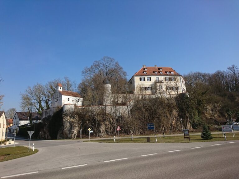
The ruins occupy a rocky outcrop beside the Danube at an elevation of 371 meters above sea level. The hilltop fortress stands within an urban setting, and its enclosure wall follows the irregular oval shape of the rock. The visible circuit consists of regularly laid Jurassic limestone and dolomite ashlar, blocks cut into regular shapes and arranged in horizontal courses. Parts of the wall are accessible, while much of the visible fabric reflects the stylized reconstruction and repairs of the 1980s rather than wholly preserved medieval masonry.
Enclosure and entrance
Castle wall
The enclosure wall defines the castle’s oval plan and incorporates masonry from the medieval complex alongside repaired and reconstructed sections. Its thirteenth-century arrangement was comprehensively repaired between 1986 and 1990 after structural failures had threatened the wall. The renewed inner facing and reconstructed portions preserve the outline of the fortified hilltop while making clear the extent of modern intervention.
Castle gate
The castle gate is a major medieval gate structure in Upper Bavaria. Its plastered front building projects in a rectangular form beyond the wall line. The pointed-arch main entrance is accompanied by a smaller pedestrian gate. The present gabled roof dates from reconstruction after a fire in 1891. Inside the gate is a depiction of the Bavarian coat of arms dated 1477, described as the oldest preserved representation of the arms. A semicircular tower stands beside the entrance.
Keep and Baroque buildings
Northwestern keep
The powerful keep occupies the northwestern part of the enclosure. Reconstructed in 1959, it later served as a water tower, a function it retained until the end of 2009. It forms one of the principal surviving elements of the castle’s defensive complex.
Pflegerschloss
The two-storey Pflegerschloss is a Baroque building attached to the old ring wall. It has a mansard roof, and its eastern side carries a Baroque figure of the Immaculate Virgin Mary. After serving as a hospital, nursery, and old-age home, the building became the location of the Vohburg Museum.
Parish church of St. Peter
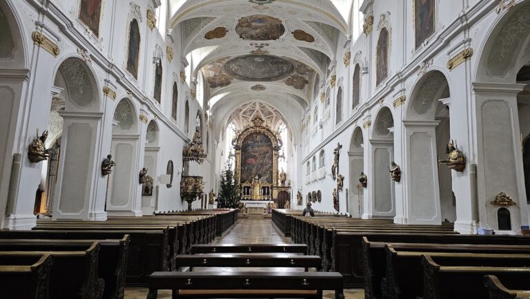
The Baroque parish church of St. Peter stands within the ring wall. It replaced a Romanesque basilica that had served as Vohburg’s principal church during the High Middle Ages.
Cemetery and funeral hall
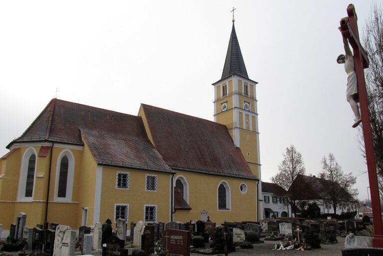
The castle interior has long functioned as a cemetery. During work on the castle hill, a new funeral hall with rooms for lying in state was built on the ground plan of the former tithe barn, which had burned down in 1910. Additions contain storage, sanitary, and ancillary rooms. The interior includes a large, brightly lit gallery and a protected courtyard with a modern fountain.
Setting above the Danube
The gate, enclosure wall, and castle-hill remains overlook Vohburg, its districts, and the surrounding landscape. The view extends north toward the southern foothills of the Franconian Jura, west across the Bayernoil refinery, Irsching power station, Danube floodplains, and Vohburg weir, east across further floodplains, and south toward the Dürnbuch Forest and the more distant rise of the Tertiary hills.