Burg Scharfenstein (Black Forest): A Medieval High-Altitude Castle
Site at a Glance
- Rating
- 3.5
- Popularity
- Very Low
- Country
- Germany
- Primary era
- Medieval
- Eras represented
- Medieval
- Civilizations
- Holy Roman Empire
- Site type
- Military
- Remains
- Castle
On this page13 sections
History
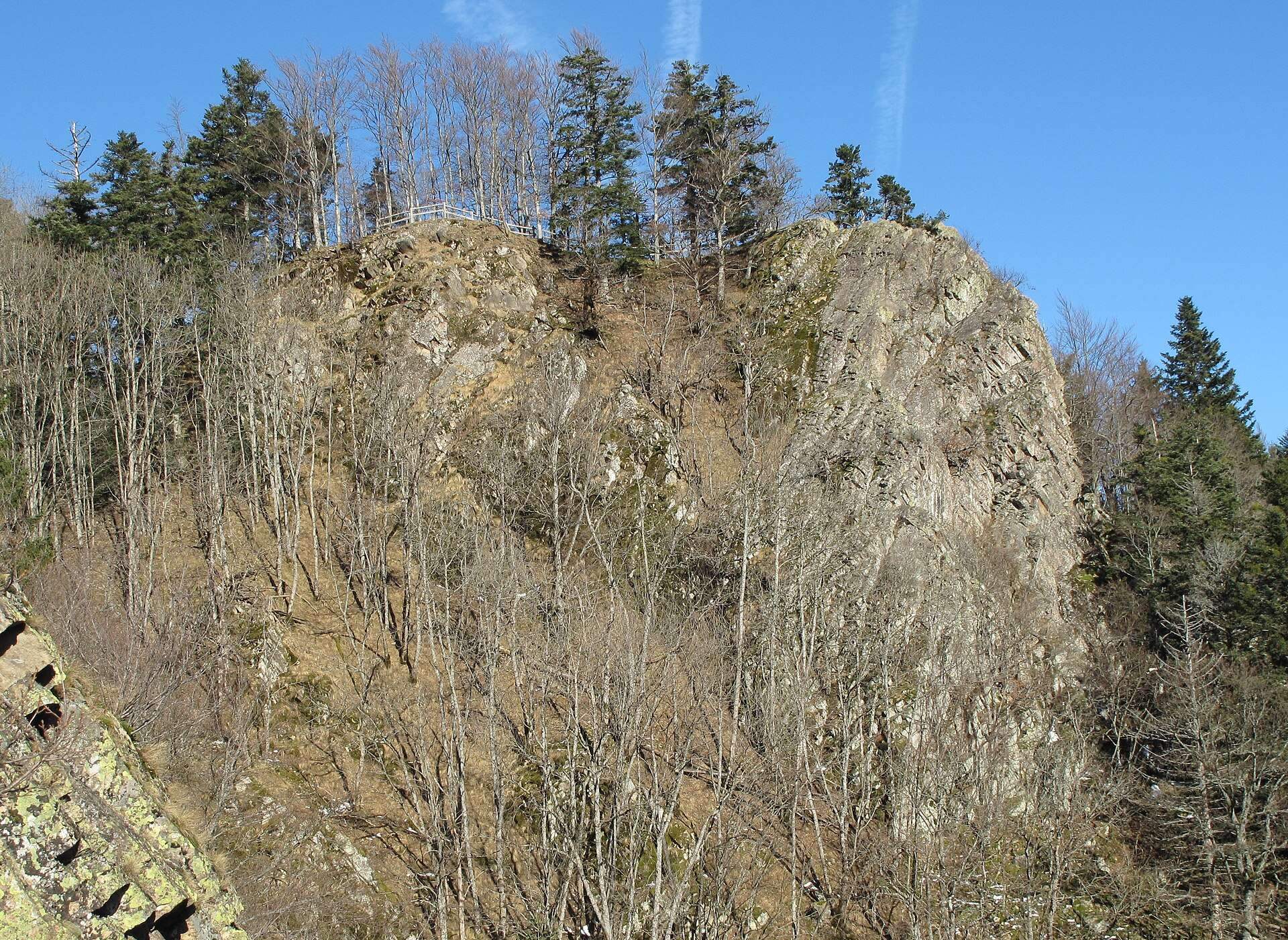
Burg Scharfenstein is the ruin of a medieval high-altitude castle in Germany, above the rear Münstertal near Obermünstertal. Built by the Lords of Staufen around 1200, the castle occupied a rocky position beside the mule track toward the Wiesental and helped protect the surrounding silver mines. Together with Burg Staufen, it secured the eastern and western entrances to the valley as the town of Staufen and the mining town of Münster developed.
Foundation and Staufen Authority
Archaeological surface finds indicate that construction of the castle complex probably began around 1200. Burg Scharfenstein first appears in written records in 1267, under the name castrum Scharphenstein, when it belonged to the Lords of Staufen. This medieval noble family was associated with the Staufen lordship in the southwestern Black Forest.
The Lords of Staufen also held reeve rights over St. Trudpert Monastery. A reeve was an official who exercised secular administrative, judicial, and protective authority for a religious institution. A document dated 1211 describes the Lords of Staufen as reeves and judicial lords of the monastery, but that document is considered forged. Their position is securely documented from 1218 onward.
Sales, Disputes, and Destruction
Financial difficulties probably led the Lords of Staufen in 1325 to sell one-quarter of their reeve rights and Burg Scharfenstein to St. Trudpert Monastery. In 1330, additional partial rights were sold to the House of Habsburg, a major European ruling dynasty that held extensive territories and rights in the region, and to the city of Freiburg.
These divided interests produced prolonged disputes among the monastery, Freiburg’s citizens, and Habsburg representatives. The disagreements involved unpaid pledge sums, ownership rights, control of mining jurisdiction, and income from the Münstertal’s rich silver deposits. Falsified documents and ransom demands connected with abducted merchants further worsened the conflict.
In 1346, Freiburg forces crossed the Schauinsland and destroyed Burg Scharfenstein. They also devastated Münster, the walled and towered mining town in the valley. The castle was not rebuilt after the attack. In 1480, the site was described as a Burgstall, a former or ruined castle site, in the possession of St. Trudpert Monastery.
Remains
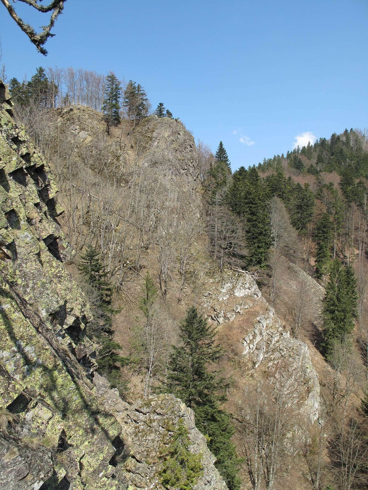
The castle occupied three rocky outcrops at about 920 metres above sea level, with the principal complex on the eastern rock plateau. Its surviving fabric consists of limited wall fragments, terraces, rock cuts, and the remains of a square tower. The arrangement of the outcrops and the surviving approach works reveal a defensively organized site extending along the ridge.
Approach and Lower Castle
Uphill Approach
The approach probably followed the line of the present uphill path. It runs along the northern flank in an elongated serpentine curve, where remnants of retaining walls reinforced the route. The path reaches a long rock terrace below the main plateau and continues toward the northeastern side of the castle rock.
Forecourt Terrace
The long terrace probably functioned as a forecourt or lower castle, an outer defensive or residential area below the main stronghold. A surviving wall fragment on its northern side measures about 7.5 metres in length and reaches up to 1.2 metres in height. It is built from irregular small stone blocks.
Upper Castle Rock
Main Castle
Stone steps at the southeastern end of the terrace lead to the broad rock plateau of the upper castle. The main castle had an approximately rectangular trapezoidal outline. Its northern side measured about 35 metres and its southern side about 38 metres. The southern settlement area was enlarged by a straight structure built across a funnel-shaped rockfall.
The main castle reached its greatest width on the eastern side, where it measured about 13.5 metres. That width continued for roughly 20 metres before the plan narrowed markedly to about 8.5 metres toward the west. Limited wall remains along the western side and southern edge contain small, regularly laid stone blocks. A prominent fragment on the northern edge consists of relatively regular porphyry blocks, a hard volcanic stone containing larger crystals in a finer-grained material.
Middle Castle Rock
A deep cleft cuts through the main rock on the west, resembling a neck ditch, a deep separation between a fortified rock and adjoining terrain. It isolates a substantially smaller rock end that forms the middle castle rock. The cleft helped divide this outcrop from the principal plateau.
Western Outcrop and Ridge
Square Tower
Beyond a ditch-like depression lies the third, western castle rock. It preserves the remains of a square tower with an internal width of about 2.70 metres and masonry approximately 1.70 metres thick. The tower forms the clearest surviving structural element on this outer rock.
Retaining Wall and Ridge
Several metres below the tower, on the southern side toward the valley, two angular, pier-like areas of worked rock stand on either side of a former retaining wall. The wall was approximately 8.5 metres wide, although only slight remains survive. Farther southwest, the rocky ground descends gently toward the Scharfenstein ridge.
A niche-like recess cuts across the ridge about halfway along it. Before the end of the spur, a flattened, plateau-like rise may have served as an advanced lookout. Wooden structures at this possible lookout position are conceivable, but archaeological evidence has not demonstrated them.