Burg Linzenberg: A Medieval Spur Castle near Beuron, Germany


Site at a Glance
- Rating
- 4.8
- Popularity
- Very Low
- Country
- Germany
- Primary era
- Medieval
- Eras represented
- Medieval
- Civilizations
- Holy Roman Empire
- Site type
- Military
- Remains
- Castle
On this page7 sections
History
Burg Linzenberg is a medieval spur castle in Germany near Beuron, probably built during the twelfth century under the Counts of Montfort. A spur castle was a fortified site on a projecting ridge or rocky outcrop, where steep natural slopes formed part of the defences. The Montforts had acquired the lordship of Sigmaringen through inheritance, placing the castle within their regional network of aristocratic and feudal power.
The Montfort period
The castle was associated with the Montforts’ feudal vassals. Algozo of Linzenberg-Friedberg appears in the records around 1216, while Albero of Linzenberg is mentioned in 1228. These references connect the site with a noble family holding property and authority in the region during the early thirteenth century.
Destruction and later ownership
Burg Linzenberg was probably destroyed by the great Friuli earthquake of 1348, an earthquake whose effects reached areas beyond the Friuli region of northeastern Italy. By around 1362, the Lenzenberg estate and nearby Falkenstein Castle were held by the Lords of Magenbuch. On 3 October 1390, Albrecht of Magenbuch sold “Linczenberg, the castle site,” with its associated rights and properties, together with the upper and lower Falkenstein castles, to Heinrich of Bubenhofen.
The sixteenth-century Zimmern Chronicle mentioned Lenzenberg as a castle site. By that time, the castle was already ruined or abandoned, and the surviving evidence was understood as the remains of an earlier fortified settlement. The name appears in several forms, including Lenzenberg, Linzenberg, and Langenfels.
Remains
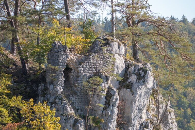
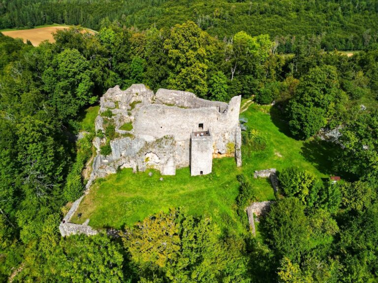
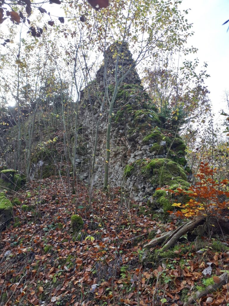
Burg Linzenberg occupied the 790-metre-high Lenzenfelsen near the hamlet of Neumühle in Beuron, in the Swabian Alb, an upland and plateau region of southwestern Germany. The complex combined a horseshoe-shaped outer ward of about 700 square metres with a smaller inner ward placed slightly to the northwest on a narrow rocky spur. Its masonry consisted of small ashlar blocks, carefully cut stones, and rubble stone. Today the site survives mainly through sparse masonry, earthworks, rock-cut features, and scattered building material.
Outer ward and defences
A neck ditch, meaning a ditch across the narrow land connection between a spur and higher ground, separated the outer ward from the Swabian Alb plateau to the southwest. It measured between 8 and 12 metres across and combined a V-shaped section with a flat-bottomed section. Sparse rubble traces the former polygonal perimeter wall. At the eastern cliff edge, a levelled rock shelf about 3 metres wide and 10 metres long may indicate construction carried out in the exposed position.
A second cross-ditch cut across the northern end of the complex. Beyond it stood a shield wall, a particularly strong defensive wall protecting the castle’s most exposed side. The wall was approximately 2.8 metres thick and 19 metres long, although only slight remains survive at its northwestern end.
Inner ward and residential tower
The inner ward occupied the highest part of the rocky spur. A trapezoidal building on its southeastern side, immediately behind the shield wall, was probably a residential tower. It measured 12.5 metres in length, with a width of 7.10 metres on the side facing the shield wall and 4.60 metres at the opposite end.
Parts of the tower remain as core masonry and limited facing on the northwest side. The facing used small ashlar blocks, while the southeastern corner includes a limestone block measuring 65 by 40 by 42 centimetres. Regularly layered small-ashlar masonry survives at the eastern corner, and three isolated ashlar blocks lie near the centre of the building. Depressions and individual stones in the soil indicate additional buildings within the inner ward.
Rock-cut features and surrounding views
At the northeastern tip of the inner-ward spur, a levelled step in the rock was probably once built over. The feature is now used as a viewpoint, with open views toward the double ruin of Falkenstein, the 772-metre Schaufelsen with the Schauenburg ruin, the rock formation containing the Heidenschloss near Neidingen, and the castle site of Auchtbühl to the northeast.