Burg Altwildenstein, Donautal: A High Medieval Castle Ruin in Germany


Site at a Glance
- Rating
- 4.4
- Popularity
- Low
- Country
- Germany
- Primary era
- Medieval
- External website
- Open
- Eras represented
- Medieval
- Civilizations
- Holy Roman Empire
- Site type
- Military
- Remains
- Castle
On this page6 sections
History
Burg Altwildenstein, also known as Vorderwilderstein, is a High Medieval castle ruin in Germany, north of Leibertingen in Baden-Württemberg. Built as part of the medieval Wildenstein group of castles, it occupied a steep rock outcrop and probably began in the twelfth century. Its original role is uncertain. It may have been the ancestral seat of the free nobles of Wildenstein, medieval nobles who held their status independently rather than as subjects of a territorial lord, or it may have served as an outwork of Wildenstein Castle.
Origins in the Twelfth Century
No written record securely dates the castle’s construction. Ceramic surface finds place its beginnings in the twelfth century, possibly in its first half. Two brothers from the surrounding area are regarded as the founders of the defensible castles established on the steep rock cliffs. Charters of Salem Monastery, a major regional Cistercian monastery with extensive documentary and landed networks, first record them as lords of Wildenstein between 1168 and 1174.
Burg Altwildenstein formed part of a wider group that included Unterwildenstein, Hexenturm, Hahnenkamm, and the principal Wildenstein Castle. The arrangement reflects a period when several fortified sites occupied the cliffs and approaches around Wildenstein, although the precise relationship between Burg Altwildenstein and the main castle remains uncertain.
Thirteenth-Century Changes and Abandonment
Bossage masonry in the former residential tower indicates alterations during the thirteenth century. Bossage masonry uses roughly projecting stone faces, often concentrated at corners or selected wall surfaces. During the same century, a new Wildenstein Castle was built near Alt- and Unterwildenstein, changing the position of Burg Altwildenstein within the local castle group.
In 1263, Burg Altwildenstein and the remaining Wildenstein estates passed by marriage to Anselm IV of Justingen, a thirteenth-century nobleman of the Justingen family, when he married an heiress. The castle was abandoned as a residence shortly afterward. Surface finds place the end of its use around 1300, possibly somewhat earlier, and the site thereafter survived as a ruin rather than as an occupied residence.
Remains
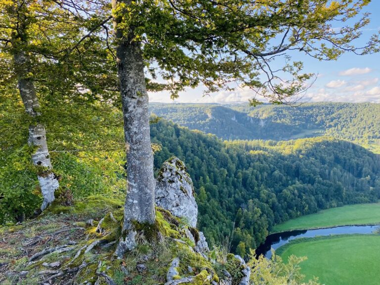
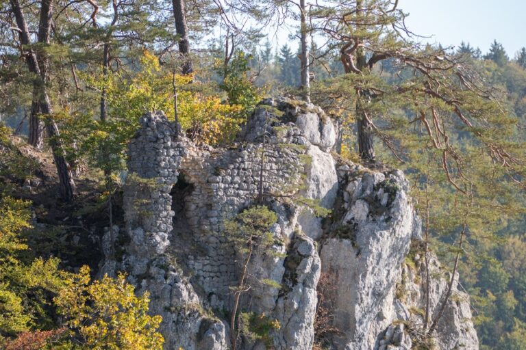
Burg Altwildenstein occupies a small, roughly bipartite castle area on a rock outcrop about ten metres high. The outcrop lies at the end of a spur extending northwest, at approximately 780 metres above sea level. Wildenstein Castle stands about 100 metres to the south and 30 metres higher, while the Danube valley lies at approximately 608 metres. A bowl-shaped neck ditch cuts across the spur immediately before the rock, separating the castle area from the rising ground toward Wildenstein Castle.
Approach and Lower Bailey
Access led along a narrow rock ledge on the western edge of the outcrop to a northwestern terrace at the valley-facing end of the spur, where the ground drops vertically. This terrace probably contained the lower bailey, an outer castle area for economic buildings and a small forecourt. Sections of retaining wall survive on the northwestern slope. A carefully built wall of small blocks is also preserved in the rising ground of the forecourt, although the surviving masonry cannot be assigned to a particular building.
A beam socket, a recess cut into rock to receive the end of a structural timber, survives at the northeastern end of the lower bailey in the area of the upper castle. The feature provides evidence for timber construction associated with the castle’s internal arrangements.
Upper Castle
The upper castle occupied an angular rock outcrop that enclosed the lower bailey on its southern and eastern sides like a natural shield wall. Access probably followed a broad rock channel rising from the presumed forecourt. The buildable area measured only about 18 by 9 metres, so the upper castle probably consisted of one principal residential structure, likely a residential tower. Such a tower combined domestic and defensive functions.
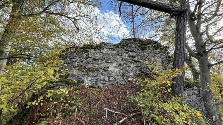
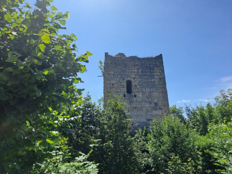
The tower was angular or rectangular and measured approximately 14 metres in length and 8 metres in width. An annex stood on its southwestern side. Several wall sections survive, including masonry built with projecting corner stones. At the southeastern corner, a larger remnant rises approximately 2 metres high. It consists of rubble masonry, formed mainly from irregular stones, with seven courses of corner blocks. One surviving corner block has a projection only toward the south, facing the rising spur. This arrangement may indicate that a new outer facing of ashlar and bossage blocks was added over older masonry.
On the eastern side of the upper castle, a retaining-wall section survives at approximately 4 metres high and 8 metres long. It is made of coarse rubble stones with barely visible layering. At the valley-facing northwestern corner of the residential tower, another remnant preserves three courses of large bossage blocks. These blocks have flat projecting faces and drafted margins approximately four centimetres wide.
A flat, elongated depression in the residential-tower area may mark a cellar, although it may instead have been a cistern. Fragments of mortar containing brick powder occur in the slope debris. Brick powder could help produce waterproof masonry, which supports the possibility that the depression belonged to a cistern. The surviving fabric includes rubble masonry, small-block masonry made from relatively small regular blocks, and bossage masonry, preserving evidence of more than one building phase within the compact castle complex.
Nearby sites