Burg Kemnat: A Medieval Spur Castle and Administrative Seat in Kaufbeuren
Site at a Glance
- Rating
- 4.6
- Popularity
- Low
- Country
- Germany
- Primary era
- Medieval
- External website
- Open
- Eras represented
- Medieval, Early Modern
- Civilizations
- Holy Roman Empire
- Site type
- Military
- Remains
- Castle
On this page11 sections
History
Burg Kemnat is the ruin of a medieval spur castle in Kaufbeuren, Germany, built around 1185 by Volkmar and Markward of Apfeltrang. The fortification became the seat of the lordship of Großkemnat and gave its builders the name Lords of Kemnat. Its name derives from the Latin caminata, meaning a heated room or building. Ceramic surface finds also point to an earlier settlement of uncertain form in the Late La Tène period.
The Lords of Kemnat
Volkmar and Markward served as ministeriales to the Counts of Ronsberg. Imperial ministeriales were legally unfree servants who could nevertheless hold influential military and administrative positions for a medieval king or emperor. After establishing their new seat, the two men adopted the name Kemnat.
The family’s most prominent member was Volkmar II of Kemnat, known as “the Wise.” He served as city bailiff of Constance, founded the Cistercian nunnery of Oberschönenfeld, and made Kemnat a setting for High Medieval art and culture. This included Minnesang, the tradition of courtly lyric poetry and song cultivated in the German-speaking lands. Volkmar II became a close associate of Conrad IV, the thirteenth-century German king of the Staufer dynasty, and entered the rank of imperial ministeriales in 1246. From 1263, he was also involved in educating Conradin, the dynasty’s last male heir.
Volkmar II was last recorded in 1282. His son Markward took over the castle in 1284. Through inheritance, Burg Kemnat passed to the Lords of Ramschwag around 1300 and, almost a century later, to the Lords of Benzenau.
From Noble Seat to Abbey Administration
Burg Kemnat was one of the few fortifications in the Allgäu that was not captured during the German Peasants’ War of 1525, a widespread uprising by rural communities against social, economic, and political grievances in the German lands. In 1551, Simprecht of Benzenau sold the castle, its associated communities, and its bailiwick rights to Kempten Abbey. Kempten Abbey was both an ecclesiastical institution and a territorial authority in the surrounding Swabian region.
The abbey established an administrative seat at Kemnat and built an administrative building. This rebuilding altered the earlier castle substantially. The bergfried, the principal tower of a medieval German castle and usually a strong defensive and symbolic structure, was incorporated into a five-storey southern wing. The complex consequently served increasingly as an administrative residence and political centre rather than solely as a military fortification.
Demolition, Conservation, and Recent Damage
During secularization, when ecclesiastical properties were transferred to secular ownership, the castle was sold to a private individual. In 1804, all buildings except the bergfried, the castle tavern, and the administrative building were demolished. The work also removed a chapel in the northeastern part of the castle courtyard.
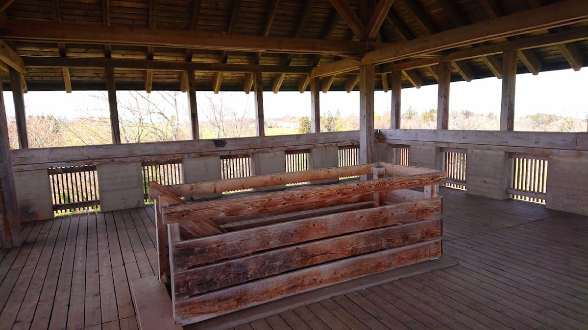
The Historical Association of Swabia acquired the tower in 1838 and arranged repairs in 1851. Further renovations followed in 1884, 1925, and 1957. The structurally unsafe castle tavern was demolished in 1978, and ownership of the tower passed to the City of Kaufbeuren in 1984. The city renovated the surviving tower, the administrative building, and the castle grounds, and installed a roofed viewing platform. A ceremonial 800th-anniversary celebration took place in 1985. A castle association now cares for the complex together with the city.
A fire on 30 September 2023 severely damaged the roof structure of the bergfried. The castle grounds are protected as an architectural heritage monument in Bavaria.
Großkemnat and the Former Outer Bailey
The modern village of Großkemnat developed from the castle’s economic or construction yard and its spacious outer bailey. Later building altered the area, while minor wall remains survive. A commemorative plaque installed at House 24 around 1933 or 1934 recalls the former construction yard.
Remains
Hilltop Fortification and Defenses
Burg Kemnat occupies an east-projecting hill at about 801 metres above sea level. It is a tongue-shaped fortification, a type of spur castle that uses a projecting ridge or hill and its steep natural slopes for defense. The roughly triangular main-castle plateau is bordered by steep slopes with exposed beds of Nagelfluh, a conglomerate made from rounded stones cemented together.
A neck ditch cuts across the land connection between the castle spur and the higher ground to the west. Positioned west of the administrative building, it reaches up to 8 metres in depth and 20 metres in width. A shallower ditch with an outer bank runs along the southern and eastern sides of the hill, while steep slopes protect the northern and eastern sides. The High Medieval buildings were constructed mainly from Nagelfluh obtained during excavation of the ditch and cut into large ashlar blocks.
Castle Walls, Courtyard, and Water Supply
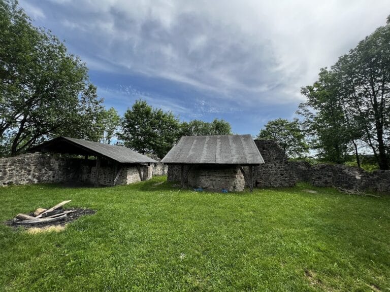
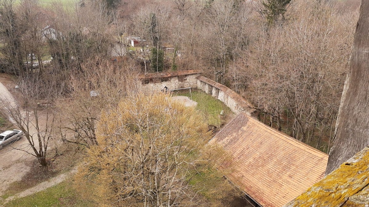
Fragments of the ring wall survive in the northwestern and southwestern parts of the site. These remains form the outer walls of the surviving administrative building and the former castle tavern. The tavern’s demolition in 1978 exposed medieval wall remains along the edge of the slope.
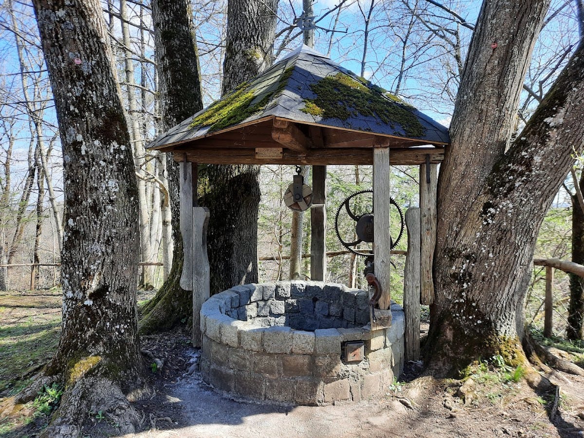
A footpath rises from the valley in the southwest and enters the main-castle plateau between the bergfried and the well. The well originally stood near the centre of the courtyard, about 20 metres east of the tower, and reaches a depth of 26 metres. A wall on the southern side enclosed the narrow courtyard. The tall southern wall had no wall-walk and was capped with roof tiles.
Sixteenth-Century Administrative Castle
Later rebuilding shaped the surviving arrangement of the castle. The bergfried formed part of the southern wing of the administrative castle, and an opening was made in its northwestern side to connect it with the adjoining building. A three-storey wing extended to the northwest. A probably three-storey northeastern building contained the St. Anne Chapel on its ground floor, possibly on the site of the earlier palas, the principal residential hall of a medieval castle.
The representative rooms occupied the second floor of the southern wing and included a dining room and a “princely room.” The tower was heightened during this rebuilding, with its upper storey reportedly made of tuff. Large window recesses were inserted into its northern side, and the present entrance at ground level was created. The administrative building was renovated in 1984 and is privately occupied while also serving as a castle tavern.
The Bergfried
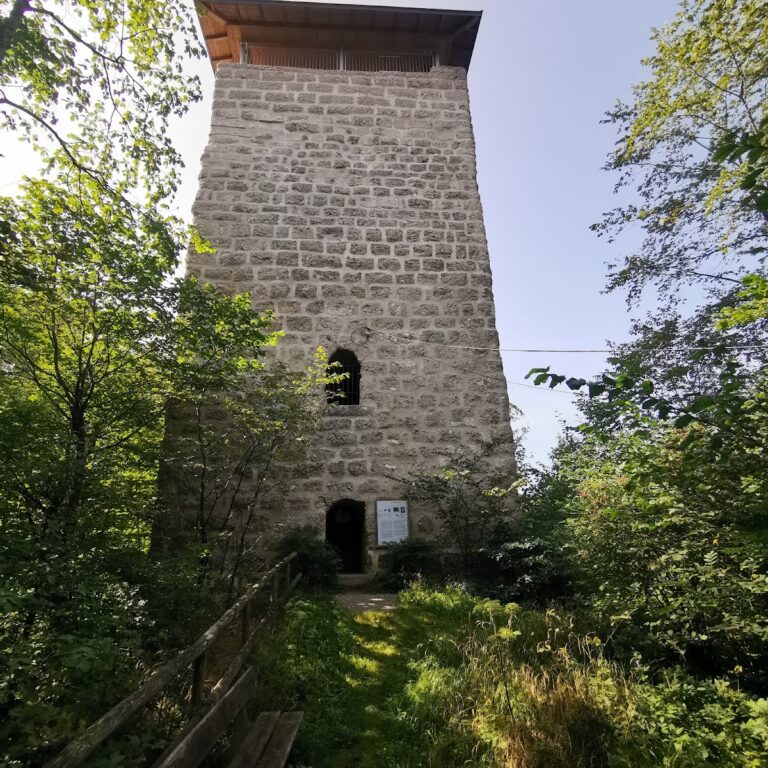
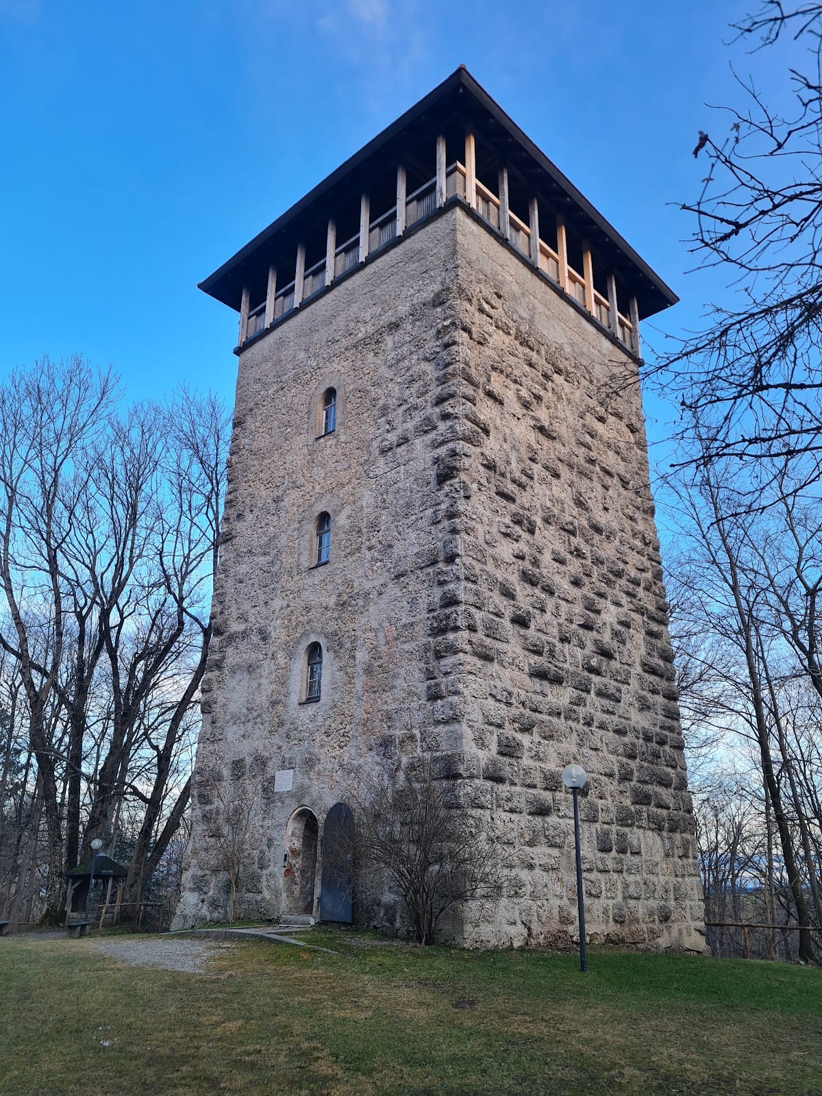
The surviving bergfried is square, with sides measuring 9.3 metres. Its walls are built from large rusticated Nagelfluh blocks with drafted margins, and a base approximately 3 metres thick supports four further storeys. Including its roof, the tower is about 23 metres high. A modern viewing platform, capped by a tent-shaped roof, stands about 16.5 metres above the ground.
The tower was originally faced entirely with large rusticated ashlar blocks. Its northwestern front was altered when the tower became part of the sixteenth-century administrative castle. Brickwork closed this altered face in 1851, and the space was used for several years as accommodation by a poor widow. A large stone plaque is set above the ground-level entrance, although its inscription is not necessarily historically accurate.
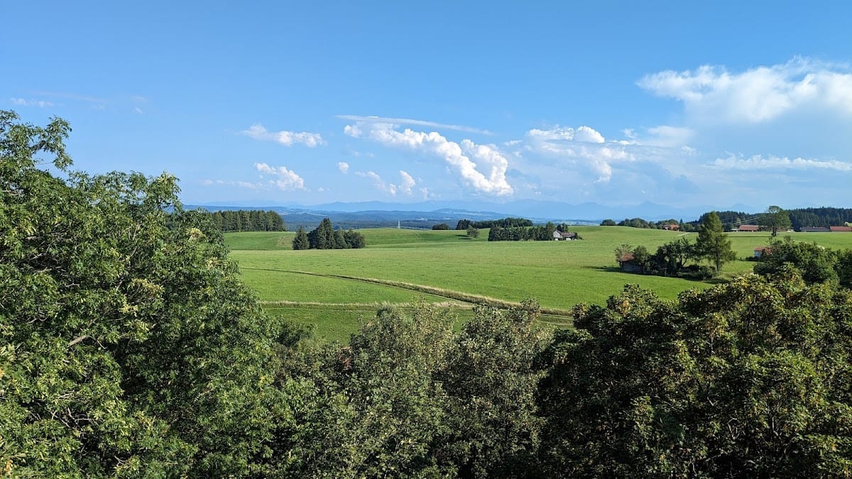
The original high entrance opened near the middle of the northwestern wall into an unvaulted shaft. The tower’s later role was chiefly legal and political rather than defensive. Its viewing platform now provides an outlook southward from the Wetterstein Mountains across the Tannheim and Lechtal Alps to the Allgäu High Alps.
Archaeological and Cultural Features
Three plans in the chronicle of the Blöcktach parish priest Guggemos depict the sixteenth-century administrative castle shortly after its demolition. A reconstruction model by the carpenter Marzell Schwarz, held in the Kaufbeuren local-history museum, shows the castle shortly before the early nineteenth-century demolition and includes the terrain profile of the former outer bailey.
The grounds also contain an open-air theatre area and a club-run theatre barn, linking the surviving castle site with continuing cultural use.