Burg Gleichenstein: A Clerical Hilltop Castle in Germany


Site at a Glance
- Rating
- 4.1
- Popularity
- Low
- Country
- Germany
- Primary era
- Medieval
- External website
- Open
- Eras represented
- Medieval, Early Modern, Modern
- Civilizations
- German, Holy Roman Empire
- Site type
- Military
- Remains
- Castle
On this page16 sections
History
Burg Gleichenstein is a medieval clerical hilltop castle in Germany, standing on the Schlossberg between Wachstedt and Martinfeld in Thuringia. Heinrich I of Gleichen probably built the present castle between 1241 and 1246 as a replacement for an earlier fortification, and it was first explicitly named in 1287. For centuries, the castle served the Archbishops of Mainz as an administrative and judicial center in the historical region of Eichsfeld.
From Velseck to Gleichenstein
The present castle occupies the site of an older and larger stronghold protected by a broad ditch across the neck of the hill. Its earliest construction belongs to an uncertain period. It may have been an imperial castle connected with the royal court at Martinfeld, which was granted to Hersfeld Abbey in 1071.
The earlier stronghold was known as Velseck or Felseck. The name Velsecke appears from the late twelfth century, including in a document of 1180 that names the knight Edelger the Younger of Velshecke as a witness. Berthold of Velsecke appears in the same role in 1209. The transition from this family and place name to the Counts of Gleichen is not dated precisely. From about 1201, Ernst III used the name “of Velsecke,” and Heinrich I did so from 1234.
In 1234, during a conflict between the Archbishop of Mainz and the Thuringian landgraves, Landgrave Heinrich Raspe destroyed the predecessor castle. Heinrich Raspe was a thirteenth-century ruler of Thuringia. The garrison of 23 men was killed or beheaded. Heinrich I of Gleichen then probably constructed Burg Gleichenstein between 1241 and 1246 and adopted the new name “of Gleichenstein.”
Mainz administration
From 1294 until 1802, Burg Gleichenstein belonged to the Archbishops of Mainz. These ecclesiastical rulers also held territorial and administrative power in parts of Eichsfeld. For roughly five centuries, the castle functioned as the administrative and judicial seat of the Mainz-controlled district, although Rusteberg Castle remained the principal administrative center.
The district associated with the castle comprised 16 villages. It extended from Kalteneber in the northwest to Beberstedt in the northeast and Büttstedt in the southeast. Its jurisdiction also included Zella Monastery and the villages of Struth and Effelder, Anrode Monastery and the villages of Bickenriede and Bebendorf, and the noble-owned settlements of Bernterode and Martinfeld. Werdigeshausen, Wolkramshausen, and Kirchberg later disappeared as settlements, while Kreuzebra was subsequently assigned to the Rusteberg district.
The court was held at Dingelstädt under the Counts of Gleichenstein and the Mainz electors at least until 1534. Thereafter, proceedings took place either at the castle or possibly near a place remembered as the Court Linden tree. The prison occupied the keep of the inner castle. Although the tower was blown up in 1648, its remaining stump and prison continued in use until the beginning of the twentieth century. The execution site has not been located, but the field name Galgenstücke was recorded between Wachstedt and Neues Haus. The administrative staff included a bailiff, judge, clerk, secretary, and messenger; the office returned to Dingelstädt in the eighteenth century.
The castle was not attacked during the German Peasants’ War. Its wider estate included the Neues Haus farmstead on the road toward Flinsberg and a sheepfold near Klüschen Hagis. Burg Gleichenstein, Neuhaus, and Hagis formed a separate parish until 1820. After the Thirty Years’ War, the property became a chamber estate, meaning a ruler’s or state domain leased for revenue, during the remaining Mainz period.
War, destruction, and reconstruction
The Thirty Years’ War was a European conflict fought from 1618 to 1648 amid religious, dynastic, and territorial struggles. In 1632, Swedish troops commanded by Bernhard of Weimar captured Burg Gleichenstein. Bernhard of Weimar was a German military commander who fought on the Swedish side. The castle was demolished in 1643 and completely destroyed in 1648.
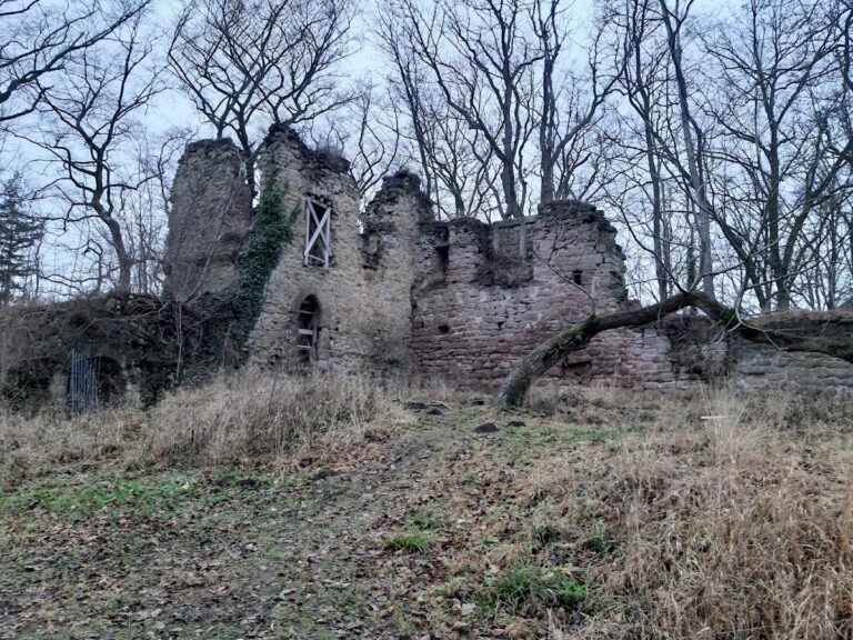
Rebuilding began in 1650. The renewed complex rose partly on older foundations, but its former defensive system and drawbridge were not restored. The reconstructed castle therefore developed with a simpler defensive arrangement. Repeated alterations in later centuries produced the mixture of medieval, early modern, and modern fabric visible today.
Estate, state ownership, and modern use
Mainz rule ended in 1802, when the castle passed to Prussia. In 1816 it became part of the Thuringian district of Mühlhausen, and in 1952 it was placed in the district of Worbis. During the nineteenth century, private owners and tenants changed frequently. The last private owner before the 1946 expropriation was Dr. Wolfgang von Schutzbar, called Milchling of Hohenhaus.
The estate was difficult to operate profitably because of its high elevation, poor soils, and severe climate. Its area fell from 235 hectares in 1854 to 86 hectares in 1946. After expropriation that year, the land was distributed among two new farmsteads and farmers in Wachstedt. One of the new farmsteads was established in the area of the former outer bailey. The castle, like the rest of the estate, became state property after the land reform.
Plans made from spring 1946 to convert the castle into an orphanage were partly carried out. A proposal to blow up the entire complex in 1947 was prevented by administrators who intervened to protect it. The site later housed a youth labor institution and other state establishments. In 1967, ownership passed to VEB Sachsenring Zwickau. The automobile works renovated the castle and operated it as a holiday and recreation facility until 1991.
Between 1994 and 2005, the complex contained a restaurant and a falconry. Hanf-Gedöns GmbH acquired it in March 2018 for use as its company headquarters and announced plans for a food manufactory, museum, and extensive reconstruction and restoration. After the company became insolvent, the castle was privatized again. The complex continues to be secured, while its owners pursue plans for public use. Archaeological and conservation work on the rediscovered well began in December 2020 with voluntary monument conservators, archaeologists, and geologists.
Remains
Burg Gleichenstein occupies the 459.7-metre-high Schlossberg, a spur of the 463.4-metre Bornberg on the edge of the Upper Eichsfeld Muschelkalk plateau. Steep slopes protect the site to the south, west, and north, while the narrow ridge to the east required additional defensive works. The castle lies about 3 kilometres west of Wachstedt and 1.8 kilometres east-northeast of Martinfeld.
Inner castle and principal buildings
Courtyard and palas
The inner castle is arranged around a triangular courtyard. The palas, the principal residential and representative building of a medieval castle, occupies the southern side. Its position forms one of the main elements of the surviving inner-castle plan, which includes structures from the medieval foundation, the post-war reconstruction, and later alterations.
West entrance and knights’ hall
A late Gothic portal with a pointed arch opens on the western side. The knights’ hall stands to the north of the courtyard. A keep, the main fortified tower, formerly stood between these buildings. It served as a prison into the eighteenth century before being dismantled completely during the twentieth century.
Service courtyard
The large service courtyard, also called the inner outer bailey, survives in wall remains. The former outer bailey and its tower can be recognized through the shape of the terrain. These surviving traces preserve the distinction between the inner castle and the areas that supported its domestic and economic functions.
Defenses and entrance works
Ditches and fortifications
Three defensive ditches once surrounded the castle. One has since disappeared, while the two surviving ditches have lost their original dimensions. The destruction of 1643 and 1648 left only parts of the medieval building structure. Reconstruction after 1650 reused existing foundations but did not restore the former fortifications or drawbridge, and later work altered the complex repeatedly.
Entrance tower and gates
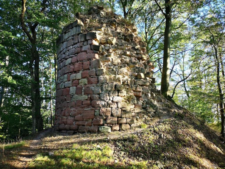
A round entrance tower was erected in the 1880s where an earlier square tower had stood. Several smaller ancillary buildings, a washhouse, and a lodging house were added between the entrance gate and the inner courtyard. The second gate of the enclosed defensive area, or zwinger, was removed. The third gate was remodeled and topped with a reading room and winter garden.
Southern terrace
The large granary at the southern end of the castle burned completely in 1932. Its former site is now occupied by the terrace viewpoint called Blaues Wunder. The terrace overlooks Martinfeld in the Rosoppe Valley, the Schimberg, parts of the southern Eichsfeld, and the Gobert.
Water supply and well
The castle’s historic water supply came from the Eselsborn spring in the valley near Klüschen Hagis. Because the castle well could not always supply the inner castle, outer bailey, and economic yard, donkeys carried water up the steep Eselsweg for centuries. This practical arrangement connected the hilltop complex with its surrounding estate.
Inner-courtyard well
A well stands in the inner courtyard. A well at the castle was mentioned in 1648, while an inventory from November 1485 lists a well-winch barrel among the kitchen utensils, providing an early indication of its use. The medieval shaft was rediscovered in 2019.
The well was probably filled and covered around 1884 after a water system using hydraulic rams was installed. A hydraulic ram is a pump that uses flowing water to raise part of that water to a higher level. The shaft’s depth is estimated at at least 70 metres because claystone from the floor of the vaulted cellar occurs naturally at the site only at that depth. The exposed shaft currently reaches 26 metres, measures 2.25 metres across, and is cut into solid rock. It contains no water at its present depth.
The wellhead is about 1.5 metres high and made of stone blocks. Its upper portion was probably rebuilt in rubble stone after the castle’s destruction during the Thirty Years’ War. The substantially preserved complex consequently contains ruined, altered, reconstructed, and demolished elements from several periods. The castle terrace has restricted access.