Kessenich Castle: A Medieval Motte Fortification in Belgium
Site at a Glance
- Rating
- 4.3
- Popularity
- Low
- Country
- Belgium
- Primary era
- Medieval
- Eras represented
- Medieval, Early Modern, Modern
- Civilizations
- Belgian, Dutch, Holy Roman Empire
- Site type
- Military
- Remains
- Castle
On this page14 sections
History
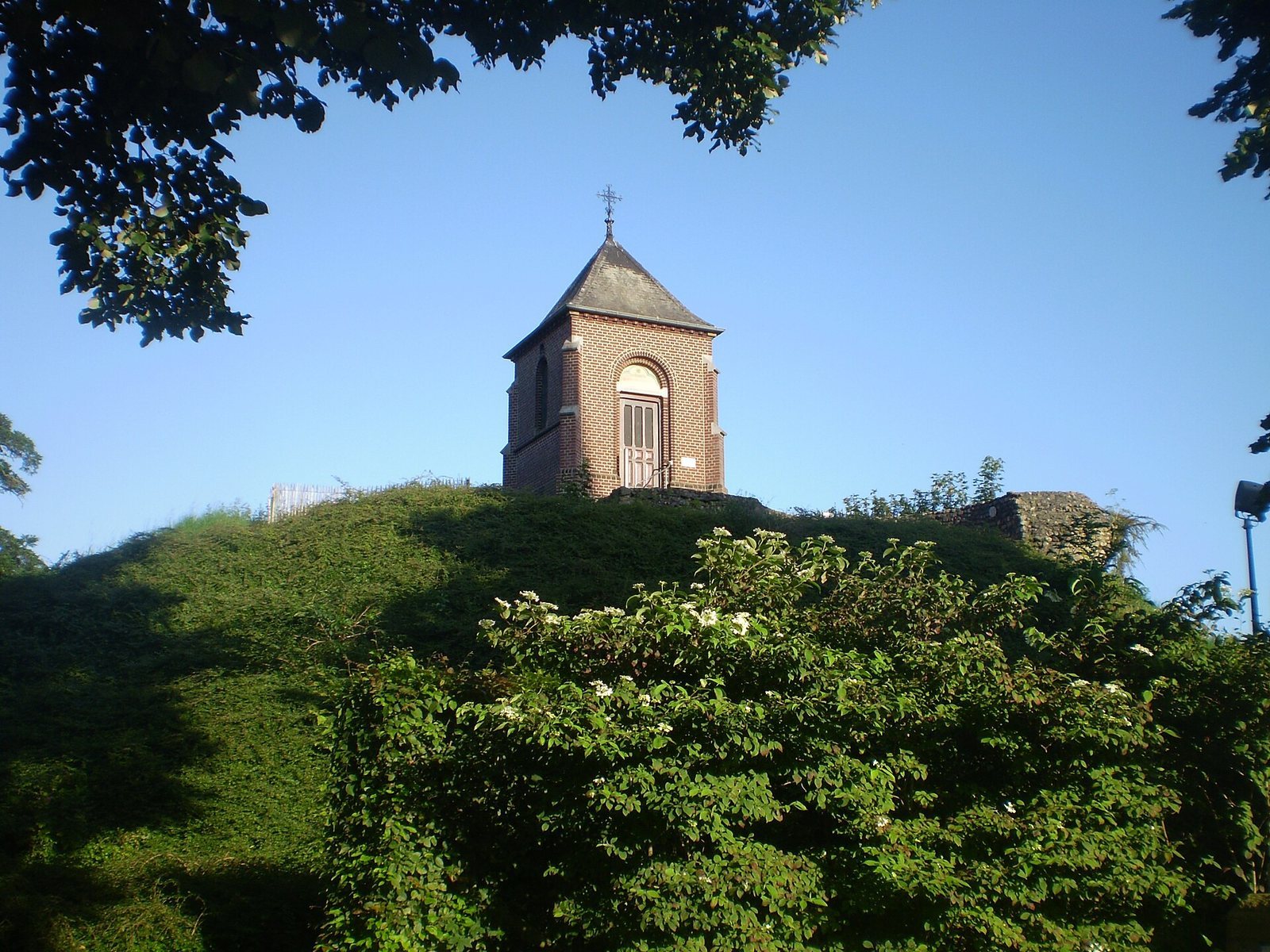
Kessenich Castle, also known as Den Berg, is a medieval fortification on an artificial motte, a mound forming a castle’s fortified core, in central Kessenich, Belgium. First mentioned in 1155, the castle’s donjon, or fortified tower, is dated to the twelfth century, though it may be older. Its raised upper ward served as a military stronghold, while the adjoining lower ward was the residential and economic center.
Roman and medieval origins
Roman-period traces occur in several parts of Kessenich, and the settlement’s earlier name, Casselin, may refer to a Roman fortification. The castle developed as a double motte, with two raised wards. One mound belonged to the County of Jülich, a historic Rhineland territory, and the other to the duchy of Brabant, a historic Low Countries territory, though the assignment of each is unclear. The second mound may have held an earlier fortification.
The donjon provided refuge during danger, while residents probably lived mainly in the lower ward. The castle’s limited interior space made the tower poorly suited to ordinary living.
Sixteenth-century changes
The octagonal donjon was largely demolished in the sixteenth century, possibly by the Burgundians, the ruling dynasty associated with the Burgundian Netherlands. Its destruction may have been punishment for the rebel leader Jan de Wilde. A square building and an enclosure wall were constructed during the same phase.
Decline and reuse
The castle remained partly in use in the seventeenth century. In 1685, Ferdinand van Kniphausen tot Vogelsanck, lord of the Imperial Lordship of Kessenich, a territory held directly from the emperor of the Holy Roman Empire, ordered repairs, although he did not live there. From 1699, the Waes family held Kessenich and owned Den Berg, but made nearby Borgitter Castle their residence. Den Berg was no longer inhabited and gradually fell into ruin as its building materials were reused elsewhere.
Under a 1740 ordinance, members of the local militia guarded barriers on Meierstraat, Schoorstraat and Veldstraat. In 1804, Hendrik Jozef Michiels van Kessenich bought most of the estates formerly held by Kessenich’s lords.
Family burial ground and archaeological work
Around 1825, the Michiels family levelled the summit and built a burial crypt, marked by a large wooden cross. In 1899, they raised a Neo-Gothic burial chapel above it, during the period when Kessenich’s church was also rebuilt.
Excavations took place in 1870, 1966, 1972 and 1984. The ruins have since been restored.
Remains
The surviving site centers on an artificial mound built on a naturally elevated slope in the Meuse valley. The wider castle layout included a lower ward and a second mound. Archaeological investigation and later restoration have helped reveal the arrangement of its structures.
Upper ward and summit structures
Donjon
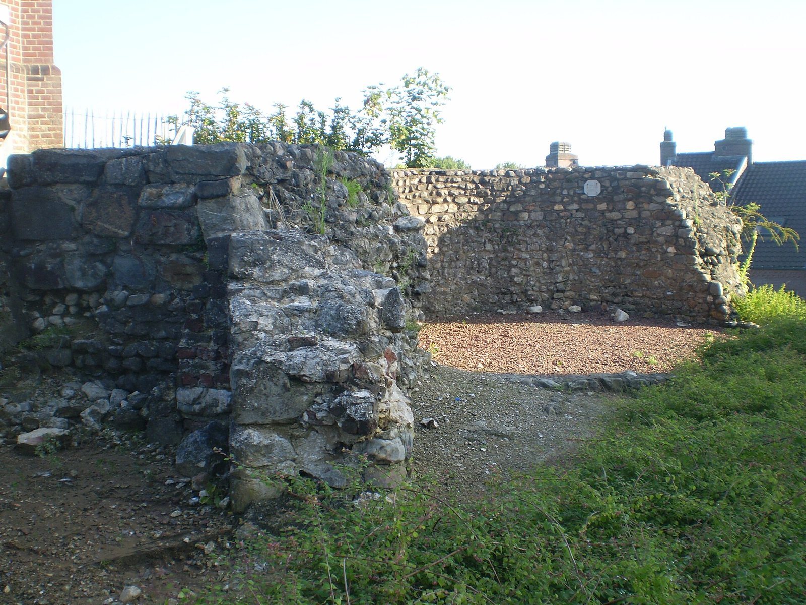
Remains of the octagonal donjon stand east of the mound’s center. Built from cobbles gathered from the Meuse, the tower measured 10 metres across. Its walls were 2.6 to 3 metres thick, enclosing a circular interior 4.6 metres wide. The small floor area offered little room for living. The mound was partly lowered, possibly to provide fill for a moat, a change that may have affected the tower’s eastern foundations.
South-side structure
A diamond-shaped structure stood against the donjon’s south side. Its walls were 1 to 1.5 metres thick. Its function is uncertain, though it may have been a stair tower replacing an external wooden staircase.
Square building and enclosure wall
West of the donjon stood a square building measuring 6 by 6 metres. Fragments of its associated enclosure wall remain visible along the mound’s slopes. The wall retained the edge of the plateau and enclosed a courtyard around the building.
Burial chapel
The Michiels family’s Neo-Gothic burial chapel occupies the summit. It stands above the earlier family crypt and has marked the summit since the nineteenth century.
Lower ward
The lower ward extended east of the raised stronghold and measured about 80 by 40 metres. It contained the Franssenhof, a feudal court, and a church that preceded St Martin’s Church.
Water defenses
Old channels of the Meuse, including the Schoor, naturally protected the castle and village to the south, east and north. A moat called the Diepe Gracht was dug along the western side and appears on the Atlas of Local Roads. The moats were filled in, with the last historic remains covered in 1949.
Second mound
A smaller motte formerly stood at Bergplaats, about 200 metres from the surviving mound, with the lower ward and church between them. A map by Jacob van Deventer, a sixteenth-century cartographer, shows it around 1550; it also appears on the eighteenth-century Ferraris maps of the Austrian Netherlands. The mound still existed during the French period, when France ruled the Low Countries in the late eighteenth and early nineteenth centuries. A description from that time called it a sandy hill near the church and described the surviving mound as the ruins of the house of Bronshorn.