Bodobrica Roman Fort: A Late Roman Frontier Base in Germany



Site at a Glance
- Rating
- 4.2
- Popularity
- Low
- Country
- Germany
- Primary era
- Classical
- External website
- Open
- Eras represented
- Classical, Medieval
- Civilizations
- Holy Roman Empire, Roman
- Site type
- Military
- Remains
- Fort
On this page14 sections
History
Bodobrica Roman Fort is a late Roman military fort in Boppard, Germany, built by the Romans in the second half of the fourth century, probably between AD 367 and 370, during the reign of Valentinian I. It stood on the Rhine Valley road within the Danube–Iller–Rhine frontier system, a late Roman defensive zone along major rivers, and served as both a military base and a trading center.
Settlement before the fort
Roman settlement in the area began in the first century AD. Earlier texts from the second and third centuries refer to the place as Bouobriga or Bontobrice, while linguistic and written evidence connects these names with an earlier Celtic settlement called Bodobrica. The civilian settlement, or vicus, flourished beside the Rhine as a community involved in fishing and trade.
The earlier settlement stood at the entrance to the Mühltal valley, where the Rhine Valley road met the Ausonius road. Its residents appear to have enjoyed relative prosperity during the second and third centuries, when elaborate tombs were placed beside the Roman long-distance road. After the Rhine again became a Roman frontier in the third century, the civilian settlement was probably moved about one kilometer east to the new fort. Late Roman finds are absent from its original location, supporting this interpretation.
The late Roman frontier
The fort belonged to Germania Prima and occupied a central position between the forts of Oberwesel and Andernach. Its garrison was the milites balistarii, late Roman artillery troops who operated projectile weapons such as stone-throwers and arrow-shooting artillery. The unit monitored and secured the Rhine frontier under the authority of the Dux Mogontiacensis, the senior commander of the relevant frontier command, whose base was at Mainz.
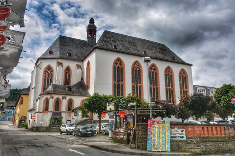
After Roman troops withdrew, civilians continued to live within the fort. Around AD 406–407, the military bath was destroyed by fire. After the northern fort wall had been demolished, a predecessor of the present St. Severus Church was built on the site around the middle of the fifth century. The church therefore formed part of the fort’s post-military transformation rather than its original Roman use.
Medieval reuse and modern investigation
The Roman walls served as Boppard’s town wall until the twelfth century. In the fourteenth century, Archbishop Baldwin of Luxembourg incorporated surviving Roman masonry into a new medieval fortification protecting the town’s eastern and western residential expansion. The southern Roman wall continued to form part of the town’s outer defenses.
Large sections of the fort were destroyed during the nineteenth century and later building work. In 1969, construction of the Zum Römer hall led to the demolition of an eight-meter-long and four-meter-high section of the western wall. The hall and adjoining buildings were removed in 2007–2008, exposing the wall again. During the relocation of Federal Highway 9 in the early 1990s, parts of the southwestern walls and Towers 1–5 were also demolished with approval from the heritage authorities.
Archaeological investigation began after sewer construction in 1939 exposed part of the western fortification near Towers 2 and 3. The discoveries also included two Frankish graves with grave goods and a figure associated with the Mithraic cult, a Roman mystery religion connected with the deity Mithras. A research program launched in 1959 led to investigations by the art historian Günter Stein between 1959 and 1962 in cooperation with the Technical University of Berlin. Stein’s 1966 study provided a basis for later work.
Excavations during renovations at St. Severus Church and construction of the market square took place from 1963 to 1966. Work in 1977 established the line of the western wall and confirmed the western gate on present-day Oberstraße. Extensive investigations from 1989 to 1995 exposed more than 55 meters of the fort wall continuously. The discoveries led heritage authorities to prevent construction of a planned police station and require the area to remain undeveloped. At the beginning of the twenty-first century, houses along the western wall were removed during construction of an underground garage, making approximately 50 meters of wall accessible again.
Bodobrica Roman Fort has formed part of the UNESCO World Heritage Site Upper Middle Rhine Valley since 2002. It is also a registered archaeological cultural monument under the heritage-protection law of Rhineland-Palatinate. Excavations and targeted collecting require authorization, and chance finds must be reported to the heritage authorities.
Remains
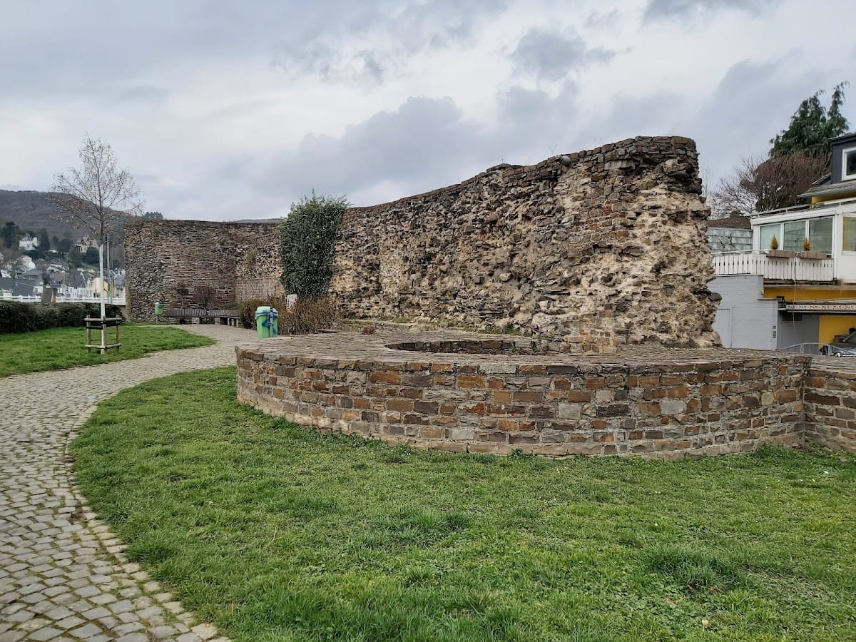
The fort occupied a rectangular area measuring about 308 by 154 meters, covering approximately 4.6 hectares. It was built on slightly raised, flood-free ground above the Rhine, roughly one kilometer southeast of the earlier civilian settlement. The late Roman enceinte, or enclosing defensive wall, was generally about three meters thick and about two meters thick along the Rhine side. It probably stood about eight meters high when constructed, while surviving sections reach up to nine meters.
Fortifications and internal layout
Walls and towers
The outer wall probably carried 28 projecting towers spaced at intervals of about 27 meters. These towers were round or horseshoe-shaped, and the largest reached about 10 meters in height and 8.70 meters in diameter. They accommodated the projectile weapons operated by the garrison. On the side facing the surrounding countryside, the wall was built mainly from small greywacke blocks. The town-facing side and tower interiors used stones with varying degrees of dressing.
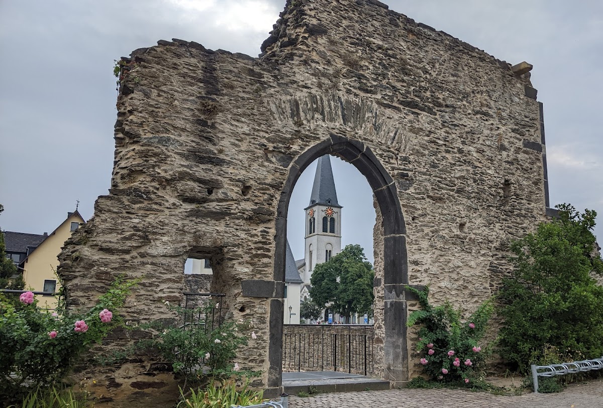
Some courses were laid in alternating angled patterns known as opus spicatum, or fishbone masonry. One tower preserves two openings interpreted as arrow or artillery slits beneath later medieval construction. The southern wall was additionally protected by at least one outer ditch, adding a further defensive element to the Rhine-side fortification system.
Entrances and roads
Entrances opened through the western and eastern short sides of the rectangle. These entrances had no gatehouses or towers. A narrow southern postern, a small secondary doorway, has been identified, while a similar opening on the north is suspected but remains unconfirmed.
The Rhine Valley road ran south of the fort. A principal road crossed the interior along the line of present-day Oberstraße, linking the fort’s internal organization with the wider Roman road network. Sections of the late Roman fortification survive as visible ruins, while other stretches remain incorporated into later town defenses or were exposed through archaeological work.
Military bath and church remains
Roman bath
A military bath built at the same time as the fort stood beneath the present St. Severus Church and was attached directly to the fort’s northern wall. It measured approximately 50 by 35 meters and followed the standard arrangement of Roman bathing facilities. Slate-like greywacke formed its walls, which were coated externally with brownish-red plaster. The building had a red-tile roof and glazed windows.
An entrance structure led into changing rooms and then to a room measuring about 20 by 9 meters beside the fort wall. This space probably served several purposes. East of it, an apsidal room had underfloor heating, a system that circulated hot air beneath the floor, and functioned as a heated room. South of the heated room, the bathing area contained cold, warm, and sweat baths. Water came from the southern slopes, while wastewater reached the Rhine through a lead channel. The pools were up to 80 centimeters deep.
Coins of Constantius II, who ruled as Roman emperor from AD 337 to 361, were found beneath the changing-room floor. Minted between AD 341 and 346, they provide evidence for activity in the bath. Marks of Legio XXII Primigenia, a Roman legion associated with the Rhine frontier, were also found, indicating that the building was in use no later than approximately AD 352–355.
Early Christian church
The bath was later covered by an early Christian church, the predecessor of St. Severus Church. A fifth-century Christian baptismal font discovered beneath the church remains in its original position. During restoration of the church interior in 2010–2011, the room and the route around the font were altered. The font has been viewable during church tours since December 2011.
Earlier settlement and burial evidence
Roman civilian settlement
The earlier vicus extended for approximately 50 meters along the Rhine at the entrance to the Mühltal valley. It contained permanent houses, including buildings with cellars. A terracotta figure of the Celtic horse goddess Epona was found in one of these houses. The 12-centimeter-high figure shows Epona seated sidesaddle on a horse and retains much of its painted surface. The original is held by the Landesmuseum Koblenz, while copies are displayed in Boppard’s municipal museum in the Electoral Castle and near the place where it was found.
Graves and religious finds
The 1939 discoveries included a figure of Cautes, one of the torch-bearing figures associated with the Mithraic cult. More than 40 burial pits were excavated in 1989–1990 in the present archaeological park. Three characteristic graves were preserved and conserved there, while several of the excavated burials date to the seventh century and belong to the early Christian period.
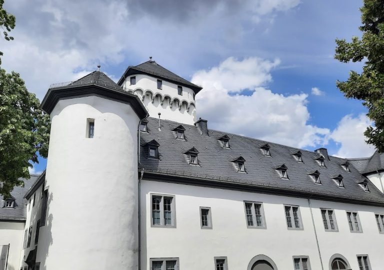
Other Roman finds from the fort and settlement are displayed in Boppard’s municipal museum in the Electoral Castle. Together with the surviving walls, the bath beneath St. Severus Church, the baptismal font, and the preserved graves, these remains trace the site’s development from a Roman civilian community to a late Roman frontier fort and then to a medieval and modern town.