Bahla Fort: A Historic Fortified Complex in Oman



Site at a Glance
- Rating
- 4.5
- Popularity
- Medium
- Country
- Oman
- Primary era
- Medieval
- External website
- Open
- Eras represented
- Medieval, Early Modern, Modern
- Civilizations
- Omani
- Site type
- Military
- Remains
- Castle
On this page18 sections
History
Bahla Fort is a major fortified complex in Oman, associated with the Bahla Oasis and with origins placed before Islam. The date of the present fortress remains uncertain, with estimates ranging from the twelfth to the fifteenth centuries and more specific proposals placing its main construction in the thirteenth and fourteenth centuries. Its position beside an important valley and on the route between Ibri and Nizwa made it an administrative, military, and defensive center.
Early origins and strategic setting
Bahla and its surrounding fortifications are traditionally linked to the third millennium BCE and to ancient civilizations of Mesopotamia and Persia. A Persian occupation of Oman in the fourth or fifth century CE has also been proposed as the setting for the first fortification on the site. These early associations remain part of the wider chronology of Bahla, while the surviving fortress developed through later building phases.
The settlement occupied a strategic position between hills and mountain ranges, beside a valley and along routes connecting Ibri, Nizwa, and the Yabrin oasis. Its defenses helped protect the eastward route from incursions from the south and may have formed part of an early defensive line between the hills. Bahla was also connected with the incense-trade route leading toward Syria and Iraq, increasing the value of its fortifications and regional position.
The Nabhani period
The Banu Nabhan controlled Oman from 1154 until the early seventeenth century and established the Nabhani dynasty, the ruling house associated with their long period of power. Bahla flourished under their rule. During periods when Bahla served as the capital of Oman, Nabhani rulers used the fort as a residence, while the complex also operated as an administrative and military center.
The fortress helped defend nearby settlements and major routes. Bahla, together with the forts of Izki, Nizwa, and Rustaq, was also a center of Kharijite resistance. Kharijism was an Islamic movement whose adherents formed distinct political and religious communities in several regions, including Oman, and the resistance opposed the policy of normalization associated with Caliph Harun al-Rashid.
The fortress underwent an early restoration during the Nabhani period. The eastern gate of Al-Qasabah, the oldest section traditionally identified within the complex, was closed during this era. The fortress had reportedly fallen into ruins by 1610, before a later restoration under the Ya’ruba rulers.
Ya’ruba and later restorations
Imam Nasir bin Murshid al-Yarubi restored the fortress during his rule from 1624 to 1649. He founded the Ya’ruba state, whose dynasty ruled Oman during the seventeenth and eighteenth centuries. A further restoration took place in 1868 under Imam Azzan bin Qais al-Busaidi.
These interventions formed part of four principal restoration phases, the earliest associated with the Nabhani period, the second with Imam Nasir bin Murshid al-Yarubi, the third with Imam Azzan bin Qais al-Busaidi, and the fourth with modern conservation. The date of some parts of the complex remains disputed. Bait al-Jabal is assigned to the eighteenth century, while Bait al-Hadith has been attributed either to the Ya’ruba period or to the middle of the nineteenth century.
Archaeology and modern conservation
Excavations by Oman’s Ministry of Heritage and Culture in 1993 and 1997 exposed several settlement layers and construction surfaces beneath the fortress. These discoveries may require a reassessment of the chronology traditionally assigned to the site. They also provided evidence for activity extending beneath the visible structures.
Bahla Fort was inscribed on the UNESCO World Heritage List in 1987 under criterion (iv), which concerns an important example of a type of building or architectural ensemble illustrating a significant historical period. Severe deterioration and partial collapse led to its inclusion on the List of World Heritage in Danger from 1988 until 2004. Restoration work began during the 1990s, including a major campaign between 1993 and 1999, and the site was removed from the danger list in 2004.
Before these modern campaigns, the fortress had not been restored since before 1987, and sections of its walls repeatedly collapsed during the rainy season. Conservation remains difficult because adobe erodes, drainage is poor, and irrigation systems have not been adequately maintained. In 2013, the ArCHIAM Centre, a research and heritage-management organization concerned with historic environments, developed a heritage-management plan for the fortress and the adjacent oasis.
Parts of the ancient wall around the wider settlement were destroyed or altered by nearby building construction. The reconstruction of the traditional market introduced modern materials, creating further conservation concerns. The survival of the fortress therefore remains connected to the condition of the oasis, its irrigation systems, and the surrounding historic fabric.
Remains
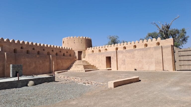
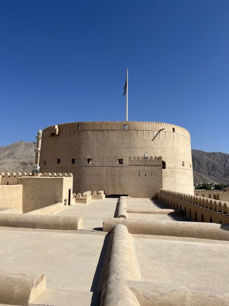
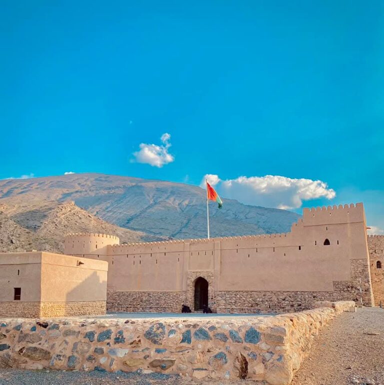
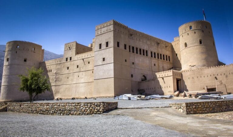
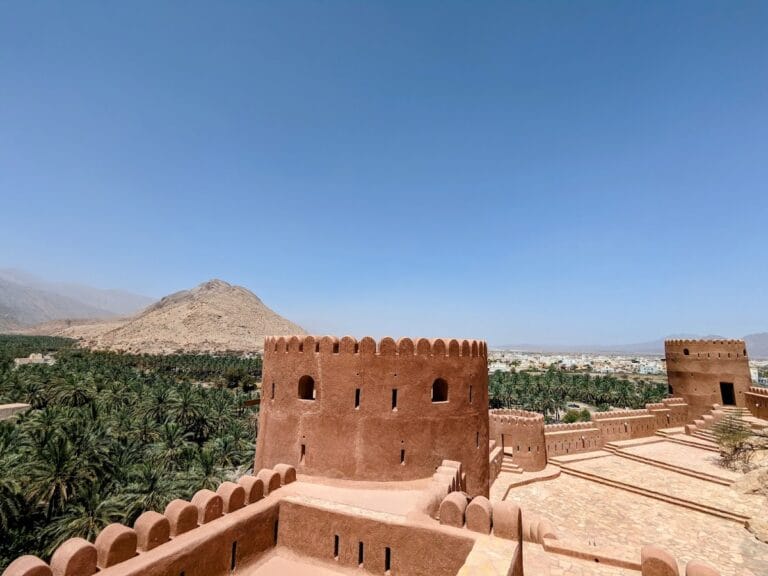
Bahla Fort stands on a moderately elevated hill within a palm oasis. The approximately triangular complex encloses a large rocky hill, leaving its central area open to the sky. Its southern side measures about 112.5 metres, its eastern side about 114 metres, and its curved northwestern side about 135 metres. The fort is built mainly from adobe, or sun-dried mud brick, with stone foundations or bases in some descriptions. Mud mortar and plaster formed part of the original construction, while saruj, a hardened waterproof mortar, was used sparingly.
Defensive enclosure and principal divisions
Walls and towers
The defensive system includes high walls, battlements, fortified positions, weapon loopholes, guard houses, and five towers. Some towers rise approximately 55 metres above sandstone foundations. The complex also contains about seven wells. Its elevated position and extensive enclosure gave the fort a large defensive footprint, while the surrounding adobe fabric has remained vulnerable to erosion and seasonal rain.
Al-Qasabah
Al-Qasabah, a fortified citadel or central enclosure, occupies the eastern part of the complex and is regarded as its oldest section. It is approximately rectangular and has towers at three corners as part of its own defensive arrangement. Its eastern gate was the old entrance to the fortress before it was closed during the Nabhani period. The date of Al-Qasabah is uncertain, with interpretations assigning it either to the Nabhani period or to a pre-Islamic Persian presence in Oman.
Bait al-Jabal
Bait al-Jabal, meaning “Mountain House,” extends through the southwestern part of the fortress. It is dated to the eighteenth century and has also been placed in the final decade of the twelfth Islamic century, a period corresponding to the eighteenth century. The Wind Tower, a named defensive tower, stands at the southern end of this section.
Bait al-Hadith
Bait al-Hadith, meaning “New House,” lies between Al-Qasabah and Bait al-Jabal. It contains numerous rooms and service installations. Its date is disputed, with different interpretations assigning it to the Ya’ruba period from 1624 to 1743 or to the middle of the nineteenth century. Restoration exposed additional rooms that had been completely buried beneath its lower floor. The main palace is also described as containing 55 rooms arranged over three floors.
Entrances and northern structures
The Sabah entrance
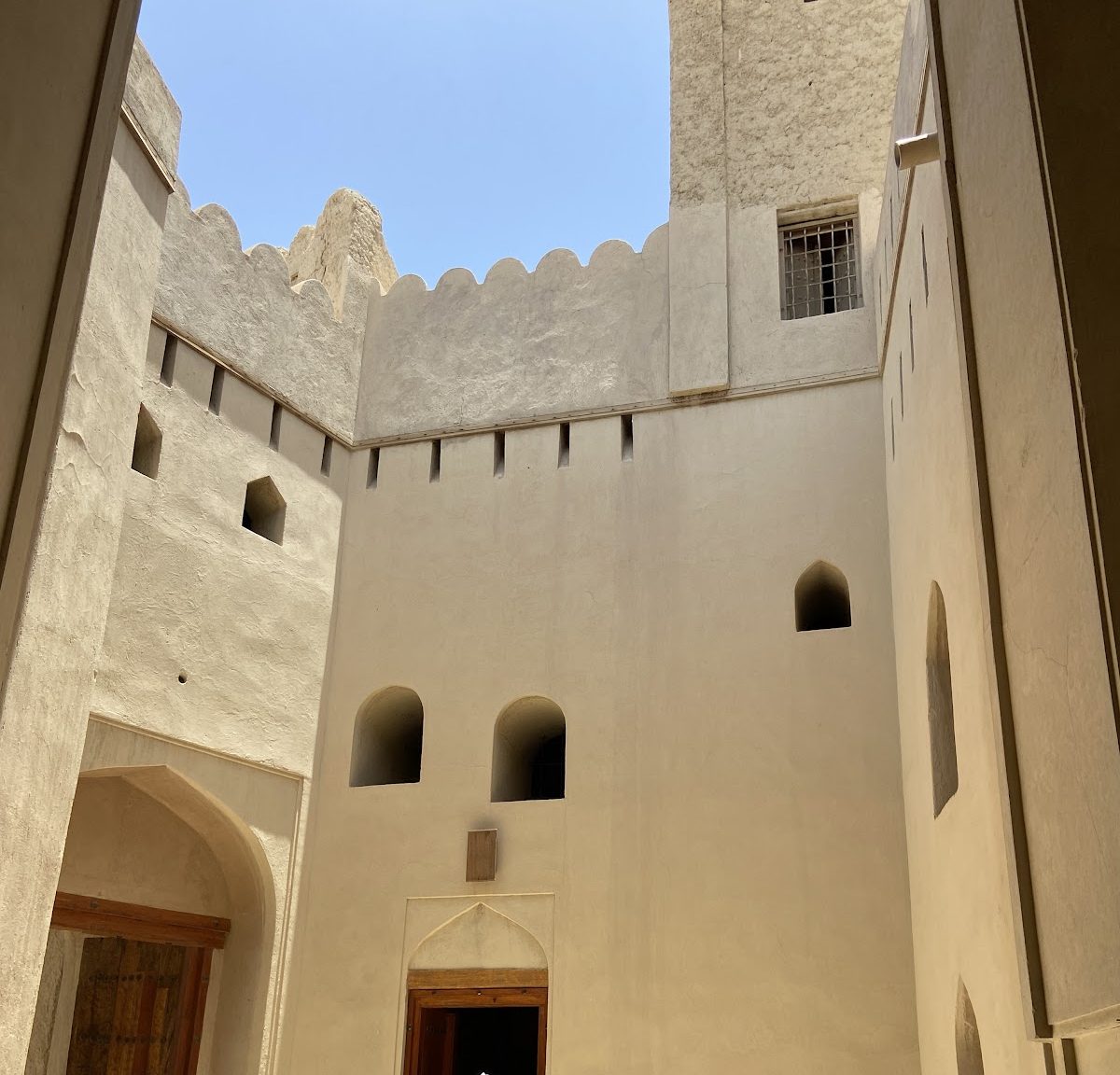
The present entrance, known as the Sabah, lies between Bait al-Jabal and Bait al-Hadith. Upper openings allowed boiling oil, water, or honey to be poured onto attackers. Raised benches inside the passage accommodated guards positioned along both sides of the entrance.
Northern defensive and service areas
Additional structures on the northern side include walls reinforced by two towers, prisons, and horse stalls. A single wall enclosed the wider settlement, and the close relationship between the fortress and surrounding houses exposed both the fort and nearby dwellings to shared risks during attacks.
Religious remains and archaeological finds
Friday Mosque
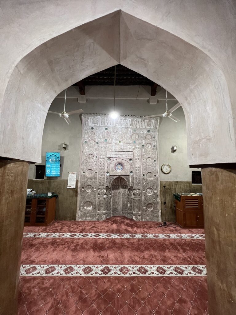
A Friday Mosque stands in the southwestern corner of the fortress complex. Its mihrab, the prayer niche indicating the direction of Mecca, dates to the fourteenth century.
Excavated material
Excavations beneath the fortress produced a broken terracotta figure of a mounted horseman with Sasanian artistic influences, a decorated soapstone fragment, and a large pottery jar probably used to store dates or collect honey. Locally made pottery and Chinese porcelain were also found. Together with the settlement layers and construction surfaces, these objects contribute to the interpretation of the site’s chronology and connections.
The oasis enclosure
The wider Bahla oasis remains associated with an ancient adobe enclosure measuring approximately 12 to 13 kilometres in length. Parts of the wall survive, while much of the oasis is ruined and some houses remain standing. The fort’s surviving fabric retains much of its traditional appearance, although extensive sections of the outer walls remain vulnerable after the rainy season. Poor drainage, threatened irrigation systems, nearby construction, and unsuitable modern repair materials continue to affect the physical remains.
Nearby sites